Search
You Searched For
Search Results
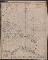
- Creator:
- Moll, Herman, d. 1732
- Call Number:
- 85 1745A
- Container / Volume:
- BRBL_00636
- Image Count:
- 1
- Resource Type:
- Maps, Atlases & Globes
- Found in:
- Beinecke Rare Book and Manuscript Library > A chart of ye West-Indies or the islands of America in the North Sea &c., being ye present seat of war / by Herman Moll, geographer.
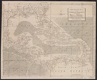
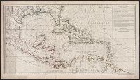
- Creator:
- Delarochette, L. (Louis), 1731-1802
- Published / Created:
- September 22d, 1796.
- Call Number:
- 85 1796A
- Container / Volume:
- BRBL_00693
- Image Count:
- 1
- Resource Type:
- Maps, Atlases & Globes
- Found in:
- Beinecke Rare Book and Manuscript Library > A general chart of the West India Islands with the adjacent coasts of the Spanish continent [cartographic material] / by L.S. de la Rochette.
- Creator:
- Kitchin, Thomas, d. 1784
- Published / Created:
- 1762]
- Call Number:
- 85 1760
- Container / Volume:
- BRBL_00693
- Image Count:
- 1
- Resource Type:
- Maps, Atlases & Globes
- Found in:
- Beinecke Rare Book and Manuscript Library > A new and correct map of the American Islands : now called the West Indies, with the whole coast of the neighbouring continent / by Thos. Kitchin geogr.
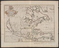
- Creator:
- Wells, Edward, 1667-1727
- Published / Created:
- between 1700 and 1722?]
- Call Number:
- 71 1722
- Container / Volume:
- BRBL_00362
- Image Count:
- 1
- Resource Type:
- Maps, Atlases & Globes
- Found in:
- Beinecke Rare Book and Manuscript Library > A new map of North America shewing its principal divisions, chief cities, townes, rivers, mountains &c. / delin. M. Burg. ; sculpt. Univ. Oxon.
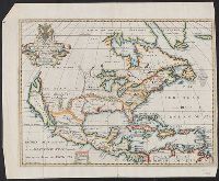
- Creator:
- Wells, Edward, 1667-1727
- Published / Created:
- between 1700 and 1722?]
- Call Number:
- 71 1722 A
- Container / Volume:
- BRBL_00362
- Image Count:
- 1
- Resource Type:
- Maps, Atlases & Globes
- Found in:
- Beinecke Rare Book and Manuscript Library > A new map of North America shewing its principal divisions, chief cities, townes, rivers, mountains &c. / delin. M. Burg. ; sculpt. Univ. Oxon.
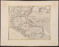
- Creator:
- Bowen, Emanuel, d. 1767
- Published / Created:
- 1747]
- Call Number:
- 85 1730A
- Container / Volume:
- BRBL_00692
- Image Count:
- 1
- Resource Type:
- Maps, Atlases & Globes
- Found in:
- Beinecke Rare Book and Manuscript Library > An accurate map of the West Indies [cartographic material] : drawn from the best authorities, assisted by the most approved modern maps and charts, and regulated by astronomical observations / by Eman: Bowen.
- Creator:
- Bellin, Jacques Nicolas, 1703-1772, cartographer
- Published / Created:
- [approximately 1720?]
- Call Number:
- 85 1720B
- Container / Volume:
- BRBL_00636
- Image Count:
- 1
- Resource Type:
- Maps, Atlases & Globes
- Found in:
- Beinecke Rare Book and Manuscript Library > Archipelague du Mexique : ou sont les isles de Cuba, Espagnole, Iamaique &c.
- Creator:
- Buache, Philippe, 1700-1773
- Published / Created:
- [1740]
- Call Number:
- 85 1740B
- Container / Volume:
- BRBL_00693
- Image Count:
- 1
- Resource Type:
- Maps, Atlases & Globes
- Found in:
- Beinecke Rare Book and Manuscript Library > Carte d'une partie de l'Amérique [cartographic material] : pour la navigation des isles et du Golfe du Mexique avec l'interieur des terres depuis la Bermude jusqu'a Cayenne, partie meridionale, reduite de la carte angloise en 20 feuilles / par Mr. Popple
- Creator:
- Chatelain, Henri Abraham
- Published / Created:
- 1719?]
- Call Number:
- 71 1770
- Container / Volume:
- BRBL_00687
- Image Count:
- 1
- Resource Type:
- Maps, Atlases & Globes
- Found in:
- Beinecke Rare Book and Manuscript Library > Carte qui contient une description des iles & terres que les Anglois possedent dans l'Amerique Septentrionale [cartographic material] : et en particulier de la Jamaique, des iles Barbades, de la Nouvelle Angleterre, des Barmudes, de la Caroline, de la Pen
- Published / Created:
- [15--]
- Call Number:
- 1978 Folio 106
- Collection Title:
- Maps of the Orinoco-Essequibo region, South America. Compiled for the Commission appointed by the
- Image Count:
- 1
- Resource Type:
- Maps, Atlases & Globes
- Found in:
- Beinecke Rare Book and Manuscript Library > Early Spanish map of Guiana
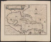
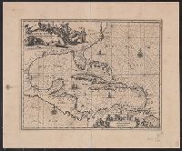
- Creator:
- Visscher, Nicolaes, 1649-1702
- Published / Created:
- [ca. 1720]
- Call Number:
- 85 1710
- Container / Volume:
- BRBL_00692
- Image Count:
- 1
- Resource Type:
- Maps, Atlases & Globes
- Found in:
- Beinecke Rare Book and Manuscript Library > Insulae Americanae in Oceano Septentrionali ac regiones adiacentes : a C. de May usque ad Lineam Aequinoctialem / per Nicolaum Visscher.
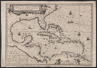
- Creator:
- Visscher, Nicolaes, 1649-1702
- Published / Created:
- ca. 1682]
- Call Number:
- 85 1650A
- Container / Volume:
- BRBL_00692
- Image Count:
- 1
- Resource Type:
- Maps, Atlases & Globes
- Found in:
- Beinecke Rare Book and Manuscript Library > Insulae Americanae in Oceano Septentrionali ac regiones adiacentes : a C. de May usque ad Lineam Aequinoctialem / per Nicolaum Visscher.
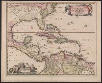
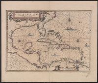
- Creator:
- Jansson, Jan, 1588-1664
- Published / Created:
- [1660?]
- Call Number:
- 85 1660
- Container / Volume:
- BRBL_00636
- Image Count:
- 1
- Resource Type:
- Maps, Atlases & Globes
- Found in:
- Beinecke Rare Book and Manuscript Library > Insulae Americanae in Oceano Septentrionali cum terris adiacentibus [cartographic material].
- Creator:
- Jansson, Jan, 1588-1664
- Published / Created:
- [1645]
- Call Number:
- 85 1652
- Container / Volume:
- BRBL_00636
- Image Count:
- 2
- Resource Type:
- Maps, Atlases & Globes
- Found in:
- Beinecke Rare Book and Manuscript Library > Insulae Americanae in Oceano Septentrionali cum terris adiacentibus [cartographic material].
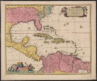
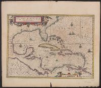
- Creator:
- Blaeu, Willem Janszoon, 1571-1638
- Published / Created:
- 1667?]
- Call Number:
- 85 1667
- Container / Volume:
- BRBL_00636
- Image Count:
- 1
- Resource Type:
- Maps, Atlases & Globes
- Found in:
- Beinecke Rare Book and Manuscript Library > Insulae Americanae in Oceano Septentrionali cum terris adiacentibus.
- Creator:
- Jansson, Jan, 1588-1664
- Published / Created:
- [1644]
- Call Number:
- 85 1652A
- Container / Volume:
- BRBL_00692
- Image Count:
- 1
- Resource Type:
- Maps, Atlases & Globes
- Found in:
- Beinecke Rare Book and Manuscript Library > Insulae Americanae in Oceano Septentrionali cum terris adiacentibus.
- Creator:
- Blaeu, Willem Janszoon, 1571-1638
- Published / Created:
- after 1635?]
- Call Number:
- 85 1673
- Container / Volume:
- BRBL_00692
- Image Count:
- 1
- Resource Type:
- Maps, Atlases & Globes
- Found in:
- Beinecke Rare Book and Manuscript Library > Insulae Americanae in Oceano Septentrionali cum terris adiacentibus.
- Creator:
- Jansson, Jan, 1588-1664
- Published / Created:
- [1638]
- Call Number:
- 85 1660A
- Container / Volume:
- BRBL_00692
- Image Count:
- 2
- Resource Type:
- Maps, Atlases & Globes
- Found in:
- Beinecke Rare Book and Manuscript Library > Insulae Americanae in Oceano Septentrionali cum terris adiacentibus.
- Creator:
- Jansson, Jan, 1588-1664
- Published / Created:
- [1638]
- Call Number:
- 85 1660B
- Container / Volume:
- BRBL_00692
- Image Count:
- 2
- Resource Type:
- Maps, Atlases & Globes
- Found in:
- Beinecke Rare Book and Manuscript Library > Insulae Americanae in Oceano Septentrionali cum terris adiacentibus.