Search
You Searched For
Search Results
- Published / Created:
- 1876
- Call Number:
- 766cea N46 1876
- Container / Volume:
- BRBL_00474
- Image Count:
- 15
- Resource Type:
- Maps, Atlases & Globes
- Found in:
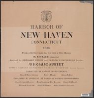
- Beinecke Rare Book and Manuscript Library > Harbor of New Haven, Connecticut.
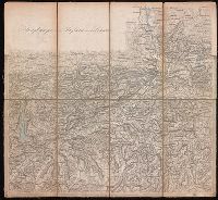
- Published / Created:
- 1853
- Call Number:
- 3627 1853
- Container / Volume:
- BRBL_00139
- Image Count:
- 15
- Resource Type:
- Maps, Atlases & Globes
- Found in:
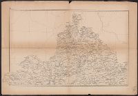
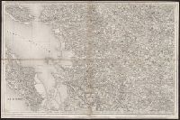
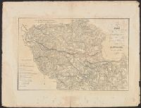
- Beinecke Rare Book and Manuscript Library > Uebersichtskarte Königsreiches Bayern : diessseits des Rheins in 15 Blättern, im Maassstabe Terrainkarte 1:250000 \ gefertigt im topographischen Bureau des k. Generalquartiermeisterstabes in den Jahren 1849-1853.
- Creator:
- Chishitsu Chōsajo (Japan)
- Published / Created:
- 1899
- Call Number:
- 57 1899A
- Container / Volume:
- BRBL_00302
- Image Count:
- 15
- Resource Type:
- Maps, Atlases & Globes
- Found in:
- Beinecke Rare Book and Manuscript Library > Topographical map of the Japanese Empire, 1899 / Imperial Geological Survey of Japan ; drawn by T. Togawa and K. Suzuki ; engraved by N. Matsudaira.
- Published / Created:
- 1878
- Call Number:
- 32 L84 1741A
- Container / Volume:
- BRBL_00048
- Image Count:
- 16
- Resource Type:
- Maps, Atlases & Globes
- Found in:
- Beinecke Rare Book and Manuscript Library > Environs of London By John Rocque 1741-1745. London, 1746-63.
- Creator:
- United States. Congress. House. Committee on the Public Lands
- Published / Created:
- [1878?].
- Call Number:
- 75 1878
- Container / Volume:
- BRBL_00406
- Image Count:
- 16
- Resource Type:
- Maps, Atlases & Globes
- Found in:
- Beinecke Rare Book and Manuscript Library > 1876 Centennial map of the United States and territories : showing the extent of public surveys, indian and military reservations, land grant R.R. rail roads, canals, cities, towns & other details / compiled from the official surveys of the General Land O
- Creator:
- Dépôt de la guerre (France)
- Published / Created:
- 1837-1869.
- Call Number:
- 38 1848
- Container / Volume:
- BRBL_00755-759
- Image Count:
- 14
- Resource Type:
- Maps, Atlases & Globes
- Found in:
- Beinecke Rare Book and Manuscript Library > [Carte de France de l'Etat-Major] / levée par les Officiers du Corps d'Etat-Major ... gravée et publiée par le Dépôt de la Guerre.
- Published / Created:
- 1882
- Call Number:
- 812 1882
- Container / Volume:
- BRBL_00555
- Image Count:
- 16
- Resource Type:
- Maps, Atlases & Globes
- Found in:
- Beinecke Rare Book and Manuscript Library > Atlas of the geological survey of Wisconsin / T.C. Chamberlin, chief geologist ; R.D. Irving, Moses Strong, assistant geologists ; W.I.L. Nicodemus, topographical assistant ; T.B. Brooks ... [et al.], contributors.
- Creator:
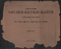
- Wolf, Heinrich, Geologe
- Published / Created:
- 1880
- Call Number:
- 435gbc 1880
- Container / Volume:
- BRBL_00763
- Image Count:
- 17
- Resource Type:
- Maps, Atlases & Globes
- Found in:
- Beinecke Rare Book and Manuscript Library > Geologische und Gruben-Revier-Karte des Kohlbeckens von Teplitz-Dux-Brüx / nach den neuesten Aufnahmen entworfen u. herausgegeben von Heinrich Wolf, k.k. Bergrath, Chef-Geolog der k.k. Geologischen Reichsanstalt in Wien.
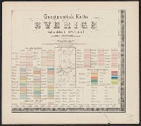
- Published / Created:
- 1838
- Call Number:
- 345ca 1838
- Container / Volume:
- BRBL_00097
- Image Count:
- 18
- Resource Type:
- Maps, Atlases & Globes
- Found in:
- Beinecke Rare Book and Manuscript Library > Geognostick Karta öfver Sverige, pa Bruks - Societetens anmodan, upprättad af J.H. af Forsselles under aren 1838-55. Lith. Inst. af J.F. Meyer & Co.,
- Creator:
- Wieser, Franz, Ritter von, 1848-1923
- Published / Created:
- [1870-1874]
- Call Number:
- BrSides 2019 102
- Image Count:
- 18
- Resource Type:
- Maps, Atlases & Globes
- Found in:
- Beinecke Rare Book and Manuscript Library > Generalstabs-Karte von Tirol / Dr. Franz Wieser.
- Published / Created:
- 1849]
- Call Number:
- 40 M72 1849
- Container / Volume:
- BRBL_00211
- Image Count:
- 12
- Resource Type:
- Maps, Atlases & Globes
- Found in:
- Beinecke Rare Book and Manuscript Library > Carta topografica del Ducato di Modena.
- Published / Created:
- [1800?]
- Call Number:
- 402 1800
- Container / Volume:
- BRBL_00705
- Image Count:
- 12
- Resource Type:
- Maps, Atlases & Globes
- Found in:
- Beinecke Rare Book and Manuscript Library > [Manuscript map of Lombardy]. Fratelli Bordiga inc.
- Creator:
- Austro-Hungarian Monarchy. Militärgeographisches Institut
- Published / Created:
- 1869?]
- Call Number:
- 3564 1869
- Container / Volume:
- BRBL_00115
- Image Count:
- 11
- Resource Type:
- Maps, Atlases & Globes
- Found in:
- Beinecke Rare Book and Manuscript Library > General-Karte des Königreiches Galizien und des Herzogthumes Bukowina / herausgegeben vom k.k. militär-geographischen Institute im Jahre 1868.
- Creator:
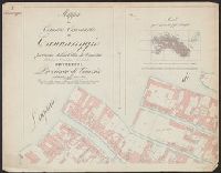
- Giunta, I.R
- Published / Created:
- 1847
- Call Number:
- 40 V55 1847C
- Container / Volume:
- BRBL_00225
- Image Count:
- 11
- Resource Type:
- Maps, Atlases & Globes
- Found in:
- Beinecke Rare Book and Manuscript Library > Mappa del comune censuario di Cannareggio : porzione della citta di Venezia, coll' Isola di S. Cristoforo e S. Michele, distretto I, provincia di Venezia, rettificata nell' anno 1842.
- Creator:
- Lejean, Guillaume, 1824-1871
- Published / Created:
- [1864?]
- Call Number:
- 62 1864
- Container / Volume:
- BRBL_00333
- Image Count:
- 11
- Resource Type:
- Maps, Atlases & Globes
- Found in:
- Beinecke Rare Book and Manuscript Library > Voyage en Abyssinie [cartographic material] : executé de 1862 a 1864 / par Guillaume Lejean.
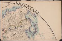
- Published / Created:
- 1873
- Call Number:
- 11 1873
- Container / Volume:
- BRBL_00010
- Image Count:
- 11
- Resource Type:
- Maps, Atlases & Globes
- Found in:
- Beinecke Rare Book and Manuscript Library > Emisfero Oriental [and] Emisfero Occidentale. Ev. Azzi ... dis. e compilo. E. Bonatti ... corre. e completo.
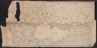
- Published / Created:
- [18--]
- Call Number:
- 11 1847A
- Image Count:
- 13
- Resource Type:
- Maps, Atlases & Globes
- Found in:
- Beinecke Rare Book and Manuscript Library > [Salisbury Collection of World Maps].
- Published / Created:
- ca. 1810]
- Call Number:
- 38 V61 1810
- Container / Volume:
- BRBL_00166
- Image Count:
- 13
- Resource Type:
- Maps, Atlases & Globes
- Found in:
- Beinecke Rare Book and Manuscript Library > [La carte des environs de Versailles dite des Chasses du Roi] / gravé par Doudan, Bouclet et Tardieu l'ainé ; ecrit par Herault, Delahaye.
- Published / Created:
- 1841
- Call Number:
- 36hc 1796
- Container / Volume:
- BRBL_00133
- Image Count:
- 13
- Resource Type:
- Maps, Atlases & Globes
- Found in:
- Beinecke Rare Book and Manuscript Library > Atlas Principes de la Strategie, par S.A.I. Le Prince Chartes, traduit de l'Allemand par le Général Jomini.
- Creator:
- Geo. W. Stadly & Co
- Published / Created:
- [186-?]
- Call Number:
- 754hc 1862C
- Container / Volume:
- BRBL_00421
- Image Count:
- 13
- Resource Type:
- Maps, Atlases & Globes
- Found in:
- Beinecke Rare Book and Manuscript Library > [13 maps showing positions of the Union and Confederate armies during the year 1862] / drawn and printed by Geo. W. Stadly & Co.