Search
You Searched For
Search Results
- Creator:
- Germany. Heer. Abteilung für Kriegskarten- und Vermessungswesen. IV. Mil.-Geo
- Published / Created:
- 1942
- Call Number:
- 32 M312 1942
- Container / Volume:
- BRBL_00052
- Image Count:
- 14
- Resource Type:
- Maps, Atlases & Globes
- Found in:
- Beinecke Rare Book and Manuscript Library > Manchester.
- Creator:
- International Boundary Commission
- Published / Created:
- 1952]
- Call Number:
- 848fab 1951
- Container / Volume:
- BRBL_00635
- Image Count:
- 15
- Resource Type:
- Maps, Atlases & Globes
- Found in:
- Beinecke Rare Book and Manuscript Library > Joint maps of the international boundary between United States and Canada from Cape Muzon to Mount St. Elias.
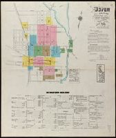
- Creator:
- Sanborn Map Company
- Published / Created:
- June, 1919.
- Call Number:
- 776 D75 1919
- Container / Volume:
- BRBL_00502
- Image Count:
- 15
- Resource Type:
- Maps, Atlases & Globes
- Found in:
- Beinecke Rare Book and Manuscript Library > Dover, Kent County, Delaware.
- Creator:
- Sanborn Map Company
- Published / Created:
- Nov. 1919.
- Call Number:
- 776 M59 1919
- Container / Volume:
- BRBL_00502
- Image Count:
- 15
- Resource Type:
- Maps, Atlases & Globes
- Found in:
- Beinecke Rare Book and Manuscript Library > Milford, Kent and Sussex Co., Delaware.
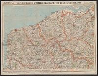
- Creator:
- Allied Forces
Great Britain. War Office. General Staff. Geographical Section
- Published / Created:
- 1943-
- Call Number:
- 11hd 1942D-44
- Image Count:
- 14
- Resource Type:
- Maps, Atlases & Globes
- Found in:
- Beinecke Rare Book and Manuscript Library > Central Europe 1:100,000.
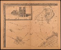
- Creator:
- Jouvin, Albert, active 1672
- Published / Created:
- 1908
- Call Number:
- 38 P21 1675
- Image Count:
- 17
- Resource Type:
- Maps, Atlases & Globes
- Found in:
- Beinecke Rare Book and Manuscript Library > Paris vers 1675 [cartographic material] : grand plan de Paris et de ses environs / par Jouvin de Rochefort, dédié à Messire Simon Arnaud.
- Creator:
- Cartes Taride (Firm)
- Published / Created:
- 1901-
- Call Number:
- Series 38gmb 1920
- Container / Volume:
- BRBL_00038B
- Image Count:
- 12
- Resource Type:
- Maps, Atlases & Globes
- Found in:
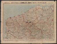
- Beinecke Rare Book and Manuscript Library > Carte routière pour automobilistes & cyclistes [cartographic material] : [France].
- Creator:
- Newcourt, Richard, d. 1679
- Published / Created:
- 1658. and 1905.
- Call Number:
- 32 L84 1658/1905
- Container / Volume:
- BRBL_00737
- Image Count:
- 12
- Resource Type:
- Maps, Atlases & Globes
- Found in:
- Beinecke Rare Book and Manuscript Library > An exact delineation of the cities of London and Westminster and the suburbs thereof, together wth. ye burrough of Sovthwark and all ye through-fares, highwaies, streetes, lanes & common allies wthin. ye same. Composed by a scale, and ichnographically described by Richard Newcovrt of Somerton in the countie of Somersett, gentleman. Willm. Faithorne, sculpsit.
- Creator:
- Kip, Johannes, 1653-1722
- Published / Created:
- 1903
- Call Number:
- 32 L84 1720/1903
- Container / Volume:
- BRBL_00736
- Image Count:
- 12
- Resource Type:
- Maps, Atlases & Globes
- Found in:
- Beinecke Rare Book and Manuscript Library > A prospect of the city of London, Westminster and St. James Park = veue et perspective de la ville de Londre, Westminster et Parc St. Jacques / John Kip delineavit et sculpsit.
- Creator:
- Great Britain. Ordnance Survey
- Published / Created:
- 1920-21.
- Call Number:
- 32 1920B
- Container / Volume:
- BRBL_00745
- Image Count:
- 11
- Resource Type:
- Maps, Atlases & Globes
- Found in:
- Beinecke Rare Book and Manuscript Library > Ordnance Survey of Great Britain 1/4 inch to one mile.
- Creator:
- Jones, Lewis A
- Published / Created:
- 1915
- Call Number:
- 794gcf B48 1914
- Container / Volume:
- BRBL_00521
- Image Count:
- 11
- Resource Type:
- Maps, Atlases & Globes
- Found in:
- Beinecke Rare Book and Manuscript Library > A report on the methods and cost of reclaiming the overflowed lands along the Big Black River, Mississippi / by Lewis A. Jones ; assisted by W.J. Schlick and C.E. Ramser.
- Published / Created:
- [1940?-1941]
- Call Number:
- 42 1940
- Container / Volume:
- BRBL_00244
- Image Count:
- 13
- Resource Type:
- Maps, Atlases & Globes
- Found in:
- Beinecke Rare Book and Manuscript Library > [Topographical map of Austria. 1: 25,000].
- Published / Created:
- [1920?]
- Call Number:
- 515 1920
- Container / Volume:
- BRBL_00707
- Image Count:
- 13
- Resource Type:
- Maps, Atlases & Globes
- Found in:
- Beinecke Rare Book and Manuscript Library > [Manuscript maps showing ruin sites etc. in the Transjordan and adjacent areas].
- Creator:
- Cartes Taride (Firm)
- Published / Created:
- 1901-
- Call Number:
- Series 38gmb 1920
- Container / Volume:
- BRBL_00038A
- Image Count:
- 20
- Resource Type:
- Maps, Atlases & Globes
- Found in:
- Beinecke Rare Book and Manuscript Library > Carte routière pour automobilistes & cyclistes [cartographic material] : [France].
- Creator:
- Assam (India). Survey Office
- Published / Created:
- [1943?]
- Call Number:
- 59gm As72 1943
- Container / Volume:
- BRBL_00319
- Image Count:
- 21
- Resource Type:
- Maps, Atlases & Globes
- Found in:
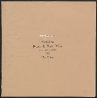
- Beinecke Rare Book and Manuscript Library > Map of Assam showing roads & railways
- Creator:
- Geological Survey (U.S.)
- Published / Created:
- 193-?]
- Call Number:
- 71 1755Q
- Container / Volume:
- BRBL_00364
- Image Count:
- 4
- Resource Type:
- Maps, Atlases & Globes
- Found in:
- Beinecke Rare Book and Manuscript Library > The Mitchell map of the British and French dominions in North America, 1755.
- Creator:
- Mexico. Comisión Geográfico-Exploradora
- Published / Created:
- 1920
- Call Number:
- 8861 1908
- Container / Volume:
- BRBL_00655
- Image Count:
- 4
- Resource Type:
- Maps, Atlases & Globes
- Found in:
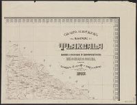
- Beinecke Rare Book and Manuscript Library > Carta general del Estado de Tlaxcala / levantada á iniciativa del Sr. Secretario de Fomento, Lic. Olegario Molina, por la Comisión Geográfico-Exploradora.
- Published / Created:
- 1952
- Call Number:
- 281 1883
- Container / Volume:
- BRBL_00024
- Image Count:
- 4
- Resource Type:
- Maps, Atlases & Globes
- Found in:
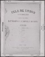
- Beinecke Rare Book and Manuscript Library > Isla de Luzon y sus adjacentes / por D. Enrique d'Almonte y Muriel.
- Creator:
- Carvalho, Filipe Carlos Dias de
- Published / Created:
- 1914
- Call Number:
- 636 1914
- Container / Volume:
- BRBL_00337
- Image Count:
- 4
- Resource Type:
- Maps, Atlases & Globes
- Found in:
- Beinecke Rare Book and Manuscript Library > Carta do distrito de Quelimane (esboço) / elaborado pelo governador do distrito, Filipe Carlos Dias de Carvalho.
- Published / Created:
- [19--]
- Call Number:
- 30f 1914
- Container / Volume:
- BRBL_00037B
- Image Count:
- 4
- Resource Type:
- Maps, Atlases & Globes
- Found in:
- Beinecke Rare Book and Manuscript Library > [Europe in 1870-1914].