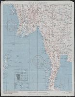
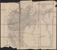
Shows roads, boundaries, railroads, power transmission lines, cities, towns, rivers, marsh, open water areas.
Alternative Title:
AAF cloth map. and Asiatic series
Description:
"Officers using this chart will mark hereon corrections and additions which come to their attention and mail direct to 'Aeronautical Chart Service, Headquarters Army Air Forces, Washington, D.C.'"--Lower left margin of each sheet. and Aviator's survival map,
Publisher:
Army Map Service, U.S. Army,
Subject (Geographic):
Burma--Maps
Subject (Name):
United States. Aeronautical Chart Service and United States. Army Air Forces
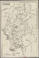
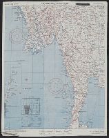
"Heliozincographed at the Survey of India Offices, Calcutta.", "No. 93 F/4 & 8 (Old no. 334)"., "Reg. no. 3268 D.'11 8. I-300.", "Season 1896-97"., and Shows boundaries, roads, areas under cultivation, trade routes, and waterways.
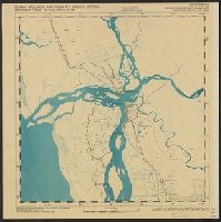
"Bearings towards target are magnetic variation 45' west of true north"., "Map reference no. 94H/SW, H/SE, H/NE, H/NW.", "Reproduction index no. 101-13A"., On verso: Composite aerial photograph of map area., and Shows "immediate target area, compiled from aerial
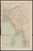
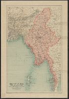
Ms. note on verso includes "From the map...Burma to N & W...Map A."; remainder of note illegible. Stamped on verso : "The gift of Otto T. Bannard." and Relief shown by spot heights.
Publisher:
John Bartholomew & Co.,
Subject (Geographic):
Burma--Maps
Subject (Name):
Bannard, Otto Tremont,--1854-1929 and Edinburgh Geographical Institute