Search
You Searched For
Search Results
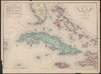
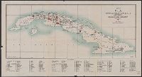
- Published / Created:
- [1880?]
- Call Number:
- 855 1880
- Container / Volume:
- BRBL_00641
- Image Count:
- 1
- Resource Type:
- Maps, Atlases & Globes
- Found in:
- Beinecke Rare Book and Manuscript Library > Map of Cuba : "The Gem of the Antilles".
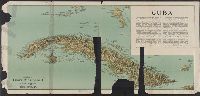
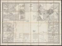
- Published / Created:
- [1897?]
- Call Number:
- 855cbf 1897A
- Container / Volume:
- BRBL_00642
- Image Count:
- 1
- Resource Type:
- Maps, Atlases & Globes
- Found in:
- Beinecke Rare Book and Manuscript Library > Cuba
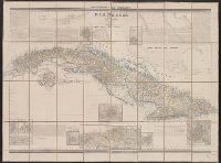
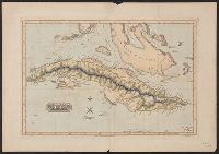
- Creator:
- Coello, Francisco, 1822-1898
- Published / Created:
- 1855
- Call Number:
- 855 1855
- Container / Volume:
- BRBL_00641
- Image Count:
- 1
- Resource Type:
- Maps, Atlases & Globes
- Found in:
- Beinecke Rare Book and Manuscript Library > Isla de Cuba / por el Teniente Coronel Capitan de Ingenieros ; D. Francisco Coello ; Las notas estadísticas e históricas han sido escritos por D. Pascual Madoz.
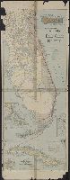
- Published / Created:
- 1898
- Call Number:
- 855 1898P
- Container / Volume:
- BRBL_00641
- Image Count:
- 1
- Resource Type:
- Maps, Atlases & Globes
- Found in:
- Beinecke Rare Book and Manuscript Library > The Evening Post map of Cuba / the Evening Post Pub. Co.
- Creator:
- Essex, Frank B
- Published / Created:
- 1911
- Call Number:
- 855 1911A
- Container / Volume:
- BRBL_00641
- Image Count:
- 1
- Resource Type:
- Maps, Atlases & Globes
- Found in:
- Beinecke Rare Book and Manuscript Library > Map of Cuba / prepared in the War College Division, General Staff War Department ; drawn by Frank B. Essex & A.B. Williams.
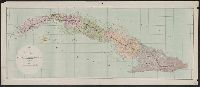
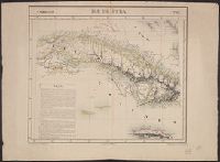
- Creator:
- Coello, Francisco, 1822-1898
- Published / Created:
- 1851
- Call Number:
- 855 1851
- Container / Volume:
- BRBL_00641
- Image Count:
- 1
- Resource Type:
- Maps, Atlases & Globes
- Found in:
- Beinecke Rare Book and Manuscript Library > Isla de Cuba / por el Teniente Coronel Capitan de Ingenieros ; D[on] Francisco Coello.
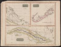
- Published / Created:
- 1816
- Call Number:
- 851 1816
- Container / Volume:
- BRBL_00694
- Image Count:
- 1
- Resource Type:
- Maps, Atlases & Globes
- Found in:
- Beinecke Rare Book and Manuscript Library > Chart of the Bahama Islands [cartographic material] : The Bermudas or Summer Islands ; Island of Cuba.
- Creator:
- Vandermaelen, Philippe, 1795-1869
- Published / Created:
- 1825]
- Call Number:
- 855 1825A
- Container / Volume:
- BRBL_00695
- Image Count:
- 1
- Resource Type:
- Maps, Atlases & Globes
- Found in:
- Beinecke Rare Book and Manuscript Library > Ile de Cuba / [cartographic material] / dressée et dessinée par Ph. Vandermaelen ; lithographiée par H. Ode, septembre 1825 ; la lettre par Frs. Charles.
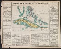
- Creator:
- Carey, Henry Charles, 1793-1879
- Published / Created:
- 1822]
- Call Number:
- 855 1827
- Container / Volume:
- BRBL_00695
- Image Count:
- 1
- Resource Type:
- Maps, Atlases & Globes
- Found in:
- Beinecke Rare Book and Manuscript Library > Cuba and the Bahama Islands / [cartographic material] / B. Tanner sc.
- Published / Created:
- 1916
- Call Number:
- 855gck 1916
- Container / Volume:
- BRBL_00642
- Image Count:
- 1
- Resource Type:
- Maps, Atlases & Globes
- Found in:
- Beinecke Rare Book and Manuscript Library > Map of Cuba : showing all working sugar estates.
- Creator:
- Lucas, Fielding, Jr., 1781-1854
- Published / Created:
- [1823]
- Call Number:
- 855 1827B
- Container / Volume:
- BRBL_00641
- Image Count:
- 1
- Resource Type:
- Maps, Atlases & Globes
- Found in:
- Beinecke Rare Book and Manuscript Library > Cuba / drawn and published by F. Lucas, Jr. ; B.T. Welch & Co., sc.
- Creator:
- Matthews-Northrup Company
- Published / Created:
- [1906?]
- Call Number:
- 792 1906
- Container / Volume:
- BRBL_00519
- Image Count:
- 1
- Resource Type:
- Maps, Atlases & Globes
- Found in:
- Beinecke Rare Book and Manuscript Library > Map of the peninsula of Florida and adjacent islands, Florida East Coast Railway.
- Published / Created:
- [1898]
- Call Number:
- 855hc 1898I
- Container / Volume:
- BRBL_00765
- Image Count:
- 1
- Resource Type:
- Maps, Atlases & Globes
- Found in:
- Beinecke Rare Book and Manuscript Library > Sketch showing a portion of the trenches occupied by Bates' brigade also the Spanish opposing works / drawn from the trenches by Lieutenant Horace Maynard Reeve, 3d Inf. Engineer, Provisional brigade, 5th Corps.
- Published / Created:
- [1898]
- Call Number:
- 855hc 1898P
- Container / Volume:
- BRBL_00765
- Image Count:
- 1
- Resource Type:
- Maps, Atlases & Globes
- Found in:
- Beinecke Rare Book and Manuscript Library > Sketch showing the operations of the command of Brigadier General John C. Bates in the campaign against Santiago de Cuba / drawn by Lieutenant Horace Maynard Reeve, 3d Inf., Engineer Officer, Provisional brigade, Fifth Corps.
- Creator:
- United States. Adjutant-General's Office. Military Information Division
- Published / Created:
- 1898]
- Call Number:
- 855hc 1898E
- Container / Volume:
- BRBL_00765
- Image Count:
- 1
- Resource Type:
- Maps, Atlases & Globes
- Found in:
- Beinecke Rare Book and Manuscript Library > Map of operations of 12th U.S. Infantry at Caney, Cuba, July 1, 1898 / by Willis Uline, 1st. Lieut., 12th Infantry.
- Published / Created:
- [1898]
- Call Number:
- 855hc 1898R
- Container / Volume:
- BRBL_00765
- Image Count:
- 1
- Resource Type:
- Maps, Atlases & Globes
- Found in:
- Beinecke Rare Book and Manuscript Library > Sketch of a reconnaisance made by Major T.H. Belt, U.S. Vol. Engr. : accompanied by Major L.H Strother, U.S. Vol. Engr. Lieut. R.W. Means, 1st Colo. Inf. Aug. 10, 1898.
- Published / Created:
- 1898]
- Call Number:
- 855hc 1898C
- Container / Volume:
- BRBL_00765
- Image Count:
- 1
- Resource Type:
- Maps, Atlases & Globes
- Found in:
- Beinecke Rare Book and Manuscript Library > Map showing roughly the course of troop D, tenth cavalry, July 1st, 1898, after leaving the regiment, and teh general direction of the attack made by the regiment.
- Published / Created:
- [1898]
- Call Number:
- 855hc 1898M
- Container / Volume:
- BRBL_00765
- Image Count:
- 1
- Resource Type:
- Maps, Atlases & Globes
- Found in:
- Beinecke Rare Book and Manuscript Library > Santiago de Cuba Position of American, Cuban, and Spanish forces on July 14th, 1898.
- Published / Created:
- [1898]
- Call Number:
- 855hc 1898N
- Container / Volume:
- BRBL_00765
- Image Count:
- 1
- Resource Type:
- Maps, Atlases & Globes
- Found in:
- Beinecke Rare Book and Manuscript Library > Santiago de Cuba Position of Cuban and Spanish forces prior to July 3rd, 1898.
- Published / Created:
- [1898]
- Call Number:
- 855hc 1898O
- Container / Volume:
- BRBL_00765
- Image Count:
- 1
- Resource Type:
- Maps, Atlases & Globes
- Found in:
- Beinecke Rare Book and Manuscript Library > Map of Santiago de Cuba showing intrenchments and position of the 5th Corps. U.S. Army and those of the Spanish / compiled from partial transit surveys and foot reconnaisance notes and sketches by Lts. Guy, Smith, Cordray. of the Inf.; Lts. Batson and G.P