- Creator:
- Great Britain. War Office. General Staff. Geographical Section
- Published / Created:
- 1919?]
- Call Number:
- 434fd 1919
- Container / Volume:
- BRBL_00251
- Image Count:
- 1
- Resource Type:
- Maps, Atlases & Globes
- Alternative Title:
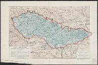
- Czecho-Slovakia
- Description:
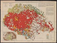
- "G.S.G.S. No. 2758.", "S.G.A. 2.4.19.", Also shows portions of Germany, Poland, Austria, Hungary, and Romania., In French and English., Relief shown by contours and spot heights., and Shows proposed boundaries and roads.
- Publisher:
- G.S.G.S.,
- Subject (Geographic):
- Czechoslovakia--Boundaries--Maps and Czechoslovakia--Maps
- Subject (Topic):
- Roads--Czechoslovakia--Maps
- Found in:
- Beinecke Rare Book and Manuscript Library > Tcheco-Slovaquie [cartographic material] = Czecho-Slovakia.