Search
You Searched For
Search Results
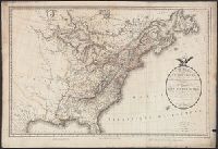
- Published / Created:
- 1805
- Call Number:
- 755 1805B
- Container / Volume:
- BRBL_00437
- Image Count:
- 1
- Resource Type:
- Maps, Atlases & Globes
- Found in:
- Beinecke Rare Book and Manuscript Library > A new map of the United States of North America ... with Upper and Lower Canada &c ... by John Cary, Engraver.
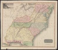
- Published / Created:
- 1813
- Call Number:
- 755 1813C
- Container / Volume:
- BRBL_00439
- Image Count:
- 1
- Resource Type:
- Maps, Atlases & Globes
- Found in:
- Beinecke Rare Book and Manuscript Library > An improved Map of the United States by Shelton & Kensett. Engraved by A. Doolittle, New Haven. AE 60. Copyright secured & entered according to Act of Congress, Nov. 8th 1813.
- Published / Created:
- 1806
- Call Number:
- 755 1806A
- Container / Volume:
- BRBL_00438
- Image Count:
- 1
- Resource Type:
- Maps, Atlases & Globes
- Found in:
- Beinecke Rare Book and Manuscript Library > A new map of part of the United States of North America ... by John Cary, Engraver.
- Published / Created:
- [1801?]
- Call Number:
- 755 1801
- Container / Volume:
- BRBL_00437
- Image Count:
- 1
- Resource Type:
- Maps, Atlases & Globes
- Found in:
- Beinecke Rare Book and Manuscript Library > Carte de la Partie Septentrionale des Etats-Unis. Gravé par Tardieu.
- Published / Created:
- [1806?]
- Call Number:
- 755 1806C
- Container / Volume:
- BRBL_00438
- Image Count:
- 1
- Resource Type:
- Maps, Atlases & Globes
- Found in:
- Beinecke Rare Book and Manuscript Library > Carte Générale des États-Unis de L'Amerique Septentrionale, rensemant aussi, quelquis Provinces Angloises adjacentes. André Scrip. Tardieu Sculp.
- Published / Created:
- 1806
- Call Number:
- 755 1806
- Container / Volume:
- BRBL_00438
- Image Count:
- 1
- Resource Type:
- Maps, Atlases & Globes
- Found in:
- Beinecke Rare Book and Manuscript Library > A map of the United States and Canada, New Scotland, New Brunswick and Newfoundland. Dresée par Lapie ... Gravée par P.A.F. Tardieu. Ecrit par J.J. Pachoux.
- Published / Created:
- 1816
- Call Number:
- 755 1816
- Container / Volume:
- BRBL_00439
- Image Count:
- 1
- Resource Type:
- Maps, Atlases & Globes
- Found in:
- Beinecke Rare Book and Manuscript Library > Northern Section of the United States including Canada, etc., by John Melish. Second edition with Additions and improvements.
- Published / Created:
- 1817
- Call Number:
- 755 1817
- Container / Volume:
- BRBL_00439
- Image Count:
- 1
- Resource Type:
- Maps, Atlases & Globes
- Found in:
- Beinecke Rare Book and Manuscript Library > Northern Provinces of the United States. Hewitt Sc., London.
- Published / Created:
- July 6th 1813.
- Call Number:
- 755 1813B
- Container / Volume:
- BRBL_00438
- Image Count:
- 1
- Resource Type:
- Maps, Atlases & Globes
- Found in:
- Beinecke Rare Book and Manuscript Library > An improved map of the United States by Shelton & Kensett. Engraved by A. Doolittle, New Haven, & T. Kensett, Cheshire ...
- Published / Created:
- [1817?]
- Call Number:
- 755 1817A
- Container / Volume:
- BRBL_00439
- Image Count:
- 1
- Resource Type:
- Maps, Atlases & Globes
- Found in:
- Beinecke Rare Book and Manuscript Library > Southern provinces of the United States. [engr. for Thomson's "New General Atlas".]
- Published / Created:
- [1820?]
- Call Number:
- 755 1820A
- Container / Volume:
- BRBL_00439
- Image Count:
- 1
- Resource Type:
- Maps, Atlases & Globes
- Found in:
- Beinecke Rare Book and Manuscript Library > United States of America. J. & G. Menzies Sculpt. Edinr.
- Published / Created:
- 1823
- Call Number:
- 755 1823A
- Container / Volume:
- BRBL_00439
- Image Count:
- 1
- Resource Type:
- Maps, Atlases & Globes
- Found in:
- Beinecke Rare Book and Manuscript Library > United States of America. Neele & Son Sculpt.
- Published / Created:
- 1830
- Call Number:
- 755 1830
- Container / Volume:
- BRBL_00440
- Image Count:
- 1
- Resource Type:
- Maps, Atlases & Globes
- Found in:
- Beinecke Rare Book and Manuscript Library > Map of the territories of Michigan and Ouisconsin on a scale of 30 geographical miles to an inch by John Farmer of Detroit, Engraved by Rawdon Clark & Co., Albany, NY.
- Published / Created:
- 1819
- Call Number:
- 755 1819
- Container / Volume:
- BRBL_00439
- Image Count:
- 1
- Resource Type:
- Maps, Atlases & Globes
- Found in:
- Beinecke Rare Book and Manuscript Library > A new map of part of the United States, exhibiting the North West, Michigan, Indiana, and Illinois territory the States of Kentucky, Ohio, Virginia, Maryland and Pennsylvania ... John Cary, Engraver.
- Published / Created:
- [1820?]
- Call Number:
- 755 1820
- Container / Volume:
- BRBL_00439
- Image Count:
- 1
- Resource Type:
- Maps, Atlases & Globes
- Found in:
- Beinecke Rare Book and Manuscript Library > Map of North and South Carolina and Georgia, constructed from the latest authorities.
- Published / Created:
- 1817
- Call Number:
- 755 1817
- Container / Volume:
- BRBL_00439
- Image Count:
- 1
- Resource Type:
- Maps, Atlases & Globes
- Found in:
- Beinecke Rare Book and Manuscript Library > Northern Provinces of the United States. Hewitt Sc., London.
- Published / Created:
- 1832
- Call Number:
- 755 1832
- Container / Volume:
- BRBL_00440
- Image Count:
- 1
- Resource Type:
- Maps, Atlases & Globes
- Found in:
- Beinecke Rare Book and Manuscript Library > The United States of North America with the British Territories.
- Published / Created:
- 1841]
- Call Number:
- 754GFC 1841
- Container / Volume:
- BRBL_00419
- Image Count:
- 1
- Resource Type:
- Maps, Atlases & Globes
- Found in:
- Beinecke Rare Book and Manuscript Library > Map of the country between New York and the Susquehanna River.
- Published / Created:
- 1908
- Call Number:
- 754gme 1908
- Container / Volume:
- BRBL_00420
- Image Count:
- 1
- Resource Type:
- Maps, Atlases & Globes
- Found in:
- Beinecke Rare Book and Manuscript Library > Erie Railroad with branches and connections / Office of Chief Engineer.
- Published / Created:
- 1904
- Call Number:
- 754gme 1904A
- Container / Volume:
- BRBL_00420
- Image Count:
- 1
- Resource Type:
- Maps, Atlases & Globes
- Found in:
- Beinecke Rare Book and Manuscript Library > Trunk line railroad systems of the United States and Canada : distance to their respective termini at the several cities of the Atlantic and Canadian Seaboard and the Gulf of Mexico. How American exports of grain, flour, provisions...etc. reach the Easter
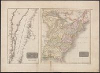
- Published / Created:
- 1809
- Call Number:
- 755 1809A
- Container / Volume:
- BRBL_00438
- Image Count:
- 1
- Resource Type:
- Maps, Atlases & Globes
- Found in:
- Beinecke Rare Book and Manuscript Library > A Map of the United States: compiled chiefly from the State Maps, and other Authentic Information, by Saml. Lewis.
- Published / Created:
- 1817
- Call Number:
- 755 1817
- Container / Volume:
- BRBL_00439
- Image Count:
- 1
- Resource Type:
- Maps, Atlases & Globes
- Found in:
- Beinecke Rare Book and Manuscript Library > Northern Provinces of the United States. Hewitt Sc., London.
- Published / Created:
- [1805?]
- Call Number:
- 755 1805A
- Container / Volume:
- BRBL_00437
- Image Count:
- 1
- Resource Type:
- Maps, Atlases & Globes
- Found in:
- Beinecke Rare Book and Manuscript Library > Carta delle Provinciae Settentrionli degli Stati Uniti.
- Published / Created:
- 1812
- Call Number:
- 755 1812A
- Container / Volume:
- BRBL_00438
- Image Count:
- 1
- Resource Type:
- Maps, Atlases & Globes
- Found in:
- Beinecke Rare Book and Manuscript Library > The British Possessions in North America from the best authorities by Samuel Lewis, 1812.
- Published / Created:
- [1800?]
- Call Number:
- 755 1800F
- Container / Volume:
- BRBL_00437
- Image Count:
- 1
- Resource Type:
- Maps, Atlases & Globes
- Found in:
- Beinecke Rare Book and Manuscript Library > Carte de la Partie Septentrionale des Etats-Unis. Gravé par Tardieu.
- Published / Created:
- July 6th 1813.
- Call Number:
- 755 1813A
- Container / Volume:
- BRBL_00438
- Image Count:
- 1
- Resource Type:
- Maps, Atlases & Globes
- Found in:
- Beinecke Rare Book and Manuscript Library > An improved map of the United States by Shelton & Kensett. Engraved by A. Doolittle, New Haven, & T. Kensett, Cheshire ...
- Published / Created:
- [1800?]
- Call Number:
- 755 1800F
- Container / Volume:
- BRBL_00437
- Image Count:
- 1
- Resource Type:
- Maps, Atlases & Globes
- Found in:
- Beinecke Rare Book and Manuscript Library > Carte de la Partie Septentrionale des Etats-Unis. Gravé par Tardieu.
- Published / Created:
- 1812
- Call Number:
- 755 1812
- Container / Volume:
- BRBL_00438
- Image Count:
- 1
- Resource Type:
- Maps, Atlases & Globes
- Found in:
- Beinecke Rare Book and Manuscript Library > To the Officers of the Army and the Citizens of the United States This Map of Upper and Lower Canada, and United States contigious Contracted from the Manuscript surveys of P.F. Tardieu, Is respectfully Inscribed by the public's most Obedient Servant Thom
- Published / Created:
- 1806
- Call Number:
- 755 1806
- Container / Volume:
- BRBL_00438
- Image Count:
- 1
- Resource Type:
- Maps, Atlases & Globes
- Found in:
- Beinecke Rare Book and Manuscript Library > A map of the United States and Canada, New Scotland, New Brunswick and Newfoundland. Dresée par Lapie ... Gravée par P.A.F. Tardieu. Ecrit par J.J. Pachoux.
- Published / Created:
- 1812
- Call Number:
- 755 1812B
- Container / Volume:
- BRBL_00438
- Image Count:
- 1
- Resource Type:
- Maps, Atlases & Globes
- Found in:
- Beinecke Rare Book and Manuscript Library > To the Officers of the Army and the Citizens of the United States This Map of Upper and Lower Canada, and United States contigious Contracted from the Mauuscript surveys of P.F. Tardieu, Is respectfully Inscribed by the public's most Obedient Servant Thom
- Published / Created:
- 1813
- Call Number:
- 755 1813
- Container / Volume:
- BRBL_00438
- Image Count:
- 1
- Resource Type:
- Maps, Atlases & Globes
- Found in:
- Beinecke Rare Book and Manuscript Library > An improved Map of the United States by Shelton & Kensett. Engraved by A. Doolittle, New Haven, & T. Kensett, Cheshire. Copyright secured & entered according to Act of Congress, July 6th 1813.
- Published / Created:
- 1812
- Call Number:
- 755 1812
- Container / Volume:
- BRBL_00438
- Image Count:
- 1
- Resource Type:
- Maps, Atlases & Globes
- Found in:
- Beinecke Rare Book and Manuscript Library > To the Officers of the Army and the Citizens of the United States This Map of Upper and Lower Canada, and United States contigious Contracted from the Manuscript surveys of P.F. Tardieu, Is respectfully Inscribed by the public's most Obedient Servant Thom
- Published / Created:
- 1806
- Call Number:
- 755 1806B
- Container / Volume:
- BRBL_00438
- Image Count:
- 1
- Resource Type:
- Maps, Atlases & Globes
- Found in:
- Beinecke Rare Book and Manuscript Library > A new map of the United States of America ... by John Cary, Engraver.
- Published / Created:
- [1810?]
- Call Number:
- 755 1810
- Container / Volume:
- BRBL_00438
- Image Count:
- 1
- Resource Type:
- Maps, Atlases & Globes
- Found in:
- Beinecke Rare Book and Manuscript Library > The Upper Territories of the United States. Kneass & Delleker Sc.
- Published / Created:
- 1826
- Call Number:
- 755gma 1826
- Container / Volume:
- BRBL_00442
- Image Count:
- 1
- Resource Type:
- Maps, Atlases & Globes
- Found in:
- Beinecke Rare Book and Manuscript Library > Map of the Country between Washington & Pittsburg referring to the contemplated Chesapeake & Ohio Canal and its general route and profile. Oct. 1826. Drawn by Lieut. Farley, U.S.A. Etched by Wm. Harrison, Georgetown, D.C., Lettered by D.R. Harrison.
- Published / Created:
- 1836
- Call Number:
- 755gme 1836
- Container / Volume:
- BRBL_00442
- Image Count:
- 1
- Resource Type:
- Maps, Atlases & Globes
- Found in:
- Beinecke Rare Book and Manuscript Library > A map of part of Alabama & Florida, showing the route of the proposed Columbus & Pensacola R.R.
- Published / Created:
- Sept. 1. 1806.
- Call Number:
- 759 1806
- Container / Volume:
- BRBL_00728
- Image Count:
- 1
- Resource Type:
- Maps, Atlases & Globes
- Found in:
- Beinecke Rare Book and Manuscript Library > A new map of part of the United States of North America ... / by John Cary, engraver, 1806.
- Published / Created:
- 1830
- Call Number:
- 755 1830
- Container / Volume:
- BRBL_00440
- Image Count:
- 1
- Resource Type:
- Maps, Atlases & Globes
- Found in:
- Beinecke Rare Book and Manuscript Library > Map of the territories of Michigan and Ouisconsin on a scale of 30 geographical miles to an inch by John Farmer of Detroit, Engraved by Rawdon Clark & Co., Albany, NY.
- Published / Created:
- 1833
- Call Number:
- 755 1833
- Container / Volume:
- BRBL_00440
- Image Count:
- 1
- Resource Type:
- Maps, Atlases & Globes
- Found in:
- Beinecke Rare Book and Manuscript Library > Map of Louisiana, Mississippi and Alabama, constructed from the latest authorities.
- Published / Created:
- 1835
- Call Number:
- 755 1835B
- Container / Volume:
- BRBL_00440
- Image Count:
- 1
- Resource Type:
- Maps, Atlases & Globes
- Found in:
- Beinecke Rare Book and Manuscript Library > Map of the States of Ohio, Indiana, and Illinois with the settled part of Michigan.
- Published / Created:
- 1835
- Call Number:
- 755 1835A
- Container / Volume:
- BRBL_00440
- Image Count:
- 1
- Resource Type:
- Maps, Atlases & Globes
- Found in:
- Beinecke Rare Book and Manuscript Library > A map of a portion of the Indian Country lying east and west of the Mississippi river to the forty sixth degree of north latitude from ... observation ... 1835 ... U.S. Top. Bureau.
- Published / Created:
- [1835?]
- Call Number:
- 755 1835
- Container / Volume:
- BRBL_00440
- Image Count:
- 1
- Resource Type:
- Maps, Atlases & Globes
- Found in:
- Beinecke Rare Book and Manuscript Library > Map showing the most direct commercial Route from Atlantic via L. Ontario, to the Province of Upper Canada the North West States and Territories and to the Mississippi. J. Price Scrip. N.Y., T. & C. Woods lithography N.Y.
- Published / Created:
- 1844
- Call Number:
- 755 1844
- Container / Volume:
- BRBL_00441
- Image Count:
- 1
- Resource Type:
- Maps, Atlases & Globes
- Found in:
- Beinecke Rare Book and Manuscript Library > Guide through Ohio, Michigan, Indiana, Illinois, Missouri, Wisconsin & Iowa by J. Calvin Smith ...
- Published / Created:
- 1828
- Call Number:
- 755cea 1828
- Container / Volume:
- BRBL_00442
- Image Count:
- 1
- Resource Type:
- Maps, Atlases & Globes
- Found in:
- Beinecke Rare Book and Manuscript Library > Carta Esferica de las Costas Orientales de la America Setentrional que comprende desde Nueva York hasta el Golfo y Rio Sn. Lorenzo con parte de la Isla de Terranova.
- Published / Created:
- [1843?]
- Call Number:
- 755 1843A
- Container / Volume:
- BRBL_00441
- Image Count:
- 1
- Resource Type:
- Maps, Atlases & Globes
- Found in:
- Beinecke Rare Book and Manuscript Library > Map exhibiting the country between Lakes Michigan and Erie and the contested boundary lines.
- Published / Created:
- [1839?]
- Call Number:
- 755 1844B
- Container / Volume:
- BRBL_00441
- Image Count:
- 1
- Resource Type:
- Maps, Atlases & Globes
- Found in:
- Beinecke Rare Book and Manuscript Library > Virginia, Maryland, and Delaware, 1844.
- Published / Created:
- 1835
- Call Number:
- 755 1835B
- Container / Volume:
- BRBL_00440
- Image Count:
- 1
- Resource Type:
- Maps, Atlases & Globes
- Found in:
- Beinecke Rare Book and Manuscript Library > Map of the States of Ohio, Indiana, and Illinois with the settled part of Michigan.
- Published / Created:
- [1815].
- Call Number:
- 755cea 1815
- Container / Volume:
- BRBL_00442
- Image Count:
- 1
- Resource Type:
- Maps, Atlases & Globes
- Found in:
- Beinecke Rare Book and Manuscript Library > A new chart of the coast of Connecticut. New York, New Jersey and the Delaware ... by Samuel Lambert, Salem. Wightman Sculpsit.
- Published / Created:
- 1829
- Call Number:
- 755GFC 1829A
- Container / Volume:
- BRBL_00442
- Image Count:
- 1
- Resource Type:
- Maps, Atlases & Globes
- Found in:
- Beinecke Rare Book and Manuscript Library > Map of the United States Lead Mines on the Upper Mississippi River ... Ebr. Martin, engraver.
- Published / Created:
- 1829
- Call Number:
- 755 1829A
- Container / Volume:
- BRBL_00440
- Image Count:
- 1
- Resource Type:
- Maps, Atlases & Globes
- Found in:
- Beinecke Rare Book and Manuscript Library > Map of the United States and the Southern part of the Canadas. By James Whitelaw, Esq.
- Published / Created:
- [1827?]
- Call Number:
- 755 1827
- Container / Volume:
- BRBL_00439
- Image Count:
- 1
- Resource Type:
- Maps, Atlases & Globes
- Found in:
- Beinecke Rare Book and Manuscript Library > [Map showing disputed boundary between U.S. and Canada] Printed at the lithographic Establishment Quarter Master General's Office Horse Guards. Drawn by L. Herbert.
- Published / Created:
- 1829
- Call Number:
- 755 1829
- Container / Volume:
- BRBL_00440
- Image Count:
- 1
- Resource Type:
- Maps, Atlases & Globes
- Found in:
- Beinecke Rare Book and Manuscript Library > The United States of North America, with the British Territories.
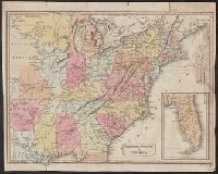
- Published / Created:
- 1827
- Call Number:
- 755 1827A
- Container / Volume:
- BRBL_00440
- Image Count:
- 4
- Resource Type:
- Maps, Atlases & Globes
- Found in:
- Beinecke Rare Book and Manuscript Library > Map of the United States and the Provinces of Upper and Lower Canada, New Brunswick and Nova Scotia ... by John & Alexr. Walker.
- Published / Created:
- 1796
- Call Number:
- 755 1802
- Container / Volume:
- BRBL_00437
- Image Count:
- 4
- Resource Type:
- Maps, Atlases & Globes
- Found in:
- Beinecke Rare Book and Manuscript Library > A map of the United States of North America ...
- Published / Created:
- [1864?]
- Call Number:
- 754hc 1864C
- Container / Volume:
- BRBL_00421
- Image Count:
- 1
- Resource Type:
- Maps, Atlases & Globes
- Found in:
- Beinecke Rare Book and Manuscript Library > Plan of the Western Seat of War. J. Manouvrier & Co., lith., N[ew] O[rleans].
- Creator:
- James River Bridge Corporation
- Published / Created:
- [1920?]
- Call Number:
- 779gmb W27 1920
- Container / Volume:
- BRBL_00505A
- Image Count:
- 2
- Resource Type:
- Maps, Atlases & Globes
- Found in:
- Beinecke Rare Book and Manuscript Library > Motor strip map, Washington and Jacksonville, via the coastal highway : through historic lands, "the cradle of the republic."