Search
You Searched For
Search Results
- Call Number:
- 1974 Folio 72
- Collection Title:
- The English pilot: describing the West-India navigation, from Hudson's-Bay to the river Amazones
- Image Count:
- 1
- Found in:
- Beinecke Rare Book and Manuscript Library > A new and correct chart of the western and southern oceans
- Call Number:
- 1973 Folio 116
- Collection Title:
- The English pilot: describing the West-India navigation, from Hudson's-Bay to the river Amazones
- Image Count:
- 2
- Found in:
- Beinecke Rare Book and Manuscript Library > A new and correct chart of the western and southern oceans
- Call Number:
- 1973 Folio 114
- Collection Title:
- The English pilot: describing the West-India navigation, from Hudson's-Bay to the river Amazones
- Image Count:
- 1
- Resource Type:
- Maps, Atlases & Globes
- Found in:
- Beinecke Rare Book and Manuscript Library > A new and correct chart of the western and southern oceans ...
- Creator:
- Harris, I., d. 1739
- Call Number:
- 1978 Folio 10
- Collection Title:
- The English pilot: describing the West-India navigation, from Hudson's-Bay to the river Amazones
- Image Count:
- 1
- Found in:
- Beinecke Rare Book and Manuscript Library > A new and correct chart shewing the variations of the compass in the western & southern oceans
- Published / Created:
- Undated
- Call Number:
- 1976 1233
- Collection Title:
- Twenty four new and accurate maps of the several parts of Europe ... : all (except the last) new
- Image Count:
- 1
- Found in:
- Beinecke Rare Book and Manuscript Library > A new map of Europe according to ye newest observations
- Creator:
- Faden, William, 1749-1836, creator
- Published / Created:
- 1788 June 24
- Call Number:
- 1982 Folio 10
- Image Count:
- 2
- Found in:
- Beinecke Rare Book and Manuscript Library > A new map of the German empire and the neighbouring states with their principal post roads : originally published by the Royal Academy of Berlin
- Creator:
- Visscher, Nicolaes, 1649-1702
- Published / Created:
- ca. 1684
- Call Number:
- Folio 469
- Collection Title:
- [Atlas factice of 13 maps by Nicolaes Visscher I, Nicolaes Visscher II, Guillaume Sanson, and
- Image Count:
- 1
- Found in:
- Beinecke Rare Book and Manuscript Library > Belgium Foederatum / [cartographic material] / emendate auctum et novissime editum, per Nicolaum Visscher
- Creator:
- Visscher, Nicolaes, 1649-1702
- Published / Created:
- ca. 1684
- Call Number:
- Folio 469
- Collection Title:
- [Atlas factice of 13 maps by Nicolaes Visscher I, Nicolaes Visscher II, Guillaume Sanson, and
- Image Count:
- 1
- Found in:
- Beinecke Rare Book and Manuscript Library > Comitatus Hannoniae et Archiepiscopatus Cameracensis tabula / [cartographic material] / per Nicolaum Visscher
- Creator:
- Danckerts, Justus, 1635-1701
- Published / Created:
- ca. 1680
- Call Number:
- Folio 469
- Collection Title:
- [Atlas factice of 13 maps by Nicolaes Visscher I, Nicolaes Visscher II, Guillaume Sanson, and
- Image Count:
- 1
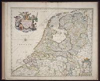
- Found in:
- Beinecke Rare Book and Manuscript Library > Comitatus Hollandiae tabula / [cartographic material] / pluribus locis recens emendata a Iusto Danckerts
- Creator:
- Visscher, Nicolaes, 1649-1702
- Published / Created:
- ca. 1684
- Call Number:
- Folio 469
- Collection Title:
- [Atlas factice of 13 maps by Nicolaes Visscher I, Nicolaes Visscher II, Guillaume Sanson, and
- Image Count:
- 1
- Found in:
- Beinecke Rare Book and Manuscript Library > Comitatus Namurci / [cartographic material] / emendata delineatio nuperrime in lucem edita per Nicolaum Visscher
- Creator:
- Visscher, Nicolaes, 1649-1702
- Published / Created:
- ca. 1684
- Call Number:
- Folio 469
- Collection Title:
- [Atlas factice of 13 maps by Nicolaes Visscher I, Nicolaes Visscher II, Guillaume Sanson, and
- Image Count:
- 2
- Found in:
- Beinecke Rare Book and Manuscript Library > Ducatus Lutzenburgi novissima et accuratissima delineatio / [cartographic material] / per Nic. Visscher
- Creator:
- Hase, Johann Matthias, 1684-1742
Homann Erben (Firm)
Reinsberger, Johann Christoph
- Published / Created:
- A. MDCCXXXXIII [1743]
- Call Number:
- 1975 Folio 31
- Collection Title:
- [Atlas factice of 42 maps, produced by the Homann Erben firm]
- Image Count:
- 1
- Found in:
- Beinecke Rare Book and Manuscript Library > Europa, secundum legitimas projectionis stereographicae regulas : et juxta recentissimas observationes aeque ac relationes adhibitis quoq[ue] veterum monumentorum subsidiis / descripta et in partes suas methodicas X divisa a Ioh. Matth. Hasio, Math. P.P.O
- Creator:
- Hase, Johann Matthias, 1684-1742
Homann Erben (Firm)
- Published / Created:
- [1743?]
- Call Number:
- 1983 Folio 23
- Collection Title:
- [Atlas factice of 50 maps, primarily by Johann Baptist Homann and/or issued by the Homann Erben
- Image Count:
- 1
- Found in:
- Beinecke Rare Book and Manuscript Library > Europa, secundum legitimas projectionis stereographicae regulas [cartographic material] : et juxta recentissimas observationes aeque ac relationes adhibitis quoq[ue] veterum monumentorum subsidiis / descripta et in partes suas methodicas X divisa a Ioh. M
- Creator:
- Hase, Johann Matthias, 1684-1742
Homann Erben (Firm)
- Published / Created:
- A. MDCCXXXXIII [1743]
- Call Number:
- 1973 Folio 30
- Collection Title:
- [Atlas factice of 32 maps and 1 distance table, produced by the Homann Erben firm]
- Image Count:
- 1
- Found in:
- Beinecke Rare Book and Manuscript Library > Europa, secundum legitimas projectionis stereographicae regulas [cartographic material] : et juxta recentissimas observationes aeque ac relationes adhibitis quoq[ue] veterum monumentorum subsidiis / descripta et in partes suas methodicas X divisa a Ioh. M
- Creator:
- Kitchin, Thomas, d. 1784, creator
Sayer, Robert, 1725-1794
- Published / Created:
- 1787 January 1
- Call Number:
- 1982 Folio 10
- Image Count:
- 2
- Found in:
- Beinecke Rare Book and Manuscript Library > Europe divided into its empires, kingdoms, states, republics, & ca
- Creator:
- Berry, William, fl. 1669-1708, creator
Sanson, Nicolas, 1600-1667
- Published / Created:
- 1680
- Call Number:
- 1973 Folio 10
- Image Count:
- 1
- Resource Type:
- Maps, Atlases & Globes
- Found in:
- Beinecke Rare Book and Manuscript Library > Europe divided into its principall states, which are subdivided into their principall provinces
- Creator:
- Visscher, Nicolaes, 1649-1702
- Published / Created:
- ca. 1684
- Call Number:
- Folio 469
- Collection Title:
- [Atlas factice of 13 maps by Nicolaes Visscher I, Nicolaes Visscher II, Guillaume Sanson, and
- Image Count:
- 1
- Found in:
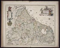
- Beinecke Rare Book and Manuscript Library > Flandriae comitatus / [cartographic material] / accuratissima descriptio edita per Nicolaum Visscher
- Creator:
- Visscher, Nicolaes, 1649-1702
- Published / Created:
- ca. 1684
- Call Number:
- Folio 469
- Collection Title:
- [Atlas factice of 13 maps by Nicolaes Visscher I, Nicolaes Visscher II, Guillaume Sanson, and
- Image Count:
- 1
- Found in:
- Beinecke Rare Book and Manuscript Library > Geographica Artesiae comitatus tabula / [cartographic material] / per Nicolaum Visscher edita
- Creator:
- Jaillot, Alexis Hubert, 1632-1712
Mortier, Pierre
Sanson, Guillaume
- Published / Created:
- [1692?]
- Call Number:
- Folio 469
- Collection Title:
- [Atlas factice of 13 maps by Nicolaes Visscher I, Nicolaes Visscher II, Guillaume Sanson, and
- Image Count:
- 1
- Found in:
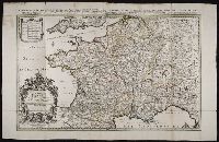
- Beinecke Rare Book and Manuscript Library > Le Royaume de France distingue suivant l’estenduee de toutes ses provinces et ses acquisitions [cartographic material] : dans l’Espagne, dans l’Italie, dans l’Allemagne, et dans la Flandre, l’Artois, le Haynaut, le Namur, et le Luxembourg, Provinces des P
- Creator:
- Visscher, Nicolaes, 1618-1679
- Published / Created:
- ca. 1677
- Call Number:
- Folio 469
- Collection Title:
- [Atlas factice of 13 maps by Nicolaes Visscher I, Nicolaes Visscher II, Guillaume Sanson, and
- Image Count:
- 1
- Found in:
- Beinecke Rare Book and Manuscript Library > Leodiensis Episcopatus in omnes subjacentes provincias distincte divisus / [cartographic material] / per Nicolaum Visscher, Amt. Bat., cum privilegio Ordinum Hollandiae et West-Frisie
- Creator:
- Jaillot, Alexis Hubert, 1632-1712
Mortier, Pierre
Sanson, Guillaume
- Published / Created:
- 1691
- Call Number:
- Folio 469
- Collection Title:
- [Atlas factice of 13 maps by Nicolaes Visscher I, Nicolaes Visscher II, Guillaume Sanson, and
- Image Count:
- 1
- Found in:
- Beinecke Rare Book and Manuscript Library > Les Provinces des Pays-Bas catholiques [cartographic material] : distinguees suivant qu’elles sont presentement partagees entre le Roy de France, le Roy d’Espagne et les Estats Generaux des Provinces-Unies / presentees au Roy par ... Guillaume Sanson Geog
- Creator:
- Danckerts, Cornelis, ca. 1603-1656
- Published / Created:
- 1643
- Call Number:
- 1983 Folio 19
- Collection Title:
- [Atlas factice of 96 maps by Blaeu, Visscher, Jansson, Hondius and others]
- Image Count:
- 1
- Found in:
- Beinecke Rare Book and Manuscript Library > Nova Europae descriptio / auctore Cornelio Dankertz
- Creator:
- Visscher, Claes Jansz., 1586 or 7-1652
- Published / Created:
- ao. 1652
- Call Number:
- 1983 Folio 19
- Collection Title:
- [Atlas factice of 96 maps by Blaeu, Visscher, Jansson, Hondius and others]
- Image Count:
- 1
- Found in:
- Beinecke Rare Book and Manuscript Library > Nova Europae descriptio / auctore N. Visscher
- Creator:
- Deur, Abraham Jansz
Visscher, Nicolaes, 1649-1702
- Published / Created:
- [ca. 1684]
- Call Number:
- Folio 469
- Collection Title:
- [Atlas factice of 13 maps by Nicolaes Visscher I, Nicolaes Visscher II, Guillaume Sanson, and
- Image Count:
- 1
- Found in:
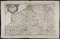
- Beinecke Rare Book and Manuscript Library > Novissima et accuratissima XVII provinciarum Germanae Inferiores delineatio [cartographic material]
- Creator:
- Visscher, Nicolaes, 1649-1702
- Published / Created:
- ca. 1684
- Call Number:
- Folio 469
- Collection Title:
- [Atlas factice of 13 maps by Nicolaes Visscher I, Nicolaes Visscher II, Guillaume Sanson, and
- Image Count:
- 1
- Found in:
- Beinecke Rare Book and Manuscript Library > Tabula ducatus Brabantiae continens Marchionatum sacri imperii et dominium Mechliniense / [cartographic material] / de novo accurate emendata et in lucem edita per Nicolaum Visscher
- Creator:
- Waghenaer, Lucas Janszoon, 1534 or 5-1606
- Published / Created:
- ann. 1605.
- Call Number:
- 1976 Folio 46
- Image Count:
- 125
- Resource Type:
- Books, Journals & Pamphlets
- Found in:
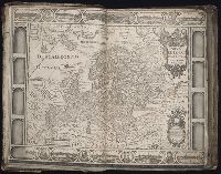
- Beinecke Rare Book and Manuscript Library > The mariners mirrovr wherin may playnly be seen the courses, heights, distances, depths, sounding, flouds and ebs, risings of lands, rocks ... of the harbouroughs, havens and ports of the greatest part of Europe: ... together w.th the rules and instrumeíÄ
- Creator:
- Visscher, Nicolaes, 1649-1702
- Published / Created:
- ca. 1689
- Call Number:
- Folio 469
- Collection Title:
- [Atlas factice of 13 maps by Nicolaes Visscher I, Nicolaes Visscher II, Guillaume Sanson, and
- Image Count:
- 1
- Found in:
- Beinecke Rare Book and Manuscript Library > Totius Fluminis Rheni novissma descriptio / [cartographic material] / per Nic. Vischer
- Call Number:
- Folio 469
- Collection Title:
- [Atlas factice of 13 maps by Nicolaes Visscher I, Nicolaes Visscher II, Guillaume Sanson, and
- Image Count:
- 2
- Found in:
- Beinecke Rare Book and Manuscript Library > [Atlas factice of 13 maps by Nicolaes Visscher I, Nicolaes Visscher II, Guillaume Sanson, and Justus Danckerts]
- Published / Created:
- MDCI [1601]
- Call Number:
- Taylor 193 3
- Collection Title:
- Tertia pars Indiae Orientalis ... / de Germanico in Latinum translata, & bono ordine disposita a
- Image Count:
- 1
- Found in:
- Beinecke Rare Book and Manuscript Library > [Descriptio Hydrograrhica sheet 2]