Search
You Searched For
Search Results
- Creator:
- United States. Office of Strategic Services
- Published / Created:
- 1943
- Call Number:
- 36gma 1943
- Container / Volume:
- BRBL_00130
- Image Count:
- 1
- Resource Type:
- Maps, Atlases & Globes
- Found in:
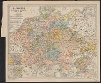
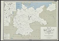
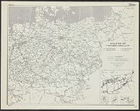
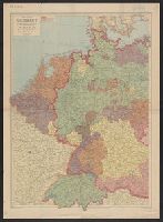
- Beinecke Rare Book and Manuscript Library > "Greater Germany" inland waterways.
- Creator:
- United States. Office of Strategic Services. Research and Analysis Branch
- Published / Created:
- 1945
- Call Number:
- 36eb 1939A
- Container / Volume:
- BRBL_00127
- Image Count:
- 1
- Resource Type:
- Maps, Atlases & Globes
- Found in:
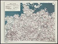
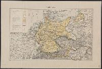
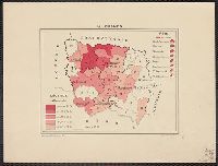
- Beinecke Rare Book and Manuscript Library > "Greater" Germany, population dependent upon commercial and service occupations (by Kreise 1939).
- Creator:
- United States. Office of Strategic Services. Research and Analysis Branch
- Published / Created:
- 1945
- Call Number:
- 36eb 1939A
- Container / Volume:
- BRBL_00127
- Image Count:
- 1
- Resource Type:
- Maps, Atlases & Globes
- Found in:
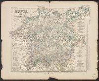
- Beinecke Rare Book and Manuscript Library > "Greater" Germany, population dependent upon commercial and service occupations (by Kreise 1939).
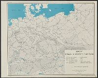
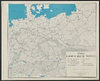
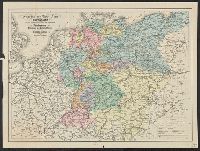
- Creator:
- United States. Office of Strategic Services. Research and Analysis Branch
- Published / Created:
- 1945
- Call Number:
- 36eb 1945A
- Container / Volume:
- BRBL_00127
- Image Count:
- 1
- Resource Type:
- Maps, Atlases & Globes
- Found in:
- Beinecke Rare Book and Manuscript Library > "Greater" Germany. : population change by Kreise, circa 1933-1939.
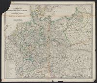
- Published / Created:
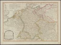
- 1805
- Call Number:
- 36 1805A
- Container / Volume:
- BRBL_00119
- Image Count:
- 1
- Resource Type:
- Maps, Atlases & Globes
- Found in:
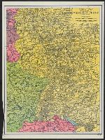
- Beinecke Rare Book and Manuscript Library > A new map of Germany divided into its circles ...
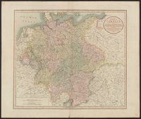
- Creator:
- Cary, John, ca. 1754-1835
- Published / Created:
- April 28, 1811.
- Call Number:
- 36 1811
- Container / Volume:
- BRBL_00119
- Image Count:
- 1
- Resource Type:
- Maps, Atlases & Globes
- Found in:
- Beinecke Rare Book and Manuscript Library > A new map of Germany, divided into its circles : viz. the upper and lower Rhine, Swabia, Austria, Bavaria, upper and lower Saxony, Franconia and Westphalia, with the Kingdom of Bohemia &c. From the latest authorities / by John Cary, engraver, 1811.
- Published / Created:
- 1811
- Call Number:
- 36 R34 1811
- Container / Volume:
- BRBL_00126
- Image Count:
- 1
- Resource Type:
- Maps, Atlases & Globes
- Found in:
- Beinecke Rare Book and Manuscript Library > A new map of the Circles of the Upper and Lower Rhine ... By John Cary, Engraver.
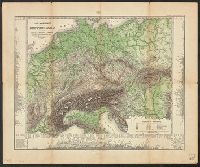
- Published / Created:
- 1841
- Call Number:
- 36hc 1796
- Container / Volume:
- BRBL_00133
- Image Count:
- 13
- Resource Type:
- Maps, Atlases & Globes
- Found in:
- Beinecke Rare Book and Manuscript Library > Atlas Principes de la Strategie, par S.A.I. Le Prince Chartes, traduit de l'Allemand par le Général Jomini.
- Published / Created:
- [1829?]
- Call Number:
- 36 B738 1829
- Container / Volume:
- BRBL_00123
- Image Count:
- 1
- Resource Type:
- Maps, Atlases & Globes
- Found in:
- Beinecke Rare Book and Manuscript Library > Braunschweig mit der Pronenade ... Aufgenommen von E.V. Heinemann gestochen von C. Marc, ... Von Carl Wilhelm Schenk.
- Published / Created:
- 1805
- Call Number:
- 36 1805
- Container / Volume:
- BRBL_00119
- Image Count:
- 1
- Resource Type:
- Maps, Atlases & Globes
- Found in:
- Beinecke Rare Book and Manuscript Library > Carte Générale de L'Allmagne Après le Recez de 1805. Gravée Par Ch. Dyonnet. Dressée Par A.A. Dufour.
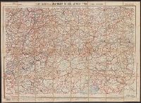
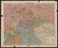
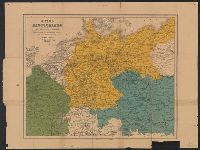
- Published / Created:
- [1910]
- Call Number:
- 36gmb 1910A
- Container / Volume:
- BRBL_00130
- Image Count:
- 1
- Resource Type:
- Maps, Atlases & Globes
- Found in:
- Beinecke Rare Book and Manuscript Library > Carte routière de l'Allemagne du Sud, Autriche, Tyrol (Grands itinéraires).
- Creator:
- Allied Forces
Great Britain. War Office. General Staff. Geographical Section
- Published / Created:
- 1943-
- Call Number:
- 11hd 1942D-44
- Image Count:
- 14
- Resource Type:
- Maps, Atlases & Globes
- Found in:
- Beinecke Rare Book and Manuscript Library > Central Europe 1:100,000.
- Creator:
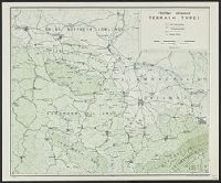
- United States. Office of Strategic Services. Research and Analysis Branch
- Published / Created:
- 1944
- Call Number:
- 36cb 1944
- Container / Volume:
- BRBL_00127
- Image Count:
- 1
- Resource Type:
- Maps, Atlases & Globes
- Found in:
- Beinecke Rare Book and Manuscript Library > Central Germany terrain types / compiled and drawn in the Branch of Research and Analysis, OSS.
- Published / Created:
- [1940?]
- Call Number:
- 36gmb 1940
- Container / Volume:
- BRBL_00130
- Image Count:
- 2
- Resource Type:
- Maps, Atlases & Globes
- Found in:
- Beinecke Rare Book and Manuscript Library > Continental-Autokarte Deutschland : in einem Blatt.
- Published / Created:
- [1830?]
- Call Number:
- 36gmd 1830
- Container / Volume:
- BRBL_00131
- Image Count:
- 1
- Resource Type:
- Maps, Atlases & Globes
- Found in:
- Beinecke Rare Book and Manuscript Library > Cours de Postes dans la Franconie depuis Schweinfort jusqn' A' Frankfort. Cours de Postes dans la Franconie par Bomberg, Baireut jusqu' a' Eger.
- Published / Created:
- 1814
- Call Number:
- 36 1814
- Container / Volume:
- BRBL_00119
- Image Count:
- 1
- Resource Type:
- Maps, Atlases & Globes
- Found in:
- Beinecke Rare Book and Manuscript Library > Cours du Rhin ... Par J.B. Poirson.
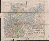
- Creator:
- Kiepert, Heinrich, 1818-1899, cartographer
- Published / Created:
- [1874?]
- Call Number:
- 36 1874
- Container / Volume:
- BRBL_00120
- Image Count:
- 1
- Resource Type:
- Maps, Atlases & Globes
- Found in:
- Beinecke Rare Book and Manuscript Library > Der Preussische Staat und das Deutsche Reich / bearbeitet von H. Kiepert u. A Gräf ; gestochen v. W. Kratz, Terrain v. Kern.
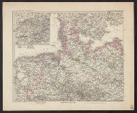
- Published / Created:
- 1880
- Call Number:
- 36 1880 1
- Container / Volume:
- BRBL_00120
- Image Count:
- 1
- Resource Type:
- Maps, Atlases & Globes
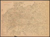
- Found in:
- Beinecke Rare Book and Manuscript Library > Deutsches Reich, in 4 Blättern. Blatt 1 / C. Vogel.
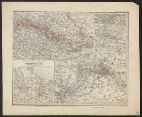
- Published / Created:
- 1879
- Call Number:
- 36 1880 2
- Container / Volume:
- BRBL_00120
- Image Count:
- 1
- Resource Type:
- Maps, Atlases & Globes
- Found in:
- Beinecke Rare Book and Manuscript Library > Deutsches Reich, in 4 Blättern. Blatt 4 / C. Vogel.
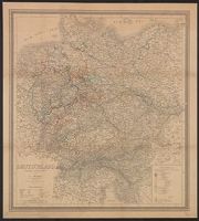
- Creator:
- Geographisches Institut (Weimar, Thuringia, Germany)
Weiland, C. F. (Carl Ferdinand), -1847, cartographer
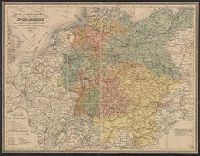
- Published / Created:
- [c1865]
- Call Number:
- 36 1865A
- Container / Volume:
- BRBL_00120
- Image Count:
- 1
- Resource Type:
- Maps, Atlases & Globes
- Found in:
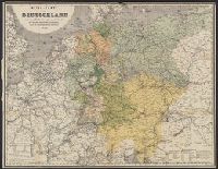
- Beinecke Rare Book and Manuscript Library > Deutschland / entworfen und gezeichnet von C.F. Weiland.
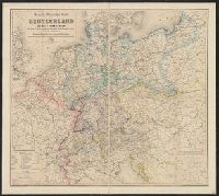
- Published / Created:
- [1910?]
- Call Number:
- 36 1618
- Image Count:
- 1
- Resource Type:
- Maps, Atlases & Globes
- Found in:
- Beinecke Rare Book and Manuscript Library > Deutschland im Zeitraum der Reformation 1492 bis 1618 von B. Hassenstein.
- Published / Created:
- 1852
- Call Number:
- 36ef 1852
- Container / Volume:
- BRBL_00127
- Image Count:
- 1
- Resource Type:
- Maps, Atlases & Globes
- Found in:
- Beinecke Rare Book and Manuscript Library > Deutschland, Niederlande, Belgien und Sweiz : National-, Sprach-, Dialect Verschiedenheit.
- Creator:
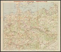
- George Philip & Son
London Geographical Institute
- Published / Created:
- 1940
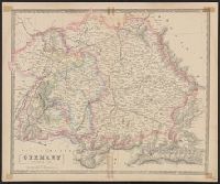
- Call Number:
- 36 1940D
- Container / Volume:
- BRBL_00121
- Image Count:
- 1
- Resource Type:
- Maps, Atlases & Globes
- Found in:
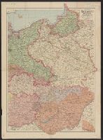
- Beinecke Rare Book and Manuscript Library > Eastern Germany, with Hungary.
- Creator:
- Great Britain. War Office. General Staff. Geographical Section
- Published / Created:
- 1918
- Call Number:
- 36ed 1918
- Container / Volume:
- BRBL_00127
- Image Count:
- 2
- Resource Type:
- Maps, Atlases & Globes
- Found in:
- Beinecke Rare Book and Manuscript Library > Ethnographical map [cartographic material].
- Creator:
- Flemming, C. (Carl), 1806-1878
Wiskott, C. T
- Published / Created:
- [1915?]
- Call Number:
- 36 1915
- Container / Volume:
- BRBL_00121
- Image Count:
- 1
- Resource Type:
- Maps, Atlases & Globes
- Found in:
- Beinecke Rare Book and Manuscript Library > Flemmings Generalkarte. Nr. 60. Mittel-Deutschland / Leitung ... J.I. Kettler ; Netzentwurf ... A. Bludau ; Zeichnung: O. Herkt.
- Creator:
- Stieler, Adolf, 1775-1836
- Published / Created:
- 1875
- Call Number:
- 36cbf 1875
- Container / Volume:
- BRBL_00127
- Image Count:
- 1
- Resource Type:
- Maps, Atlases & Globes
- Found in:
- Beinecke Rare Book and Manuscript Library > Fluss- und Bergkarte von Deutschland und den anliegenden Ländern / entworfen u. gez. von Adolf Stieler, 1820.
- Creator:
- United States. Office of Strategic Services. Research and Analysis Branch
- Published / Created:
- 1944
- Call Number:
- 36gm 1944A
- Container / Volume:
- BRBL_00130
- Image Count:
- 1
- Resource Type:
- Maps, Atlases & Globes
- Found in:
- Beinecke Rare Book and Manuscript Library > Germany : Super-Highway (Reichsautobahn) / compiled and drawn in the Branch of Research and Analysis, OSS.
- Creator:
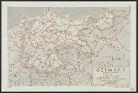
- United States. Office of Strategic Services. Research and Analysis Branch
- Published / Created:
- 1944
- Call Number:
- 36gmb 1944B
- Container / Volume:
- BRBL_00130
- Image Count:
- 1
- Resource Type:
- Maps, Atlases & Globes
- Found in:
- Beinecke Rare Book and Manuscript Library > Germany : principal road construction offices / compiled and drawn in the Branch of Research and Analysis, OSS.
- Published / Created:
- 1816
- Call Number:
- 36 1816
- Container / Volume:
- BRBL_00119
- Image Count:
- 1
- Resource Type:
- Maps, Atlases & Globes
- Found in:
- Beinecke Rare Book and Manuscript Library > Germany North of the Mayne. Neele Sc ... London. Drawn & Engraved for Thompson's new General Atlas.
- Published / Created:
- 1816
- Call Number:
- 36 1816A
- Container / Volume:
- BRBL_00119
- Image Count:
- 1
- Resource Type:
- Maps, Atlases & Globes
- Found in:
- Beinecke Rare Book and Manuscript Library > Germany South of the Mayne. Neele Sc ... London. Drawn & Engraved for Thompson's new General Atlas.
- Creator:
- Darley, James M. (James Morrison)
National Geographic Society (U.S.). Cartographic Section
- Published / Created:
- c1944.
- Call Number:
- 36 1944C
- Container / Volume:
- BRBL_00121
- Image Count:
- 1
- Resource Type:
- Maps, Atlases & Globes
- Found in:
- Beinecke Rare Book and Manuscript Library > Germany and its approaches : with international boundaries as of September 1, 1939, the day Germany invaded Poland and, in red, boundaries as of January 1, 1938, before Germany seized Austria and Czechoslovakia / compiled and drawn in the Cartographic Sec
- Creator:
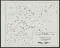
- United States. Office of Strategic Services. Research and Analysis Branch
- Published / Created:
- 1945
- Call Number:
- 36cb 1945A
- Container / Volume:
- BRBL_00127
- Image Count:
- 1
- Resource Type:
- Maps, Atlases & Globes
- Found in:
- Beinecke Rare Book and Manuscript Library > Germany eastern border regions : surface configuration.
- Creator:
- United States. Office of Strategic Services. Research and Analysis Branch
- Published / Created:
- 1943
- Call Number:
- 36gf 1943
- Container / Volume:
- BRBL_00130
- Image Count:
- 1
- Resource Type:
- Maps, Atlases & Globes
- Found in:
- Beinecke Rare Book and Manuscript Library > Germany, centers of machine tool production / Board of Economic Warfare, Enemy Branch.
- Creator:
- United States. Office of Strategic Services. Research and Analysis Branch
- Published / Created:
- 1945
- Call Number:
- 36gf 1941E
- Container / Volume:
- BRBL_00129
- Image Count:
- 1
- Resource Type:
- Maps, Atlases & Globes
- Found in:
- Beinecke Rare Book and Manuscript Library > Germany, distribution of the basic chemicals industry (coal tar, nitrogen, calcium carbide, sulphuric acid, alkalies, chlorine) (1941).
- Creator:
- United States. Office of Strategic Services. Research and Analysis Branch
- Published / Created:
- 1945
- Call Number:
- 36gf 1941A
- Container / Volume:
- BRBL_00129
- Image Count:
- 1
- Resource Type:
- Maps, Atlases & Globes
- Found in:
- Beinecke Rare Book and Manuscript Library > Germany, distribution of the commercial chemicals industry (dyes, paints, lacquers, photo-chemicals, pharmaceuticals, fertilizers, wood pulp) (1941).
- Creator:
- United States. Office of Strategic Services. Research and Analysis Branch
- Published / Created:
- 1945
- Call Number:
- 36gf 1939E
- Container / Volume:
- BRBL_00129
- Image Count:
- 1
- Resource Type:
- Maps, Atlases & Globes
- Found in:
- Beinecke Rare Book and Manuscript Library > Germany, distribution of the glass and ceramics industry (1939).
- Creator:
- United States. Office of Strategic Services. Research and Analysis Branch
- Published / Created:
- 1945
- Call Number:
- 36gf 1939
- Container / Volume:
- BRBL_00129
- Image Count:
- 1
- Resource Type:
- Maps, Atlases & Globes
- Found in:
- Beinecke Rare Book and Manuscript Library > Germany, distribution of the heavy machinery industry (1939).
- Creator:
- United States. Office of Strategic Services. Research and Analysis Branch
- Published / Created:
- 1945
- Call Number:
- 36gf 1941
- Container / Volume:
- BRBL_00129
- Image Count:
- 1
- Resource Type:
- Maps, Atlases & Globes
- Found in:
- Beinecke Rare Book and Manuscript Library > Germany, distribution of the light metals industry (including semi-finished products) (1941).
- Creator:
- United States. Office of Strategic Services. Research and Analysis Branch
- Published / Created:
- 1945
- Call Number:
- 36gf 1939F
- Container / Volume:
- BRBL_00129
- Image Count:
- 1
- Resource Type:
- Maps, Atlases & Globes
- Found in:
- Beinecke Rare Book and Manuscript Library > Germany, distribution of the precision and optical instruments industry (1939).
- Creator:
- United States. Office of Strategic Services. Research and Analysis Branch
- Published / Created:
- 1945
- Call Number:
- 36gf 1941C
- Container / Volume:
- BRBL_00129
- Image Count:
- 1
- Resource Type:
- Maps, Atlases & Globes
- Found in:
- Beinecke Rare Book and Manuscript Library > Germany, distribution of the war chemicals industry (explosives, poison gas) (1941).
- Creator:
- United States. Office of Strategic Services. Research and Analysis Branch
- Published / Created:
- 1944
- Call Number:
- 36gmb 1944
- Container / Volume:
- BRBL_00130
- Image Count:
- 4
- Resource Type:
- Maps, Atlases & Globes
- Found in:
- Beinecke Rare Book and Manuscript Library > Germany, roads.
- Creator:
- United States. Office of Strategic Services. Research and Analysis Branch
- Published / Created:
- 1943
- Call Number:
- 36cb 1943
- Container / Volume:
- BRBL_00127
- Image Count:
- 1
- Resource Type:
- Maps, Atlases & Globes
- Found in:
- Beinecke Rare Book and Manuscript Library > Germany, terrain & selected railroads / compiled and drawn in the Branch of Research and Analysis, OSS.
- Published / Created:
- 1919]
- Call Number:
- 11hcf 1919B-16
- Container / Volume:
- BRBL_00010O
- Image Count:
- 1
- Resource Type:
- Maps, Atlases & Globes
- Found in:
- Beinecke Rare Book and Manuscript Library > Germany.
- Creator:
- George Philip & Son
- Published / Created:
- [1853?]
- Call Number:
- 36 1853
- Container / Volume:
- BRBL_00120
- Image Count:
- 1
- Resource Type:
- Maps, Atlases & Globes
- Found in:
- Beinecke Rare Book and Manuscript Library > Germany. Northern part.
- Creator:
- George Philip & Son
- Published / Created:
- [1853?]
- Call Number:
- 36 1853A
- Container / Volume:
- BRBL_00120
- Image Count:
- 1
- Resource Type:
- Maps, Atlases & Globes
- Found in:
- Beinecke Rare Book and Manuscript Library > Germany. Southern part.
- Published / Created:
- [1860?]
- Call Number:
- 36gm 1860
- Container / Volume:
- BRBL_00130
- Image Count:
- 1
- Resource Type:
- Maps, Atlases & Globes
- Found in:
- Beinecke Rare Book and Manuscript Library > Geschäfts und Reise-Karte von Deutschland und den angrenzenden Ländern mit Angabe aller Eisenbahnen, Poststrassen und Dampfschiffslinien.
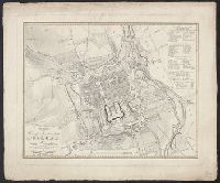
- Published / Created:
- 1823
- Call Number:
- 36 G712 1823
- Container / Volume:
- BRBL_00124
- Image Count:
- 1
- Resource Type:
- Maps, Atlases & Globes
- Found in:
- Beinecke Rare Book and Manuscript Library > Grundriss der Herzog Residenzstadt Gotha und deren Umgebung ... Gest. v. E.G. Edler. Entw. v. gez. v. I.C. Bär.
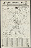
- Published / Created:
- [1917?]
- Call Number:
- 36hc 1917
- Container / Volume:
- BRBL_00133
- Image Count:
- 1
- Resource Type:
- Maps, Atlases & Globes
- Found in:
- Beinecke Rare Book and Manuscript Library > Home Headquarters Map : French and German Frontiers.
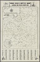
- Published / Created:
- [1917?]
- Call Number:
- 36hc 1917a
- Container / Volume:
- BRBL_00133
- Image Count:
- 1
- Resource Type:
- Maps, Atlases & Globes
- Found in:
- Beinecke Rare Book and Manuscript Library > Home Headquarters Map : German and Polish Frontiers.
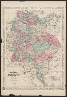
- Creator:
- Johnson and Ward
Johnson, A. J. (Alvin Jewett), 1827-1884
- Published / Created:
- [c1865]
- Call Number:
- 36 1865
- Container / Volume:
- BRBL_00120
- Image Count:
- 2
- Resource Type:
- Maps, Atlases & Globes
- Found in:
- Beinecke Rare Book and Manuscript Library > Johnson's Germany [cartographic material].
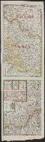
- Creator:
- Stieler, Adolf, 1775-1836
Stülpnagel, Friedrich von, 1913-
- Published / Created:
- 1876
- Call Number:
- 36 1876
- Container / Volume:
- BRBL_00120
- Image Count:
- 4
- Resource Type:
- Maps, Atlases & Globes
- Found in:
- Beinecke Rare Book and Manuscript Library > Karte des Deutschen Reichs und der Nachbarländer in XXV Blättern / entworfen von Adolf Stieler. Gezeichnet von demselben, F.v. Stülpnagel u. A.
- Published / Created:
- [1910?]
- Call Number:
- 36gm 1910A
- Container / Volume:
- BRBL_00130
- Image Count:
- 2
- Resource Type:
- Maps, Atlases & Globes
- Found in:
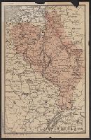
- Beinecke Rare Book and Manuscript Library > Königsreich Württemberg, Grosshzt. Hessen u. Baden nordölicher Teil.
- Creator:
- Geographical Publishing Co
- Published / Created:
- 1917
- Call Number:
- 11hc 1917F
- Container / Volume:
- BRBL_00010D
- Image Count:
- 2
- Resource Type:
- Maps, Atlases & Globes
- Found in:
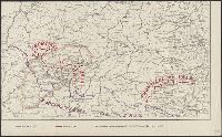
- Beinecke Rare Book and Manuscript Library > Map of the Franco-German war front : from Hirson, France to Basel, Switzerland, and the Russo-German war front from Riga, Russia, to Lemberg, Austria / Published for the Volume Library.
- Creator:
- Wyld, James, 1812-1887
- Published / Created:
- [1875?]
- Call Number:
- 36 1875
- Container / Volume:
- BRBL_00120
- Image Count:
- 1
- Resource Type:
- Maps, Atlases & Globes
- Found in:
- Beinecke Rare Book and Manuscript Library > Map of the Germanic confederated states : including the kingdoms of Prussia, and the empire of Germany / James Wyld.
- Creator:
- Pope-Hennessy, Una, 1876-1949
- Published / Created:
- [1917]
- Call Number:
- 11hc 1919Y
- Image Count:
- 2
- Resource Type:
- Maps, Atlases & Globes
- Found in:
- Beinecke Rare Book and Manuscript Library > Map of the main prison camps in Germany and Austria / by Mrs Pope-Hennessy.
- Creator:
- Goldschmidt, Albert
Kraatz, Leopold
- Published / Created:
- [1871?]
- Call Number:
- 36 1871
- Container / Volume:
- BRBL_00120
- Image Count:
- 1
- Resource Type:
- Maps, Atlases & Globes
- Found in:
- Beinecke Rare Book and Manuscript Library > Neue-Karte von Deutschland und den angrenzenden Ländern : mit besonderer Berücksichtigung der Eisenbahn und Dampfboot-Course / nach den neusten und besten Quellen bearbeitet von Leopold Kraatz.
- Creator:
- Mayr, J. G
- Published / Created:
- [1866?]
- Call Number:
- 36 1866A
- Container / Volume:
- BRBL_00120
- Image Count:
- 2
- Resource Type:
- Maps, Atlases & Globes
- Found in:
- Beinecke Rare Book and Manuscript Library > Neueste Übersichts-Karte von Deutschland und Ost-Frankreich : bis Paris, London, Kopenhagen, Warschau, Pesth, Venedig u[nd] Genua, in besonderer Rücksicht auf Eisenbahn-, Dampfschiff-, Post- u[nd] Telegraphen-Verbindungen, mit statistischen Distanz-Tabe
- Published / Created:
- 1840
- Call Number:
- 36 P84 1840
- Container / Volume:
- BRBL_00126
- Image Count:
- 1
- Resource Type:
- Maps, Atlases & Globes
- Found in:
- Beinecke Rare Book and Manuscript Library > Neuester Plan von der Königlichen Residenzstadt Potsdam nach trigonometrischen Vermessungen, so wie geo- und hydrometrischen Aufnahmen ausgearbeitet in der geographischen Kunstschule zu Postdam ... Gez. von Aug. Petermann. Gestochen von Ernst Reyhen.
- Creator:
- Weiland, G. H
- Published / Created:
- 1860?]
- Call Number:
- 36 1860A
- Container / Volume:
- BRBL_00120
- Image Count:
- 1
- Resource Type:
- Maps, Atlases & Globes
- Found in:
- Beinecke Rare Book and Manuscript Library > Nord-ost Frankreich, Deutschland, Belgien u[nd] Holland : nebst den angrenzenden Theilen der benachbarten Länder / von G.H. Weiland.
- Published / Created:
- [1845?]
- Call Number:
- 36cb 1845
- Container / Volume:
- BRBL_00127
- Image Count:
- 1
- Resource Type:
- Maps, Atlases & Globes
- Found in:
- Beinecke Rare Book and Manuscript Library > Plateau v. Deutschland, nach Berghaus. Lith ... Albracht Platt.
- Published / Created:
- 1808
- Call Number:
- 36gmd 1808
- Container / Volume:
- BRBL_00131
- Image Count:
- 1
- Resource Type:
- Maps, Atlases & Globes
- Found in:
- Beinecke Rare Book and Manuscript Library > Post Charte von Teutchland neue berichtegte Ausagabe von F.L. Güssefeld.
- Published / Created:
- 1816
- Call Number:
- 36gmd 1816
- Container / Volume:
- BRBL_00131
- Image Count:
- 1
- Resource Type:
- Maps, Atlases & Globes
- Found in:
- Beinecke Rare Book and Manuscript Library > Post Karte von Deutschland ...
- Creator:
- Hanser, G.
- Published / Created:
- 1848
- Call Number:
- 36gm 1848
- Container / Volume:
- BRBL_00130
- Image Count:
- 2
- Resource Type:
- Maps, Atlases & Globes
- Found in:
- Beinecke Rare Book and Manuscript Library > Post- und eisenbahn-reisekarte : Deutschland, Holland, Belgien, die Schweiz, Italien bis Neapel, der grösste Theil von Frankreich, Ungarn, Polen, etc. ; mit besonderer rücksicht auf eisenbahnen u. seedampfschiffahrt ... / originalzeichnung v. G. Hanser.
- Published / Created:
- 1821
- Call Number:
- 36gmd 1821
- Container / Volume:
- BRBL_00131
- Image Count:
- 1
- Resource Type:
- Maps, Atlases & Globes
- Found in:
- Beinecke Rare Book and Manuscript Library > Post-Reisse Karte von Deutschland ... von Georg Leiste ... gestochen v. H.F.E. Wildt.
- Creator:
- Heinrich & Zink
- Published / Created:
- 1856
- Call Number:
- 36gmd 1856B
- Container / Volume:
- BRBL_00131
- Image Count:
- 1
- Resource Type:
- Maps, Atlases & Globes
- Found in:
- Beinecke Rare Book and Manuscript Library > Post-und Reise-Karte von Deutschland [cartographic material] : und einem Theile der angrenzenden Länder nach den besten Hilfsmitteln neu bearbeitet.
- Published / Created:
- 1806
- Call Number:
- 36gmd 1806
- Container / Volume:
- BRBL_00131
- Image Count:
- 1
- Resource Type:
- Maps, Atlases & Globes
- Found in:
- Beinecke Rare Book and Manuscript Library > Postcharte durch ganz Deutschland ... Homanns Erben.
- Creator:
- United States. Office of Strategic Services. Research and Analysis Branch
- Published / Created:
- 1944
- Call Number:
- 36gme 1944
- Container / Volume:
- BRBL_00132
- Image Count:
- 1
- Resource Type:
- Maps, Atlases & Globes
- Found in:
- Beinecke Rare Book and Manuscript Library > Railroad administration of "Greater Germany" / compiled and drawn in the Branch of Research and Analysis, OSS.
- Creator:
- United States. Office of Strategic Services. Research and Analysis Branch
- Published / Created:
- 1943
- Call Number:
- 36gme 1943C
- Container / Volume:
- BRBL_00132
- Image Count:
- 1
- Resource Type:
- Maps, Atlases & Globes
- Found in:
- Beinecke Rare Book and Manuscript Library > Railways of "Greater Germany" / compiled and drawn in the Branch of Research and Analysis, OSS.
- Creator:
- United States. Office of Strategic Services. Research and Analysis Branch
- Published / Created:
- 1944
- Call Number:
- 36gme 1944C
- Container / Volume:
- BRBL_00132
- Image Count:
- 1
- Resource Type:
- Maps, Atlases & Globes
- Found in:
- Beinecke Rare Book and Manuscript Library > Railways of "Greater Germany" / compiled and drawn in the Branch of Research and Analysis, OSS.
- Creator:
- Rand McNally and Company
- Published / Created:
- [1923?]
- Call Number:
- 30 1940J
- Container / Volume:
- BRBL_00032B
- Image Count:
- 1
- Resource Type:
- Maps, Atlases & Globes
- Found in:
- Beinecke Rare Book and Manuscript Library > Rand McNally war map of Western Front.
- Published / Created:
- 1944
- Call Number:
- 36gmd 1944A
- Container / Volume:
- BRBL_00131
- Image Count:
- 1
- Resource Type:
- Maps, Atlases & Globes
- Found in:
- Beinecke Rare Book and Manuscript Library > Ravenstein Karte Grossdeutschland : Ausgabe 4: Die Deutschen Postleitgebiete.
- Published / Created:
- 1834
- Call Number:
- 36gmd 1834
- Container / Volume:
- BRBL_00131
- Image Count:
- 1
- Resource Type:
- Maps, Atlases & Globes
- Found in:
- Beinecke Rare Book and Manuscript Library > Reise-, Post-und Boss Karte von Deutschland ... von R.J. Vollrath Hoffman. in Stein gest. von W. Pebuda in Stuttgart.
- Published / Created:
- 1864
- Call Number:
- 36 1864
- Container / Volume:
- BRBL_00120
- Image Count:
- 1
- Resource Type:
- Maps, Atlases & Globes
- Found in:
- Beinecke Rare Book and Manuscript Library > Reise-Karte von Deutschland und einem Theile der angrenzenden Länder : mit Angabe sämmtlicher Eisenbahnen, nach den besten Hülfsmitteln bearbeitet.
- Published / Created:
- 1864
- Call Number:
- 36fac 1864A
- Image Count:
- 2
- Resource Type:
- Maps, Atlases & Globes
- Found in:
- Beinecke Rare Book and Manuscript Library > Reise-Karte von Deutschland, und einem Theile der angrenzenden Länder, mit Angable sämmtlicher Eisenbahnen : nach den besten Hülfsmitteln bearbeitet.
- Published / Created:
- 1901
- Call Number:
- 36j 1913D
- Container / Volume:
- BRBL_00134
- Image Count:
- 1
- Resource Type:
- Maps, Atlases & Globes
- Found in:
- Beinecke Rare Book and Manuscript Library > Sektion Mittenberg 545, Mosbach 559
- Published / Created:
- 1901
- Call Number:
- 36j 1913C
- Container / Volume:
- BRBL_00134
- Image Count:
- 1
- Resource Type:
- Maps, Atlases & Globes
- Found in:
- Beinecke Rare Book and Manuscript Library > Sektion Worms 544, Mannheim 558
- Creator:
- Gea verlag
- Published / Created:
- 1921
- Call Number:
- 30 1921
- Container / Volume:
- BRBL_00032
- Image Count:
- 1
- Resource Type:
- Maps, Atlases & Globes
- Found in:
- Beinecke Rare Book and Manuscript Library > The Gea map of Europe.
- Published / Created:
- 1918
- Call Number:
- 11hc 1918D-2
- Container / Volume:
- BRBL_00010E
- Image Count:
- 2
- Resource Type:
- Maps, Atlases & Globes
- Found in:
- Beinecke Rare Book and Manuscript Library > The Position of the Western Front.
- Creator:
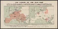
- Edward Stanford Ltd
- Published / Created:
- [1917?]
- Call Number:
- 11hc 1917O
- Container / Volume:
- BRBL_00010E
- Image Count:
- 1
- Resource Type:
- Maps, Atlases & Globes
- Found in:
- Beinecke Rare Book and Manuscript Library > The lesson of the war map.
- Published / Created:
- [1887?]
- Call Number:
- 3627 1887
- Container / Volume:
- BRBL_00139
- Image Count:
- 2
- Resource Type:
- Maps, Atlases & Globes
- Found in:
- Beinecke Rare Book and Manuscript Library > Uebersichtskarte für kombinirbare Rundreisebillete / (zu J. Chr. Hacker's Fahrplan).
- Creator:
- Chapin, R. M., Jr
Time, inc
- Published / Created:
- 1944
- Call Number:
- 11hd 1945C
- Container / Volume:
- BRBL_00010ZF
- Image Count:
- 1
- Resource Type:
- Maps, Atlases & Globes
- Found in:
- Beinecke Rare Book and Manuscript Library > Wacht am Rhein [cartographic material] / TIME map by R. M. Chapin, Jr.
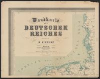
- Creator:
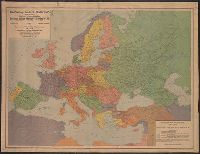
- Dietrich Reimer Verlag (Berlin, Germany)
Kiepert, Heinrich, 1818-1899
Kiepert, Richard, 1846-1915
Simon Schropp'sche Hof-Landkartenhandlung
- Published / Created:
- [1940?]
- Call Number:
- 36 1940B
- Container / Volume:
- BRBL_00121
- Image Count:
- 7
- Resource Type:
- Maps, Atlases & Globes
- Found in:
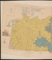
- Beinecke Rare Book and Manuscript Library > Wandkarte des Deutschen Reiches / bearbeitet von H. Kiepert.
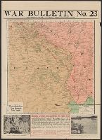
- Published / Created:
- 1918
- Call Number:
- 11hc 1918Z-7
- Image Count:
- 1
- Resource Type:
- Maps, Atlases & Globes
- Found in:
- Beinecke Rare Book and Manuscript Library > War Bulletin No. 23 : showing the latest battle lines and pictures.
- Published / Created:
- 1832
- Call Number:
- 36 1832
- Container / Volume:
- BRBL_00119
- Image Count:
- 1
- Resource Type:
- Maps, Atlases & Globes
- Found in:
- Beinecke Rare Book and Manuscript Library > Western Germany By J. Arrowsmith.
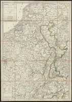
- Creator:
- George Philip & Son
London Geographical Institute
- Published / Created:
- 1940
- Call Number:
- 36 1940A
- Container / Volume:
- BRBL_00121
- Image Count:
- 1
- Resource Type:
- Maps, Atlases & Globes
- Found in:
- Beinecke Rare Book and Manuscript Library > Western Germany, with Holland, Belgium and Switzerland.
- Creator:
- Army Service Schools (U.S.)
- Published / Created:
- [1915?]
- Call Number:
- 11hc 1916C
- Container / Volume:
- BRBL_00010C
- Image Count:
- 1
- Resource Type:
- Maps, Atlases & Globes
- Found in:
- Beinecke Rare Book and Manuscript Library > Western theatre-European War.
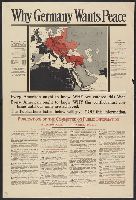
- Creator:
- United States. Committee on Public Information
- Published / Created:
- [1918]
- Call Number:
- 11hc 1917A
- Container / Volume:
- BRBL_00010D
- Image Count:
- 1
- Resource Type:
- Maps, Atlases & Globes
- Found in:
- Beinecke Rare Book and Manuscript Library > Why Germany wants peace : every American ought to know why we entered this War; every American ought to know why this conflict must continue until our aims are achieved; the publications listed below will give you this information.
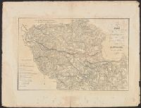
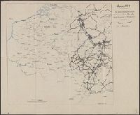
- Published / Created:
- 1919]
- Call Number:
- 11hcf 1919B-48
- Image Count:
- 3
- Resource Type:
- Maps, Atlases & Globes
- Found in:
- Beinecke Rare Book and Manuscript Library > [3 maps of France showing location of German troops].
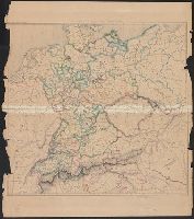
- Published / Created:
- 1919
- Call Number:
- 11hcf 1919B-50
- Container / Volume:
- BRBL_00010S
- Image Count:
- 4
- Resource Type:
- Maps, Atlases & Globes
- Found in:
- Beinecke Rare Book and Manuscript Library > [4 Ethnographic Maps of Central Europe] / Dess. par A.D. Alanasiu.
- Published / Created:
- [1919?].
- Call Number:
- 11hcf 1919A-5
- Container / Volume:
- BRBL_00010N
- Image Count:
- 1
- Resource Type:
- Maps, Atlases & Globes
- Found in:
- Beinecke Rare Book and Manuscript Library > [Germany : the German propositions after World War I.]
- Published / Created:
- 1936?]
- Call Number:
- 11hd 1942D-51
- Container / Volume:
- BRBL_00010ZD
- Image Count:
- 1
- Resource Type:
- Maps, Atlases & Globes
- Found in:
- Beinecke Rare Book and Manuscript Library > [Karte des Deutschen Reiche, Polen.]
- Published / Created:
- 191-]
- Call Number:
- 11hcf 1919-2
- Container / Volume:
- BRBL_00010J
- Image Count:
- 1
- Resource Type:
- Maps, Atlases & Globes
- Found in:
- Beinecke Rare Book and Manuscript Library > [Map of area in dispute between Belgium and Germany.]
- Published / Created:
- 1919?]
- Call Number:
- 11hcf 1919B-11
- Image Count:
- 2
- Resource Type:
- Maps, Atlases & Globes
- Found in:
- Beinecke Rare Book and Manuscript Library > [Portion of map of France and Germany].
- Published / Created:
- 191-.
- Call Number:
- 11hc 1915R
- Container / Volume:
- BRBL_00010C
- Image Count:
- 2
- Resource Type:
- Maps, Atlases & Globes
- Found in:
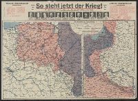
- Beinecke Rare Book and Manuscript Library > [So steht jetzt der Krieg!] : Kriegsoperationskarte über alle Kriegsschauplätze der welt.