
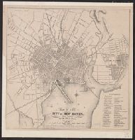
You Searched For
1 - 70 of 70
Search Results


- Published / Created:
- [1824]
- Call Number:
- 766 N46 1824A
- Container / Volume:
- BRBL_00470
- Image Count:
- 1
- Resource Type:
- Maps, Atlases & Globes
- Description:
- This map is mounted. It measures about 1/4" larger.
- Publisher:
- A. Doolittle,
- Subject (Geographic):
- New Haven (Conn.)--Maps
- Found in:
- Beinecke Rare Book and Manuscript Library > "To the mayor, aldermen & Common Council of the city of New Haven, this plan is ... dedicated by ... Amos Doolittle."
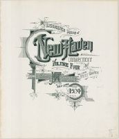
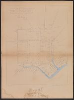
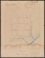
- Published / Created:
- 1852
- Call Number:
- 766 N46 1852B
- Container / Volume:
- BRBL_00470
- Image Count:
- 1
- Resource Type:
- Maps, Atlases & Globes
- Subject (Geographic):
- New Haven (Conn.)--Maps
- Found in:
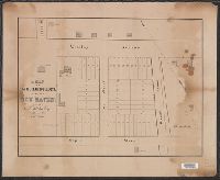
- Beinecke Rare Book and Manuscript Library > A map of 60 building lots in the city of New Haven belonging to C.T. Shelton, Esq.
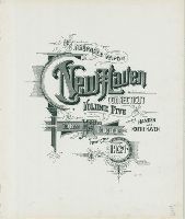
4.

- Creator:
- Wadsworth, James, 1730-1817
- Published / Created:
- [1865?]
- Call Number:
- 766 N46 1748Z
- Container / Volume:
- BRBL_00469A
- Image Count:
- 1
- Resource Type:
- Maps, Atlases & Globes
- Description:
- "Respectfully dedicated to the citizens of New Haven by David R. Brown.", Cadastral map showing individual houses with owners' names and professions., and Includes table of first grantees, keyed to numbered lots.
- Publisher:
- Lith. by C. Currier,
- Subject (Geographic):
- New Haven (Conn.)--Maps
- Subject (Name):
- Brown, David R and Currier, Charles, 1818-1887
- Subject (Topic):
- Real property--Connecticut--New Haven--Maps
- Found in:
- Beinecke Rare Book and Manuscript Library > A plan of the town of New Haven [cartographic material] : with all the buildings in 1748 / taken by the Hon. Gen. Wadsworth of Durham, to which are added the names and professions of the inhabitants at that period, also the location of lots to many of the
5.
- Published / Created:
- [1806?]
- Call Number:
- 766 N46 1806
- Container / Volume:
- BRBL_00469A
- Image Count:
- 1
- Resource Type:
- Maps, Atlases & Globes
- Description:
- Preliminary record.
- Publisher:
- T. Kensett Engraver,
- Subject (Geographic):
- New Haven (Conn.)--Maps
- Found in:
- Beinecke Rare Book and Manuscript Library > A plan of the town of New Haven with all the buildings in 1748 taken by gen. Wadsworth ... Wm Lyon 1806.
6.

- Creator:
- Lyman, Edward (Mapmaker : New Haven, Conn.)
- Published / Created:
- 1874, and c1872]
- Call Number:
- 766 N46 1874A
- Container / Volume:
- BRBL_00471
- Image Count:
- 1
- Resource Type:
- Maps, Atlases & Globes
- Alternative Title:
- Benham's New Haven city directory., City of New Haven, and New map of the city of New Haven
- Description:
- From Benham's New Haven city directory, no. 35 [New Haven: J.H. Benham, 1874].
- Publisher:
- J.H. Benham,
- Subject (Geographic):
- New Haven (Conn.)--Maps
- Found in:
- Beinecke Rare Book and Manuscript Library > Benham's new map of the city of New Haven / drawn by Edward Lyman ; from the records & surveys by S. Butler, civil engineer.
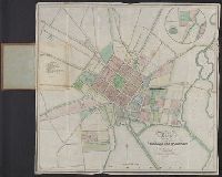
- Creator:
- Hill, A. B
- Published / Created:
- c1896.
- Call Number:
- 766 N46 1896A
- Container / Volume:
- BRBL_00473
- Image Count:
- 1
- Resource Type:
- Maps, Atlases & Globes
- Description:
- Includes inset of Yale College campus.
- Publisher:
- Geo. H. Walker & Co.,
- Subject (Geographic):
- New Haven (Conn.)--Maps and New Haven Metropolitan Area (Conn.)--Maps
- Subject (Name):
- Geo. H. Walker & Co
- Found in:
- Beinecke Rare Book and Manuscript Library > City of New Haven, Connecticut / A.B. Hill ; engraved by Geo. H. Walker & Co.
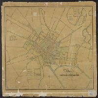
- Creator:
- Hill, A. B., civil engineer
- Published / Created:
- c1893.
- Call Number:
- 766 N46 1893J
- Container / Volume:
- BRBL_00473
- Image Count:
- 1
- Resource Type:
- Maps, Atlases & Globes
- Description:
- Inset: [Yale campus]. Scale [1:2,400]. and Shows city wards, schools, churches, parks, etc.
- Publisher:
- Geo. H. Walker & Co.,
- Subject (Geographic):
- New Haven (Conn.)--Maps
- Subject (Name):
- Geo. H. Walker & Co
- Found in:
- Beinecke Rare Book and Manuscript Library > City of New Haven, Connecticut / A.B. Hill, c.e.
- Published / Created:
- 1863
- Call Number:
- 766 N46 1863
- Container / Volume:
- BRBL_00471
- Image Count:
- 1
- Resource Type:
- Maps, Atlases & Globes
- Subject (Geographic):
- New Haven (Conn.)--Maps
- Found in:
- Beinecke Rare Book and Manuscript Library > City of New Haven.
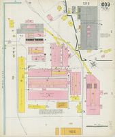
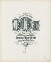
- Creator:
- Sanborn-Perris Map Co., issuing body
- Published / Created:
- August 1917
- Call Number:
- 766 N46 1901
- Image Count:
- 2
- Resource Type:
- Maps, Atlases & Globes
- Abstract:
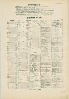
- Sanborn fire insurance maps are a rich source of historic data on the urban built environment of North America during the 19th and early 20th centuries. The atlases were created for the purpose of underwriting fire insurance policies, which depended upon accurate and frequently-updated information about construction materials, municipal and transportation infrastructure, industrial and commercial landuse and more. The Yale University Library Map Department scanned its holdings of Sanborn fire insurance maps (consisting primarily of Connecticut towns) in order to make the maps more accessible.
- Description:
- "Vol. 1... 98 sheets, (4396)"; "Volume 2... 105 sheets, (4670).", Accompanied by additional sheet 100R and new sheet 100B, dated Aug. 1917., Contains information on population, prevailing winds, water facilities and fire department., Includes index of streets and specials., Partial cadastral map., Sheets 5, 8, and 101-104 are duplicated as "skeleton" sheets., and SMLMAPL 766 N46 1901: Sheets disbound. "Triplicate" stamp on some sheets. Library of Congress copyright stamp on title sheet.
- Subject (Geographic):
- New Haven (Conn.)--Maps
- Subject (Name):
- Library of Congress Stamp
- Subject (Topic):
- Fire risk assessment--Connecticut--New Haven--Maps and Real property--Connecticut--New Haven--Maps
- Found in:
- Beinecke Rare Book and Manuscript Library > Insurance maps of New Haven, Connecticut., Insurance maps of New Haven, Connecticut: [New and additional sheets].
- Creator:
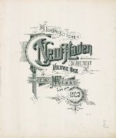
- Sanborn Map & Publishing Co., issuing body
- Published / Created:
- 1886
- Call Number:
- 766 N46 1886 Copy 2
- Image Count:
- 31
- Resource Type:
- Maps, Atlases & Globes
- Abstract:
- Sanborn fire insurance maps are a rich source of historic data on the urban built environment of North America during the 19th and early 20th centuries. The atlases were created for the purpose of underwriting fire insurance policies, which depended upon accurate and frequently-updated information about construction materials, municipal and transportation infrastructure, industrial and commercial landuse and more. The Yale University Library Map Department scanned its holdings of Sanborn fire insurance maps (consisting primarily of Connecticut towns) in order to make the maps more accessible.
- Description:
- Contains information on population, prevailing winds, water facilities and fire department., Includes index of streets and specials., Partial cadastral map., SMLMAPL 766 N46 1886 Copy 1: Imperfect: Sheets chipped with no loss of text. Stamp of Greewich Insurance Company. With corrections to Aug. 1897., and SMLMAPL 766 N46 1886 Copy 2: Imperfect: title sheet from volume one wanting. "Triplicate" stamps of the Library of Congress.
- Subject (Geographic):
- New Haven (Conn.)--Maps
- Subject (Name):
- Greenwich Insurance Company Stamp and Library of Congress Stamp
- Subject (Topic):
- Fire risk assessment--Connecticut--New Haven--Maps and Real property--Connecticut--New Haven--Maps
- Found in:
- Beinecke Rare Book and Manuscript Library > Insurance maps of New Haven, Connecticut. Volume 1.
- Creator:
- Sanborn-Perris Map Co., issuing body
- Published / Created:
- 1901
- Call Number:
- 766 N46 1901
- Image Count:
- 103
- Resource Type:
- Maps, Atlases & Globes
- Abstract:
- Sanborn fire insurance maps are a rich source of historic data on the urban built environment of North America during the 19th and early 20th centuries. The atlases were created for the purpose of underwriting fire insurance policies, which depended upon accurate and frequently-updated information about construction materials, municipal and transportation infrastructure, industrial and commercial landuse and more. The Yale University Library Map Department scanned its holdings of Sanborn fire insurance maps (consisting primarily of Connecticut towns) in order to make the maps more accessible.
- Description:
- "Vol. 1... 98 sheets, (4396)"; "Volume 2... 105 sheets, (4670).", Accompanied by additional sheet 100R and new sheet 100B, dated Aug. 1917., Contains information on population, prevailing winds, water facilities and fire department., Includes index of streets and specials., Partial cadastral map., Sheets 5, 8, and 101-104 are duplicated as "skeleton" sheets., and SMLMAPL 766 N46 1901: Sheets disbound. "Triplicate" stamp on some sheets. Library of Congress copyright stamp on title sheet.
- Subject (Geographic):
- New Haven (Conn.)--Maps
- Subject (Name):
- Library of Congress Stamp
- Subject (Topic):
- Fire risk assessment--Connecticut--New Haven--Maps and Real property--Connecticut--New Haven--Maps
- Found in:
- Beinecke Rare Book and Manuscript Library > Insurance maps of New Haven, Connecticut. Volume 1.
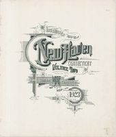
- Creator:
- Sanborn Map Company, issuing body
- Published / Created:
- 1924
- Call Number:
- 766 N46 1924
- Image Count:
- 110
- Resource Type:
- Maps, Atlases & Globes
- Abstract:
- Sanborn fire insurance maps are a rich source of historic data on the urban built environment of North America during the 19th and early 20th centuries. The atlases were created for the purpose of underwriting fire insurance policies, which depended upon accurate and frequently-updated information about construction materials, municipal and transportation infrastructure, industrial and commercial landuse and more. The Yale University Library Map Department scanned its holdings of Sanborn fire insurance maps (consisting primarily of Connecticut towns) in order to make the maps more accessible.
- Alternative Title:
- Insurance maps of New Haven, Connecticut, including East Haven, Insurance maps of New Haven, Connecticut, including Hamden and North Haven, Insurance maps of New Haven, Connecticut, including West Haven, and New Haven, Connecticut
- Description:
- Partial cadastral maps., Sheets contain information on population, water facilities and fire departments., SMLMAPL 766 N46 1924: Sheets disbound., Volume 1 includes "Map of Congested District" and 10 skeleton maps., Volume 3 includes 2 skeleton maps., Volume 5: sheets 514-516, 532, 556, 557, and 563-577 noted on index map as "proposed.", and Volumes include indices of streets and specials.
- Subject (Geographic):
- East Haven (Conn.)--Maps, Hamden (Conn.)--Maps, New Haven (Conn.)--Maps, North Haven (Conn.)--Maps, and West Haven (Conn.)--Maps
- Subject (Name):
- Library of Congress Ownership
- Subject (Topic):
- Fire risk assessment--Connecticut--East Haven--Maps, Fire risk assessment--Connecticut--Hamden--Maps, Fire risk assessment--Connecticut--New Haven--Maps, Fire risk assessment--Connecticut--North Haven--Maps, Fire risk assessment--Connecticut--West Haven--Maps, Real property--Connecticut--East Haven--Maps, Real property--Connecticut--Hamden--Maps, Real property--Connecticut--New Haven--Maps, Real property--Connecticut--North Haven--Maps, and Real property--Connecticut--West Haven--Maps
- Found in:
- Beinecke Rare Book and Manuscript Library > Insurance maps of New Haven, Connecticut. Volume 1.
- Creator:
- Sanborn Map & Publishing Co., issuing body
- Published / Created:
- 1886
- Call Number:
- 766 N46 1886 Copy 2
- Image Count:
- 30
- Resource Type:
- Maps, Atlases & Globes
- Abstract:
- Sanborn fire insurance maps are a rich source of historic data on the urban built environment of North America during the 19th and early 20th centuries. The atlases were created for the purpose of underwriting fire insurance policies, which depended upon accurate and frequently-updated information about construction materials, municipal and transportation infrastructure, industrial and commercial landuse and more. The Yale University Library Map Department scanned its holdings of Sanborn fire insurance maps (consisting primarily of Connecticut towns) in order to make the maps more accessible.
- Description:
- Contains information on population, prevailing winds, water facilities and fire department., Includes index of streets and specials., Partial cadastral map., SMLMAPL 766 N46 1886 Copy 1: Imperfect: Sheets chipped with no loss of text. Stamp of Greewich Insurance Company. With corrections to Aug. 1897., and SMLMAPL 766 N46 1886 Copy 2: Imperfect: title sheet from volume one wanting. "Triplicate" stamps of the Library of Congress.
- Subject (Geographic):
- New Haven (Conn.)--Maps
- Subject (Name):
- Greenwich Insurance Company Stamp and Library of Congress Stamp
- Subject (Topic):
- Fire risk assessment--Connecticut--New Haven--Maps and Real property--Connecticut--New Haven--Maps
- Found in:
- Beinecke Rare Book and Manuscript Library > Insurance maps of New Haven, Connecticut. Volume 2.
- Creator:
- Sanborn-Perris Map Co., issuing body
- Published / Created:
- 1901
- Call Number:
- 766 N46 1901
- Image Count:
- 112
- Resource Type:
- Maps, Atlases & Globes
- Abstract:
- Sanborn fire insurance maps are a rich source of historic data on the urban built environment of North America during the 19th and early 20th centuries. The atlases were created for the purpose of underwriting fire insurance policies, which depended upon accurate and frequently-updated information about construction materials, municipal and transportation infrastructure, industrial and commercial landuse and more. The Yale University Library Map Department scanned its holdings of Sanborn fire insurance maps (consisting primarily of Connecticut towns) in order to make the maps more accessible.
- Description:
- "Vol. 1... 98 sheets, (4396)"; "Volume 2... 105 sheets, (4670).", Accompanied by additional sheet 100R and new sheet 100B, dated Aug. 1917., Contains information on population, prevailing winds, water facilities and fire department., Includes index of streets and specials., Partial cadastral map., Sheets 5, 8, and 101-104 are duplicated as "skeleton" sheets., and SMLMAPL 766 N46 1901: Sheets disbound. "Triplicate" stamp on some sheets. Library of Congress copyright stamp on title sheet.
- Subject (Geographic):
- New Haven (Conn.)--Maps
- Subject (Name):
- Library of Congress Stamp
- Subject (Topic):
- Fire risk assessment--Connecticut--New Haven--Maps and Real property--Connecticut--New Haven--Maps
- Found in:
- Beinecke Rare Book and Manuscript Library > Insurance maps of New Haven, Connecticut. Volume 2.
- Creator:
- Sanborn Map Company, issuing body
- Published / Created:
- 1924
- Call Number:
- 766 N46 1924
- Image Count:
- 92
- Resource Type:
- Maps, Atlases & Globes
- Abstract:
- Sanborn fire insurance maps are a rich source of historic data on the urban built environment of North America during the 19th and early 20th centuries. The atlases were created for the purpose of underwriting fire insurance policies, which depended upon accurate and frequently-updated information about construction materials, municipal and transportation infrastructure, industrial and commercial landuse and more. The Yale University Library Map Department scanned its holdings of Sanborn fire insurance maps (consisting primarily of Connecticut towns) in order to make the maps more accessible.
- Alternative Title:
- Insurance maps of New Haven, Connecticut, including East Haven, Insurance maps of New Haven, Connecticut, including Hamden and North Haven, Insurance maps of New Haven, Connecticut, including West Haven, and New Haven, Connecticut
- Description:
- Partial cadastral maps., Sheets contain information on population, water facilities and fire departments., SMLMAPL 766 N46 1924: Sheets disbound., Volume 1 includes "Map of Congested District" and 10 skeleton maps., Volume 3 includes 2 skeleton maps., Volume 5: sheets 514-516, 532, 556, 557, and 563-577 noted on index map as "proposed.", and Volumes include indices of streets and specials.
- Subject (Geographic):
- East Haven (Conn.)--Maps, Hamden (Conn.)--Maps, New Haven (Conn.)--Maps, North Haven (Conn.)--Maps, and West Haven (Conn.)--Maps
- Subject (Name):
- Library of Congress Ownership
- Subject (Topic):
- Fire risk assessment--Connecticut--East Haven--Maps, Fire risk assessment--Connecticut--Hamden--Maps, Fire risk assessment--Connecticut--New Haven--Maps, Fire risk assessment--Connecticut--North Haven--Maps, Fire risk assessment--Connecticut--West Haven--Maps, Real property--Connecticut--East Haven--Maps, Real property--Connecticut--Hamden--Maps, Real property--Connecticut--New Haven--Maps, Real property--Connecticut--North Haven--Maps, and Real property--Connecticut--West Haven--Maps
- Found in:
- Beinecke Rare Book and Manuscript Library > Insurance maps of New Haven, Connecticut. Volume 2.

- Creator:
- Sanborn Map Company, issuing body
- Published / Created:
- 1924
- Call Number:
- 766 N46 1924
- Image Count:
- 82
- Resource Type:
- Maps, Atlases & Globes
- Abstract:
- Sanborn fire insurance maps are a rich source of historic data on the urban built environment of North America during the 19th and early 20th centuries. The atlases were created for the purpose of underwriting fire insurance policies, which depended upon accurate and frequently-updated information about construction materials, municipal and transportation infrastructure, industrial and commercial land use and more. The Yale University Library Map Department scanned its holdings of Sanborn fire insurance maps (consisting primarily of Connecticut towns) in order to make the maps more accessible.
- Alternative Title:
- Insurance maps of New Haven, Connecticut, including East Haven, Insurance maps of New Haven, Connecticut, including Hamden and North Haven, Insurance maps of New Haven, Connecticut, including West Haven, and New Haven, Connecticut
- Description:
- Partial cadastral maps., Sheets contain information on population, water facilities and fire departments., SMLMAPL 766 N46 1924: Sheets disbound., Volume 1 includes "Map of Congested District" and 10 skeleton maps., Volume 3 includes 2 skeleton maps., Volume 5: sheets 514-516, 532, 556, 557, and 563-577 noted on index map as "proposed.", and Volumes include indices of streets and specials.
- Subject (Geographic):
- East Haven (Conn.)--Maps, Hamden (Conn.)--Maps, New Haven (Conn.)--Maps, North Haven (Conn.)--Maps, and West Haven (Conn.)--Maps
- Subject (Name):
- Library of Congress Ownership
- Subject (Topic):
- Fire risk assessment--Connecticut--East Haven--Maps, Fire risk assessment--Connecticut--Hamden--Maps, Fire risk assessment--Connecticut--New Haven--Maps, Fire risk assessment--Connecticut--North Haven--Maps, Fire risk assessment--Connecticut--West Haven--Maps, Real property--Connecticut--East Haven--Maps, Real property--Connecticut--Hamden--Maps, Real property--Connecticut--New Haven--Maps, Real property--Connecticut--North Haven--Maps, and Real property--Connecticut--West Haven--Maps
- Found in:
- Beinecke Rare Book and Manuscript Library > Insurance maps of New Haven, Connecticut. Volume 3.
- Creator:
- Sanborn Map Company, issuing body
- Published / Created:
- 1924
- Call Number:
- 766 N46 1924
- Image Count:
- 92
- Resource Type:
- Maps, Atlases & Globes
- Abstract:
- Sanborn fire insurance maps are a rich source of historic data on the urban built environment of North America during the 19th and early 20th centuries. The atlases were created for the purpose of underwriting fire insurance policies, which depended upon accurate and frequently-updated information about construction materials, municipal and transportation infrastructure, industrial and commercial landuse and more. The Yale University Library Map Department scanned its holdings of Sanborn fire insurance maps (consisting primarily of Connecticut towns) in order to make the maps more accessible.
- Alternative Title:
- Insurance maps of New Haven, Connecticut, including East Haven, Insurance maps of New Haven, Connecticut, including Hamden and North Haven, Insurance maps of New Haven, Connecticut, including West Haven, and New Haven, Connecticut
- Description:
- Partial cadastral maps., Sheets contain information on population, water facilities and fire departments., SMLMAPL 766 N46 1924: Sheets disbound., Volume 1 includes "Map of Congested District" and 10 skeleton maps., Volume 3 includes 2 skeleton maps., Volume 5: sheets 514-516, 532, 556, 557, and 563-577 noted on index map as "proposed.", and Volumes include indices of streets and specials.
- Subject (Geographic):
- East Haven (Conn.)--Maps, Hamden (Conn.)--Maps, New Haven (Conn.)--Maps, North Haven (Conn.)--Maps, and West Haven (Conn.)--Maps
- Subject (Name):
- Library of Congress Ownership
- Subject (Topic):
- Fire risk assessment--Connecticut--East Haven--Maps, Fire risk assessment--Connecticut--Hamden--Maps, Fire risk assessment--Connecticut--New Haven--Maps, Fire risk assessment--Connecticut--North Haven--Maps, Fire risk assessment--Connecticut--West Haven--Maps, Real property--Connecticut--East Haven--Maps, Real property--Connecticut--Hamden--Maps, Real property--Connecticut--New Haven--Maps, Real property--Connecticut--North Haven--Maps, and Real property--Connecticut--West Haven--Maps
- Found in:
- Beinecke Rare Book and Manuscript Library > Insurance maps of New Haven, Connecticut. Volume 4.
- Creator:
- Sanborn Map Company, issuing body
- Published / Created:
- 1924
- Call Number:
- 766 N46 1924
- Image Count:
- 55
- Resource Type:
- Maps, Atlases & Globes
- Abstract:
- Sanborn fire insurance maps are a rich source of historic data on the urban built environment of North America during the 19th and early 20th centuries. The atlases were created for the purpose of underwriting fire insurance policies, which depended upon accurate and frequently-updated information about construction materials, municipal and transportation infrastructure, industrial and commercial landuse and more. The Yale University Library Map Department scanned its holdings of Sanborn fire insurance maps (consisting primarily of Connecticut towns) in order to make the maps more accessible.
- Alternative Title:
- Insurance maps of New Haven, Connecticut, including East Haven, Insurance maps of New Haven, Connecticut, including Hamden and North Haven, Insurance maps of New Haven, Connecticut, including West Haven, and New Haven, Connecticut
- Description:
- Partial cadastral maps., Sheets contain information on population, water facilities and fire departments., SMLMAPL 766 N46 1924: Sheets disbound., Volume 1 includes "Map of Congested District" and 10 skeleton maps., Volume 3 includes 2 skeleton maps., Volume 5: sheets 514-516, 532, 556, 557, and 563-577 noted on index map as "proposed.", and Volumes include indices of streets and specials.
- Subject (Geographic):
- East Haven (Conn.)--Maps, Hamden (Conn.)--Maps, New Haven (Conn.)--Maps, North Haven (Conn.)--Maps, and West Haven (Conn.)--Maps
- Subject (Name):
- Library of Congress Ownership
- Subject (Topic):
- Fire risk assessment--Connecticut--East Haven--Maps, Fire risk assessment--Connecticut--Hamden--Maps, Fire risk assessment--Connecticut--New Haven--Maps, Fire risk assessment--Connecticut--North Haven--Maps, Fire risk assessment--Connecticut--West Haven--Maps, Real property--Connecticut--East Haven--Maps, Real property--Connecticut--Hamden--Maps, Real property--Connecticut--New Haven--Maps, Real property--Connecticut--North Haven--Maps, and Real property--Connecticut--West Haven--Maps
- Found in:
- Beinecke Rare Book and Manuscript Library > Insurance maps of New Haven, Connecticut. Volume 5.

- Published / Created:
- [1835?]
- Call Number:
- Art Storage 1005
- Container / Volume:
- BRBL_00470
- Image Count:
- 1
- Resource Type:
- Maps, Atlases & Globes
- Alternative Title:
- Map of forty-one building Lots in the city of New Haven
- Description:
- Coordinates not present on map and are approximated. and North oriented towards the upper right.
- Publisher:
- [publisher not identified],
- Subject (Geographic):
- New Haven (Conn.)--Maps
- Found in:
- Beinecke Rare Book and Manuscript Library > Map of 41 building Lots in the city of New Haven.
21.

- Published / Created:
- 1835]
- Call Number:
- 766 N46 1835A
- Container / Volume:
- BRBL_00470
- Image Count:
- 1
- Resource Type:
- Maps, Atlases & Globes
- Description:
- "Miller & Co.'s lith., 46 Mer. Ex.", Includes inset of New Haven city center., and Library's copy 2 annotated in black ink and pencil.
- Publisher:
- Franklin & Jenkins,
- Subject (Geographic):
- New Haven (Conn.)--Maps
- Subject (Name):
- Franklin & Jenkins and Miller & Co
- Subject (Topic):
- Real property--Connecticut--New Haven--Maps
- Found in:
- Beinecke Rare Book and Manuscript Library > Map of 48 valuable lots in the city of New Haven, for sale by Franklin & Jenkins on Wednesday 3rd June 1835 at 12 o'clock at the Merchts. Exchg. New York.
22.

- Published / Created:
- 1835]
- Call Number:
- 766 N46 1835A
- Container / Volume:
- BRBL_00470
- Image Count:
- 1
- Resource Type:
- Maps, Atlases & Globes
- Description:
- "Miller & Co.'s lith., 46 Mer. Ex.", Includes inset of New Haven city center., and Library's copy 2 annotated in black ink and pencil.
- Publisher:
- Franklin & Jenkins,
- Subject (Geographic):
- New Haven (Conn.)--Maps
- Subject (Name):
- Franklin & Jenkins and Miller & Co
- Subject (Topic):
- Real property--Connecticut--New Haven--Maps
- Found in:
- Beinecke Rare Book and Manuscript Library > Map of 48 valuable lots in the city of New Haven, for sale by Franklin & Jenkins on Wednesday 3rd June 1835 at 12 o'clock at the Merchts. Exchg. New York.
23.

- Published / Created:
- 1835]
- Call Number:
- 766 N46 1835A
- Container / Volume:
- BRBL_00470
- Image Count:
- 1
- Resource Type:
- Maps, Atlases & Globes
- Description:
- "Miller & Co.'s lith., 46 Mer. Ex.", Includes inset of New Haven city center., and Library's copy 2 annotated in black ink and pencil.
- Publisher:
- Franklin & Jenkins,
- Subject (Geographic):
- New Haven (Conn.)--Maps
- Subject (Name):
- Franklin & Jenkins and Miller & Co
- Subject (Topic):
- Real property--Connecticut--New Haven--Maps
- Found in:
- Beinecke Rare Book and Manuscript Library > Map of 48 valuable lots in the city of New Haven, for sale by Franklin & Jenkins on Wednesday 3rd June 1835 at 12 o'clock at the Merchts. Exchg. New York.
24.

- Published / Created:
- 1836
- Call Number:
- 766 N46 1836A
- Container / Volume:
- BRBL_00470
- Image Count:
- 1
- Resource Type:
- Maps, Atlases & Globes
- Publisher:
- Miller & Co., lith.,
- Subject (Geographic):
- New Haven (Conn.)--Maps
- Found in:
- Beinecke Rare Book and Manuscript Library > Map of 500 Valuable Lots in the Eastern Section of the City of New Haven for Sale by JC Parker ...
25.

- Published / Created:
- 1836
- Call Number:
- 766 N46 1836
- Container / Volume:
- BRBL_00470
- Image Count:
- 1
- Resource Type:
- Maps, Atlases & Globes
- Publisher:
- JC Parker,
- Subject (Geographic):
- New Haven (Conn.)--Maps
- Found in:
- Beinecke Rare Book and Manuscript Library > Map of 500 Valuable Lots in the Eastern Section of the City of New Haven for Sale by JC Parker ...

- Published / Created:
- 1850
- Call Number:
- 766 N46 1850
- Container / Volume:
- BRBL_00470
- Image Count:
- 1
- Resource Type:
- Maps, Atlases & Globes
- Subject (Geographic):
- New Haven (Conn.)--Maps
- Found in:
- Beinecke Rare Book and Manuscript Library > Map of 53 building lots in the city of New Haven, the property of Thos. Downing.
27.

- Published / Created:
- 1837
- Call Number:
- 766 N46 1837
- Container / Volume:
- BRBL_00470
- Image Count:
- 1
- Resource Type:
- Maps, Atlases & Globes
- Publisher:
- Miller & Co., lith.,
- Subject (Geographic):
- New Haven (Conn.)--Maps
- Found in:
- Beinecke Rare Book and Manuscript Library > Map of Building Lots in the City of New Haven to be sold by J.C. Parker on Monday 16th October 1837, at 11 o'clock at this Auction Room, Curch St., New Haven.
- Published / Created:
- 1909
- Call Number:
- 766 N42 1909
- Container / Volume:
- BRBL_00469
- Image Count:
- 1
- Resource Type:
- Maps, Atlases & Globes
- Description:
- "Engr. ER Fisk, NY."
- Publisher:
- The Price & Lee Co.,
- Subject (Geographic):
- New Haven (Conn.)--Maps
- Found in:
- Beinecke Rare Book and Manuscript Library > Map of New Britain.
- Published / Created:
- 1916
- Call Number:
- 766 N42 1916
- Container / Volume:
- BRBL_00469A
- Image Count:
- 2
- Resource Type:
- Maps, Atlases & Globes
- Description:
- "Engr. ER Fisk, NY."
- Publisher:
- The Price & Lee Co.,
- Subject (Geographic):
- New Haven (Conn.)--Maps
- Found in:
- Beinecke Rare Book and Manuscript Library > Map of New Britain.
- Published / Created:
- [1881?]
- Call Number:
- 766 N46 1724A
- Image Count:
- 1
- Resource Type:
- Maps, Atlases & Globes
- Description:
- Accompanied by typed letter, "The Brown Map," from Sarah Cazneau Day Woodward., Coordinates not present on map and are approximated., Pen and ink with names of house-holders entered in longhand. Bodies of water colored blue., Possibly copied by Sarah Cazneau Day Woodward., and See A.P. Stokes, Historical prints of New Haven, number 2.
- Subject (Geographic):
- New Haven (Conn.)--Maps
- Subject (Name):
- Stiles, Ezra, 1727-1795 and Woodward, Sarah Day
- Found in:
- Beinecke Rare Book and Manuscript Library > Map of New Haven / drawn by Joseph Brown, 1724 ; copied by Prest. Ezra Stiles, 1782.
- Published / Created:
- [1881]
- Call Number:
- 766 N46 1724
- Container / Volume:
- BRBL_00712
- Image Count:
- 1
- Resource Type:
- Maps, Atlases & Globes
- Description:
- "This copy was made February 1881 by Mrs. Sarah Caznesu Day Woodward and by her presented to Sylvester Smith.", Coordinates not present on map and are approximated., Mounted on linen., Pen and ink with names of house-holders entered in longhand. Bodies of water colored blue., and See A.P. Stokes, Historical prints of New Haven, number 2.
- Subject (Geographic):
- New Haven (Conn.)--Maps
- Subject (Name):
- Smith, Sylvester, 1820-1911., Stiles, Ezra, 1727-1795, and Woodward, Sarah Day
- Found in:
- Beinecke Rare Book and Manuscript Library > Map of New Haven / drawn by Joseph Brown, 1724 ; copied by Prest. Ezra Stiles, 1782.
- Published / Created:
- 1830
- Call Number:
- 766 N46 1830
- Container / Volume:
- BRBL_00470
- Image Count:
- 1
- Resource Type:
- Maps, Atlases & Globes
- Description:
- Inset, in circle 9cm. in diameter: Fair Haven, the Eastern Section of New Haven City. and The map is colored by hand, parks being green.
- Publisher:
- Jocelyn, Darling & Co.,
- Subject (Geographic):
- New Haven (Conn.)--Maps
- Found in:
- Beinecke Rare Book and Manuscript Library > Map of the City of New Haven from actual survey by D.W. Buckingham, county surveyor.

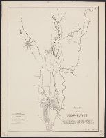
- Published / Created:
- 1860
- Call Number:
- 766GFA N46 1860A
- Container / Volume:
- BRBL_00475
- Image Count:
- 1
- Resource Type:
- Maps, Atlases & Globes
- Description:
- Copies 4 and 5 positive photstats.
- Subject (Geographic):
- New Haven (Conn.)--Maps
- Found in:
- Beinecke Rare Book and Manuscript Library > Map of the New-Haven water survey.

- Creator:
- Whiteford, R
- Published / Created:
- 1867]
- Call Number:
- 766 N46 1867A
- Container / Volume:
- BRBL_00471
- Image Count:
- 1
- Resource Type:
- Maps, Atlases & Globes
- Alternative Title:
- Benham's New Haven directory.
- Description:
- "The red lines indicate the fire districts." and From: Benham's New Haven directory. 1867.
- Publisher:
- J.H. Benham,
- Subject (Geographic):
- New Haven (Conn.)--Maps
- Subject (Topic):
- Fire protection districts--Connecticut--New Haven--Maps
- Found in:
- Beinecke Rare Book and Manuscript Library > Map of the city of New Haven / R. Whiteford.

- Creator:
- Buckingham, D. W.
- Published / Created:
- 1849
- Call Number:
- 766 N49 1849
- Container / Volume:
- BRBL_00470
- Image Count:
- 1
- Resource Type:
- Maps, Atlases & Globes
- Description:
- Coordinates not present on map and are approximated. and Inset: Fair Haven, the eastern section of New Haven City, on reduced scale approximately 1:15,840.
- Publisher:
- [publisher not identified],
- Subject (Geographic):
- New Haven (Conn.)--Maps
- Found in:
- Beinecke Rare Book and Manuscript Library > Map of the city of New Haven : from actual survey by D.W. Buckingham, county surveyor.

- Creator:
- Buckingham, D. W.
- Published / Created:
- 1849
- Call Number:
- 766 N49 1849
- Container / Volume:
- BRBL_00470
- Image Count:
- 1
- Resource Type:
- Maps, Atlases & Globes
- Description:
- Coordinates not present on map and are approximated., Copy 2: Mounted on linen., and Inset: Fair Haven, the eastern section of New Haven City, on reduced scale approximately 1:15,840.
- Publisher:
- [publisher not identified],
- Subject (Geographic):
- New Haven (Conn.)--Maps
- Found in:
- Beinecke Rare Book and Manuscript Library > Map of the city of New Haven : from actual survey by D.W. Buckingham, county surveyor.

- Creator:
- Whiteford, R
- Published / Created:
- c1852.
- Call Number:
- 766 N46 1852A
- Container / Volume:
- BRBL_00470
- Image Count:
- 1
- Resource Type:
- Maps, Atlases & Globes
- Alternative Title:
- City of New Haven
- Description:
- Key to 51 churches, banks, hotels, schools, and public buildings included; with precincts numbered 1-6. and Relief shown by hachures.
- Publisher:
- L.S. Punderson,
- Subject (Geographic):
- New Haven (Conn.)--Maps
- Subject (Name):
- Punderson, Lemuel Swift, b. 1782?
- Found in:
- Beinecke Rare Book and Manuscript Library > Map of the city of New Haven : from surveys / by R. Whiteford.

- Creator:
- Whiteford, R
- Published / Created:
- c1852.
- Call Number:
- 766 N46 1852A
- Container / Volume:
- BRBL_00470
- Image Count:
- 2
- Resource Type:
- Maps, Atlases & Globes
- Alternative Title:
- City of New Haven
- Description:
- Key to 51 churches, banks, hotels, schools, and public buildings included; with precincts numbered 1-4. and Relief shown by hachures.
- Publisher:
- L.S. Punderson,
- Subject (Geographic):
- New Haven (Conn.)--Maps
- Subject (Name):
- Punderson, Lemuel Swift, b. 1782?
- Found in:
- Beinecke Rare Book and Manuscript Library > Map of the city of New Haven : from surveys / by R. Whiteford.

- Creator:
- Whiteford, R
- Published / Created:
- c1852.
- Call Number:
- 766 N46 1852A
- Container / Volume:
- BRBL_00470
- Image Count:
- 2
- Resource Type:
- Maps, Atlases & Globes
- Description:
- Key to 42 points of interest including churches, banks, schools, and public buildings. and Relief shown by hachures.
- Publisher:
- L.S. Punderson,
- Subject (Geographic):
- New Haven (Conn.)--Maps
- Subject (Name):
- Punderson, Lemuel Swift, b. 1782?
- Found in:
- Beinecke Rare Book and Manuscript Library > Map of the city of New Haven : from surveys / by R. Whiteford.

- Published / Created:
- 1931
- Call Number:
- 766gfa N46 1931
- Container / Volume:
- BRBL_00475
- Image Count:
- 1
- Resource Type:
- Maps, Atlases & Globes
- Description:
- Blueprint.
- Publisher:
- Blair & Marchant, Inc.,
- Subject (Geographic):
- New Haven (Conn.)--Maps
- Found in:
- Beinecke Rare Book and Manuscript Library > New Haven Water Co. Map of Mill River Property.

- Published / Created:
- 1916
- Call Number:
- 766gd N46 1916
- Container / Volume:
- BRBL_00475
- Image Count:
- 1
- Resource Type:
- Maps, Atlases & Globes
- Description:
- "Part of the Biennial report of the State Shell Fish Commission".
- Publisher:
- State Shell Fish Commission,
- Subject (Geographic):
- New Haven (Conn.)--Maps and Orange (Conn.)--Maps
- Found in:
- Beinecke Rare Book and Manuscript Library > Oyster grounds in New Haven harbor, Towns of New Haven and Orange.

- Published / Created:
- 185-?]
- Call Number:
- 766 F162 1855
- Container / Volume:
- BRBL_00468
- Image Count:
- 1
- Resource Type:
- Maps, Atlases & Globes
- Alternative Title:
- Fair Haven, New Haven Co., Conn.
- Description:
- "20." and Includes business directory.
- Publisher:
- s.n.,
- Subject (Geographic):
- Fair Haven (New Haven, Conn.)--Commerce--Maps and New Haven (Conn.)--Maps
- Found in:
- Beinecke Rare Book and Manuscript Library > Plan of Fair Haven, New Haven Co., Conn.

- Creator:
- Doolittle, Amos, 1754-1832
- Published / Created:
- 1824
- Call Number:
- 766 N46 1824
- Container / Volume:
- BRBL_00469A
- Image Count:
- 1
- Resource Type:
- Maps, Atlases & Globes
- Alternative Title:
- New Haven region property maps.
- Description:
- "To the mayor, aldermen & common council of the city of New Haven, this plan is with all due respect most humbly dedicated by their most obedient humble servant, Amos Doolittle.", Copy 4 from drawer no. 15, New Haven region property maps., and Includes text
- Publisher:
- Surveyed & published by A. Doolittle,
- Subject (Geographic):
- New Haven (Conn.)--Maps
- Found in:
- Beinecke Rare Book and Manuscript Library > Plan of New Haven / A. Doolittle, engraver.

- Creator:
- Doolittle, Amos, 1754-1832
- Published / Created:
- Octr. 28th, 1812.
- Call Number:
- 766 N46 1812
- Container / Volume:
- BRBL_00469A
- Image Count:
- 1
- Resource Type:
- Maps, Atlases & Globes
- Description:
- "To the mayor, aldermen & common council of the city of New Haven, this plan is with all due respect most humbly dedicated by their most obedient humble servant, Amos Doolittle."
- Publisher:
- A. Doolittle,
- Subject (Geographic):
- New Haven (Conn.)--Maps
- Found in:
- Beinecke Rare Book and Manuscript Library > Plan of New Haven / surveyed & published by A. Doolittle, Engraver, New Haven.

- Creator:
- Beers, F. W. (Frederick W.)
- Published / Created:
- 1868]
- Call Number:
- 766 N46 1868
- Container / Volume:
- BRBL_00471
- Image Count:
- 1
- Resource Type:
- Maps, Atlases & Globes
- Description:
- Copy 1: Imperfect: missing center section replaced with photostatic copy., From: F.W. Beers' Atlas of New Haven County Connecticut. 1868., In upper right: 14., and Text on verso.
- Publisher:
- F.W. Beers, A.D. Ellis, & G.G. Soule, ...
- Subject (Geographic):
- New Haven (Conn.)--Maps
- Subject (Name):
- Beers, F. W. (Frederick W.). Atlas of New Haven County Connecticut. 1868
- Found in:
- Beinecke Rare Book and Manuscript Library > Plan of the city of New Haven : New Haven, Conn.

- Creator:
- Beers, F. W. (Frederick W.)
- Published / Created:
- 1868]
- Call Number:
- 766 N46 1868
- Container / Volume:
- BRBL_00471
- Image Count:
- 2
- Resource Type:
- Maps, Atlases & Globes
- Description:
- From: F.W. Beers' Atlas of New Haven County Connecticut. 1868., In upper right: 14., and Text on verso.
- Publisher:
- F.W. Beers, A.D. Ellis, & G.G. Soule, ...
- Subject (Geographic):
- New Haven (Conn.)--Maps
- Subject (Name):
- Beers, F. W. (Frederick W.). Atlas of New Haven County Connecticut. 1868
- Found in:
- Beinecke Rare Book and Manuscript Library > Plan of the city of New Haven : New Haven, Conn.

- Published / Created:
- 1894
- Call Number:
- 766gfa N46 1894
- Container / Volume:
- BRBL_00475
- Image Count:
- 1
- Resource Type:
- Maps, Atlases & Globes
- Description:
- Blueprint .
- Subject (Geographic):
- New Haven (Conn.)--Maps
- Found in:
- Beinecke Rare Book and Manuscript Library > Plan of the sewerage system of New Haven Ct.
- Creator:
- Price & Lee Co., author
- Call Number:
- 766 N46 1880B
- Container / Volume:
- BRBL_00472
- Image Count:
- 2
- Resource Type:
- Maps, Atlases & Globes
- Alternative Title:
- New map of the City of New Haven
- Description:
- Copy 1: Advertising on verso: Evan Evans ... tinsmith, plumber, and gas-fitter; John C. Ritter ... marble and granite monuments; the Smith Granite Co., Westerley, R.I.
- Subject (Geographic):
- New Haven (Conn.)--Maps
- Subject (Name):
- Forbes Albertype Co., printer
- Found in:
- Beinecke Rare Book and Manuscript Library > Price, Lee & Co. new map of the City of New Haven / surveyed by S.W. Searle, surveyor and civil engineer and drawn by him expressly for their new city directory.
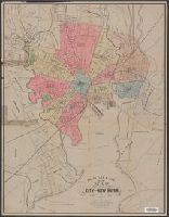
- Creator:
- Price & Lee Co
- Published / Created:
- 1878]
- Call Number:
- 766 N46 1878
- Container / Volume:
- BRBL_00472
- Image Count:
- 2
- Resource Type:
- Maps, Atlases & Globes
- Alternative Title:
- New map of the city of New Haven
- Publisher:
- Price and Lee,
- Subject (Geographic):
- New Haven (Conn.)--Maps and New Haven Metropolitan Area (Conn.)--Maps
- Subject (Name):
- Searle, S. W
- Subject (Topic):
- Streets--Connecticut--New Haven--Maps
- Found in:
- Beinecke Rare Book and Manuscript Library > Price, Lee & Co. new map of the city of New Haven / surveyed by S.W. Searle.
- Creator:
- Price & Lee Co
- Published / Created:
- 1891
- Call Number:
- 766 N46 1891P
- Container / Volume:
- BRBL_00473
- Image Count:
- 2
- Resource Type:
- Maps, Atlases & Globes
- Alternative Title:
- New map of the city of New Haven.
- Publisher:
- Price, Lee & Co.],
- Subject (Geographic):
- New Haven (Conn.)--Maps and New Haven Metropolitan Area (Conn.)--Maps
- Subject (Name):
- Searle, S. W
- Found in:
- Beinecke Rare Book and Manuscript Library > Price, Lee & Co.'s new map of the city of New Haven / surveyed by S.W. Searle and drawn by him expressly for their new city directory.
- Creator:
- Price & Lee Co
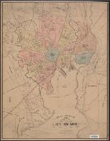
- Published / Created:
- 1882
- Call Number:
- 766 N46 1882P
- Container / Volume:
- BRBL_00472
- Image Count:
- 1
- Resource Type:
- Maps, Atlases & Globes
- Alternative Title:
- New map of the city of New Haven.
- Publisher:
- Price, Lee & Co.,
- Subject (Geographic):
- New Haven (Conn.)--Maps and New Haven Metropolitan Area (Conn.)--Maps
- Subject (Name):
- Searle, S. W
- Subject (Topic):
- Streets--Connecticut--New Haven--Maps
- Found in:
- Beinecke Rare Book and Manuscript Library > Price, Lee & Co.'s new map of the city of New Haven / surveyed by S.W. Searle.
- Creator:
- Price & Lee Co
- Published / Created:
- 1882
- Call Number:
- 766 N46 1882P
- Container / Volume:
- BRBL_00472
- Image Count:
- 2
- Resource Type:
- Maps, Atlases & Globes
- Alternative Title:
- New map of the city of New Haven.
- Publisher:
- Price, Lee & Co.,
- Subject (Geographic):
- New Haven (Conn.)--Maps and New Haven Metropolitan Area (Conn.)--Maps
- Subject (Name):
- Searle, S. W
- Subject (Topic):
- Streets--Connecticut--New Haven--Maps
- Found in:
- Beinecke Rare Book and Manuscript Library > Price, Lee & Co.'s new map of the city of New Haven / surveyed by S.W. Searle.
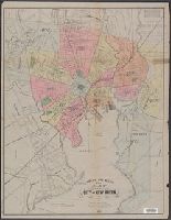
- Creator:
- Price & Lee Co
- Published / Created:
- 1887
- Call Number:
- 766 N46 1887
- Container / Volume:
- BRBL_00472
- Image Count:
- 2
- Resource Type:
- Maps, Atlases & Globes
- Alternative Title:
- New map of the city of New Haven.
- Publisher:
- Price and Lee],
- Subject (Geographic):
- New Haven (Conn.)--Maps and New Haven Metropolitan Area (Conn.)--Maps
- Subject (Name):
- Searle, S. W
- Subject (Topic):
- Streets--Connecticut--New Haven--Maps
- Found in:
- Beinecke Rare Book and Manuscript Library > Price, Lee & Co.'s new map of the city of New Haven / surveyed by S.W. Searle.

- Creator:
- Price & Lee Co
- Published / Created:
- 1883
- Call Number:
- 766 N46 1883A
- Container / Volume:
- BRBL_00472
- Image Count:
- 2
- Resource Type:
- Maps, Atlases & Globes
- Alternative Title:
- New map of the city of New Haven.
- Publisher:
- Price, Lee & Co.,
- Subject (Geographic):
- New Haven (Conn.)--Maps and New Haven Metropolitan Area (Conn.)--Maps
- Subject (Name):
- Searle, S. W
- Subject (Topic):
- Streets--Connecticut--New Haven--Maps
- Found in:
- Beinecke Rare Book and Manuscript Library > Price, Lee & Co.'s new map of the city of New Haven / surveyed by S.W. Searle.

- Published / Created:
- 1905
- Call Number:
- 766cbf N46 1905
- Container / Volume:
- BRBL_00474
- Image Count:
- 1
- Resource Type:
- Maps, Atlases & Globes
- Publisher:
- John F. Fairchild Assoc.,
- Subject (Geographic):
- New Haven (Conn.)--Maps
- Found in:
- Beinecke Rare Book and Manuscript Library > Revised sketch subdivision, Sachem's Wood, property of the late Isaphene Hillhouse.

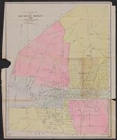
- Published / Created:
- 1911
- Call Number:
- 766an N46 1911
- Container / Volume:
- BRBL_00474
- Image Count:
- 1
- Resource Type:
- Maps, Atlases & Globes
- Subject (Geographic):
- New Haven (Conn.)--Maps
- Found in:
- Beinecke Rare Book and Manuscript Library > Saloon map of New Haven.

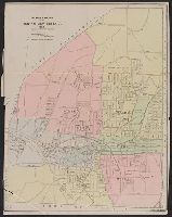
- Published / Created:
- 1911
- Call Number:
- 766an N46 1911
- Container / Volume:
- BRBL_00474
- Image Count:
- 1
- Resource Type:
- Maps, Atlases & Globes
- Subject (Geographic):
- New Haven (Conn.)--Maps
- Found in:
- Beinecke Rare Book and Manuscript Library > Saloon map of New Haven.

- Published / Created:
- 1921
- Call Number:
- 766gmb N46 1921
- Container / Volume:
- BRBL_00475
- Image Count:
- 1
- Resource Type:
- Maps, Atlases & Globes
- Description:
- Includes table of data.
- Subject (Geographic):
- New Haven (Conn.)--Maps
- Found in:
- Beinecke Rare Book and Manuscript Library > State of Connecticut Highway Department traffic census at New Haven, Nov. 12, 1921. / Yale-Princeton football game 8AM to 8PM.
65.

- Creator:
- Price & Lee Co
- Published / Created:
- 1905
- Call Number:
- 766 N46 1905
- Container / Volume:
- BRBL_00473
- Image Count:
- 2
- Resource Type:
- Maps, Atlases & Globes
- Alternative Title:
- New map of the city of New Haven
- Publisher:
- Price & Lee Co.],
- Subject (Geographic):
- New Haven (Conn.)--Maps and New Haven Metropolitan Area (Conn.)--Maps
- Subject (Name):
- Hill, A. B
- Found in:
- Beinecke Rare Book and Manuscript Library > The Price & Lee Co's. new map of the city of New Haven / A.B. Hill, drawn by him for their new city directory.
66.

- Creator:
- Price & Lee Co
- Published / Created:
- 1892
- Call Number:
- 766 N46 1892
- Container / Volume:
- BRBL_00473
- Image Count:
- 2
- Resource Type:
- Maps, Atlases & Globes
- Alternative Title:
- New map of the city of New Haven
- Publisher:
- Price & Lee Co.],
- Subject (Geographic):
- New Haven (Conn.)--Maps and New Haven Metropolitan Area (Conn.)--Maps
- Subject (Name):
- Searle, S. W
- Found in:
- Beinecke Rare Book and Manuscript Library > The Price & Lee Co.'s new map of the city of New Haven / surveyed by S.W. Searle and drawn by him expressly for their new city directory.

- Creator:
- Price & Lee Co
- Published / Created:
- 1893
- Call Number:
- 766 N46 1893B
- Container / Volume:
- BRBL_00473
- Image Count:
- 2
- Resource Type:
- Maps, Atlases & Globes
- Alternative Title:
- New map of the city of New Haven.
- Publisher:
- Price and Lee],
- Subject (Geographic):
- New Haven (Conn.)--Maps and New Haven Metropolitan Area (Conn.)--Maps
- Subject (Name):
- Searle, S. W
- Subject (Topic):
- Streets--Connecticut--New Haven--Maps
- Found in:
- Beinecke Rare Book and Manuscript Library > The Price & Lee Co.'s new map of the city of New Haven / surveyed by S.W. Searle.
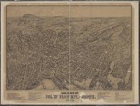
- Published / Created:
- 1879
- Call Number:
- 766am N46 1879V
- Container / Volume:
- BRBL_00474
- Image Count:
- 1
- Resource Type:
- Maps, Atlases & Globes
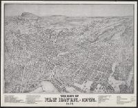
- Description:
- A view of New Haven., Has list of 51 important places., Indexed., and Shows buildings, trees, houses, streets, names of streets, etc.
- Publisher:
- O.H. Bailey & J.C. Hazen,
- Subject (Geographic):
- New Haven (Conn.)--Maps
- Found in:
- Beinecke Rare Book and Manuscript Library > The city of New Haven, Conn.
- Published / Created:
- 1879
- Call Number:
- 766am N46 1879V
- Container / Volume:
- BRBL_00474
- Image Count:
- 1
- Resource Type:
- Maps, Atlases & Globes
- Description:
- A view of New Haven., Has list of 51 important places., Indexed., and Shows buildings, trees, houses, streets, names of streets, etc.
- Publisher:
- O.H. Bailey & J.C. Hazen,
- Subject (Geographic):
- New Haven (Conn.)--Maps
- Found in:
- Beinecke Rare Book and Manuscript Library > The city of New Haven, Conn.

- Published / Created:
- 1895
- Call Number:
- 766gfa N46 1895
- Container / Volume:
- BRBL_00475
- Image Count:
- 2
- Resource Type:
- Maps, Atlases & Globes
- Description:
- Copy of ms. by the Associated Mutual Insurance Co., Boston, Mass., Letter of comment attached., and Shows chief water mains and reservoirs.
- Subject (Geographic):
- New Haven (Conn.)--Maps
- Found in:
- Beinecke Rare Book and Manuscript Library > Water Supply. New Haven, Conn.