Search
You Searched For
Search Results
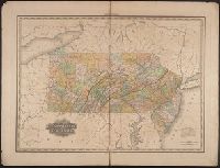
- Creator:
- Howell, Reading, 1743-1827
- Published / Created:
- 1816
- Call Number:
- 774 1816
- Container / Volume:
- BRBL_00498
- Image Count:
- 1
- Resource Type:
- Maps, Atlases & Globes
- Found in:
- Beinecke Rare Book and Manuscript Library > A map of the state of Pennsylvania / [cartographic material] / by Reading Howell, MDCCCXVI ; published by Emmor Kimber.
- Published / Created:
- 186-.
- Call Number:
- 754gme 1865
- Container / Volume:
- BRBL_00420
- Image Count:
- 1
- Resource Type:
- Maps, Atlases & Globes
- Found in:
- Beinecke Rare Book and Manuscript Library > Map of the Williamsport and Elmira rail road : with its connections.
- Published / Created:
- [1875?]
- Call Number:
- 774J 1875
- Container / Volume:
- BRBL_00502
- Image Count:
- 1
- Resource Type:
- Maps, Atlases & Globes
- Found in:
- Beinecke Rare Book and Manuscript Library > An Historical map of Pennsylvania showing the Indian Names of Streams and Villages, and paths of travel; The Sites of Old Forts and Battle Fields; The Sucessive Purchases from the Indians; and the names and dates of Counties and County Towns, with Tables
- Published / Created:
- 1840
- Call Number:
- 774gme 1840A
- Container / Volume:
- BRBL_00501A
- Image Count:
- 1
- Resource Type:
- Maps, Atlases & Globes
- Found in:
- Beinecke Rare Book and Manuscript Library > Map exhibiting that portion of the state of Pennsylvania traversed by the surveys for a continuous Rail Road from Hirrisburg to Pittsburg made under the direction of Charles L. Schlatter, C.E. in the year 1839 and 1840. Drawn by Charles Cramer.
- Published / Created:
- [1839?]
- Call Number:
- 774GM 1840
- Container / Volume:
- BRBL_00501A
- Image Count:
- 1
- Resource Type:
- Maps, Atlases & Globes
- Found in:
- Beinecke Rare Book and Manuscript Library > Map of the canals ans railroads of Pennsylvania and New Jersey and the adjoining states. 1840.
- Call Number:
- 774gme 1840B
- Container / Volume:
- BRBL_00501A
- Image Count:
- 1
- Resource Type:
- Maps, Atlases & Globes
- Found in:
- Beinecke Rare Book and Manuscript Library > Map exhibiting that portion of the state of Pennsylvania traversed by the surveys for a continous railroad from Harrisburg to Pittsburg, 1839-40.
- Creator:
- Howell, Reading, 1743-1827
- Published / Created:
- 1811
- Call Number:
- 774 1811
- Container / Volume:
- BRBL_00498
- Image Count:
- 1
- Resource Type:
- Maps, Atlases & Globes
- Found in:
- Beinecke Rare Book and Manuscript Library > A map of the state of Pennsylvania / [cartographic material] / by Reading Howell, MDCCCXI ; engraved by J. Vallance.
- Published / Created:
- [1820]
- Call Number:
- 774 M319 1820
- Container / Volume:
- BRBL_00499
- Image Count:
- 1
- Resource Type:
- Maps, Atlases & Globes
- Found in:
- Beinecke Rare Book and Manuscript Library > Mantua Village & Roads in its Vicinity, situated 3 iles from the old Court house of Philadelphia, in Blockley. W. side of Schuylkill, on lands of Richard Peters Esqr. by Samuel Hains, Surveyor.
- Creator:
- Tanner, Henry Schenck, 1786-1858
- Published / Created:
- [1823]
- Call Number:
- 774 1823
- Container / Volume:
- BRBL_00498
- Image Count:
- 1
- Resource Type:
- Maps, Atlases & Globes
- Found in:
- Beinecke Rare Book and Manuscript Library > Map of Pennsylvania and New Jersey / by H.S. Tanner ; engraved by H.S. Tanner & assistants.
- Published / Created:
- 1864
- Call Number:
- 774GBC 1864A
- Container / Volume:
- BRBL_00501
- Image Count:
- 1
- Resource Type:
- Maps, Atlases & Globes
- Found in:
- Beinecke Rare Book and Manuscript Library > Lloyd's map of the great oil region of Allegheny River, Cherry and Cherry-Tree Runs, and Pithole Creek : in Cornplanter, Cherry-Tree and Allegheny Townships, Venango County.