Search
You Searched For
Search Results
- Creator:
- Adam and Charles Black (Firm)
Aikman, George, engraver
Barlow, Peter, 1776-1862
- Published / Created:
- 1854]
- Call Number:
- 11 1854
- Container / Volume:
- BRBL_00009
- Image Count:
- 1
- Resource Type:
- Maps, Atlases & Globes
- Found in:
- Beinecke Rare Book and Manuscript Library > A chart of magnetic curves of equal variation / by Peter Barlow.
- Published / Created:
- 1815
- Call Number:
- 11 1818
- Container / Volume:
- BRBL_00007
- Image Count:
- 1
- Resource Type:
- Maps, Atlases & Globes
- Found in:
- Beinecke Rare Book and Manuscript Library > Allgemeine Welt Charte nach Mercators Projection Entworfen von A.I. Krusenstern, Capitain der Russischen Marine. I. Walker, sculp. Verhessert bis zum 1818.
- Published / Created:
- [1825]
- Call Number:
- 11 1825
- Container / Volume:
- BRBL_00007
- Image Count:
- 1
- Resource Type:
- Maps, Atlases & Globes
- Found in:
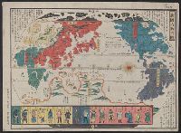
- Beinecke Rare Book and Manuscript Library > Bankoku Jinbutsu no Dzu. [Picture of the World and its People].
- Published / Created:
- 1806
- Call Number:
- 11 1806A
- Container / Volume:
- BRBL_00007
- Image Count:
- 1
- Resource Type:
- Maps, Atlases & Globes
- Found in:
- Beinecke Rare Book and Manuscript Library > Beide Halbkugeln der Erde ... von Joseph Wüstinger.
- Published / Created:
- [1815]
- Call Number:
- 11 1815
- Container / Volume:
- BRBL_00007
- Image Count:
- 1
- Resource Type:
- Maps, Atlases & Globes
- Found in:
- Beinecke Rare Book and Manuscript Library > Chikkyu Bankoku Sankai Yochi Zen Zuzetsu. [Descriptive Map of the Globe with all countries, Lands, and Seas]. Description by Mito Sekisui Chogenshu. Copy of Sekisui's famous world map.
- Published / Created:
- 1858
- Call Number:
- 11 1858
- Container / Volume:
- BRBL_00009
- Image Count:
- 1
- Resource Type:
- Maps, Atlases & Globes
- Found in:
- Beinecke Rare Book and Manuscript Library > Colton's Map of the World on Mercator's Projection.
- Published / Created:
- 1806
- Call Number:
- 11 1806
- Container / Volume:
- BRBL_00007
- Image Count:
- 1
- Resource Type:
- Maps, Atlases & Globes
- Found in:
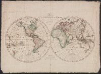
- Beinecke Rare Book and Manuscript Library > Die Erde in zwey halbkugeln nach den vorzüglichsten charten und zuverlässigsten Ortsbestimmungen entworfen von Conrad Mannert ... I. Rausch fe.
- Published / Created:
- 1807
- Call Number:
- 11 1807
- Container / Volume:
- BRBL_00007
- Image Count:
- 1
- Resource Type:
- Maps, Atlases & Globes
- Found in:
- Beinecke Rare Book and Manuscript Library > Die beyden Halbkugeln der Erde ... von D.F. Sotzmann.
- Published / Created:
- [1805]
- Call Number:
- 11 1805
- Container / Volume:
- BRBL_00007
- Image Count:
- 1
- Resource Type:
- Maps, Atlases & Globes
- Found in:
- Beinecke Rare Book and Manuscript Library > Die beyden Halbkugeln. Samt den neuesten Entdeckungen. F. Reisser sc. A Cracovia et Leopol cheze J.B. Biasion.
- Published / Created:
- 1873
- Call Number:
- 11 1873
- Container / Volume:
- BRBL_00010
- Image Count:
- 11
- Resource Type:
- Maps, Atlases & Globes
- Found in:
- Beinecke Rare Book and Manuscript Library > Emisfero Oriental [and] Emisfero Occidentale. Ev. Azzi ... dis. e compilo. E. Bonatti ... corre. e completo.
- Published / Created:
- 1907
- Call Number:
- 11 1907
- Container / Volume:
- BRBL_00010
- Image Count:
- 1
- Resource Type:
- Maps, Atlases & Globes
- Found in:
- Beinecke Rare Book and Manuscript Library > GlobusKarte Weltkarte in Teilkarten in Einheitlichem Flächenmassstabe.
- Creator:
- G.W. & C.B. Colton & Co
J.H. Colton & Co
- Published / Created:
- [1855]
- Call Number:
- 11 1855
- Container / Volume:
- BRBL_00009
- Image Count:
- 1
- Resource Type:
- Maps, Atlases & Globes
- Found in:
- Beinecke Rare Book and Manuscript Library > Map showing the telegraph lines in operation, under contract, and contemplated, to complete the circuit of the globe / entered according to Act of Congress in the year 1855 by J.H. Colton & Co. in the Clerks Office of the District Court for the Southern D
- Published / Created:
- 1812
- Call Number:
- 11 1812
- Container / Volume:
- BRBL_00007
- Image Count:
- 1
- Resource Type:
- Maps, Atlases & Globes
- Found in:
- Beinecke Rare Book and Manuscript Library > Mappa-Monde Contenant les parties connues Du Globe Terreste. Dresseés Suivant les Dernieres Observations. Par J.B. Nollin Ingenieur Gèographe. Revue et Corrigée par J.B. Poirson.
- Published / Created:
- 1845
- Call Number:
- 11 1845
- Container / Volume:
- BRBL_00007
- Image Count:
- 1
- Resource Type:
- Maps, Atlases & Globes
- Found in:
- Beinecke Rare Book and Manuscript Library > Mappe - Monde, divisée en deux hémisphères avec les découvertes faites dans les derniers voyages ... per Hérisson, Géographe.
- Published / Created:
- [1812]
- Call Number:
- 11 1812A
- Container / Volume:
- BRBL_00007
- Image Count:
- 1
- Resource Type:
- Maps, Atlases & Globes
- Found in:
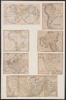
- Beinecke Rare Book and Manuscript Library > Mappe - Mondes sur Diverses Projections [6 maps] Gravé par Chamouin rue de la Harpe No. 35. Ecrit par Giraldon.
- Published / Created:
- 1895
- Call Number:
- 11 1895A
- Container / Volume:
- BRBL_00010
- Image Count:
- 1
- Resource Type:
- Maps, Atlases & Globes
- Found in:
- Beinecke Rare Book and Manuscript Library > Mappe of the Principal Voyages and Discoveries Made by the Hollanders, with the principal Lands, places and Factories in their possession. Brought together by Mr. Ant Mensing, Amsterdamme, 1895.
- Published / Created:
- c.1917.
- Call Number:
- 11 1917A
- Container / Volume:
- BRBL_00010
- Image Count:
- 1
- Resource Type:
- Maps, Atlases & Globes
- Found in:
- Beinecke Rare Book and Manuscript Library > Planiglobe of the Antipodes.
- Published / Created:
- 1914
- Call Number:
- 11 1914A
- Container / Volume:
- BRBL_00010
- Image Count:
- 2
- Resource Type:
- Maps, Atlases & Globes
- Found in:
- Beinecke Rare Book and Manuscript Library > Sekai jikyoku, meisai dai chizu, [Map of the World]. Compiled by Chirichosa Kai.
- Published / Created:
- 1845]
- Call Number:
- 11 1845A
- Container / Volume:
- BRBL_00007
- Image Count:
- 1
- Resource Type:
- Maps, Atlases & Globes
- Found in:
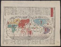
- Beinecke Rare Book and Manuscript Library > Shinsen Bankoku Jinbutsu Ichiran. [Newly Compiled Map of the World and drawn by Kochoen Shunshu]. Shiba, Shinmeimae, Yedo.
- Published / Created:
- [1826]
- Call Number:
- 11 1826A
- Container / Volume:
- BRBL_00007
- Image Count:
- 1
- Resource Type:
- Maps, Atlases & Globes
- Found in:
- Beinecke Rare Book and Manuscript Library > The World [in two hemispheres].
- Published / Created:
- 1847
- Call Number:
- 11 1847E
- Container / Volume:
- BRBL_00008
- Image Count:
- 1
- Resource Type:
- Maps, Atlases & Globes
- Found in:
- Beinecke Rare Book and Manuscript Library > The World at one view.
- Published / Created:
- 1847
- Call Number:
- 11 1847E
- Container / Volume:
- BRBL_00008
- Image Count:
- 1
- Resource Type:
- Maps, Atlases & Globes
- Found in:
- Beinecke Rare Book and Manuscript Library > The World at one view.
- Published / Created:
- 1850
- Call Number:
- 11 1850
- Container / Volume:
- BRBL_00009
- Image Count:
- 1
- Resource Type:
- Maps, Atlases & Globes
- Found in:
- Beinecke Rare Book and Manuscript Library > The World on Mercator's Projection: By David H. Burr. Showing the different routes to California and distance by each. Routes of different Navigators, route of the contemplated Pacific R.Road. Distances to China, Europe, etc.
- Published / Created:
- [1870?]
- Call Number:
- 11 1870
- Container / Volume:
- BRBL_00009
- Image Count:
- 1
- Resource Type:
- Maps, Atlases & Globes
- Found in:
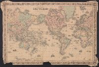
- Beinecke Rare Book and Manuscript Library > The World on Mercator's projection. Engraved by Charles Copley, N.Y.
- Creator:
- Wyld, James, 1812-1887, creator
- Published / Created:
- 1852
- Call Number:
- 11 1852A
- Container / Volume:
- BRBL_00009
- Image Count:
- 1
- Resource Type:
- Maps, Atlases & Globes
- Found in:
- Beinecke Rare Book and Manuscript Library > The world, on Mercator's projection.
- Published / Created:
- 1534
- Call Number:
- Taylor 74
- Collection Title:
- Epitome trium terrae partium Asiae, Africae et Europae compendiariam locorum descriptionem
- Image Count:
- 1
- Found in:
- Beinecke Rare Book and Manuscript Library > Typus cosmographicus universalis
- Published / Created:
- 1534
- Call Number:
- 1976 +271
- Collection Title:
- Epitome trium terrae partium Asiae, Africae et Europae compendiariam locorum descriptionem
- Image Count:
- 1
- Found in:
- Beinecke Rare Book and Manuscript Library > Typus cosmographicus universalis
- Published / Created:
- [1943?]
- Call Number:
- 11hd 1943B
- Container / Volume:
- BRBL_00010ZE
- Image Count:
- 2
- Resource Type:
- Maps, Atlases & Globes
- Found in:
- Beinecke Rare Book and Manuscript Library > WOR International Radio News Map.
- Published / Created:
- 1847
- Call Number:
- 11 1847
- Container / Volume:
- BRBL_00008
- Image Count:
- 1
- Resource Type:
- Maps, Atlases & Globes
- Found in:
- Beinecke Rare Book and Manuscript Library > World at one view.
- Call Number:
- 11ba 1915
- Container / Volume:
- BRBL_00010A
- Image Count:
- 1
- Resource Type:
- Maps, Atlases & Globes
- Found in:
- Beinecke Rare Book and Manuscript Library > [Philips' 12 inch terrestrial globe.]
- Published / Created:
- 1915
- Call Number:
- 11ba 1915A
- Container / Volume:
- BRBL_00010A
- Image Count:
- 1
- Resource Type:
- Maps, Atlases & Globes
- Found in:
- Beinecke Rare Book and Manuscript Library > [Philips' 4 inch graphic globe.]
- Published / Created:
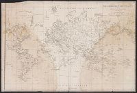
- [1853]
- Call Number:
- 11 1853
- Container / Volume:
- BRBL_00009
- Image Count:
- 1
- Resource Type:
- Maps, Atlases & Globes
- Found in:
- Beinecke Rare Book and Manuscript Library > [World Map].
- Published / Created:
- [1848]
- Call Number:
- 11 1848
- Container / Volume:
- BRBL_00009
- Image Count:
- 1
- Resource Type:
- Maps, Atlases & Globes
- Found in:
- Beinecke Rare Book and Manuscript Library > [World Map].