Search
You Searched For
Search Results
- Creator:
- Maryland Geological Survey
- Published / Created:
- 1912
- Call Number:
- 777cbf B21 1912
- Container / Volume:
- BRBL_00504A
- Image Count:
- 1
- Resource Type:
- Maps, Atlases & Globes
- Found in:
- Beinecke Rare Book and Manuscript Library > Baltimore.
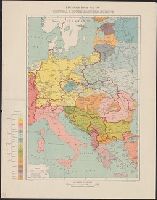
- Published / Created:
- 1916
- Call Number:
- 304ed 1916
- Container / Volume:
- BRBL_00034A
- Image Count:
- 1
- Resource Type:
- Maps, Atlases & Globes
- Found in:
- Beinecke Rare Book and Manuscript Library > Ethnographical Map of Central & South Eastern Europe.
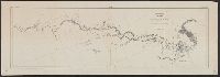
- Published / Created:
- 1898
- Call Number:
- 848 T15 1898
- Container / Volume:
- BRBL_00634
- Image Count:
- 1
- Resource Type:
- Maps, Atlases & Globes
- Found in:
- Beinecke Rare Book and Manuscript Library > Explorations in Alaska 1898 portions of Tanana and White Rivers.
- Creator:
- La Rocque, George A., 1908-
- Published / Created:
- 1966
- Call Number:
- 817cbj 1966
- Container / Volume:
- BRBL_00564
- Image Count:
- 1
- Resource Type:
- Maps, Atlases & Globes
- Found in:
- Beinecke Rare Book and Manuscript Library > General availability of ground water and depth to water level in the Missouri River Basin / by G.A. La Rocque, Jr.
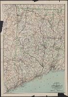
- Creator:
- C.S. Hammond & Company
- Published / Created:
- c1916.
- Call Number:
- 766gmb 1916H
- Container / Volume:
- BRBL_00475
- Image Count:
- 1
- Resource Type:
- Maps, Atlases & Globes
- Found in:
- Beinecke Rare Book and Manuscript Library > Hammond's new road map of Connecticut (Eastern part) / based on the surveys of the United States Geological Survey, United States Coast and Geodetic Survey and the various local surveys, revised and corrected ... C.S. Hammond & Company.
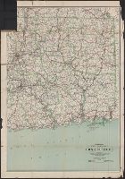
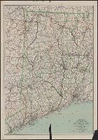
- Creator:
- C.S. Hammond & Company
- Published / Created:
- 1916
- Call Number:
- 766gmb 1916H
- Container / Volume:
- BRBL_00475
- Image Count:
- 1
- Resource Type:
- Maps, Atlases & Globes
- Found in:
- Beinecke Rare Book and Manuscript Library > Hammond's new road map of Connecticut (Western part) / based on the surveys of the United States Geological Survey, United States Coast and Geodetic Survey and the various local surveys, revised and corrected ... C.S. Hammond & Company.
- Creator:
- C.S. Hammond & Company.
- Published / Created:
- ©1913.
- Call Number:
- BrSides Double Folio 2017 10
- Image Count:
- 1
- Resource Type:
- Maps, Atlases & Globes
- Found in:
- Beinecke Rare Book and Manuscript Library > Hammond's new road map of Connecticut [cartographic material] / based on the surveys of the United States Geological Survey, United States Coast and Geodetic Survey and the various local surveys, revised and corrected ... C.S. Hammond & Company.
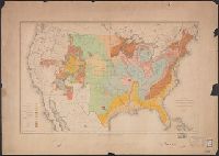
- Creator:
- United States. Office of Farm Management
- Published / Created:
- 1915
- Call Number:
- 75gce 1915
- Container / Volume:
- BRBL_00410
- Image Count:
- 1
- Resource Type:
- Maps, Atlases & Globes
- Found in:
- Beinecke Rare Book and Manuscript Library > Irrigation map of the United States / engraved and printed by the U.S. Geological Survey ; outline of irrigated areas based upon data collected by the Bureau of the Census, 1910 ; revised by Irrigation Division, Office of Experimental Stations, and by the
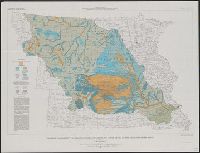
- Creator:
- Maryland Geological Survey
- Published / Created:
- 1900
- Call Number:
- 777fb Al53 1900
- Container / Volume:
- BRBL_00504A
- Image Count:
- 3
- Resource Type:
- Maps, Atlases & Globes
- Found in:
- Beinecke Rare Book and Manuscript Library > Map of Allegany County showing the topography and election districts. / Maryland Geological Survey, in cooperation with U.S. Geological Survey.
- Creator:
- Selden, Henry S
- Published / Created:
- 1899
- Call Number:
- 80 1899
- Container / Volume:
- BRBL_00536
- Image Count:
- 1
- Resource Type:
- Maps, Atlases & Globes
- Found in:
- Beinecke Rare Book and Manuscript Library > Map of Texas and parts of adjoining territories / compiled by and under the direction of Robert T. Hill ; drawn by Henry S. Selden and Willard D. Johnson.
- Creator:
- McGee, W. J., 1853-1912
- Published / Created:
- 1884
- Call Number:
- 75CA 1884
- Container / Volume:
- BRBL_00407A
- Image Count:
- 1
- Resource Type:
- Maps, Atlases & Globes
- Found in:
- Beinecke Rare Book and Manuscript Library > Map of the United States exhibiting the present status of knowledge relating to the areal distribution of geologic groups : (preliminary compilation) / compiled by W.J. McGee.
- Creator:
- Appalachian Mountain Club
- Published / Created:
- 1890
- Call Number:
- 764 B65 1890A
- Container / Volume:
- BRBL_00456
- Image Count:
- 1
- Resource Type:
- Maps, Atlases & Globes
- Found in:
- Beinecke Rare Book and Manuscript Library > Map of the country about Boston / Geo. S. Harris & Sons, lith.
- Published / Created:
- 1883?]
- Call Number:
- 842 1883
- Container / Volume:
- BRBL_00598
- Image Count:
- 1
- Resource Type:
- Maps, Atlases & Globes
- Found in:
- Beinecke Rare Book and Manuscript Library > Northeastern Arizona / U.S. Geological Survey ; Henry Gannett, chief geographer ; A.H. Thompson, geographer in charge ; H.M. Wilson, topographer.
- Creator:
- Richardson, G. B
- Published / Created:
- 1921
- Call Number:
- 774gbc 1921
- Container / Volume:
- BRBL_00501A
- Image Count:
- 1
- Resource Type:
- Maps, Atlases & Globes
- Found in:
- Beinecke Rare Book and Manuscript Library > Oil and gas fields of Pennsylvania / compiled under the direction of G.B. Richardson.
- Creator:
- United States. Department of Agriculture. Division of Publications
- Published / Created:
- 1910
- Call Number:
- 75fb 1910
- Container / Volume:
- BRBL_00410
- Image Count:
- 1
- Resource Type:
- Maps, Atlases & Globes
- Found in:
- Beinecke Rare Book and Manuscript Library > Outline map of the United States by counties / engraved and printed by the U.S. Geological Survey.
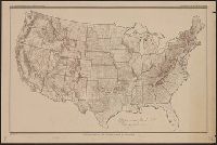
- Creator:
- United States. Department of Agriculture. Division of Publications
- Published / Created:
- 1915
- Call Number:
- 75eb 1910B
- Container / Volume:
- BRBL_00410
- Image Count:
- 1
- Resource Type:
- Maps, Atlases & Globes
- Found in:
- Beinecke Rare Book and Manuscript Library > Outline map of the United States by counties / engraved and printed by the U.S. Geological Survey.
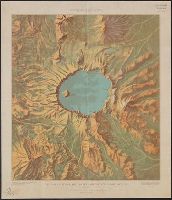
- Creator:
- Renshawe, J. H. (John Henry), 1852-
- Published / Created:
- [1914?]
- Call Number:
- 846am C855 1914
- Container / Volume:
- BRBL_00623
- Image Count:
- 1
- Resource Type:
- Maps, Atlases & Globes
- Found in:
- Beinecke Rare Book and Manuscript Library > Panoramic View of the Crater Lake National Park, Oregon / prepared by John H. Renshawe from topographic sheet of the United States Geological Survey.
- Creator:
- Renshawe, John H
- Published / Created:
- [1914?]
- Call Number:
- 831am G45 1920
- Container / Volume:
- BRBL_00581
- Image Count:
- 1
- Resource Type:
- Maps, Atlases & Globes
- Found in:
- Beinecke Rare Book and Manuscript Library > Panoramic view of the Glacier National Park, Montana / prepared by John H. Renshawe from topographic sheets of the United States Geological Survey ; engraved and printed by the United States Geological Survey.
- Creator:
- Renshawe, John H
- Published / Created:
- [1914]
- Call Number:
- 847am M864 1914
- Container / Volume:
- BRBL_00628
- Image Count:
- 1
- Resource Type:
- Maps, Atlases & Globes
- Found in:
- Beinecke Rare Book and Manuscript Library > Panoramic view of the Mount Rainier National Park, Washington / prepared by John H. Renshawe from topographic sheet of the United States Geological Survey.
- Creator:
- Renshawe, John H
- Published / Created:
- [1915?]
- Call Number:
- 833am Y38 1915
- Container / Volume:
- BRBL_00585
- Image Count:
- 1
- Resource Type:
- Maps, Atlases & Globes
- Found in:
- Beinecke Rare Book and Manuscript Library > Panoramic view of the Yellowstone National Park, Wyoming-Montana-Idaho / prepared by John H. Renshawe from topographic sheets of the United States Geological Survey.
- Creator:
- Renshawe, John H
- Published / Created:
- [1930?]
- Call Number:
- 844am Y83 1930
- Container / Volume:
- BRBL_00612
- Image Count:
- 1
- Resource Type:
- Maps, Atlases & Globes
- Found in:
- Beinecke Rare Book and Manuscript Library > Panoramic view of the Yosemite National Park, California.
- Creator:
- Brooks, Alfred H. (Alfred Hulse), 1871-1924
- Published / Created:
- 1904
- Call Number:
- 848 M215 1904
- Container / Volume:
- BRBL_00634
- Image Count:
- 1
- Resource Type:
- Maps, Atlases & Globes
- Found in:
- Beinecke Rare Book and Manuscript Library > Reconnaissance map of Mt. McKinley region, Alaska / Alfred H. Brooks, geologist in charge. Topography by D.L. Reaburn. Surveyed in 1902. Additional information compiled from surveys by U.S. Geo. Surveys and U.S. Army.
- Creator:
- McGee, W. J., 1853-1912
- Published / Created:
- [1893?]
- Call Number:
- 75CA 1893
- Container / Volume:
- BRBL_00408
- Image Count:
- 10
- Resource Type:
- Maps, Atlases & Globes
- Found in:
- Beinecke Rare Book and Manuscript Library > Reconnoissance map of the United States showing the distribution of the geologic system so far as known / compiled from data in possession of the U.S. Geological Survey by W.J. McGee, 1893.
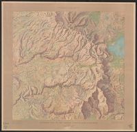
- Published / Created:
- 1905?]
- Call Number:
- 754cbf 1910
- Container / Volume:
- BRBL_00417
- Image Count:
- 1
- Resource Type:
- Maps, Atlases & Globes
- Found in:
- Beinecke Rare Book and Manuscript Library > Relief map of the southern Appalachian region : showing the distribution of the mountains.
- Creator:
- Dinsmore, A. F
- Published / Created:
- 1919
- Call Number:
- 841fcm 1919
- Container / Volume:
- BRBL_00597
- Image Count:
- 1
- Resource Type:
- Maps, Atlases & Globes
- Found in:
- Beinecke Rare Book and Manuscript Library > State of New Mexico / compiled by A.F. Dinsmore ; traced and lettered by Wm. Bauman ; engraved and printed by the U.S. Geological Survey.
- Published / Created:
- 1946?]
- Call Number:
- 825cbf F778 1943
- Container / Volume:
- BRBL_00575
- Image Count:
- 1
- Resource Type:
- Maps, Atlases & Globes
- Found in:
- Beinecke Rare Book and Manuscript Library > Tactical map, Fort Riley & vicinity / horizontal and vertical control by U.S.G.S. & U.S.C. & G.S. ; aerial photography by Flight C 1st Photographic Squadron, A.C. Dec. 1940 ; multiplex mapping & drafting by the District Engineer, U.S.E.D. Little Rock, Ark
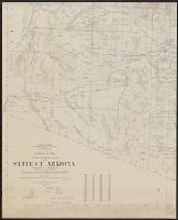
- Creator:
- Darton, Nelson Horatio, 1865-1948
- Published / Created:
- 1923
- Call Number:
- 842 1923A
- Container / Volume:
- BRBL_00599
- Image Count:
- 4
- Resource Type:
- Maps, Atlases & Globes
- Found in:
- Beinecke Rare Book and Manuscript Library > Topographic map of the State of Arizona / University of Arizona, Arizona Bureau of Mines in cooperation with Department of the Interior, U.S. Geological Survey ; prepared by N.H. Darton.
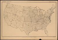
- Creator:
- Gannett, Henry, 1846-1914
- Published / Created:
- [1904]
- Call Number:
- 754cbf 1904
- Container / Volume:
- BRBL_00417
- Image Count:
- 1
- Resource Type:
- Maps, Atlases & Globes
- Found in:
- Beinecke Rare Book and Manuscript Library > United States contour map / U.S. Geological Survey ; compiled by Henry Gannett.