


- None1
Search
Limit your search
- Public✖[remove]25
- Stokes, John Lort, 1811-1885. Discoveries in Australia.3
- Beagle (Ship)2
- Arrowsmith, John, 1790-1873, publisher1
- Beagle Expedition--(1831-1836)--Maps.1
- Childs, Cephas Grier, 1793-18711
- Dawson, S. J. (Simon James), 1820-1902. Report on the Exploration of the Country between Lake Superior and the Red River Settlement.1
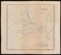
- Grey, George,--1812-18981
- Grey, George,--1812-1898--Travel--Australia--Western Australia--Maps.1
- Grosvenor, Gilbert Hovey, 1875-19661
- Hay, William1