Search
You Searched For
Search Results
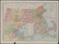
- Creator:
- Rand McNally and Company
- Published / Created:
- [1911]
- Call Number:
- 764 1911
- Container / Volume:
- BRBL_00453
- Image Count:
- 1
- Resource Type:
- Maps, Atlases & Globes
- Description:
- principal cities, list of Massachusetts
- Subject (Geographic):
- Massachusetts--Maps
- Subject (Topic):
- Railroads--Massachusetts--Maps
- Found in:
- Beinecke Rare Book and Manuscript Library > Massachusetts.
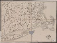
- Creator:
- Massachusetts. Board of Railroad Commissioners
- Published / Created:
- 1882
- Call Number:
- 764gme 1882
- Container / Volume:
- BRBL_00462
- Image Count:
- 1
- Resource Type:
- Maps, Atlases & Globes
- Description:
- Shows railroads in Massachusetts and
- Subject (Geographic):
- Massachusetts--Maps
- Subject (Topic):
- Railroads--Massachusetts--Maps
- Found in:
- Beinecke Rare Book and Manuscript Library > Map of the railroads of the state of Massachusetts : accompanying the report of the Railroad Commissioners.
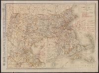
- Creator:
- Rand McNally and Company
- Published / Created:
- [1921]
- Call Number:
- 764 1921
- Container / Volume:
- BRBL_00453
- Image Count:
- 2
- Resource Type:
- Maps, Atlases & Globes
- Alternative Title:
- Standard map of Massachusetts
- Description:
- principal cities, list of Massachusetts
- Subject (Geographic):
- Massachusetts--Maps
- Subject (Topic):
- Railroads--Massachusetts--Maps
- Found in:
- Beinecke Rare Book and Manuscript Library > Rand McNally standard map of Massachusetts.
- Creator:
- Massachusetts. Board of Railroad Commissioners
- Published / Created:
- 1874
- Call Number:
- 764gme 1874
- Container / Volume:
- BRBL_00462
- Image Count:
- 1
- Resource Type:
- Maps, Atlases & Globes
- Subject (Geographic):
- Massachusetts--Maps
- Subject (Topic):
- Railroads--Massachusetts--Maps
- Found in:
- Beinecke Rare Book and Manuscript Library > Map of the railroads of the state of Massachusetts : accompanying the report of the railroad commissioners. 1874.
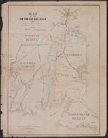
- Creator:
- Ferguson, W. E
- Published / Created:
- 1850
- Call Number:
- 764gme 1850
- Container / Volume:
- BRBL_00462
- Image Count:
- 1
- Resource Type:
- Maps, Atlases & Globes
- Abstract:
- Map of eastern Massachusetts covering
- Subject (Topic):
- Railroads--Massachusetts--Maps
- Found in:
- Beinecke Rare Book and Manuscript Library > Map of the Old Colony Rail Road with its branches & connecting roads, prepared under the direction of the Committee of Investigation, Jany. 1850, S. Dwight Eaton, Engr.
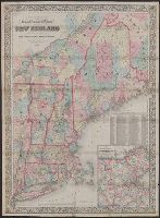
- Creator:
- Colton, G. Woolworth (George Woolworth), 1827-1901
- Published / Created:
- 1866, c1860.
- Call Number:
- 753 1866C
- Container / Volume:
- BRBL_00415
- Image Count:
- 1
- Resource Type:
- Maps, Atlases & Globes
- Subject (Geographic):
- Massachusetts--Maps
- Subject (Topic):
- Railroads--Massachusetts--Maps
- Found in:
- Beinecke Rare Book and Manuscript Library > G. Woolworth Colton's railroad, township & distance map of New England : with adjacent portions of New York, Canada & New Brunswick.
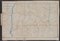
- Creator:
- Barnes, Oliver W
- Published / Created:
- 1868
- Call Number:
- 771 1868A
- Container / Volume:
- BRBL_00479
- Image Count:
- 1
- Resource Type:
- Maps, Atlases & Globes
- Subject (Geographic):
- Massachusetts--Maps
- Subject (Topic):
- Railroads--Massachusetts--Maps
- Found in:
- Beinecke Rare Book and Manuscript Library > Map of portions of New York and New England showing the routes of the Dutchess and Columbia & Connecticut Western Rail Roads / Oliver W. Barnes.