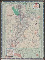
China Road Map 1:1,000,000, Series (Standard map series designation system) ; 301., and Series ; 301
Description:
"2-45.", "Compiled in 1944, from large-scale Chinese maps. Road classification based on Intelligence Reports, 1944.", "Kwangtung, China" in bottom right corner., Includes inset map indexed to political divisions and glossary., and Relief shown by altitude tints,
"A.M.S. 5301.", Cloth map (silk)., For further information see a Web site devoted to the history and identification of the AAF cloth maps., Heights and depths in meters., Includes: Index to boundarie, and Relief shown by gradient tints, contours, and spot heights.
Publisher:
Amy Map Service,
Subject (Geographic):
East Asia--Maps
Subject (Name):
UnitedStates. Army Map Service
Subject (Topic):
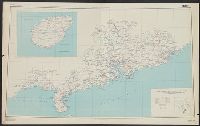
Military geography--Japan--Kagoshima--Maps, Military geography--Japan--Nagasaki--Maps, Military maps, Military topography--Japan--Kagoshima--Maps, and Military topography--Japan--Nagasaki--Maps
Great Britain. Royal Air Force. Central Interpretation Unit
Published / Created:
1943
Call Number:
475 1944
Container / Volume:
BRBL_00262
Image Count:
1
Resource Type:
Maps, Atlases & Globes
Alternative Title:
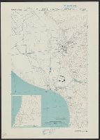
Geographical Section, General Staff ; no. 4415, GSGS (Series) ; 4415., and Vlonë (Valona) city plan
Description:
"1-44.", "1943.", "First G.S.G.S. edition, 1943.", "Ground information supplied by I.S.T.D.", "War Office 1943.", Inset: [Krionero]., Military grid., and Relief shown by contours, land form drawings, and one spot height.
Great Britain. War Office. General Staff. Geographical Section
Published / Created:
1945
Call Number:
5681 1945
Container / Volume:
BRBL_00300
Image Count:
2
Resource Type:
Maps, Atlases & Globes
Alternative Title:
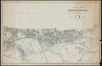
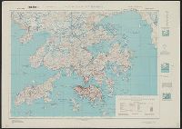
GSGS (Series), Hong Kong and Lema Islands, Hong Kong and Lema Islands., and Hong Kong and New territory.
Description:
"7-45.", "8-45.", "Reproduced under the direction of the Chief of Engineers by the Army Map Service (AM), U.S. Army ... 1945, from Kodalines of GSGS Second Edition 1945...", and North sheet. Hong Kong and New territory -- South sheet. Hong Kong and Lema Islands.
Publisher:
Army Map Service, U.S. Army,
Subject (Geographic):
Hong Kong (China)--Maps and New Territories (China)--Maps
Great Britain. War Office. General Staff. Geographical Section
Published / Created:
1943
Call Number:
3969 Ib4 1943
Container / Volume:
BRBL_00194
Image Count:
1
Resource Type:
Maps, Atlases & Globes
Alternative Title:
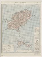
Great Britain. War Office. General Staff. Geographical Section. G.S.G.S. ; 4376., GSGS (Series) ; 4376., Ibiza and Formentera, and Its [G.S.G.S.] ; 4376
Description:
"Contour interval 50 metres.", "N3835-E109 / 35x34.", Five classes of roads and paths, and wooded and intensely culivated areas are shown., In upper margin: Balearic islands 1:100,000 ..., and Insets: Index to adjoining sheets and incidence of grid letters--Relia
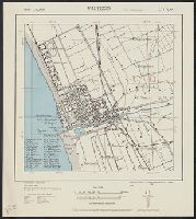
GSGS (Series) ; 4380., Provisional G.S.G.S. ; 4380, and Viareggio city plan
Description:
"4-43.", "Copied from Italy 1:25,000 map 104-1 S.E.", "First edition 1943.", Important streets and buildings are named., Includes index to some buildings., and Military grid (brown).