Search
You Searched For
Search Results
- Creator:
- United States. Army Map Service
- Published / Created:
- 1943
- Call Number:
- 533gm 1943
- Container / Volume:
- BRBL_00288
- Image Count:
- 1
- Resource Type:
- Maps, Atlases & Globes
- Found in:
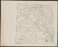
- Beinecke Rare Book and Manuscript Library > ʻIrāq [cartographic material] : special strategic map.
- Published / Created:
- c1902.
- Call Number:
- 75gme 1915
- Container / Volume:
- BRBL_00414A
- Image Count:
- 1
- Resource Type:
- Maps, Atlases & Globes
- Subject (Geographic):
- United States--Maps
- Found in:
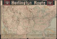
- Beinecke Rare Book and Manuscript Library > [United States] Burlington Route / Burlington R.R.
- Published / Created:
- [1920?].
- Call Number:
- 75 1920
- Container / Volume:
- BRBL_00407A
- Image Count:
- 2
- Resource Type:
- Maps, Atlases & Globes
- Subject (Geographic):
- United States--Maps
- Found in:
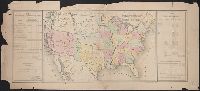
- Beinecke Rare Book and Manuscript Library > [United States] / printed by Rand McNally & Company for free distribution through the newspapers represented by Frederic J. Haskin ; photographs by Harris & Ewing.
- Published / Created:
- 1866
- Call Number:
- 75 1866H
- Container / Volume:
- BRBL_00403
- Image Count:
- 1
- Resource Type:
- Maps, Atlases & Globes
- Subject (Geographic):
- United States--Maps
- Found in:
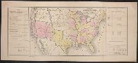
- Beinecke Rare Book and Manuscript Library > [United States] / drawn by A. Lindenkohl ; Chas. G. Krebs, Litho.
- Published / Created:
- 1848?]
- Call Number:
- 75 1848C
- Container / Volume:
- BRBL_00399
- Image Count:
- 1
- Resource Type:
- Maps, Atlases & Globes
- Subject (Geographic):
- United States--Maps
- Found in:
- Beinecke Rare Book and Manuscript Library > [United States Treaties] E. Gilman, draftsman. P.S. Duval's Steam lith. press, Philadelphia.
- Published / Created:
- 1848?]
- Call Number:
- 75 1848B
- Container / Volume:
- BRBL_00399
- Image Count:
- 1
- Resource Type:
- Maps, Atlases & Globes
- Subject (Geographic):
- United States--Maps
- Found in:
- Beinecke Rare Book and Manuscript Library > [United States Treaties] E. Gilman, draftsman. P.S. Duval's Steam lith. press, Philadelphia.
- Published / Created:
- 186-]
- Call Number:
- 754gme 1860B
- Container / Volume:
- BRBL_00420
- Image Count:
- 1
- Resource Type:
- Maps, Atlases & Globes
- Subject (Geographic):
- United States--Maps
- Subject (Topic):
- Railroads--United States--Maps
- Found in:
- Beinecke Rare Book and Manuscript Library > [Railroads of the Northern United States from Iowa to Boston, Massachusetts]
- Published / Created:
- 1920
- Call Number:
- 75ak 1920
- Container / Volume:
- BRBL_00407A
- Image Count:
- 1
- Resource Type:
- Maps, Atlases & Globes
- Subject (Geographic):
- United States--Maps
- Found in:
- Beinecke Rare Book and Manuscript Library > [Outline Map of the United States] / engraved and printed by the U.S. Geological Survey.
- Call Number:
- 1974 +231
- Collection Title:
- A new and elegant general atlas, comprising all the new discoveries, to the present time
- Image Count:
- 1
- Subject (Geographic):
- United States--Maps--1804
- Found in:
- Beinecke Rare Book and Manuscript Library > [Map of the United States of America]
- Published / Created:
- [1849?]
- Call Number:
- 75 1849E
- Container / Volume:
- BRBL_00400
- Image Count:
- 1
- Resource Type:
- Maps, Atlases & Globes
- Subject (Geographic):
- United States--Maps
- Found in:
- Beinecke Rare Book and Manuscript Library > [Map of Frontier Stations and lines of transportation in the U.S. and North America].
- Published / Created:
- 1683?]
- Call Number:
- 807 1683
- Container / Volume:
- BRBL_00717
- Image Count:
- 2
- Resource Type:
- Maps, Atlases & Globes
- Subject (Geographic):
- United States--Maps, Manuscript--Early
- Found in:
- Beinecke Rare Book and Manuscript Library > [An untitled manuscript map in French depicting the Mississippi River valley from the Gulf of Mexico to the Illinois River in the north and tracing the Wabash and Ohio Rivers in the northeast .]
- Creator:
- United States. Army Map Service
- Published / Created:
- 1945
- Call Number:
- 273 T171 1945
- Container / Volume:
- BRBL_00023B
- Image Count:
- 1
- Resource Type:
- Maps, Atlases & Globes
- Found in:
- Beinecke Rare Book and Manuscript Library > [Air support charts, Tarakan] / prepared and reproduced by Army Map Service.
- Creator:
- United States. Army Map Service
- Published / Created:
- 1944
- Call Number:
- 50 1945M
- Container / Volume:
- BRBL_00273
- Image Count:
- 1
- Resource Type:
- Maps, Atlases & Globes
- Subject (Name):
- United States. Army Map Service
- Found in:
- Beinecke Rare Book and Manuscript Library > [AAF cloth chart]. Eastern Asia [cartographic material].
- Published / Created:
- 19--?].
- Call Number:
- 75CFH 1900
- Container / Volume:
- BRBL_00409
- Image Count:
- 1
- Resource Type:
- Maps, Atlases & Globes
- Subject (Geographic):
- United States--Maps
- Found in:
- Beinecke Rare Book and Manuscript Library > Zones of Equal Temperature : mean minimum temperature [for the year].
- Creator:
- United States. Army Map Service
- Published / Created:
- 1945
- Call Number:
- 56 W48 1945
- Container / Volume:
- BRBL_00297
- Image Count:
- 1
- Resource Type:
- Maps, Atlases & Globes
- Found in:
- Beinecke Rare Book and Manuscript Library > Yung-chia (Wenchow) China, Chekiang Province [cartographic material].
- Published / Created:
- c1918.
- Call Number:
- 75eha 1918
- Image Count:
- 1
- Resource Type:
- Maps, Atlases & Globes
- Subject (Geographic):
- United States--Maps
- Found in:
- Beinecke Rare Book and Manuscript Library > Y.W.C.A. War Work Centers in the United States.
- Creator:
- United States. Army Map Service
- Published / Created:
- [19]44.
- Call Number:
- 269gmb 1945B
- Container / Volume:
- BRBL_00023A
- Image Count:
- 1
- Resource Type:
- Maps, Atlases & Globes
- Found in:
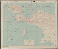
- Beinecke Rare Book and Manuscript Library > Western New Guinea : special strategic map / compiled by the Army Map Service.
- Creator:
- Petermann, A. (August Heinrich), 1822-1878
- Published / Created:
- 1879
- Call Number:
- 75 1879A
- Container / Volume:
- BRBL_00407
- Image Count:
- 2
- Resource Type:
- Maps, Atlases & Globes
- Subject (Geographic):
- United States--Maps
- Found in:
- Beinecke Rare Book and Manuscript Library > West-Indien in 4 Blättern / [A.] Petermann ; bearbeitet von H. Habenicht.
- Call Number:
- Ck44 23
- Collection Title:
- Kort beskrifning om provincien Nya Swerige uti America : som nu foertjden af the Engelske kallas
- Image Count:
- 1
- Subject (Geographic):
- United States --Maps --Early works to
- Found in:
- Beinecke Rare Book and Manuscript Library > Virginiae N. Angliae N. Hollandiae nec non Nova Sueviae delineatio
- Creator:
- Great Britain. Inter-service Topographical Dept
- Published / Created:
- 1943
- Call Number:
- 40 V715 1943
- Image Count:
- 1
- Resource Type:
- Maps, Atlases & Globes
- Subject (Name):
- United States. Army Map Service
- Found in:
- Beinecke Rare Book and Manuscript Library > Villa San Giovanni [cartographic material] / compiled and drawn by Inter-Service Topographical Department ; produced under the Superintendence of Vice-Admiral John Edgell, hydrographer.