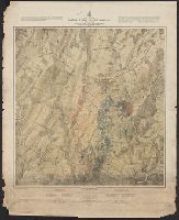
"Positions of troops compiled and added for the government by John B. Bachelder.", "The survey was ordered by Brevet Major General A.A. Humphreys, Chief of Engineers, and conducted under Brevet Major General G.K. Warren, Major of Engineers.", and Relief shown b
Publisher:
J.B. Bachelder, and Published by authority of the Hon. the Secretary of War, Office of the Chief of Engineers U.S. Army ;
Subject (Geographic):
UnitedStates--History--CivilWar, 1861
Subject (Name):
United States. Army. Corps of Engineers and Warren, Gouverneur Kemble, 1830-1882
"Entered according to Act of Congress in the year 1866 by O.D. Case & Company, in the Clerk's Office of the District Court of the United States for the District of Connecticut." and Relief shown by hachures.
"Entered according to Act of Congress in the year 1866 by O.D. Case & Company, in the Clerk's Office of the District Court of the United States for the District of Connecticut." and Relief shown by hachures.
"Entered according to Act of Congress in the year 1866 by O.D. Case & Company, in the Clerk's Office of the District Court of the United States for the District of Connecticut." and Relief shown by hachures.
Inset: [Sketch of the environs of Bull Run from Washington to Fredericksburg]., Label on verso with typed title of map., Oriented with north to upper left., and Relief shown by hachures.
Publisher:
W. Hargrave White,
Subject (Geographic):
UnitedStates--History--CivilWar, 1861
Subject (Name):
Bornemann, F. W. and White, W. Hargrave
Subject (Topic):
Bull Run, 1st Battle of, Va., 1861--Maps and United States--History--Civil War, 1861-1865
The following categories of statistics are given for the United States and individual states: Population in 1860; Vote for President in 1860; Men furnished in war of 1861-'5; Volunteers; Substitutes; Personal service; Commutation; Bounty men; U.S. bounty
Relative position of the northern states and the southern confederated states and United States and the relative position of the northern states and the southern confederated states
Description:
Accompanying covers with title: Wyld's new map of the United States., Includes tables of population statistics for the "free states" and the "slave states", exports, presidential voting statistics, and real and personal property in both the, and Outline color.
Publisher:
James Wyld,
Subject (Geographic):
UnitedStates--History--CivilWar, 1861
Subject (Topic):
Confederate States of America--History--Civil War, 1861-1865--Maps
Insets: City of Washington and District of Columbia. Scale ca. 1:190,000. 13 x 14 cm. Country round Washington. Scale ca. 1:1,020,000. 18 x 24 cm.-Pensacola bay and its fortifications. Scale ca. 1:155,000. 12 x 14 cm.-Charleston and the harbour. Scale ca.
Eastern Virginia showing the positions of the armies on March 15, 1862., Field of Bull Run showing the positions of the armies at 4:30 p.m. on August 29, 1862., and Field of Fredericksburg showing the positions of the troops on the morning of December 13, 1862.
Description:
Annotated in red and blue to show Union and Confederate positions., Eastern Virginia showing the positions of the armies on March 15, 1862 [Scale ca. 1:1,005,840] --, and Kentucky and Tennessee showing the positions of the armies on the morning of February, 6,
Publisher:
s.n,
Subject (Geographic):
UnitedStates--History--CivilWar, 1861
Subject (Name):
Ropes, John Codman, 1836-1899. Story of the Civil War