Skip to search
Skip to main content
Skip to first result
Search
You Searched For
"Turkey--Maps"
New Search
Search Results
Creator:
Published / Created:
1910-13.
Call Number:
501 1910
Container / Volume:
BRBL_00276
Image Count:
1
Resource Type:
Maps, Atlases & Globes
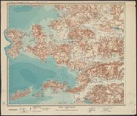
Description:
Blatt 3 only. and Relief shown by contours and shading.
Publisher:
J. Perthes,
Subject (Geographic):
Turkey --Maps
Found in:
Beinecke Rare Book and Manuscript Library > Topographische Karte des westlichen Kleinasien / Entworfen von Dr. Alfred Philippson ; hrsg ; mit unterstützung der WentzelStiftung.
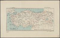
Creator:
Published / Created:
1943
Call Number:
501 1943
Container / Volume:
BRBL_00276
Image Count:
1
Resource Type:
Maps, Atlases & Globes
Alternative Title:
Geographic Section, General Staff ; no. 4292 and GSGS (Series) ; 4292.
Description:
Elevation shown by contour lines and spot heights in meters., Importance of cities symbolized by print size., and Railroad lines are identicated.
Publisher:
Army Map Service, U.S. Army,
Subject (Geographic):
Turkey --Maps
Subject (Name):
United States. Army Map Service
Found in:
Beinecke Rare Book and Manuscript Library > Turkey [cartographic material].
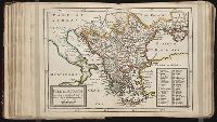
Published / Created:
1813
Call Number:
501 1813
Container / Volume:
BRBL_00276
Image Count:
1
Resource Type:
Maps, Atlases & Globes
Description:
From Pinkerton's Modern Atlas.
Publisher:
Cadell & Davies,
Subject (Geographic):
Turkey --Maps
Found in:
Beinecke Rare Book and Manuscript Library > Turkey in Asia. Neele Sculpt. Strand.
Call Number:
1976 1233
Collection Title:
Twenty four new and accurate maps of the several parts of Europe ... : all (except the last) new
Image Count:
1
Alternative Title:
Turkey in Europe
Description:
In pencil on verso: 24. and Table of contents for maps 20-24 misnumbered.
Subject (Geographic):
Turkey --Maps
Subject (Name):
Barker, B. (Benjamin), d. 1764, bookseller, Clements, Henry, d. 1719, bookseller, King, Charles, d. 1735, bookseller, Nicholson, John, d. ca. 1717, bookseller, Parker, Richard, fl. 1692-1725, bookseller, and Tooke, Benjamin, d. 1716, bookseller
Subject (Topic):
Atlases --Early works to 1800
Collection Created:
[London] : Sold by J. Nicholson at the King’s-Arms in Little Britain, Benj. Barker and Charles King ..., Benj. Tooke ..., Hen. Clements ..., R. Parker and Ralph Smith under the Royal-Exchange ..., [1715?]
Found in:
Beinecke Rare Book and Manuscript Library > Turkey in Europe according to the newest observations
Published / Created:
[1812?]
Call Number:
501 1812A
Container / Volume:
BRBL_00276
Image Count:
1
Resource Type:
Maps, Atlases & Globes
Subject (Geographic):
Turkey --Maps
Found in:
Beinecke Rare Book and Manuscript Library > Turquie D'Asie. Gravé par Chamouin rue de la Harpe No. 35. Ecrit par Giraldon.
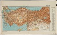
Published / Created:
[191-?]
Call Number:
11hcf 1919-24
Image Count:
1
Resource Type:
Maps, Atlases & Globes
Alternative Title:
Asie Mineure and Carte No. 3
Description:
Includes index of adjoining sheets. and Legend on upper right side of sheet corresponding with notes on map.
Publisher:
s.n.,
Subject (Geographic):
Turkey --Maps
Found in:
Beinecke Rare Book and Manuscript Library > Turquie d'Asie, Feuille No. 1 : Carte No. 3, Asie Mineure.
Creator:
Published / Created:
1942
Call Number:
501cbf 1942
Container / Volume:
BRBL_00276
Image Count:
2
Resource Type:
Maps, Atlases & Globes
Description:
Includes glossary., Index on verso., and Relief shown by gradient tints, shading and spot heights.
Publisher:
Geogr. Inst. Ed. Hölzel,
Subject (Geographic):
Turkey --Maps
Found in:
Beinecke Rare Book and Manuscript Library > Türkei 1:2,000,000 [cartographic material] / Geor. Inst. Ed. Hölzel, Wien, 1941.
Published / Created:
1870?]
Call Number:
501 1870
Container / Volume:
BRBL_00276
Image Count:
1
Resource Type:
Maps, Atlases & Globes
Publisher:
s.n.,
Subject (Geographic):
Turkey --Maps
Found in:
Beinecke Rare Book and Manuscript Library > [Section East and South East of Smyrna].
Published / Created:
1846
Call Number:
501 AN41 1839A
Container / Volume:
BRBL_00276
Image Count:
1
Resource Type:
Maps, Atlases & Globes
Description:
Surveyed in 1839.
Publisher:
Simon Schropp & Co.,
Subject (Geographic):
Ankara (Turkey )--Maps
Found in:
Beinecke Rare Book and Manuscript Library > Karte der Umgegend von Angora ...
Published / Created:
1897
Call Number:
491 IS7 1897
Container / Volume:
BRBL_00270
Image Count:
1
Resource Type:
Maps, Atlases & Globes
Publisher:
Schall & Grund,
Subject (Geographic):
Istanbul (Turkey )--Maps
Found in:
Beinecke Rare Book and Manuscript Library > Karte der umgegend von Constantinopel / bearbeitet und gezeichnet von C. Frh. v. d. Goltz (Pascha), Generalleutenant.
Branch:v1.61.6 ,Deployed:2024-06-12T09:55:19-04:00