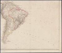
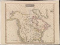
Date inferred from Stevens and Tree's Comparative cartography, which lists two issues, date, Date on map: 4th September 1804., Includes ornate title cartouche with American plants and animals, engraved by W. & G. Cooke., and Relief shown by hachures and shading.
Publisher:
A. Arrowsmith, No. 10 Soho Square,
Subject (Geographic):
America--Maps
Subject (Name):
W. & G. Cooke, West, W., engraver, and Wilson, H., engraver
In lower margin: London: Published 1 Jan. 1795 by A. Arrowsmith, No. 10 Soho Square ... additions to 1802., Includes notes., and Relief shown by hachures.
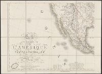
Includes text., Insets: Ile de Saint Domingue, dressée par H. Brue ́-- Ile de la Martinique -- Ile de la Guadeloupe de Marie-Galante, la désirade et les saintes -- Partie occidentale des iles Alëutiennes., Prime meridian: Paris., and Relief shown pictorially.
Publisher:
chez Desray, libraire-editeur, Rue Haute-feuille, No. 4 pres̀ celle St. Andre ́des Arcs : and chez J. Goujon, marchand de cartes geógraphiques, Rue du Bac No. 6,
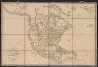
Prime meridian: Paris., Relief shown by hachures., Shows boundaries of European claims on North America., Yale's copy blind stamped, "Ch. [?]cquet, Quai de Cont[?], no. 17, Paris.", and Yale's copy labelled on backing: Amérique septle. chez T.H. Wessel, gran
Publisher:
Chez J. Goujon, editeur-propriétaire, rue du Bac, no. 6, près le Pont royal,
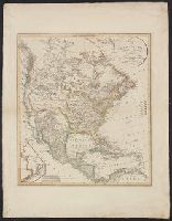
"Ergänzt und nach den neuern Entdeckungen der Hrn. Lewis Clarke u: Pike vervollstandigt.", Includes inset of "Nordwestlichster Theil von Nord America.", Relief shown by hachures., and Yale's copy stamped on backing: Yale University Library, Karpinski-Von Wieser
Includes inset of Jamaica., Relief shown by hachures., and Yale's copy with portion of a cover pasted on backing, showing advertisements for Betts maps.