Search
You Searched For
Search Results
- Creator:
- United States. Congress. House. Committee on the Public Lands
- Published / Created:
- [1878?].
- Call Number:
- 75 1878
- Container / Volume:
- BRBL_00406
- Image Count:
- 16
- Resource Type:
- Maps, Atlases & Globes
- Found in:
- Beinecke Rare Book and Manuscript Library > 1876 Centennial map of the United States and territories : showing the extent of public surveys, indian and military reservations, land grant R.R. rail roads, canals, cities, towns & other details / compiled from the official surveys of the General Land O
- Creator:
- Steiger, W. T
- Published / Created:
- 1854
- Call Number:
- 75gme 1854
- Container / Volume:
- BRBL_00411
- Image Count:
- 2
- Resource Type:
- Maps, Atlases & Globes
- Found in:
- Beinecke Rare Book and Manuscript Library > Diagram of the United States of America, Mexico, the West India Islands and Isthmus of Darien : showing proposed routes of the Pacific Rail Road ... / by W. T. Steiger, General Land Office ; Lith. by A. Hoen & Co. Baltimore.
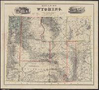
- Creator:
- Bond, Frank, 1856-1940
- Published / Created:
- 1886
- Call Number:
- 833 1886
- Container / Volume:
- BRBL_00584
- Image Count:
- 1
- Resource Type:
- Maps, Atlases & Globes
- Found in:
- Beinecke Rare Book and Manuscript Library > Holt's new map of Wyoming : compiled by permission from official records in U.S. Land Office / Frank & Fred. Bond, draftsmen.
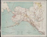
- Creator:
- Hendges, M
- Published / Created:
- 1898
- Call Number:
- 848 1898J
- Container / Volume:
- BRBL_00630
- Image Count:
- 1
- Resource Type:
- Maps, Atlases & Globes
- Found in:
- Beinecke Rare Book and Manuscript Library > Map of Alaska / compiled from the official records of the General Land Office, U.S. Coast & Geodetic Survey, U.S. Geological Survey, Canadian and other sources, under the direction of Harry King ; compiled and drawn by M. Hendges.
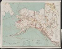
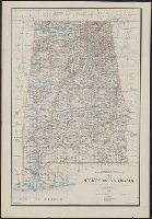
- Creator:
- King, Harry
- Published / Created:
- 1895
- Call Number:
- 793 1895
- Container / Volume:
- BRBL_00520
- Image Count:
- 1
- Resource Type:
- Maps, Atlases & Globes
- Found in:
- Beinecke Rare Book and Manuscript Library > Map of the state of Alabama : compiled from the official records of the General Land Office and other sources / under the direction of Harry King, C.E. Chief of Drafting Division G.L.O.; compiled by Rob[t] H. Morton; revised and drawn by Daniel O'Hare.
- Creator:
- O'Hare, Daniel
- Published / Created:
- 1896
- Call Number:
- 795 1896
- Container / Volume:
- BRBL_00521
- Image Count:
- 1
- Resource Type:
- Maps, Atlases & Globes
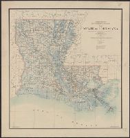
- Found in:
- Beinecke Rare Book and Manuscript Library > Map of the state of Louisiana / compiled from the official records of the General Land Office and other sources under the direction of Harry King ; revised and drawn by Daniel O'Hare.
- Creator:
- Roeser, C. (Charles)
- Published / Created:
- 1879
- Call Number:
- 844 1879
- Container / Volume:
- BRBL_00603
- Image Count:
- 2
- Resource Type:
- Maps, Atlases & Globes
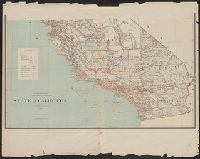
- Found in:
- Beinecke Rare Book and Manuscript Library > State of California / Department of the Interior, General Land Office ; compiled ... by C. Roeser, principal draughtsman G.L.O.
- Creator:
- Strum, G. P. (Gustave P.)
- Published / Created:
- 1885
- Call Number:
- 844 1885
- Container / Volume:
- BRBL_00603
- Image Count:
- 2
- Resource Type:
- Maps, Atlases & Globes
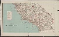
- Found in:
- Beinecke Rare Book and Manuscript Library > State of California / Department of the Interior, General Land Office ; compiled ... under supervision of G.P. Strum, principal draughtsman G.L.O. ; drawn by G.P. Strum.
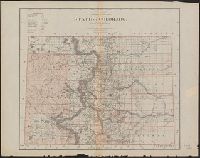
- Creator:
- Dinsmore, A. F
- Published / Created:
- 1892
- Call Number:
- 834 1892A
- Container / Volume:
- BRBL_00587
- Image Count:
- 1
- Resource Type:
- Maps, Atlases & Globes
- Found in:
- Beinecke Rare Book and Manuscript Library > State of Colorado / Department of the Interior, General Land Office ; compiled and drawn by A.F. Dinsmore ; traced and lettered by Wm. Naylor.
- Creator:
- Roeser, C. (Charles)
- Published / Created:
- 1879
- Call Number:
- 834 1879A
- Container / Volume:
- BRBL_00587
- Image Count:
- 1
- Resource Type:
- Maps, Atlases & Globes
- Found in:
- Beinecke Rare Book and Manuscript Library > State of Colorado : compiled from the official records of the General Land Office and other sources / by C. Roeser, principal draughtsman G.L.O.
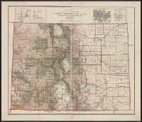
- Creator:
- Dinsmore, A. F
- Published / Created:
- 1905
- Call Number:
- 834 1905
- Container / Volume:
- BRBL_00588
- Image Count:
- 1
- Resource Type:
- Maps, Atlases & Globes
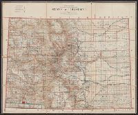
- Found in:
- Beinecke Rare Book and Manuscript Library > State of Colorado : compiled from the official records of the General Land Office and other sources under the direction of Frank Bond / U.S. General Land Office ; compiled by A.F. Dinsmore.
- Creator:
- Morton, Robert H
- Published / Created:
- 1899
- Call Number:
- 832 1899
- Container / Volume:
- BRBL_00582
- Image Count:
- 1
- Resource Type:
- Maps, Atlases & Globes
- Found in:
- Beinecke Rare Book and Manuscript Library > State of Idaho / compiled by R.H. Morton.
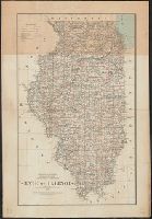
- Creator:
- Roeser, C. (Charles)
- Published / Created:
- 1878
- Call Number:
- 806 1878
- Container / Volume:
- BRBL_00547
- Image Count:
- 1
- Resource Type:
- Maps, Atlases & Globes
- Found in:
- Beinecke Rare Book and Manuscript Library > State of Illinois / [cartographic material] / compiled from the official records of the General Land Office and other sources by C. Roeser, principal draughtsman G.L.O.
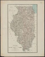
- Creator:
- Strum, G. P. (Gustave P.)
- Published / Created:
- 1885
- Call Number:
- 806 1885
- Container / Volume:
- BRBL_00547
- Image Count:
- 1
- Resource Type:
- Maps, Atlases & Globes
- Found in:
- Beinecke Rare Book and Manuscript Library > State of Illinois [cartographic material] : compiled from the official records of the General Land Office and other sources under the supervision of G.P. Strum.
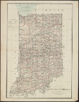
- Creator:
- Roeser, C. (Charles)
- Published / Created:
- 1878
- Call Number:
- 805 1878
- Container / Volume:
- BRBL_00546
- Image Count:
- 1
- Resource Type:
- Maps, Atlases & Globes
- Found in:
- Beinecke Rare Book and Manuscript Library > State of Indiana / compiled from the official records of the General Land Office and other sources by C. Roeser, principal draughtsman, G.L.O.
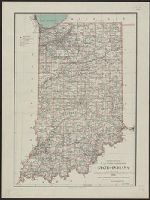
- Creator:
- Hendges, M. (Matthew)
- Published / Created:
- 1886
- Call Number:
- 805 1886
- Container / Volume:
- BRBL_00546
- Image Count:
- 1
- Resource Type:
- Maps, Atlases & Globes
- Found in:
- Beinecke Rare Book and Manuscript Library > State of Indiana / compiled from the official records of the General Land Office and other sources by Geo. U. Mayo, chief of Draughting Div., G.L.O. ; drawn by M. Hendges.
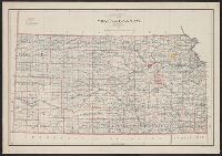
- Creator:
- Berthrong, I. P
- Published / Created:
- 1898
- Call Number:
- 825 1898
- Container / Volume:
- BRBL_00573
- Image Count:
- 1
- Resource Type:
- Maps, Atlases & Globes
- Found in:
- Beinecke Rare Book and Manuscript Library > State of Kansas / compiled from the official records of the General Land Office and other sources under the direction of Harry King ; compiled and drawn by I.P. Berthrong ; revised and corrected to May 1898 by M. Hendges.
- Creator:
- Roser, C
- Published / Created:
- 1878
- Call Number:
- 811 1878
- Container / Volume:
- BRBL_00552
- Image Count:
- 1
- Resource Type:
- Maps, Atlases & Globes
- Found in:
- Beinecke Rare Book and Manuscript Library > State of Michigan / compiled from the official records of the General Land Office and other sources by C. Roser, principal draughtsman G.L.O.
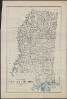
- Creator:
- Morton, Robert H
- Published / Created:
- 1890
- Call Number:
- 794 1890
- Container / Volume:
- BRBL_00521
- Image Count:
- 1
- Resource Type:
- Maps, Atlases & Globes
- Found in:
- Beinecke Rare Book and Manuscript Library > State of Mississippi : compiled from the official records of the General Land Office and other sources, under supervision of A.F. Dinsmore, Principal Draughtsman G.L.O. / compiled and drawn by Robert H. Morton.
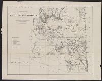
- Creator:
- Roeser, C. (Charles)
- Published / Created:
- 1879
- Call Number:
- 842 1879A
- Container / Volume:
- BRBL_00598
- Image Count:
- 1
- Resource Type:
- Maps, Atlases & Globes
- Found in:
- Beinecke Rare Book and Manuscript Library > Territory of Arizona / compiled from the official records of the General Land Office and other sources by C. Roeser, principal draughtsman, G.L.O.
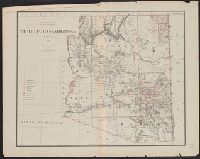
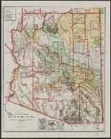
- Creator:
- Roeser, C. (Charles)
- Published / Created:
- 1876
- Call Number:
- 842 1876
- Container / Volume:
- BRBL_00598
- Image Count:
- 1
- Resource Type:
- Maps, Atlases & Globes
- Found in:
- Beinecke Rare Book and Manuscript Library > Territory of Arizona / compiled from the official records of the General Land Office and other sources by C. Roeser, principal draughtsman, G.L.O.
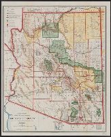
- Creator:
- O'Hare, Daniel
- Published / Created:
- 1906
- Call Number:
- 842 1906
- Container / Volume:
- BRBL_00599
- Image Count:
- 1
- Resource Type:
- Maps, Atlases & Globes
- Found in:
- Beinecke Rare Book and Manuscript Library > Territory of Arizona / compiled from the official records of the General Land Office and other sources under the direction of Frank Bond ; compiled and drawn by Daniel O'Hare.
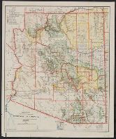
- Creator:
- O'Hare, Daniel
- Published / Created:
- 1903
- Call Number:
- 842 1903A
- Container / Volume:
- BRBL_00599
- Image Count:
- 1
- Resource Type:
- Maps, Atlases & Globes
- Found in:
- Beinecke Rare Book and Manuscript Library > Territory of Arizona / compiled from the official records of the General Land Office and other sources under the direction of Frank Bond ; compiled and drawn by Daniel O'Hare.
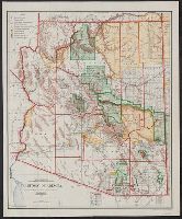
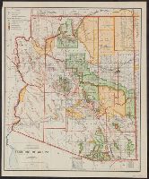
- Creator:
- O'Hare, Daniel
- Published / Created:
- 1910
- Call Number:
- 842 1910A
- Container / Volume:
- BRBL_00599
- Image Count:
- 1
- Resource Type:
- Maps, Atlases & Globes
- Found in:
- Beinecke Rare Book and Manuscript Library > Territory of Arizona / compiled from the official records of the General Land Office and other sources under the direction of I.P. Berthrong ; compiled and drawn by Daniel O'Hare ; lettering by Wm. Bauman.
- Creator:
- O'Hare, Daniel
- Published / Created:
- 1907
- Call Number:
- 842 1907A
- Container / Volume:
- BRBL_00599
- Image Count:
- 1
- Resource Type:
- Maps, Atlases & Globes
- Found in:
- Beinecke Rare Book and Manuscript Library > Territory of Arizona / compiled from the official records of the General Land Office and other sources under the direction of I.P. Berthrong ; compiled and drawn by Daniel O'Hare.
- Creator:
- O'Hare, Daniel
- Published / Created:
- 1908
- Call Number:
- 842 1908A
- Container / Volume:
- BRBL_00599
- Image Count:
- 1
- Resource Type:
- Maps, Atlases & Globes
- Found in:
- Beinecke Rare Book and Manuscript Library > Territory of Arizona / compiled from the official records of the General Land Office and other sources under the direction of I.P. Berthrong ; compiled and drawn by Daniel O'Hare.
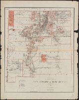
- Creator:
- Roeser, C. (Charles)
- Published / Created:
- 1879
- Call Number:
- 841 1879
- Container / Volume:
- BRBL_00596
- Image Count:
- 1
- Resource Type:
- Maps, Atlases & Globes
- Found in:
- Beinecke Rare Book and Manuscript Library > Territory of New Mexico / compiled from the official records of the General Land Office and other sources by C. Roeser, principal draughtsman, G.L.O.
- Creator:
- Berthrong, I. P
- Published / Created:
- 1908
- Call Number:
- 75j 1908
- Container / Volume:
- BRBL_00414A
- Image Count:
- 1
- Resource Type:
- Maps, Atlases & Globes
- Found in:
- Beinecke Rare Book and Manuscript Library > United States showing routes of principal explorers and early roads and highways [map] / from data prepared by Frank Bond ; by I. B. Berthrong.
- Creator:
- Berthrong, I. P
- Published / Created:
- 1908
- Call Number:
- 75gmb 1908
- Container / Volume:
- BRBL_00411
- Image Count:
- 1
- Resource Type:
- Maps, Atlases & Globes
- Found in:
- Beinecke Rare Book and Manuscript Library > United States showing routes of principal explorers and early roads and highways [map] / from data prepared by Frank Bond ; by I. B. Berthrong.
- Creator:
- Berthrong, I. P
- Published / Created:
- 1908
- Call Number:
- 75j 1908
- Container / Volume:
- BRBL_00414A
- Image Count:
- 1
- Resource Type:
- Maps, Atlases & Globes
- Found in:
- Beinecke Rare Book and Manuscript Library > United States showing routes of principal explorers and early roads and highways [map] / from data prepared by Frank Bond ; by I. B. Berthrong.
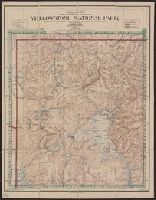
- Creator:
- Berthrong, I. P
- Published / Created:
- [1911]
- Call Number:
- 833fcm Y38 1911
- Container / Volume:
- BRBL_00585
- Image Count:
- 1
- Resource Type:
- Maps, Atlases & Globes
- Found in:
- Beinecke Rare Book and Manuscript Library > Yellowstone National Park / compiled from the official records of the General Land Office, U.S. Geological Survey and other sources, under the direction of I.P. Berthrong, Chief of Drafting Division, G.L.O., 1911 ; compiled and drawn by I.P. Berthrong ; l