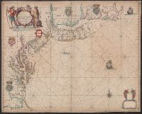
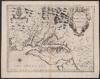
Appears in: John Seller, Atlas maritimus, 1675 (McCorkle 36)., Depths shown by soundings in Chesapeake Bay and south to Cape Hatteras., Includes decorative cartouche, coats of arms, and other ill. Lower right corner: empty cartouche., and Mounted on linen. Verso
Subject (Geographic):
Middle Atlantic States--Nautical charts--Early works to 1800 and New England--Nautical charts--Early works to 1800
Copper engraving, colored to show coasts of Eng., Decorative cartouche containing royal arms; on respective countries - coats of arms; compass rose - n. to right; Neptune carrying union jack in upper left; 2 ships, a whale., and Removed fr. the Atlas Maritimus.
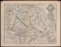
At upper right, the seal of the Great Mogul, with English transliteration., From Samuel Purchas's Purchas his pilgrimes (1625)., and In upper right corner: 579.
Publisher:
[Printed by W. Stansby for H. Fetherstone],
Subject (Geographic):
South Asia--Maps--Early works to 1800.
Subject (Name):
Featherstone, Henry, -1647, Purchas, Samuel, 1577?-1626. Purchas his Pilgrimage., and Stansby, William, active 1597-1638
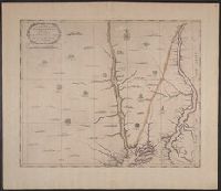
Author statement from McCorkle, p. 40., Includes ill. of animals and coat of arms., Relief shown pictorially., Verso: P. nos. "46", "45"; titles "The Description of New Neatherlands ... ", "The Description, and Verso: Stamped "Yale University Library".
Publisher:
Sold by Tho: Basset in Fleetstreet, and Richard Chiswell in St. Pauls Church Yard,
Subject (Geographic):
New England--Maps--Early works to 1800 and New York (State)--Maps--Early works to 1800
Subject (Name):
Bassett, Thomas, bookseller, Chiswell, Richard, Lamb, Francis, and Speed, John, 1552?-1629. Prospect of the most famous parts of the world
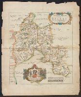
Map of New England, New Yorke, New Iersey, Mary-land & Virginia
Description:
"Separate publication ca. 1676" (McCorkle 38)., Includes hand colored illustration of American Indians., Relief shown pictorially., and Verso: Partially stamped "Yale University".
Publisher:
Sould by Robert Morden ... and by William Berry ... ,
Subject (Geographic):
Middle Atlantic States--Maps--Early works to 1800 and New England--Maps--Early works to 1800
Subject (Name):
Berry, William, fl. 1669-1708 and King, Gregory, 1648-1712, engraver
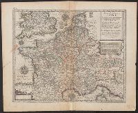
Appears in Speed's The theatre of the Empire of Great Britaine., English on recto, verso., Oriented west., Relief shown pictorially., Sheet measures 43.5 x 56 cm. Cross Collection no. 215., and Verso: Page nos. 43-44; titles "The description of Mary-land", "The description of Virginia"; signature Y.
Publisher:
Sold by Thomas Basset in Fleetstreet and Richard Chiswell in St. Pauls Church yard,
Subject (Geographic):
Maryland--History--Colonial period, ca. 1600-1775--Maps--Early works to 1800, Maryland--Maps--Early works to 1800, Virginia--History--Colonial period, ca. 1600-1775--Maps--Early works to 1800, and Virginia--Maps--Early works t
Subject (Name):
Bassett, Thomas, bookseller, Chiswell, Richard, Lamb, Francis, engraver, and Speed, John, 1552?-1629. Theatre of the Empire of Great Britaine