"The base is a copy of a part of chart T of the U.S. Coast and Geodetic Survey, edition of June 1897.", Insets: Trails from tide water to the headwaters of the Yukon River, Alaska--The Klondike gold region, Canada., Published January, 1898., and Relief shown by hachures and spot heights.
Subject (Geographic):
Alaska--Maps
Subject (Name):
U.S. Coast and Geodetic Survey
Subject (Topic):
Coal mines and mining--Alaska--Maps, Gold mines and mining--Alaska--Maps, Mail steamers--Alaska--Maps, and Trails--Alaska--Maps
In two sheets., Includes inset of The Hawaiian Islands., and Relief shown by contours and spot heights; contour interval 40 ft.
Publisher:
Dept. of the Interior, U.S. Geological Survey,
Subject (Geographic):
Hawaii--Oahu and Oahu (Hawaii)--Maps
Subject (Name):
Birdseye, C. H. (Claude Hale), 1878-1941, Davis, Geo. R. (George R.), Fowler, A. T, Hawaii. Territorial Survey., Marshall, R. B. (Robert Bradford), 1867-1949, and U.S. Coast and Geodetic Survey
At head of title: Department of the Interior, United States Geological Survey, J.W. Powell, director. and Contour lines drawn at 100, 500, 1000, 1500, 2000, and thence upward at each 1000 feet above sea level.
Publisher:
Engraved by Julius Bien & Co.,
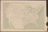
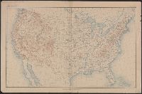
Subject (Geographic):
United States--Maps
Subject (Name):
Gannett, Henry, 1846-1914 and King, Harry, (Harold G. R.)
"Surveyed in 1888-91, 1896, and 1906-1907." and On verso: Jamestown Exposition on Hampton Roads, Virginia : plan of exposition grounds and buildings : progress map, June 1st 1907 / made by W.R. Kelly ; copyright applied for by Jamestown Exposition Co. Scale [ca. 1:6,800]
Publisher:
U.S. Geological Survey,
Subject (Geographic):
Hampton Roads (Va. : Harbor)--Maps, Norfolk Metropolitan Area (Va.)--Maps, Norfolk Metropolitan Area (Va.)--Maps, Topographic, and Norfolk Region (Va.)--Maps, Topographic
Subject (Name):
Jamestown Exposition Co, Jamestown Ter-centennial Exposition--(1907)--Maps, Kelly, W. R. Jamestown Exposition on Hampton Roads, Virginia, and U.S. Coast and Geodetic Survey
"Engraved Apr. 1901 by Julius Bien & Co.", "Surveyed in 1897-98.", Plate CXXXIII from the "Twenty-first annual report" of the U.S. Geological Survey, Part 5, Forest reserves (1900)., Relief shown by contours and spot heights., and Shows five classes of land cover.
Publisher:
The Survey,
Subject (Geographic):
Chelan County (Wash.)--Maps and Douglas County (Wash.)--Maps
Subject (Name):
Farmer, R. A, Geological Survey (U.S.). Annual report, Griswold, W. T, and Plummer, Fred G. (Fred Gordon), 1864-1913
Subject (Topic):
Forests and forestry--Washington (State)--Chelan County--Maps, Forests and forestry--Washington (State)--Douglas County--Maps, Forests and forestry--Washington (State)--Okanogan County--Maps, and Land capability for agricultur