
Search


Limit your search
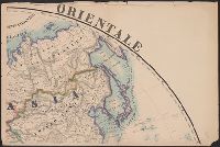
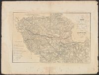
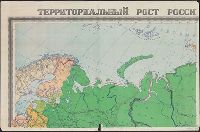
- Maps, Atlases & Globes✖[remove]8,530
- English6,178
- German757
- French537
- Italian475
- Spanish; Castilian239
- Russian56
- Dutch; Flemish46
- Japanese40
- Latin39
- Portuguese35
- Rand McNally and Company227
- United States. Office of Strategic Services. Research and Analysis Branch206
- United States. Army Map Service190
- Great Britain. War Office. General Staff. Geographical Section150
- Geological Survey (U.S.)86
- H.M. Gousha Company66
- United States. General Land Office66
- Maury, Matthew Fontaine, 1806-187342
- United States. Department of State. Division of Map Intelligence and Cartography42
- National Geographic Society (U.S.). Cartographic Division38
- World War, 1914-1918--Maps65
- Railroads--United States--Maps50
- World War, 1939-1945--Campaigns--Western Front--Historical geography--Maps36
- Railroads--West (U.S.)--Maps30
- Railroads--Canada--Maps25
- Streets--California--Los Angeles--Maps23
- Railroads--Texas--Maps22
- Roads--California--Los Angeles Metropolitan Area--Maps20
- World War, 1914-1918--France--Maps20
- World War, 1914-1918--Europe--Maps18
- Bien, Julius, 1826-190955
- United States. Army Map Service55
- Julius Bien & Co45
- United States. Hydrographic Office37
- United States. Bureau of Ordnance and Hydrography36
- Streeter, Thomas W.--(Thomas Winthrop),--1883-1965--Ownership33
- United States. General Land Office33
- United States. Office of Strategic Services. Reproduction Branch33
- Maury, Matthew Fontaine, 1806-1873. Wind and current charts31
- Geological Survey (U.S.)30
- 1800 to 1999✖[remove]8,530
- 1800 to 1819491
- 1820 to 1839645
- 1840 to 18591,154
- 1860 to 18791,387
- 1880 to 18991,111
- 1900 to 19191,997
- 1920 to 1939613
- 1940 to 19591,315
- 1960 to 1979142
- 1980 to 1999112
Current results range from 1728 to 1999