Skip to search
Skip to main content
Skip to first result
Search
You Searched For
Format
cartographic
Publication Place
London :
New Search
Search Results
Creator:
Published / Created:
25th, March 1775.
Call Number:
72cea 1775
Container / Volume:
BRBL_00373
Image Count:
1
Resource Type:
Maps, Atlases & Globes
Found in:
Beinecke Rare Book and Manuscript Library > A chart of the Banks of Newfoundland / drawn from a great number of hydrographical surveys, chiefly from those of Chabert, Cook, and Fleurieu, connected and ascertained by astronomical observations.
Creator:
Published / Created:
1801
Call Number:
73 1801
Container / Volume:
BRBL_00374
Image Count:
1
Resource Type:
Maps, Atlases & Globes
Found in:
Beinecke Rare Book and Manuscript Library > A map of America between latitudes 40 and 70 north and longitudes 45 and 180 west exhibiting Mackenzie's track from Montreal to Fort Chipewyan & from thence to the north sea in 1789 & to the west Pacific Ocean in 1793.
Creator:
Published / Created:
Dec. 1st 1807.
Call Number:
73 1807
Container / Volume:
BRBL_00374
Image Count:
1
Resource Type:
Maps, Atlases & Globes
Found in:
Beinecke Rare Book and Manuscript Library > A new map of Upper & Lower Canada / from the latest authorities by John Cary, engraver.
Creator:
Published / Created:
1 Jan. 1788.
Call Number:
734 1788
Container / Volume:
BRBL_00379
Image Count:
1
Resource Type:
Maps, Atlases & Globes
Found in:
Beinecke Rare Book and Manuscript Library > A new and correct map of the Province of Quebec, with the adjacent states and provinces / from the French surveys connected with those made by Captain Carver, and other officers, in His Majesty's service.
Creator:
Published / Created:
1838
Call Number:
734 1834
Container / Volume:
BRBL_00379
Image Count:
1
Resource Type:
Maps, Atlases & Globes
Found in:
Beinecke Rare Book and Manuscript Library > Lower Canada : New Brunswick, Nova Scotia, Prince Edwards Id. Newfoundland, and a large portion of the United States / by J. Arrowsmith.
Creator:
Published / Created:
1829
Call Number:
734 Q31 1827
Container / Volume:
BRBL_00380
Image Count:
1
Resource Type:
Maps, Atlases & Globes
Found in:
Beinecke Rare Book and Manuscript Library > Plan of the harbour and basin of Quebec / surveyed by order of H.R. Highness the Lord High Admiral by Commander H.W. Bayfield and his assistants Lieut. P.E. Collins & A.F.J. Bowen, Midn., Oct. 1827.
Creator:
Published / Created:
31st July 1785.
Call Number:
732 1785
Container / Volume:
BRBL_00376A
Image Count:
1
Resource Type:
Maps, Atlases & Globes
Found in:
Beinecke Rare Book and Manuscript Library > A new map of Nova Scotia, and Cape Britain [cartographic material] : With the adjacent parts of New England and Canada, from the latest authorities / J. Lodge sc.
Creator:
Published / Created:
April 28 1811.
Call Number:
732 1811
Container / Volume:
BRBL_00376A
Image Count:
1
Resource Type:
Maps, Atlases & Globes
Found in:
Beinecke Rare Book and Manuscript Library > A new map of Nova Scotia, Newfoundland &c., from the latest authorities / by John Cary, engraver.
Creator:
Published / Created:
1759?]
Call Number:
732cea H13 1759
Container / Volume:
BRBL_00378
Image Count:
1
Resource Type:
Maps, Atlases & Globes
Found in:
Beinecke Rare Book and Manuscript Library > A chart of the harbour of Halifax, in Nova Scotia : with Jebucto Bay and Cape Sambrô, also the islands, ledges of rocks, shoals & soundings / survey'd, by order of His Excellency Brigadier General Lawrence, Governour of the Province of Nova Scotia, by Ch
Creator:
Published / Created:
25 May, 1775.
Call Number:
7345cea 1775
Container / Volume:
BRBL_00381
Image Count:
1
Resource Type:
Maps, Atlases & Globes
Found in:
Beinecke Rare Book and Manuscript Library > An exact chart of the river St. Laurence : from Fort Frontenac to the island of Anticosti shewing the soundings, rocks, shoals & c with views of the lands and all necessary instructions for navigating that river to Quebec / by ... Thos. Jefferys.
Creator:
Published / Created:
1832 February 15
Call Number:
73 1832
Container / Volume:
BRBL_00374
Image Count:
1
Resource Type:
Maps, Atlases & Globes
Found in:
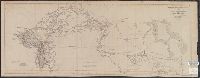
Beinecke Rare Book and Manuscript Library > British North America : by permission dedicated to the Honble. Hudsons Bay Company, containing the latest information which their documents furnish / by their obedient servant, J. Arrowsmith.
Creator:
Published / Created:
1834
Call Number:
73 1834
Container / Volume:
BRBL_00374
Image Count:
1
Resource Type:
Maps, Atlases & Globes
Found in:
Beinecke Rare Book and Manuscript Library > British North America / engraved by J. & C. Walker.
Creator:
Published / Created:
1834 February 15
Call Number:
73 1834A
Container / Volume:
BRBL_00374
Image Count:
1
Resource Type:
Maps, Atlases & Globes
Found in:
Beinecke Rare Book and Manuscript Library > Upper Canada &c [cartographic material] / by J. Arrowsmith.
Creator:
Published / Created:
Apr. 12 1838.
Call Number:
734 M769 1834
Container / Volume:
BRBL_00380
Image Count:
1
Resource Type:
Maps, Atlases & Globes
Found in:
Beinecke Rare Book and Manuscript Library > Montreal harbour : River St. Lawrence / surveyed by Captain H.W. Bayfield, 1834 ; J. & C. Walker, sculpt.
Creator:
Published / Created:
12 Septemr. 1776.
Call Number:
734 Q31 1776
Container / Volume:
BRBL_00380
Image Count:
1
Resource Type:
Maps, Atlases & Globes
Found in:
Beinecke Rare Book and Manuscript Library > Plan of the city and environs of Quebec, with its siege and blockade by the Americans : from the 8th of December 1775 to the 13th of May 1776 / Engraved by Wm. Faden.
Creator:
Published / Created:
1801
Call Number:
73 1801
Container / Volume:
BRBL_00374
Image Count:
1
Resource Type:
Maps, Atlases & Globes
Found in:
Beinecke Rare Book and Manuscript Library > A map of America between latitudes 40 and 70 north and longitudes 45 and 180 west exhibiting Mackenzie's track from Montreal to Fort Chipewyan & from thence to the north sea in 1789 & to the west Pacific Ocean in 1793.
Published / Created:
1858
Call Number:
736 1858
Container / Volume:
BRBL_00382
Image Count:
1
Resource Type:
Maps, Atlases & Globes
Found in:
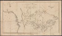
Beinecke Rare Book and Manuscript Library > Copy of Sketch shewing the Region Explored by S.J. Dawson & his party, between Red River and the Great Saskatchewan.
Published / Created:
1858
Call Number:
736 R246 1858
Container / Volume:
BRBL_00382
Image Count:
1
Resource Type:
Maps, Atlases & Globes
Found in:
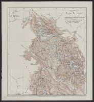
Beinecke Rare Book and Manuscript Library > Map of Part of the Valley of Red River north of 49th parallel : To accompany a report on the Canadian Red River Exploring Expedition / by H.Y. Hind.
Published / Created:
1859
Call Number:
739 1859
Container / Volume:
BRBL_00388
Image Count:
1
Resource Type:
Maps, Atlases & Globes
Found in:
Beinecke Rare Book and Manuscript Library > The Provinces of British Columbia & Vancouver Island with portions of the United States and Hudson's Bay Territories.
Published / Created:
1858
Call Number:
735 1858
Container / Volume:
BRBL_00382
Image Count:
1
Resource Type:
Maps, Atlases & Globes
Found in:
Beinecke Rare Book and Manuscript Library > Plan Showing proposed route from Lake Superior to Red River Settlement.
Creator:
Published / Created:
1859
Call Number:
739 1859A
Container / Volume:
BRBL_00388
Image Count:
1
Resource Type:
Maps, Atlases & Globes
Found in:
Beinecke Rare Book and Manuscript Library > Country between the Red River Settlement and the Rocky Mountains.
Published / Created:
[c1925].
Call Number:
739 1925
Container / Volume:
BRBL_00389
Image Count:
1
Resource Type:
Maps, Atlases & Globes
Found in:
Beinecke Rare Book and Manuscript Library > British Columbia.
Published / Created:
1903. +
Call Number:
739 R59 1902
Container / Volume:
BRBL_00390
Image Count:
1
Resource Type:
Maps, Atlases & Globes
Found in:
Beinecke Rare Book and Manuscript Library > Sketch map of the Canadian Rocky Mountains / by J. Norman Collie, F.R.S.
Creator:
Published / Created:
[1871]
Call Number:
7391 1871
Container / Volume:
BRBL_00394
Image Count:
1
Resource Type:
Maps, Atlases & Globes
Found in:
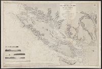
Beinecke Rare Book and Manuscript Library > Vancouver Island and adjacent shores of British Columbia / surveyed by G.H. Richards, assisted by R.C. Mayne ... [et al.], 1859-65 ; compiled and drawn for engraving by E.J. Powell ; engraved by Davies & Powell.
Creator:
Published / Created:
1739
Call Number:
1996 +91
Image Count:
3
Resource Type:
Books, Journals & Pamphlets
Found in:
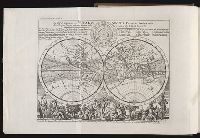
Beinecke Rare Book and Manuscript Library > Modern history: or, The present state of all nations. Describing their respective situations, persons, habits, ... animals and minerals. ... By Mr. Salmon. Illustrated with cuts and maps ... by Herman Moll ...
Published / Created:
[1759-1771] and 1763 May
Call Number:
Z17 289q
Image Count:
1
Resource Type:
Books, Journals & Pamphlets
Found in:
Beinecke Rare Book and Manuscript Library > Royal magazine; or, Gentleman's monthly companion.
Creator:
Published / Created:
1848
Call Number:
Zc12 +841cabj
Image Count:
7
Found in:
Beinecke Rare Book and Manuscript Library > Illustrations of the manners, customs, and condition of the North American Indians : in a series of letters and notes written during eight years of travel and adventure among the wildest and most remarkable tribes now existing. : with three hundred and si
Creator:
Published / Created:
1689
Call Number:
1973 425
Image Count:
29
Found in:
Beinecke Rare Book and Manuscript Library > Mr. Ogilby's and William Morgan's Pocket book of the roads : with their computed and measured distances, and the distinction of market and post-towns / by William Morgan ...
Creator:
Published / Created:
1787
Call Number:
1977 Folio 177
Image Count:
2
Resource Type:
Maps, Atlases & Globes
Found in:
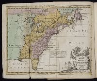
Beinecke Rare Book and Manuscript Library > A map of the country between Albemarle Sound, and Lake Erie [cartographic material] : comprehending the whole of Virginia, Maryland, Delaware and Pensylvania, with parts of several other of the United States of America / engraved by S.J. Neele.
Creator:
Published / Created:
[1768]
Call Number:
1977 Folio 177
Image Count:
2
Resource Type:
Maps, Atlases & Globes
Found in:
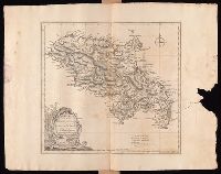
Beinecke Rare Book and Manuscript Library > Martinico, one of the Caribbee Islands in the West Indies subject to the French / [cartographic material] / according to the observations of Mr. Houel engineer ; by Thos. Jefferys, geographer to His Royal Highness the Prince.
Creator:
Published / Created:
Jany. 1st, 1795.
Call Number:
1977 Folio 177
Image Count:
2
Resource Type:
Maps, Atlases & Globes
Found in:
Beinecke Rare Book and Manuscript Library > A map of China : with the surrounding states, correctly copied from Monsr. d'Anville : engraved for Monsr. de Paun's Philosophical dissertations on the Egyptians & Chinese.
Creator:
Published / Created:
Jany. 1st , 1793.
Call Number:
1977 Folio 177
Image Count:
2
Resource Type:
Maps, Atlases & Globes
Found in:
Beinecke Rare Book and Manuscript Library > A new map of France divided into eighty three departments according to the decree of the National Assembly in 1790.
Creator:
Published / Created:
[1783?]
Call Number:
1977 Folio 177
Image Count:
4
Resource Type:
Maps, Atlases & Globes
Found in:
Beinecke Rare Book and Manuscript Library > England and Ireland : containing all the cities, boroughs, markettowns & principal villages : with the coast of France from Calais to Brest delineated and engraved from actual surveys / by Richard William Seale.
Creator:
Published / Created:
[1759]
Call Number:
1977 Folio 177
Image Count:
2
Resource Type:
Maps, Atlases & Globes
Found in:
Beinecke Rare Book and Manuscript Library > A map of the King of Great Britain's Dominions in Germany, or, The Electorate of Brunswick-Lunenburg with its dependencies [cartographic material] : containing the Dutchies of Lunenburg, Calenberg, Grunbenhagen, Lauenburg, Bremen & Verden, and the countie
Creator:
Published / Created:
1746
Call Number:
2002 Folio 94
Image Count:
24
Resource Type:
Maps, Atlases & Globes
Found in:
Beinecke Rare Book and Manuscript Library > A plan of the cities of London and Westminster, and borough of Southwark, with the contiguous buildings / from an actual survey, taken by John Rocque, land-surveyor, and engraved by John Pine ...
Branch:v1.60.98 ,Deployed:2024-05-29T09:42:50-04:00