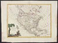
From his atlas Prospect of the World, pp. 9-10, sig. e, catch. in-., Includes text, inset of Greenland, and views of towns and ill. of figures in margins., Text of "The description of America" on verso., and Tooley identifies this as a 1676 issue, noting NY and Maryland mentioned for the first time in text about Virginia (section 14) on verso; and Hochelaga, Quebec, and Tadasac added to description of Canada.
Publisher:
are to be sold by Thomas Bassett in Fleet Street and by Richard Chiswell in St. Pauls Churchyard,
Subject (Geographic):
America--Maps--Early works to 1800.
Subject (Name):
Bassett, Thomas, bookseller., Chiswell, Richard., Goos, Abraham, engraver., and Speed, John, 1552?-1629. Prospect of the most famous parts of the world.
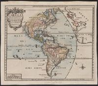
Includes text, inset of Greenland, col. ill. of native figures and town views in margins., Matches item 2, dated 1626-7, in Tooley's California as an island (Map collector's circle, no. 8); Boston and Long Island not marked, [p.] 9-10 on verso., and Signature o
Publisher:
Are to be sold in Pops-head Alley against the exchange by G. Humble,
Subject (Geographic):
America--Maps--Early works to 1800 and Western Hemisphere--Maps--Early works to 1800
Subject (Name):
Goos, Abraham and Humble, George, d. 1640
Subject (Topic):
Cities and towns--America--Aerial views--Early works to 1800 and Indigenous peoples--America--Portraits--Early works to 1800
Hand col., Includes text, inset of Greenland, col. ill. o, Matches item 3, dated 1631, in Tooley's California as an island (Map collector's circle, no. 8); Boston and Long Island not marked, [p.] 10 on verso., Relief shown pictorially., and Signature on verso: E.
Publisher:
Are to be sold in Pops-head Alley against the exchange by G. Humble,
Subject (Geographic):
America--Maps--Early works to 1800 and Western Hemisphere--Maps--Early works to 1800
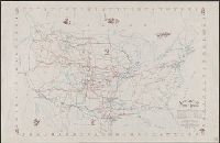
"Sponsored jointly by the Western Range Cattle Industry Study and the American Pioneer Trails Association.", Scale ca, 1:5,575,000., and With illus., ports., and facsims. of cattle brands.
Publisher:
[Smith-Brooks Print Co.,
Subject (Name):
American Pioneer Trails Association, Brayer, Herbert Oliver, Glen, Hugh T, Smith-Brooks Co, and Western Range Cattle Industry Study
Subject (Topic):
Cattle trade--United States--Maps and Cattle trails--United States--Maps
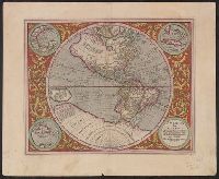
Ancillary maps: Golfo Mexicano, Cuba, Haiti nunc Hispaniola., Includes notes and decorative floral border., Map was published in "Atlas sive Cosmographicae" by Jodocus Hondius in 1613. Map was again published in the 1623 and 1630 edition by Henricus Hondius., Relief shown pictorially., Sheet measures 47.7 x 58.2 cm. Cross Collection no. 115., and Verso: signature "M" on page 39, page 40. Text in Latin.
Publisher:
s.n.,
Subject (Geographic):
America--Maps--Early works to 1800 and Western Hemisphere--Maps--Early works to 1800
Subject (Name):
Hondius, Hendrik, 1597-1651. Atlas sive Cosmographicae and Hondius, Jodocus, 1563-1612. Atlas sive Cosmographicae
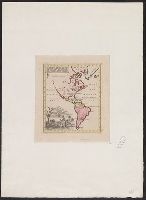
Hand col. Sheet measures 24 x 20.5 cm. Cross Collection no. 118., Relief shown pictorially., and Text in upper left hand corner of map "aus America holt man: Gold, Silber Kupfer, Perlen, Corallen, Diamanten, Cacao, Caffee, Tobac, Zucker, Reis, Baumwolle, Seide, Ingwer, Indigo, Cochenille, Faeberholz, Bauholz, Viehaeute, Pelzwerke, Stockfisch".