Search
You Searched For
Search Results
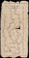
- Creator:
- Munson, Samuel B., 1806-1880.
- Published / Created:
- 1845
- Call Number:
- 80 1845A
- Image Count:
- 1
- Resource Type:
- Maps, Atlases & Globes
- Found in:
- Beinecke Rare Book and Manuscript Library > A new map of the western rivers, or, Travellers guide : exhibiting the Mississippi, Missouri, Ohio, and Illinois rivers with all the principal towns, islands & distances / by Saml. B. Munson.
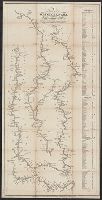
- Creator:
- Munson, Samuel B., 1806-1880, cartographer.
- Published / Created:
- 1844
- Call Number:
- 807 1844
- Image Count:
- 1
- Resource Type:
- Maps, Atlases & Globes
- Found in:
- Beinecke Rare Book and Manuscript Library > A new map of the western rivers, or, Travellers guide : exhibiting the Mississippi, Missouri, Ohio, and Illinois rivers with all the principal towns, islands & distances / by Saml. B. Munson.
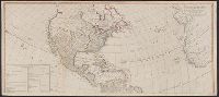
- Creator:
- Anville, Jean Baptiste Bourguignon d', 1697-1782
- Published / Created:
- 1794
- Call Number:
- 70 1794
- Container / Volume:
- BRBL_00686
- Image Count:
- 2
- Resource Type:
- Maps, Atlases & Globes
- Found in:
- Beinecke Rare Book and Manuscript Library > A new map of the whole continent of America : divided into North and South and West Indies wherein are exactly described the United States of North America as well as the several European possessions according to the preliminaries of peace signed at Versa
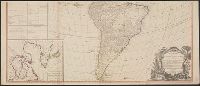
- Creator:
- Anville, Jean Baptiste Bourguignon d', 1697-1782
- Published / Created:
- 1794
- Call Number:
- 70 1794
- Container / Volume:
- BRBL_00725
- Image Count:
- 2
- Resource Type:
- Maps, Atlases & Globes
- Found in:
- Beinecke Rare Book and Manuscript Library > A new map of the whole continent of America : divided into North and South and West Indies wherein are exactly described the United States of North America as well as the several European possessions according to the preliminaries of peace signed at Versa
- Creator:
- Senex, John, d. 1740
- Published / Created:
- 1720]
- Call Number:
- 11 1720B
- Container / Volume:
- BRBL_00680
- Image Count:
- 1
- Resource Type:
- Maps, Atlases & Globes
- Found in:
- Beinecke Rare Book and Manuscript Library > A new map of the world [cartographic material] : from the latest observations / revised by I. Senex.
- Published / Created:
- [1705]
- Call Number:
- 11 1705B
- Container / Volume:
- BRBL_00004
- Image Count:
- 1
- Resource Type:
- Maps, Atlases & Globes
- Found in:
- Beinecke Rare Book and Manuscript Library > A new map of the world according to Wrights alias Mercators projection &c. Drawn from the newest and most exact observations ... by Ier. Seller and Cha. Price. H. Moll fecit.
- Creator:
- Blome, Richard, d. 1705
- Published / Created:
- [1669]
- Call Number:
- 71 1669
- Container / Volume:
- BRBL_00360
- Image Count:
- 1
- Resource Type:
- Maps, Atlases & Globes
- Found in:
- Beinecke Rare Book and Manuscript Library > A new mapp of America Septentrionale / designed by Mousieur Sanson, geographer to the French King and rendred into English, and illustrated by Richard Blome by His Majesties especiall command ; Francis Lamb sculp.
- Creator:
- Browne, Christopher, fl. 1684-1712, creator
- Published / Created:
- [ca. 1700?]
- Call Number:
- 1973 Folio 10
- Image Count:
- 1
- Resource Type:
- Maps, Atlases & Globes
- Found in:
- Beinecke Rare Book and Manuscript Library > A new mapp of Rome shewing its antient and present scituation
- Creator:
- Berry, William, fl. 1669-1708, creator
- Published / Created:
- [1689?]
- Call Number:
- 1973 Folio 10
- Image Count:
- 1
- Resource Type:
- Maps, Atlases & Globes
- Found in:
- Beinecke Rare Book and Manuscript Library > A new mapp of the kingdome of England and Wales: containing all the cities, market towns, with the roades from town to town, and the numbers of reputed miles between them, are given by inspection without scale or compass