Search
You Searched For
Search Results
- Creator:
- Moll, Herman, d. 1732
- Published / Created:
- [178-?]
- Call Number:
- 1973 Folio 113
- Image Count:
- 2
- Resource Type:
- Maps, Atlases & Globes
- Found in:
- Beinecke Rare Book and Manuscript Library > Atlas minor: or A new and curious set of sixty two maps, in which are shewn all the empires, kingdoms, countries, states in all the known parts of the earth ... by Herman Moll ...
- Creator:
- Des Barres, Joseph F. W. (Joseph Frederick Wallet), 1722-1824
- Published / Created:
- 1775?-1781?]
- Call Number:
- 1983 Folio 25
- Image Count:
- 3
- Resource Type:
- Maps, Atlases & Globes
- Found in:
- Beinecke Rare Book and Manuscript Library > [The Atlantic Neptune : published for the use of the Royal Navy Great Britain / by Joseph F.W. Des Barres, esq.].
- Published / Created:
- 1850
- Call Number:
- 1976 Folio 96
- Collection Title:
- A new universal atlas containing maps of the various empires, kingdoms, states and republics of the
- Image Count:
- 1
- Resource Type:
- Maps, Atlases & Globes
- Found in:
- Beinecke Rare Book and Manuscript Library > 10. Map of Connecticut
- Published / Created:
- 1846
- Call Number:
- 1976 Folio 93
- Collection Title:
- A new universal atlas containing maps of the various empires, kingdoms, states and republics of the
- Image Count:
- 1
- Resource Type:
- Maps, Atlases & Globes
- Found in:
- Beinecke Rare Book and Manuscript Library > 9. Connecticut
- Creator:
- Clark, William, 1770-1838
Lewis, Samuel, 1753 or 4-1822
- Published / Created:
- [ca. 1814]
- Call Number:
- Zc10 814Le
- Collection Title:
- History of the expedition under the command of Captains Lewis and Clark, to the sources of the
- Image Count:
- 2
- Resource Type:
- Maps, Atlases & Globes
- Found in:
- Beinecke Rare Book and Manuscript Library > A map of Lewis and Clark's track, across the western portion of North America fom the Mississippi to the Pacific Ocean; by order of the Executive of the United States . In 1804, 5 & 6
- Creator:
- Cook, James, 1728-1779
Gulielmus Whitchurch
- Published / Created:
- 1776
- Call Number:
- 1977 +300
- Collection Title:
- A voyage towards the South pole, and round the world. Performed in His Majesty’s ships the
- Image Count:
- 1
- Resource Type:
- Maps, Atlases & Globes
- Found in:
- Beinecke Rare Book and Manuscript Library > A chart of the southern hemisphere; shewing the tracks of some of the most distinguished navigators
- Published / Created:
- 1719
- Call Number:
- Defoe 50 719db 1
- Collection Title:
- The life and strange surprizing adventures of Robinson Crusoe, of York, mariner : who lived eight
- Image Count:
- 1
- Resource Type:
- Maps, Atlases & Globes
- Found in:
- Beinecke Rare Book and Manuscript Library > A Map of the world, on wch is delineated the voyages of Robinson Cruso
- Creator:
- Visscher, Nicolaes, 1649-1702
- Published / Created:
- Undated
- Call Number:
- 1973 Folio 71
- Collection Title:
- [Atlas nouveau contenant toutes les parties du monde ou sont exactement marques les empires
- Image Count:
- 1
- Resource Type:
- Maps, Atlases & Globes
- Found in:
- Beinecke Rare Book and Manuscript Library > A new mapp of the kingdome of England, representing the princedome of Wales, and other provinces, cities, market towns, with the roads from town to town and the number of reputed miles between them, are given by inspection without scale or compass
- Published / Created:
- 1774 November 29
- Call Number:
- 1975 Folio 51
- Collection Title:
- The American atlas; or, A geographical description of the whole continent of America; wherein are
- Image Count:
- 1
- Resource Type:
- Maps, Atlases & Globes
- Found in:
- Beinecke Rare Book and Manuscript Library > A map of the most inhabited part of New England, containing the provinces of Massachusets Bay and New Hampshire, with the colonies of Conecticut and Rhode Island, divided into counties and townships: the whole composed from actual surveys and its situatio
- Creator:
- Russell, J.C
- Call Number:
- Defoe 57 W99 g816
- Collection Title:
- The Swiss family Ro
- Image Count:
- 1
- Resource Type:
- Maps, Atlases & Globes
- Found in:
- Beinecke Rare Book and Manuscript Library > Settlements of the Swiss pastor & his family in the desert island
- Creator:
- Moll, Herman, d. 1732
- Published / Created:
- [1732]
- Call Number:
- E1015 M66 1732
- Collection Title:
- Atlas minor: or a set of sixty-two new and correct maps, of all parts of the world. All composed
- Image Count:
- 1
- Resource Type:
- Maps, Atlases & Globes
- Found in:
- Beinecke Rare Book and Manuscript Library > A general map of Great Britain and Ireland with part of Germany, Holland, Flanders, France &c. agreeable to modern history
- Published / Created:
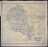
- 1884
- Call Number:
- Zc10 885up
- Collection Title:
- Range and ranch cattle
- Image Count:
- 1
- Resource Type:
- Maps, Atlases & Globes
- Found in:
- Beinecke Rare Book and Manuscript Library > The range and ranch cattle area of the United States
- Creator:
- Wyld, James, 1812-1887
- Published / Created:
- 1841
- Call Number:
- 1977 Folio 193
- Collection Title:
- A new general atlas of modern geography, consisting of a complete collection of maps of the four
- Image Count:
- 1
- Resource Type:
- Maps, Atlases & Globes
- Found in:
- Beinecke Rare Book and Manuscript Library > The phenomena of the universe ...
- Creator:
- Wyld, James, 1812-1887
- Published / Created:
- [1845?]
- Call Number:
- 1977 Folio 193
- Collection Title:
- A new general atlas of modern geography, consisting of a complete collection of maps of the four
- Image Count:
- 1
- Resource Type:
- Maps, Atlases & Globes
- Found in:
- Beinecke Rare Book and Manuscript Library > Map of the United Kingdom of Great Britain and Ireland
- Creator:
- Waghenaer, Lucas Janszoon, 1534 or 5-1606
- Published / Created:
- ann. 1605.
- Call Number:
- 1976 Folio 46
- Image Count:
- 1
- Resource Type:
- Maps, Atlases & Globes
- Found in:
- Beinecke Rare Book and Manuscript Library > The mariners mirrovr wherin may playnly be seen the courses, heights, distances, depths, sounding, flouds and ebs, risings of lands, rocks ... of the harbouroughs, havens and ports of the greatest part of Europe: ... together w.th the rules and instrumeíÄ
- Creator:
- Bry, Theodor de, 1528-1598
- Call Number:
- 1976 Folio 110
- Collection Title:
- The mariners mirrovr wherin may playnly be seen the courses, heights, distances, depths, sounding
- Image Count:
- 1
- Resource Type:
- Maps, Atlases & Globes
- Found in:
- Beinecke Rare Book and Manuscript Library > The sea coastes of Portugal betwene Camino & Montego eue as the countrie there aboutes is lying and situated with all the havens thereof exactly done, and corected with great dilligence
- Creator:
- Bry, Theodor de, 1528-1598
- Call Number:
- 1976 Folio 110
- Collection Title:
- The mariners mirrovr wherin may playnly be seen the courses, heights, distances, depths, sounding
- Image Count:
- 1
- Resource Type:
- Maps, Atlases & Globes
- Found in:
- Beinecke Rare Book and Manuscript Library > The sea coastes of England, from the Sorlinges by the landes end to Plymouth with the hauens and harbrowghes
- Creator:
- Bry, Theodor de, 1528-1598
- Call Number:
- 1976 Folio 110
- Collection Title:
- The mariners mirrovr wherin may playnly be seen the courses, heights, distances, depths, sounding
- Image Count:
- 1
- Resource Type:
- Maps, Atlases & Globes
- Found in:
- Beinecke Rare Book and Manuscript Library > The sea coastes of England betweene the Ile of Wight & Douer, with the principal hauens thereof according to their situation and appearing
- Published / Created:
- Undated
- Call Number:
- 1973 Folio 56
- Collection Title:
- The American pilot, containing the navigation of the sea coast of North America, from the Streights
- Image Count:
- 1
- Resource Type:
- Maps, Atlases & Globes
- Found in:
- Beinecke Rare Book and Manuscript Library > A chart of South Carolina and Georgia
- Published / Created:
- 1833
- Call Number:
- 2002 Folio 97
- Collection Title:
- Tanner’s universal atlas : subscription price $1.00 a number, seperate [sic] numbers $1.50 each
- Image Count:
- 1
- Resource Type:
- Maps, Atlases & Globes
- Found in:
- Beinecke Rare Book and Manuscript Library > A new map of Maine
- Creator:
- Humphrys, F
- Published / Created:
- 1850
- Call Number:
- 1975 Folio 26
- Collection Title:
- A new universal atlas containing maps of the various empires, kingdoms, states and republics of the
- Image Count:
- 1
- Resource Type:
- Maps, Atlases & Globes
- Found in:
- Beinecke Rare Book and Manuscript Library > Lengths of the principal rivers in the world
- Published / Created:
- 1850
- Call Number:
- 1975 Folio 26
- Collection Title:
- A new universal atlas containing maps of the various empires, kingdoms, states and republics of the
- Image Count:
- 1
- Resource Type:
- Maps, Atlases & Globes
- Found in:
- Beinecke Rare Book and Manuscript Library > A new map of Maine
- Published / Created:
- 1846
- Call Number:
- 1976 Folio 93
- Collection Title:
- Mitchell’s universal atlas
- Image Count:
- 1
- Resource Type:
- Maps, Atlases & Globes
- Found in:
- Beinecke Rare Book and Manuscript Library > A new map of Maine
- Published / Created:
- 1833
- Call Number:
- 1976 Folio 98
- Collection Title:
- A new universal atlas, containing maps of the various empires, kingdoms, states and republics of
- Image Count:
- 1
- Resource Type:
- Maps, Atlases & Globes
- Found in:
- Beinecke Rare Book and Manuscript Library > A new map of Maine
- Published / Created:
- 1850
- Call Number:
- 1976 Folio 96
- Collection Title:
- A new universal atlas containing maps of the various empires, kingdoms, states and republics of the
- Image Count:
- 1
- Resource Type:
- Maps, Atlases & Globes
- Found in:
- Beinecke Rare Book and Manuscript Library > A new map of Maine
- Call Number:
- 1976 Folio 94
- Collection Title:
- A new universal atlas containing maps of the various empires, kingdoms, states and republics of the
- Image Count:
- 1
- Resource Type:
- Maps, Atlases & Globes
- Found in:
- Beinecke Rare Book and Manuscript Library > A new map of Maine
- Call Number:
- CF2041 +L54
- Collection Title:
- A true & exact history of the island of Barbados. Illustrated with a mapp of the island, as also
- Image Count:
- 1
- Resource Type:
- Maps, Atlases & Globes
- Found in:
- Beinecke Rare Book and Manuscript Library > A topographicall description and admeasurement of the yland of Barbados in the West Indyaes with the m.rs names of the seuerall plantacons
- Creator:
- Melish, John, 1771-1822. United States of America
Tannen, B
- Published / Created:
- 1821
- Call Number:
- 1996 142
- Collection Title:
- United States directory for the use of travellers and merchants : giving an account of the
- Image Count:
- 1
- Resource Type:
- Maps, Atlases & Globes
- Found in:
- Beinecke Rare Book and Manuscript Library > United States of America compiled from the latest & best authorities
- Creator:
- Berry, William, fl. 1669-1708, creator
Sanson, Nicolas, 1600-1667
- Published / Created:
- 1680
- Call Number:
- 1973 Folio 10
- Image Count:
- 1
- Resource Type:
- Maps, Atlases & Globes
- Found in:
- Beinecke Rare Book and Manuscript Library > A mapp of all the world in two hemispheres in which are exactly described all the parts of the earth and seas
- Creator:
- Berry, William, fl. 1669-1708, creator
Sanson, Nicolas, 1600-1667
- Published / Created:
- 1680
- Call Number:
- 1973 Folio 10
- Image Count:
- 1
- Resource Type:
- Maps, Atlases & Globes
- Found in:
- Beinecke Rare Book and Manuscript Library > Europe divided into its principall states, which are subdivided into their principall provinces
- Creator:
- Browne, Christopher, fl. 1684-1712, bookseller
Morden, Robert, d. 1703, creator
Nicholls, Sutton, engraver
- Published / Created:
- [ca. 1700]
- Call Number:
- 1973 Folio 10
- Image Count:
- 1
- Resource Type:
- Maps, Atlases & Globes
- Found in:
- Beinecke Rare Book and Manuscript Library > A new mapp of the sea coasts of England, Scotland, and Ireland: with the adjacent coasts of France, Holand, Denmark & Norway, shewing the scituation and distance of the several ports, harbors, havens, creeks, sands &c
- Creator:
- Berry, William, fl. 1669-1708, creator
- Published / Created:
- [1689?]
- Call Number:
- 1973 Folio 10
- Image Count:
- 1
- Resource Type:
- Maps, Atlases & Globes
- Found in:
- Beinecke Rare Book and Manuscript Library > A new mapp of the kingdome of England and Wales: containing all the cities, market towns, with the roades from town to town, and the numbers of reputed miles between them, are given by inspection without scale or compass
- Creator:
- Browne, Christopher, fl. 1684-1712, bookseller
Lea, Philip, fl. 1683-1700
Morden, Robert, d. 1703, creator
- Published / Created:
- 1700
- Call Number:
- 1973 Folio 10
- Image Count:
- 1
- Resource Type:
- Maps, Atlases & Globes
- Found in:
- Beinecke Rare Book and Manuscript Library > This actuall survey of London, Westminster & Southwark is humbly dedicated to ye Ld. Mayor [and] Court of Aldermen by Ro. Morden, Phil. Lea, Chr. Browne
- Creator:
- Browne, Christopher, fl. 1684-1712, creator
- Published / Created:
- [169-?]
- Call Number:
- 1973 Folio 10
- Image Count:
- 1
- Resource Type:
- Maps, Atlases & Globes
- Found in:
- Beinecke Rare Book and Manuscript Library > A new chart of the sea coasts of France: together with the English Chanell describing ye severall harbors, sands, rocks, and anchoridges, etc. on the said coasts
- Creator:
- Visscher, Nicolaes, 1649-1702, creator
- Published / Created:
- [ca. 1689]
- Call Number:
- 1973 Folio 10
- Image Count:
- 1
- Resource Type:
- Maps, Atlases & Globes
- Found in:
- Beinecke Rare Book and Manuscript Library > Exactissima Regni Scotiae tabula tam in septentrionalem et meriodionalem quam in minores earundem provincias, insulasq[ue], ei undique praetensas accurate divisa
- Creator:
- Browne, Christopher, fl. 1684-1712, bookseller
Morden, Robert, d. 1703, creator
Petty, William, Sir, 1623-1687
- Published / Created:
- [ca. 1700]
- Call Number:
- 1973 Folio 10
- Image Count:
- 1
- Resource Type:
- Maps, Atlases & Globes
- Found in:
- Beinecke Rare Book and Manuscript Library > A new map of Ireland
- Creator:
- Browne, Christopher, fl. 1684-1712, creator
- Published / Created:
- [1704?]
- Call Number:
- 1973 Folio 10
- Image Count:
- 1
- Resource Type:
- Maps, Atlases & Globes
- Found in:
- Beinecke Rare Book and Manuscript Library > The war in Portugall and Spain: with the harbours of the Groyne, Vigo & Bayonna, Porto, Lisbon [and] St. Ubes, Cadiz, and a chart from England to the streights
- Creator:
- Berry, William, fl. 1669-1708, creator
Sanson, Nicolas, 1600-1667
- Published / Created:
- [1682]
- Call Number:
- 1973 Folio 10
- Image Count:
- 1
- Resource Type:
- Maps, Atlases & Globes
- Found in:
- Beinecke Rare Book and Manuscript Library > Spain divided into its severall kingdoms and principalities, according as they are comprehended under the crowns of Castile and Aragon, in the possession of his Catholick Majesty and under the crown of Portugal, in the possession of the king of Portugal
- Creator:
- Berry, William, fl. 1669-1708, creator
Sanson, Nicolas, 1600-1667
- Published / Created:
- [168-]
- Call Number:
- 1973 Folio 10
- Image Count:
- 1
- Resource Type:
- Maps, Atlases & Globes
- Found in:
- Beinecke Rare Book and Manuscript Library > Principality of Catalonia: in which are comprehended the counties of Rossillion and of Cerdagne divided into its severall vigueries or provost-ship
- Creator:
- Berry, William, fl. 1669-1708, creator
Sanson, Nicolas, 1600-1667
- Published / Created:
- [168-]
- Call Number:
- 1973 Folio 10
- Image Count:
- 1
- Resource Type:
- Maps, Atlases & Globes
- Found in:
- Beinecke Rare Book and Manuscript Library > The kingdom of France: distinguished according to the extent of all its provinces and conquests in Spain, Italy, Germany, Flanders, Artoise, Haynoult, Namur, and Luxembourg, provinces of the low countries
- Creator:
- Berry, William, fl. 1669-1708, creator
Sanson, Nicolas, 1600-1667
- Published / Created:
- 1682
- Call Number:
- 1973 Folio 10
- Image Count:
- 1
- Resource Type:
- Maps, Atlases & Globes
- Found in:
- Beinecke Rare Book and Manuscript Library > Italy: distinguished according to the extent of all the states, kingdoms, republicks, dukedoms, principalities etc. that doe at present divide it
- Creator:
- Browne, Christopher, fl. 1684-1712, bookseller
Morden, Robert, d. 1703, creator
- Published / Created:
- [168-?]
- Call Number:
- 1973 Folio 10
- Image Count:
- 1
- Resource Type:
- Maps, Atlases & Globes
- Found in:
- Beinecke Rare Book and Manuscript Library > A new map of the estates of Savoy [and] Piedmont: with the countries adjacent
- Creator:
- Browne, Christopher, fl. 1684-1712, bookseller
Jaillot, Alexis Hubert, 1632?-1712, creator
Morden, Robert, d. 1703, bookseller
- Published / Created:
- [ca. 1701]
- Call Number:
- 1973 Folio 10
- Image Count:
- 1
- Resource Type:
- Maps, Atlases & Globes
- Found in:
- Beinecke Rare Book and Manuscript Library > H. Jalliots map of the seat of war in Italy cont. ye duchyes of Milan, Mantua, Parma, etc. with the Venetian territoryes
- Creator:
- Browne, Christopher, fl. 1684-1712, creator
- Published / Created:
- [ca. 1700?]
- Call Number:
- 1973 Folio 10
- Image Count:
- 1
- Resource Type:
- Maps, Atlases & Globes
- Found in:
- Beinecke Rare Book and Manuscript Library > A new mapp of Rome shewing its antient and present scituation
- Creator:
- Berry, William, fl. 1669-1708, creator
- Published / Created:
- [ca. 1680]
- Call Number:
- 1973 Folio 10
- Image Count:
- 1
- Resource Type:
- Maps, Atlases & Globes
- Found in:
- Beinecke Rare Book and Manuscript Library > Mediterranean Sea divided into its principal parts or seas
- Creator:
- Berry, William, fl. 1669-1708, creator
Sanson, Nicolas, 1600-1667
- Published / Created:
- 1683
- Call Number:
- 1973 Folio 10
- Image Count:
- 1
- Resource Type:
- Maps, Atlases & Globes
- Found in:
- Beinecke Rare Book and Manuscript Library > The states of the empire of the Turks in Europe: subdivided according to ye extent of its governments
- Creator:
- Berry, William, fl. 1669-1708, creator
Sanson, Nicolas, 1600-1667
- Published / Created:
- [168-?]
- Call Number:
- 1973 Folio 10
- Image Count:
- 1
- Resource Type:
- Maps, Atlases & Globes
- Found in:
- Beinecke Rare Book and Manuscript Library > The kingdom of Hungary and the states that have been subject to it which are now the northern parts of Turkey in Europe
- Creator:
- Berry, William, fl. 1669-1708, creator
Sanson, Nicolas, 1600-1667
- Published / Created:
- [ca. 1686]
- Call Number:
- 1973 Folio 10
- Image Count:
- 1
- Resource Type:
- Maps, Atlases & Globes
- Found in:
- Beinecke Rare Book and Manuscript Library > The empire of Germany divided according to the extent of all the estates, principalities and soveraignities that are or have been comprehended under the name of Germany
- Creator:
- Berry, William, fl. 1669-1708, creator
Sanson, Nicolas, 1600-1667
- Published / Created:
- [ca. 1686]
- Call Number:
- 1973 Folio 10
- Image Count:
- 1
- Resource Type:
- Maps, Atlases & Globes
- Found in:
- Beinecke Rare Book and Manuscript Library > Part of the circle of Austria viz the Archdukedom of Austria, divided into the higher and lower
- Creator:
- Berry, William, fl. 1669-1708, creator
Sanson, Nicolas, 1600-1667
- Published / Created:
- 1688
- Call Number:
- 1973 Folio 10
- Image Count:
- 1
- Resource Type:
- Maps, Atlases & Globes
- Found in:
- Beinecke Rare Book and Manuscript Library > Part of the circle of Austria in which are the Dukedomes of Stiria, and Carinthia, of Carniola, and other heriditary countrys of the house of Austria