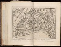
Gouwen, Gilliam van der Visscher, Nicolaes, 1649-1702, creator
Published / Created:
[1690?]
Call Number:
1973 Folio 10
Image Count:
1
Resource Type:
Maps, Atlases & Globes
Alternative Title:
Landkaart vertonende het Graafschap Holland
Description:
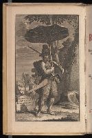
Alternate title in upper margin: Landkaart vertonende het Graafschap Holland, seer dienstig om te reysen na : en van syne naburige provincien, als mede de Hoven van Soestdyk, 't Loo en Cleef / t' Amsteldam door Nicolaus Visscher met privilegie., Bar scales in Milliaria Germanica communia and Milliaria Gallica sive horae itineris., Ferro meridian., Includes col. ill. of figures in title cartouche., No. 44 of 69 maps bound together in composite atlas., Place-names in Dutch., Relief shown pictorially., and Scale [ca. 1:300 000].
Uytenbogaart, J. W. H. (Johannes Wilhelmus Huybert) Wit, Frederik de., creator
Published / Created:
[1680?]
Call Number:
1973 Folio 10
Image Count:
1
Resource Type:
Maps, Atlases & Globes
Description:
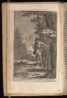
Appears in the Wit's Atlas from 1680., Dedication: Amplissimo Doctissimoque Viro Domino Do. Joanni Uytenbogaert Jcto. nomine Illustrium et praepotent. DD. ordinum Hollandiae et Westvrisiae Aerary Publici Amstelodamensis Tribuno., Includes color illustrated views of Messina, Catania, and Trapano, and ancillary maps of Milazzo and Palermo., No. 21 of 69 maps bound together in composite atlas., Oriented with north toward the upper left., Relief shown pictorially., Scale indeterminable., and Urbibus praecipuis exornatum et novissime editum per F. de Wit.
Publisher:
Gedruckt tot Amsterdam by Frederik de Wit inde Kalverstraet by den Dam inde Witte Paskaert
Bound, as issued, with the author's Tractaet vant zee-bouck-houden. [Amsterdam] 1597., Engraved t.-p., and Signatures: A⁴ (A2-3 signed A1-2) A-C⁸ A-E⁸.
Publisher:
Ghedruckt by Barendt Adriaenzoon in t' Vergulde Schryf-boeck ...,
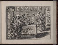
Descriptive letterpress in Dutch and French at foot of most of the plates., Engraved title vignette (coat of arms of Amsterdam)., First edition (in book form) was published about 1770 under title: Afbeeldingen van de wijd vermaarde koopstad Amsterdam, benevens deszelfs voornaamste gebouwen en gezigten (Amsterdam, P. Fouquet jr.)--cf. Muller, Frederik, & co. Oud-Amsterdam [1912], p. 14., and Paged continuously (by signatures).
Ferro meridian., Gemeene Duytsche mylen van 15 in een graedt., No. 53 of 69 maps bound together in composite atlas., Relief shown pictorially., and Scale [ca 1:8 750 000].
Publisher:
By Frederick de Wit in de Kalversbraet in de Witte Pascaert