Also appeared in Faden's [General atlas. London : William Faden, 1811?]., No. 10 of 43 maps bound together in composite atlas., Relief shown pictorially., and Scale [1: 510,000].
The discovery, settlement, and present state of Kentucky: and an essay towards the topography and
Image Count:
1
Description:
Engrav'd for S. Campbell's Edition of Imlay's Description of Kentucky., Preceding title page., and Teaching resource: Professor John Mack Faragher, History 141: The American West.
Subject (Geographic):
Kentucky --Maps --Early works to 1800 and Ohio River Valley
Includes dedication statement "To the Governor and Legislature of the Commonwealth of Pennsylvania this map is respectfully inscribed by the author"., Includes drawing of Schuylkill permanent bridge on lower left hand corner., and Map shows "line limiting the p
Publisher:
Kimber & Conrad & Johnson & Warner,
Subject (Geographic):
Pennsylvania--Maps
Subject (Name):
Johnson & Warner, Kimber & Conrad, and Vallance, J. (John), 1770-1823
Beneath neat line "Philada. published by Kimber & Conrad & Johnson & Warner"., Includes dedication statement "To the Governor and Legislature of the Commonwealth of Pennsylvania this map is respectfully inscribed by the author"., and Includes drawing of Schuylk
Publisher:
Kimber & Conrad & Johnson & Warner,
Subject (Geographic):
Pennsylvania--Maps
Subject (Name):
Johnson & Warner, Kimber & Conrad, and Kimber, Emmor, 1775-1850
"Engraved for Morse's geography.", From Jedidiah Morse's American geography, or, A view of the present situation of the United States of America. Elizabethtown, N.J. : Printed by Shepard Kollock, 1789., Prime meridians: Philadelphia and London., and Relief shown
Publisher:
[publisher not identified],
Subject (Geographic):
Southern States--Boundaries--Maps--Early works to 1800., Southern States--Maps--Early works to 1800., and Spain--Colonies--America--Maps--Early works to 1800.
Subject (Name):
Doolittle, Amos, 1754-1832, Morse, Jedidiah, 1761-1826, and Pendleton, Nathaniel,--1756-1821--Ownership.
Subject (Topic):
Boundaries, Indians of North America--Southern States--Maps--Early works to 1800, and Spanish colonies
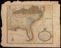
"Engraved for Morse's geography.", From Jedidiah Morse's American geography, or, A view of the present situation of the United States of America. Elizabethtown, N.J. : Printed by Shepard Kollock, 1789., Imperfect: torn along fold, with some loss of text. Manuscript note on verso: Map of Georgia. From the Nathaniel Pendleton family papers., Prime meridians: Philadelphia and London., Relief shown pictorially., Shows borders, roads, towns, and Native American villages., and Watermark.
Publisher:
[publisher not identified],
Subject (Geographic):
Southern States--Boundaries--Maps--Early works to 1800., Southern States--Maps--Early works to 1800., and Spain--Colonies--America--Maps--Early works to 1800.
Subject (Name):
Doolittle, Amos, 1754-1832, Morse, Jedidiah, 1761-1826, and Pendleton, Nathaniel,--1756-1821
Subject (Topic):
Boundaries, Indians of North America--Southern States--Maps--Early works to 1800., and Spanish colonies
Detached from the American geography ... / by Jedidiah Morse. -- Second edition. London : Published by John Stockdale, 1792., Longitude west from London., NcD., and Relief shown by hachures.
Publisher:
Publish'd by John Stockdale,
Subject (Geographic):
South Atlantic States--Maps--Early works to 1800. and United States--South Atlantic States
Subject (Name):
Harrison, William, approximately 1750-1803, Morse, Jedidiah, 1761-1826, and Stockdale, John, 1749?-1814
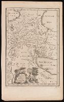
From Thomas Stackhouse's New history of the Holy Bible (London, 1752)., In lower left corner, "Pl. 4"; in lower right corner, "page 26.", and Relief shown pictorially.
Publisher:
[Printed for John Hinton],
Subject (Geographic):
Middle East--Historical geography--Maps--Early works to 1800. and Middle East--Maps--Early works to 1800.
Subject (Name):
Hinton, John, -1781 and Stackhouse, Thomas, approximately 1680-1752. New history of the Holy Bible.