Search
You Searched For
Search Results
- Published / Created:
- [1738]
- Call Number:
- BrSides Folio 2017 4
- Image Count:
- 12
- Resource Type:
- Maps, Atlases & Globes
- Found in:
- Beinecke Rare Book and Manuscript Library > The first [-twelfth] sheet of Chinese Tartary ...
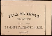
- Creator:
- Almonte y Muriel, Enrique d', 1858-1917, cartographer.
- Published / Created:
- 1883
- Call Number:
- BrSides Double Folio 2019 106
- Image Count:
- 8
- Resource Type:
- Maps, Atlases & Globes
- Found in:
- Beinecke Rare Book and Manuscript Library > Isla de Luzon y sus adjacentes / por D. Enrique d'Almonte y Muriel ; grabado por José Mendez.
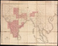
- Creator:
- Survey of India.
- Published / Created:
- 1827-1904.
- Call Number:
- Series 59 1827
- Image Count:
- 61
- Resource Type:
- Maps, Atlases & Globes
- Found in:
- Beinecke Rare Book and Manuscript Library > [Indian atlas 1:253 440, full sheets] / Survey of India.
- Creator:
- Homann Erben (Firm)
- Published / Created:
- 1777
- Call Number:
- 755 1777B
- Container / Volume:
- BRBL_00431
- Image Count:
- 1
- Resource Type:
- Maps, Atlases & Globes
- Found in:
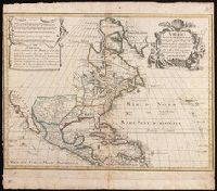
- Beinecke Rare Book and Manuscript Library > America Septentrionalis a Domino d'Anville in Galliis edita nunc in Anglia : coloniis in interiorem Virginiam deductis nec non Fluvii Ohio cursu aucta notisque geographicis et historicis illustrata et ad bellum praesentis temporis accomodata / sumptibus Homannianorum Heredum.
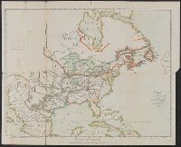
- Creator:
- Imbert, J. Leopold
- Published / Created:
- 1777
- Call Number:
- 755 1777K
- Container / Volume:
- BRBL_00431
- Image Count:
- 1
- Resource Type:
- Maps, Atlases & Globes
- Found in:
- Beinecke Rare Book and Manuscript Library > Carte des possessions angloises dans l'Amérique septentrionale : pour servir d'intelligence à la guerre presente / traduite de l'Anglois par J. Leopold Imbert.
- Creator:
- Franquelin, Jean Baptiste Louis.
- Published / Created:
- between 1896 and 1901]
- Call Number:
- 795.8881857
- Image Count:
- 1
- Resource Type:
- Maps, Atlases & Globes
- Found in:
- Beinecke Rare Book and Manuscript Library > Franquelin's map of Louisiana.
- Creator:
- Allard, Carel, 1648-ca. 1709.
- Published / Created:
- 1696]
- Call Number:
- 1973 Folio 18
- Image Count:
- 1
- Resource Type:
- Maps, Atlases & Globes
- Found in:
- Beinecke Rare Book and Manuscript Library > Planisphaerium terrestre, sive terrarum orbis, planisphaericè constructi repraesentatio quintuplex [cartographic material] : adjunctis aliquibus astronomicae geographiae tyrociniis / auctore Carolo Allard, Amstelo-Batavo = Vlakke aard-kloot, gemeenlyk genaamd de geheele waereld, vysvoudiglyk in vlakke ronden verbeeld : mitsgaders eenige noodige ontwerpen des sterrekundigen aard-beschryvings / door Carel Allard, tot Amsterdam.
- Creator:
- Jansson, Jan, 1588-1664, cartographer, publisher.
- Published / Created:
- [between 1652 and 1684]
- Call Number:
- BrSides Double Folio 2019 100
- Image Count:
- 1
- Resource Type:
- Maps, Atlases & Globes
- Found in:
- Beinecke Rare Book and Manuscript Library > Tribvs Rvben, et Gad et partes orientales tribuum Beniamin, Ephraim, et dimidiae Manasse intra Iordanem.
- Creator:
- Jansson, Jan, 1588-1664, cartographer, publisher.
- Published / Created:
- [between 1652 and 1684]
- Call Number:
- BrSides Double Folio 2019 100
- Image Count:
- 1
- Resource Type:
- Maps, Atlases & Globes
- Found in:
- Beinecke Rare Book and Manuscript Library > Dimidia Tribus Manasse ultra Iordanem, tribus Neptalim et partes orientales tribuum Zabuion et Isachar.
- Creator:
- Seutter, Matthaeus, 1678-1756, cartographer.
- Published / Created:
- [before 1727]
- Call Number:
- BrSides Double Folio 2019 102
- Image Count:
- 1
- Resource Type:
- Maps, Atlases & Globes
- Found in:
- Beinecke Rare Book and Manuscript Library > Nova mappa geographica Maris Assoviensis, Vel de Zabache et Paludis Maeotidis / accuratè aeri incisa et in luce[m] edita per Matthaeum Seutter, Chalcograph.
- Creator:
- Jansson, Jan, 1588-1664, cartographer, publisher.
- Published / Created:
- [between 1652 and 1684]
- Call Number:
- BrSides Double Folio 2019 100
- Image Count:
- 1
- Resource Type:
- Maps, Atlases & Globes
- Found in:
- Beinecke Rare Book and Manuscript Library > Tribus Aser, et partes occidentales tribuum Zabulon et Isachar.
- Creator:
- Dorman, Moses, author.
- Published / Created:
- 1830
- Call Number:
- 764 An23 1830
- Image Count:
- 1
- Resource Type:
- Maps, Atlases & Globes
- Found in:
- Beinecke Rare Book and Manuscript Library > A plan of Andover taken for the town / by Moses Dorman, Jr.
- Creator:
- Jansson, Jan, 1588-1664, cartographer, publisher.
- Published / Created:
- [between 1652 and 1684]
- Call Number:
- BrSides Double Folio 2019 100
- Image Count:
- 1
- Resource Type:
- Maps, Atlases & Globes
- Found in:
- Beinecke Rare Book and Manuscript Library > Pars maxima tribvs Ivda versus orientem.
- Published / Created:
- [between 1652 and 1684]
- Call Number:
- BrSides Double Folio 2019 99
- Image Count:
- 1
- Resource Type:
- Maps, Atlases & Globes
- Found in:
- Beinecke Rare Book and Manuscript Library > Britannia prout divisa fuit temporibus Anglo-Saxonvm praesertim durante illorum heptarchia.
- Creator:
- Jansson, Jan, 1588-1664, cartographer, publisher.
- Published / Created:
- [between 1652 and 1684]
- Call Number:
- BrSides Double Folio 2019 100
- Image Count:
- 1
- Resource Type:
- Maps, Atlases & Globes
- Found in:
- Beinecke Rare Book and Manuscript Library > Tribvs Simeon et pars meridionalis tribvs Dan, et orientalis tribvs Ivda.
- Creator:
- Keere, Pieter van den, 1571-approximately 1646, cartographer.
- Published / Created:
- [between 1652 and 1684]
- Call Number:
- BrSides Double Folio 2019 103
- Image Count:
- 1
- Resource Type:
- Maps, Atlases & Globes
- Found in:
- Beinecke Rare Book and Manuscript Library > Germaniae veteris nova descriptio / Petrus Kaerius celavit.
- Creator:
- Seutter, Matthaeus, 1678-1756, cartographer.
- Published / Created:
- [between 1731 and 1741]
- Call Number:
- BrSides Double Folio 2019 104
- Image Count:
- 1
- Resource Type:
- Maps, Atlases & Globes
- Found in:
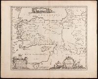
- Beinecke Rare Book and Manuscript Library > Magni Turcarum dominatoris imperium per Europam, Asiam, et Africam : se extendens regiones tam proprias, quam tributarias et clientelares ut et omnes beglerbegatus sive praefecturas generales oculis sistens / accuratissima cura delineatum per Mattheum Seu
- Creator:
- Jansson, Jan, 1588-1664, cartographer, publisher.
- Published / Created:
- [between 1652 and 1684]
- Call Number:
- BrSides Double Folio 2019 101
- Image Count:
- 1
- Resource Type:
- Maps, Atlases & Globes
- Found in:
- Beinecke Rare Book and Manuscript Library > Tabula itineraria patriarcharum Abrahami, Isaaci et Iacobi.
- Creator:
- L'Isle, Guillaume de, 1675-1726, cartographer.
- Published / Created:
- [1718]
- Call Number:
- BrSides Double Folio 2019 105
- Image Count:
- 1
- Resource Type:
- Maps, Atlases & Globes
- Found in:
- Beinecke Rare Book and Manuscript Library > America septentrionalis : concinnata juxta observationes D[omi]n[o] n[ostro] Academiae Regalis Scientiarum et nonnullorum aliorum, et juxta annotationes recentissimas / par G. De L'Isle, geographum.
- Creator:
- Adrichem, Christiaan van, 1533-1585, cartographer.
- Published / Created:
- [between 1652 and 1684]
- Call Number:
- BrSides Double Folio 2019 97
- Image Count:
- 1
- Resource Type:
- Maps, Atlases & Globes
- Found in:
- Beinecke Rare Book and Manuscript Library > Situs Terrae Promissionis S.S. Bibliorum / intelligentiam exacte aperiens per Chr. Adrichom ; sculpserunt Everardus Sim. Hamers-veldt et Salomon Rogeri.
- Creator:
- Jansson, Jan, 1588-1664, cartographer, publisher.
- Published / Created:
- [between 1652 and 1684]
- Call Number:
- BrSides Double Folio 2019 100
- Image Count:
- 1
- Resource Type:
- Maps, Atlases & Globes
- Found in:
- Beinecke Rare Book and Manuscript Library > Tribuum Ephraim, Beniamin, et Dimidiae, Manasse intra Iordanem partes occidentales, et partes septentrionales Dan et Juda.
- Creator:
- Stokes, John Lort, 1811-1885, cartographer.
- Published / Created:
- Apr. 5, 1845.
- Call Number:
- BrSides Double Folio 2019 107
- Image Count:
- 1
- Resource Type:
- Maps, Atlases & Globes
- Found in:
- Beinecke Rare Book and Manuscript Library > The Victoria River : 1839 / surveyed by Commr. J.L. Stokes, R.N. ; J. & C. Walker, sculpt.
- Creator:
- Homann Erben (Firm), cartographer, publisher.
- Published / Created:
- 1756
- Call Number:
- 755 1756Ea
- Image Count:
- 1
- Resource Type:
- Maps, Atlases & Globes
- Found in:
- Beinecke Rare Book and Manuscript Library > America Septentrionalis a Domino d'Anville in Galliis edita nunc in Anglia : coloniis in interiorem Virginiam deductis nec non Fluvii Ohio cursu aucta notisque geographicis et historicis illustrata / sumptibus Homannianorum Heredum.
- Creator:
- Stokes, John Lort, 1811-1885, cartographer.
- Published / Created:
- April 10, 1845.
- Call Number:
- BrSides Double Folio 2019 108
- Image Count:
- 1
- Resource Type:
- Maps, Atlases & Globes
- Found in:
- Beinecke Rare Book and Manuscript Library > The Albert River : 1841 / surveyed by J.L. Stokes, R.N. ; J. & C. Walker, sculpt.
- Creator:
- Bellin, Jacques Nicolas, 1703-1772, cartographer.
- Published / Created:
- 1755
- Call Number:
- 731 1755B
- Image Count:
- 1
- Resource Type:
- Maps, Atlases & Globes
- Found in:
- Beinecke Rare Book and Manuscript Library > Partie occidentale de la Nouvelle France ou du Canada / par Mr. Bellin, ingenieur du Roy et de la Marine, pour seruir à l'intelligence des affaires et de l'etat present en Amerique, communiquée au public par les Heritiers de Homanen l'an 1755.
- Creator:
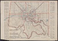
- Sides, William
- Published / Created:
- 1859
- Call Number:
- 777 B21 1859
- Container / Volume:
- BRBL_00503
- Image Count:
- 1
- Resource Type:
- Maps, Atlases & Globes
- Found in:
- Beinecke Rare Book and Manuscript Library > Map of Baltimore.
- Creator:
- Jefferys, Thomas, -1771, printmaker.
- Published / Created:
- 1755
- Call Number:
- 783 1755F
- Container / Volume:
- BRBL_00507
- Image Count:
- 1
- Resource Type:
- Maps, Atlases & Globes
- Found in:
- Beinecke Rare Book and Manuscript Library > A map of the most inhabited part of Virginia containing the whole province of Maryland with part of Pensilvania, New Jersey and North Carolina / drawn by Joshua Fry & Peter Jefferson in 1751.
- Creator:
- Automobile Club of America, cartographer.
- Published / Created:
- [1908]
- Call Number:
- 762gmb 1908
- Container / Volume:
- BRBL_00451
- Image Count:
- 1
- Resource Type:
- Maps, Atlases & Globes
- Found in:
- Beinecke Rare Book and Manuscript Library > Automobile map of New Hampshire / Automobile Club of America.
- Creator:
- Home Educator Company.
- Published / Created:
- c1905.
- Call Number:
- 76gm 1905
- Image Count:
- 1
- Resource Type:
- Maps, Atlases & Globes
- Found in:
- Beinecke Rare Book and Manuscript Library > The New England commercial and route survey [cartographic material] : showing all postoffices, railroads, electric roads in operation and proposed, good roads, population (showing latest Massachusetts census) and a comprehensive distance table.
- Creator:
- Anville, Jean Baptiste Bourguignon d', 1697-1782.
- Published / Created:
- MDCCLXIV [1764]
- Call Number:
- 53 1764
- Image Count:
- 1
- Resource Type:
- Maps, Atlases & Globes
- Found in:
- Beinecke Rare Book and Manuscript Library > Orbis Romani pars orientalis : auspiciis serenissmi principis Ludovici Philippi Aurelianorum Ducis publici juris factus. / Auctor d'Anville ... ; [engraved by] Guill. De-la-Haye.
- Published / Created:
- [1846?]
- Call Number:
- 796hc 1846
- Image Count:
- 1
- Resource Type:
- Maps, Atlases & Globes
- Found in:
- Beinecke Rare Book and Manuscript Library > Map of Texas.
- Creator:
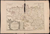
- Nolin, Jean Baptiste, 1648-1708
- Published / Created:
- 1703
- Call Number:
- 381 1703
- Image Count:
- 1
- Resource Type:
- Maps, Atlases & Globes
- Found in:
- Beinecke Rare Book and Manuscript Library > La Province ou Duché de Bretagne divisée en deux grandes parties, qui sont la Haute, et la Basse Bretagne, le gouvernement general de Bretagne, comprenant les lieutenances generales de Bretagne et du Comté Nantois : la Lieutenance Generale de Bretagne
- Creator:
- Hughes, Andrew, 18th century
- Published / Created:
- [1780?]
- Call Number:
- 786 1780A
- Image Count:
- 1
- Resource Type:
- Maps, Atlases & Globes
- Found in:
- Beinecke Rare Book and Manuscript Library > A draught of South Carolina and Georgia from Sewee to St. Estaca / by Andrew Hughes.
- Creator:
- Anville, Jean Baptiste Bourguignon d', 1697-1782
- Published / Created:
- MDCCLII [1752]
- Call Number:
- 556 1752
- Image Count:
- 1
- Resource Type:
- Maps, Atlases & Globes
- Found in:
- Beinecke Rare Book and Manuscript Library > Seconde partie de la carte d'Asie : contenant la Chine, et partie de la Tartarie, l'Inde au delà du Gange, les isles Sumatra, Java, Borneo, Moluques, Philippines et du Japon : publiée sous les auspices de Monsigneur Louis Phillippe D'Orléans, Duc D'Orl
- Creator:
- E.P. Dutton (Firm)
- Published / Created:
- ©1860.
- Call Number:
- 764 B65 1860
- Image Count:
- 1
- Resource Type:
- Maps, Atlases & Globes
- Found in:
- Beinecke Rare Book and Manuscript Library > New map of the vicinity of Boston [cartographic material] : with the dates of settlement and distance from the capital / Boston Map Store, E.P. Dutton & Co.
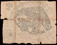
- Creator:
- Bradshaw, George, 1801-1853
- Published / Created:
- [approximately 1850?]
- Call Number:
- 38 P21 1850A
- Image Count:
- 1
- Resource Type:
- Maps, Atlases & Globes
- Found in:
- Beinecke Rare Book and Manuscript Library > Bradshaw's plan of Paris, and map of the environs.
- Published / Created:
- Novr. 1800.
- Call Number:
- Small 32 L84 1666
- Image Count:
- 1
- Resource Type:
- Maps, Atlases & Globes
- Found in:
- Beinecke Rare Book and Manuscript Library > Sir Christopher Wren's design for re-building the City of London, after the great fire in 1666 : from an original drawing in the Library of All Soul's College, Oxford / J. Barlow sculp. ; Wm. Delamotte copy, 1800.
- Creator:
- Lotter, Matthäus Albrecht, 1741-1810.
- Published / Created:
- 1776?]
- Call Number:
- 755 1776E
- Image Count:
- 1
- Resource Type:
- Maps, Atlases & Globes
- Found in:
- Beinecke Rare Book and Manuscript Library > Carte nouvelle de l'Amérique angloise contenant tout ce que les Anglois possedent sur le continent de l'Amérique septentrionale savoir le Canada : la Nouvelle Ecosse ou Acadie, les treize provinces unies qui font : les quatres colonies de la Nouvelle Angleterre ... / gravée exactement d'après les determinations geographiques dernierement faites par Matthieu Albert Lotter.
- Creator:
- Senex, John, -1740, cartographer.
- Published / Created:
- c 1709.
- Call Number:
- 2017 Folio 93
- Image Count:
- 1
- Resource Type:
- Maps, Atlases & Globes
- Found in:
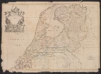
- Beinecke Rare Book and Manuscript Library > The VII United Provinces : corrected from the observations communicated to the Royal Society at London & ye Royal Academy at Paris / Io. Senex, F.R.S.
- Creator:
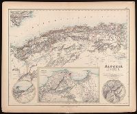
- Johnson, J. Hugh (John Hugh)
- Published / Created:
- [1872?]
- Call Number:
- BrSides Folio 2019 97
- Image Count:
- 1
- Resource Type:
- Maps, Atlases & Globes
- Found in:
- Beinecke Rare Book and Manuscript Library > Algeria [cartographic material] = l'Algérie / drawn by J. Hugh Johnson ; engraved at Stanford's Geographical Establishment.
- Creator:
- Palairet, Jean, 1697-1774, cartographer.
- Published / Created:
- 1755
- Call Number:
- BrSides Double Folio 2019 111
- Image Count:
- 1
- Resource Type:
- Maps, Atlases & Globes
- Found in:
- Beinecke Rare Book and Manuscript Library > Carte des possessions angloises & françoises du continent de l'Amérique septentrionale / Thos. Kitchin, sculpt.
- Creator:
- Duval, P. (Pierre), 1619-1682, cartographer.
- Published / Created:
- [between 1652 and 1684]
- Call Number:
- BrSides Double Folio 2019 98
- Image Count:
- 1
- Resource Type:
- Maps, Atlases & Globes
- Found in:
- Beinecke Rare Book and Manuscript Library > Tabula itineris decies mille Graecorum sub Cyro contra fratrem suum Artaxerxem Regem Persarum : eorumque reditus sub Xenophonte secundum ipsium Xenophontis commentaria / per P. du Val, Abbevillensem Geographum Regium.
- Creator:
- Madison, James, 1751-1836, creator.
- Published / Created:
- March 4, 1807.
- Call Number:
- BrSides Double Folio 2019 110
- Image Count:
- 1
- Resource Type:
- Maps, Atlases & Globes
- Found in:
- Beinecke Rare Book and Manuscript Library > A map of Virginia [cartographic material] : Formed from actual surveys, and the latest as well as most accurate observations / by James Madison, D.D., president of Wm. & Mary College. ; Drawn by: Wm. Davis. ; Engraved by: Fred. Bossler, Ricmd.
- Creator:
- Distrito Federal (Mexico). Consejo Superior de Gobierno.
- Published / Created:
- [1906?]
- Call Number:
- 88 M57 1906
- Container / Volume:
- BRBL_00647
- Image Count:
- 1
- Resource Type:
- Maps, Atlases & Globes
- Found in:
- Beinecke Rare Book and Manuscript Library > Plano oficial de la ciudad de México. : Edición especial para el Consejo Superior de Gobierno del Distrito Federal, con motivo de la reunión del X Congreso Geológico Internacional, septiembre de 1906.
- Creator:
- Senex, John, -1740, cartographer.
- Published / Created:
- 1709
- Call Number:
- 33 1728A
- Container / Volume:
- BRBL_00683
- Image Count:
- 1
- Resource Type:
- Maps, Atlases & Globes
- Found in:
- Beinecke Rare Book and Manuscript Library > The VII United Provinces : corrected from the observations communicated to the Royal Society at London & ye Royal Academy at Paris / Io. Senex, F.R.S.
- Creator:
- Sanson, Nicolas, 1600-1667, cartographer.
- Published / Created:
- [ca. 1700?]
- Call Number:
- 1973 Folio 18
- Image Count:
- 1
- Resource Type:
- Maps, Atlases & Globes
- Found in:
- Beinecke Rare Book and Manuscript Library > La Russie blanche ou Moscovie [cartographic material] : divisée suivant l'estendue des royaumes, duchés, principautés, provinces et peuples qui sont presentement soubs la domination du czar de la Russie ... / par le Sr. Sanson geographe ordre. du roy.
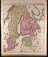
- Creator:
- Valck, G. (Gerard), 1651 or 1652-1726.
- Published / Created:
- ca. 1702?]
- Call Number:
- 1973 Folio 18
- Image Count:
- 1
- Resource Type:
- Maps, Atlases & Globes
- Found in:
- Beinecke Rare Book and Manuscript Library > Sueciae magnae, totius orbis regni antiquissimi, hodierna in sex principales suas partes : Gothiam nempe, Sueciam propriam sive stricté sumptam, Nordlandiam, Finniam, Ingriam, Livoniam earundemq[ue] subdivisionum, ac adjacentium insularum geographica distinctio / ex optimis auctorum descriptionibus collecta, per Geo. et Leo. Valk.
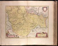
- Creator:
- Blaeu, Willem Janszoon, 1571-1638.
- Published / Created:
- [ca. 1631]
- Call Number:
- 1973 Folio 18
- Image Count:
- 1
- Resource Type:
- Maps, Atlases & Globes
- Found in:
- Beinecke Rare Book and Manuscript Library > Territorio di Trento [cartographic material].
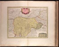
- Creator:
- Blaeu, Joan, 1596-1673.
- Published / Created:
- ca. 1670]
- Call Number:
- 1973 Folio 18
- Image Count:
- 1
- Resource Type:
- Maps, Atlases & Globes
- Found in:
- Beinecke Rare Book and Manuscript Library > Territorium Basileense, cum adjacentibus [cartographic material].
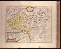
- Creator:
- Blaeu, Joan, 1596-1673.
- Published / Created:
- ca. 1670]
- Call Number:
- 1973 Folio 18
- Image Count:
- 1
- Resource Type:
- Maps, Atlases & Globes
- Found in:
- Beinecke Rare Book and Manuscript Library > March. Brandenburgici pars, quae marchia media vulgo Mittelmarck audit [cartographic material].