Search
You Searched For
Search Results
- Creator:
- Sanborn Map Company
- Published / Created:
- August, 1923.
- Call Number:
- 776 B764 1923
- Container / Volume:
- BRBL_00502
- Image Count:
- 4
- Resource Type:
- Maps, Atlases & Globes
- Found in:
- Beinecke Rare Book and Manuscript Library > Bridgeville, Sussex County, Delaware.
- Published / Created:
- [ca. 1880]
- Call Number:
- 771 N49 1880A
- Container / Volume:
- BRBL_00488
- Image Count:
- 1
- Resource Type:
- Maps, Atlases & Globes
- Found in:
- Beinecke Rare Book and Manuscript Library > Bridgman's map of the suburbs of New York City embracing the territory occupied by the homes of New York businessmen.
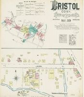
- Creator:
- Sanborn-Perris Map Co., issuing body
- Published / Created:
- 1890
- Call Number:
- 766 B77 1890
- Image Count:
- 9
- Resource Type:
- Maps, Atlases & Globes
- Found in:
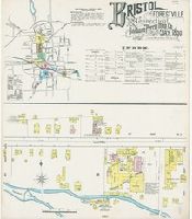
- Beinecke Rare Book and Manuscript Library > Bristol and Forestville, Hartford Co., Connecticut.
- Creator:
- Sanborn Map & Publishing Co., issuing body
- Published / Created:
- 1884
- Call Number:
- 766 B77 1884
- Image Count:
- 5
- Resource Type:
- Maps, Atlases & Globes
- Found in:
- Beinecke Rare Book and Manuscript Library > Bristol, Conn.
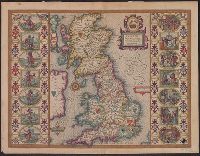
- Creator:
- Speed, John, 1552?-1629
- Published / Created:
- [1612?]
- Call Number:
- 3191 1611
- Container / Volume:
- BRBL_00732
- Image Count:
- 2
- Resource Type:
- Maps, Atlases & Globes
- Found in:
- Beinecke Rare Book and Manuscript Library > Britain as it was devided in the tyme of the Englishe Saxons especially during their heptarchy / performed by Iohn Speede and are to be sold by John Sudbury & Georg. Humble, in Popes head alley at Londo[n].
- Published / Created:
- [between 1652 and 1684]
- Call Number:
- BrSides Double Folio 2019 99
- Image Count:
- 1
- Resource Type:
- Maps, Atlases & Globes
- Found in:
- Beinecke Rare Book and Manuscript Library > Britannia prout divisa fuit temporibus Anglo-Saxonvm praesertim durante illorum heptarchia.
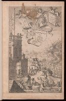
- Creator:
- Ogilby, John, 1600-1676
- Published / Created:
- 1675
- Call Number:
- EEdea 675P
- Image Count:
- 2
- Found in:
- Beinecke Rare Book and Manuscript Library > Britannia, volume the first, or, An illustration of the kingdom of England and dominion of Wales : by a geographical and historical description of the principal roads thereof : actually admeasured and delineated in a century of whole-sheet copper-sculps : accomodated with the ichnography of the several cities and capital towns : and compleated by an accurate account of the more remarkable passages of antiquity, together with a novel discourse of the present state
- Creator:
- Horsley, John, 1675-1732, cartographer
Laurie, Richard Holmes
- Published / Created:
- 1821
- Call Number:
- 3190 No. 6
- Container / Volume:
- BRBL_00041
- Image Count:
- 1
- Resource Type:
- Maps, Atlases & Globes
- Found in:
- Beinecke Rare Book and Manuscript Library > Britanniæ Antiquæ [cartographic material] : tabula geographica ex ævi Romani monumentis / ab eruditissimo viro Johanne Horsley ... recentissinmus observationibus concinnata.
- Creator:
- Royal Geographical Society (Great Britain)
- Published / Created:
- 1909
- Call Number:
- 19 1909A
- Container / Volume:
- BRBL_00013
- Image Count:
- 1
- Resource Type:
- Maps, Atlases & Globes
- Found in:
- Beinecke Rare Book and Manuscript Library > British Antarctic Expedition, 1907 [cartographic material] : general map showing the explorations and surveys of the Expedition, 1907-09.
- Creator:
- Mawson, Douglas Sir, 1882-1958
- Published / Created:
- 1909
- Call Number:
- 19 1909C
- Container / Volume:
- BRBL_00013
- Image Count:
- 1
- Resource Type:
- Maps, Atlases & Globes
- Found in:
- Beinecke Rare Book and Manuscript Library > British Antarctic Expedition, 1907 [cartographic material] : route and surveys of the South Magnetic Polar Party, 1908-09 : from triangulation and traverses / by Douglas Mawson.