Search
You Searched For
Search Results
- Creator:
- Chauveau, François, 1613-1676
Jaillot, Alexis Hubert, 1632?-1712. Atlas nouveau
Sanson, Guillaume
- Published / Created:
- 1673
- Call Number:
- 1973 Folio 57
- Collection Title:
- Composite atlas of 41 maps from Alexis Hubert Jaillot's Atlas nouveau.
- Image Count:
- 1
- Found in:
- Beinecke Rare Book and Manuscript Library > Provinces-Unies des Pays-Bas : auec leurs acquisitions dans La Flandre, Le Brabant, Le Limbourg, et Le Lyege, et les places queílles possedoient sur le Rhein, dans le Ducheí de Cleves, et dans l'Archevescheí et Eslectorat de Cologne / par le Sr. Sanson
- Creator:
- Moll, Herman, d. 1732
- Published / Created:
- [1732]
- Call Number:
- E1015 M66 1732
- Image Count:
- 1
- Found in:
- Beinecke Rare Book and Manuscript Library > Atlas minor: or a set of sixty-two new and correct maps, of all parts of the world. All composed and done by Herman Moll, geographer ...
- Creator:
- Moll, Herman, d. 1732
- Published / Created:
- [1732]
- Call Number:
- E1015 M66 1732
- Collection Title:
- Atlas minor: or a set of sixty-two new and correct maps, of all parts of the world. All composed
- Image Count:
- 1
- Found in:
- Beinecke Rare Book and Manuscript Library > The Island of St. Christophers, alias St. Kitts By H. Moll Geographer
- Published / Created:
- 1850
- Call Number:
- 1976 Folio 96
- Collection Title:
- A new universal atlas containing maps of the various empires, kingdoms, states and republics of the
- Image Count:
- 1
- Resource Type:
- Maps, Atlases & Globes
- Found in:
- Beinecke Rare Book and Manuscript Library > 10. Map of Connecticut
- Published / Created:
- 1635
- Call Number:
- 1975 Folio 32
- Collection Title:
- Toonneel des aerdriicx, ofte nieuwe atlas, dat is beschryving van alle landen; nu nieulycx
- Image Count:
- 1
- Found in:
- Beinecke Rare Book and Manuscript Library > Nova Belgica et Anglia Nova
- Creator:
- Moll, Herman, d. 1732
- Published / Created:
- [1732]
- Call Number:
- E1015 M66 1732
- Collection Title:
- Atlas minor: or a set of sixty-two new and correct maps, of all parts of the world. All composed
- Image Count:
- 1
- Resource Type:
- Maps, Atlases & Globes
- Found in:
- Beinecke Rare Book and Manuscript Library > A general map of Great Britain and Ireland with part of Germany, Holland, Flanders, France &c. agreeable to modern history
- Creator:
- Homann Erben (Firm)
Ovalle, Alonso de, 1601-1651
Techo, Nicolas del, 1611-1685
- Published / Created:
- A. MDCCXXXIII [1733]
- Call Number:
- 1975 Folio 31
- Collection Title:
- [Atlas factice of 42 maps, produced by the Homann Erben firm]
- Image Count:
- 1
- Found in:
- Beinecke Rare Book and Manuscript Library > Typus geographicus [cartographic material] : Chili a Paraguay freti Magellanici &c., ex. PPbg. Alfonso d'Ovalle & Nicol. Techo nec non de Brouwer, Narbouroug, de Beauchesne &c., a Guiliel de l'Islio descripta, insuperque secundum recentiores du Frezier re
- Creator:
- Homann, Johann Baptist, 1663-1724
Visscher, Nicolaes, 1649-1702
- Published / Created:
- 1715?
- Call Number:
- 1975 Folio 31
- Collection Title:
- [Atlas factice of 42 maps, produced by the Homann Erben firm]
- Image Count:
- 1
- Found in:
- Beinecke Rare Book and Manuscript Library > Hiberniae regnum tam in praecipuas Ultoniae, Connaciae, Laceniae et Momoniae [cartographic material] : quam in minores earundem provincias et ditiones divisum ex prototype Guil. Petty-Vischeriano deductu et exhibitum / a Joh. Bapt. Homanno
- Creator:
- Homann, Johann Baptist, 1663-1724, creator
- Published / Created:
- 1720?
- Call Number:
- 1975 Folio 31
- Collection Title:
- [Atlas factice of 42 maps, produced by the Homann Erben firm]
- Image Count:
- 1
- Found in:
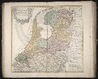
- Beinecke Rare Book and Manuscript Library > Belgii pars septentrionalis communi nomine vulgo Hollandia nuncupata continens statum potentissimae Batavorum Reipublicea sev provincias VII foederatas / exhibente Io. Baptista Homanno
- Creator:
- Homann, Johann Baptist, 1663-1724
Hubner, Johann, 1668-1731
- Published / Created:
- ca. 1715
- Call Number:
- 1975 Folio 31
- Collection Title:
- [Atlas factice of 42 maps, produced by the Homann Erben firm]
- Image Count:
- 1
- Found in:
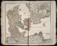
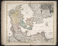
- Beinecke Rare Book and Manuscript Library > Regni Daniae, in quo sunt Ducatus Holsatia et Slesvicum, insulae Danicae, provinciae Iutia, Scania, Bleckingia, nova tabula / [cartographic material] / edita a Io. Baptista Homanno ; et aucta secundum geographiam novissimam Iohann Huebneri, I.U.L
- Creator:
- Homann, Johann Baptist, 1663-1724
- Published / Created:
- [172-?]
- Call Number:
- 1975 Folio 31
- Collection Title:
- [Atlas factice of 42 maps, produced by the Homann Erben firm]
- Image Count:
- 2
- Found in:
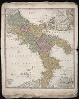
- Beinecke Rare Book and Manuscript Library > Novissima & exactissima totivs regni Neapolis tabvla / praesentis belli statvi accommodata et exhibita a Ioanne Bapt. Homanno
- Creator:
- Homann Erben (Firm)
L'Isle, Guillaume de, 1675-1726
Riccioli, Giovanni Battista, 1598-1671
- Published / Created:
- [1742?]
- Call Number:
- 1975 Folio 31
- Collection Title:
- [Atlas factice of 42 maps, produced by the Homann Erben firm]
- Image Count:
- 1
- Found in:
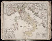
- Beinecke Rare Book and Manuscript Library > Italia [cartographic material] : in suos status divisa et ex prototypo del Isliano desumta, elementis insuper Geographiae Schazianis accom[m]odata
- Creator:
- Hase, Johann Matthias, 1684-1742
Homann Erben (Firm)
Reinsberger, Johann Christoph
- Published / Created:
- A. MDCCXXXXIII [1743]
- Call Number:
- 1975 Folio 31
- Collection Title:
- [Atlas factice of 42 maps, produced by the Homann Erben firm]
- Image Count:
- 1
- Found in:
- Beinecke Rare Book and Manuscript Library > Europa, secundum legitimas projectionis stereographicae regulas : et juxta recentissimas observationes aeque ac relationes adhibitis quoq[ue] veterum monumentorum subsidiis / descripta et in partes suas methodicas X divisa a Ioh. Matth. Hasio, Math. P.P.O
- Creator:
- Homann Erben (Firm)
Nolin, Jean Baptiste, 1686-1762
- Published / Created:
- 1736
- Call Number:
- 1975 Folio 31
- Collection Title:
- [Atlas factice of 42 maps, produced by the Homann Erben firm]
- Image Count:
- 1
- Found in:
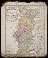
- Beinecke Rare Book and Manuscript Library > Regnum Portugalliae divisum in quinque provincias majores & subdivisum in sua quaeque territoria una cum regno Algarbiae speciali mappa exhibitum
- Creator:
- Homann, Johann Baptist, 1663-1724
- Published / Created:
- 1724?
- Call Number:
- 1975 Folio 31
- Collection Title:
- [Atlas factice of 42 maps, produced by the Homann Erben firm]
- Image Count:
- 1
- Found in:
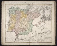
- Beinecke Rare Book and Manuscript Library > Regnorum Hispaniae et Portugalliae tabula generalis de l'Isliana / aucta et ad usum scholarum novissime accom[m]odata a Ioh. Bapt. Homanno, , S.C.M. Geogr.
- Creator:
- Homann Erben (Firm)
L'Isle, Guillaume de, 1675-1726
- Published / Created:
- 1741
- Call Number:
- 1975 Folio 31
- Collection Title:
- [Atlas factice of 42 maps, produced by the Homann Erben firm]
- Image Count:
- 1
- Found in:
- Beinecke Rare Book and Manuscript Library > Regni Galliae seu Franciae et Navarrae [cartographic material] : tabula geographica in usum elementorum geographiae schazianorum accom[m]odata / per Homannianos Heredes
- Creator:
- Homann, Johann Baptist, 1663-1724
- Published / Created:
- 1742?
- Call Number:
- 1975 Folio 31
- Collection Title:
- [Atlas factice of 42 maps, produced by the Homann Erben firm]
- Image Count:
- 1
- Found in:
- Beinecke Rare Book and Manuscript Library > Praefectura Generalis & Comitatus Provinciae una cum Terris adjacentibus in suas Dioeceses & Praeturas subdivisus ad prototypum del Islianum / [cartographic material] / excusus studion Homannianorum Heredum
- Creator:
- Homann Erben (Firm)
Homann, Johann Baptist, 1663-1724
- Published / Created:
- 1729
- Call Number:
- 1975 Folio 31
- Collection Title:
- [Atlas factice of 42 maps, produced by the Homann Erben firm]
- Image Count:
- 1
- Found in:
- Beinecke Rare Book and Manuscript Library > Magna Britannia complectens Angliae, Scotiae, et Hyberniae regn [cartographic material] : in suas prov. et comitat. divisa et ex mappis Londinensibus designata / per Homannum
- Creator:
- Homann, Johann Baptist, 1663-1724
Visscher, Nicolaes, 1649-1702
- Published / Created:
- 1715?
- Call Number:
- 1975 Folio 31
- Collection Title:
- [Atlas factice of 42 maps, produced by the Homann Erben firm]
- Image Count:
- 1
- Found in:
- Beinecke Rare Book and Manuscript Library > Magnae Britanniae pars meridionalis in qua regnum Angliae tam in septem antiqua Anglo-Saxonum regna quom in omnes Hodiernas regiones accurate divisum hic ostenditur quam tabula ab archetypo Vischeriano desumptam exhibet / [cartographic material] / Ioh. Ba
- Creator:
- Homann, Johann Baptist, 1663-1724
Visscher, Nicolaes, 1649-1702
- Published / Created:
- 1715?
- Call Number:
- 1975 Folio 31
- Collection Title:
- [Atlas factice of 42 maps, produced by the Homann Erben firm]
- Image Count:
- 1
- Found in:
- Beinecke Rare Book and Manuscript Library > Magnae Britanniae pars septentrionalis qua regnum Scotiae [cartographic material] : in suas partes et subjacentes insulas divisum : accurata tabula ex archetypo Vischeriano desumta exhibetur imitatore / Johan. Bapt. Homanno
- Creator:
- Homann Erben (Firm)
Mayer, Tobias, 1723-1762
Schneider, R. A.
- Published / Created:
- 1747 [i.e. 1748?]
- Call Number:
- 1975 Folio 31
- Collection Title:
- [Atlas factice of 42 maps, produced by the Homann Erben firm]
- Image Count:
- 1
- Found in:
- Beinecke Rare Book and Manuscript Library > Belgii universi seu inferioris Germaniae quam XVII provinciae Austriaco Gallico et Batavo sceptro parentes constituunt nova tabula geographica / [cartographic material] / a Tobia Majero, Math. Cult. ad leges legitimae delineationis revocata
- Creator:
- Cassini, Cesar-Francois, 1714-1784
Mayer, Tobias, 1723-1762
Snellius, Willebrord, 1580-1626
- Published / Created:
- 1747
- Call Number:
- 1975 Folio 31
- Collection Title:
- [Atlas factice of 42 maps, produced by the Homann Erben firm]
- Image Count:
- 1
- Resource Type:
- Maps, Atlases & Globes
- Found in:
- Beinecke Rare Book and Manuscript Library > Belgivm Catholicvm seu decem provinciae Germaniae inferioris : cum confiniis Germaniae svp. et Franciae legitime omnia delineata et ad ductum observationum astronomicarum, nec non geometricarum operationum a Cassinio Snellio Muschenbrokio aliisqve rite ha
- Creator:
- Homann Erben (Firm)
Homann, Johann Baptist, 1663-1724
- Published / Created:
- 1732
- Call Number:
- 1975 Folio 31
- Collection Title:
- [Atlas factice of 42 maps, produced by the Homann Erben firm]
- Image Count:
- 1
- Found in:
- Beinecke Rare Book and Manuscript Library > Potentissimae Helvetiorum Reipublicae cantones tredecim cum foederatis et subjectis provinciis / exhibiti a Ioh. Baptista Homanno
- Creator:
- Homann, Johann Baptist, 1663-1724
- Published / Created:
- 1730?
- Call Number:
- 1975 Folio 31
- Collection Title:
- [Atlas factice of 42 maps, produced by the Homann Erben firm]
- Image Count:
- 1
- Found in:
- Beinecke Rare Book and Manuscript Library > Ducatus Mediolani una cum confinyes accurata tabula / [cartographic material] / exhibitus auctus et eme[n]datus per Ioh. Bapt. Homannum
- Creator:
- Homann, Johann Baptist, 1663-1724
- Published / Created:
- 1720?
- Call Number:
- 1975 Folio 31
- Collection Title:
- [Atlas factice of 42 maps, produced by the Homann Erben firm]
- Image Count:
- 1
- Found in:
- Beinecke Rare Book and Manuscript Library > Dominii Veneti cum vicinis Parmae, Mutinae, Mantuae, et Mirandolae statibus nova descriptio / [cartographic material] / edita a Ioh. Baptista Homanno, sacrae caes. majestatis geographo
- Creator:
- Homann Erben (Firm)
Homann, Johann Baptist, 1663-1724
- Published / Created:
- 1743
- Call Number:
- 1975 Folio 31
- Collection Title:
- [Atlas factice of 42 maps, produced by the Homann Erben firm]
- Image Count:
- 1
- Found in:
- Beinecke Rare Book and Manuscript Library > Carta Geographica, la quale rappresenta lo Stato della Republica di Genova partita nella Riviera di Levante et di Ponente / [cartographic material] / data in publico per gli Heredi d'Homann ; con privil. imp le 1743 = Staat von der Republic Genova, nach s
- Creator:
- Homann Erben (Firm)
Mayer, Tobias, 1723-1762
- Published / Created:
- 1748
- Call Number:
- 1975 Folio 31
- Collection Title:
- [Atlas factice of 42 maps, produced by the Homann Erben firm]
- Image Count:
- 1
- Found in:
- Beinecke Rare Book and Manuscript Library > Statvs Ecclesiastici nec non Magni Ducatvs Toscanae nova tabula geographica [cartographic material] / secundum prinicipia legitimae delineationis descripta a Tob. Majero, Societ. Geogr. Sodali
- Creator:
- Homann Erben (Firm)
Homann, Johann Baptist, 1663-1724
- Published / Created:
- ca. 1741
- Call Number:
- 1975 Folio 31
- Collection Title:
- [Atlas factice of 42 maps, produced by the Homann Erben firm]
- Image Count:
- 2
- Found in:
- Beinecke Rare Book and Manuscript Library > Imperii Romano Germanici in svos statvs et circvlos divisi tabvla generalis in ufus iuventutis erundiendae accommodata / a Ioh Bapt Homanno, S.C.M. Geographo, Reg. Boruss. Societ. Scient. Sodali
- Creator:
- Homann Erben (Firm)
Muller, J. C. (Johann Christoph), 1673-1721
- Published / Created:
- ca. 1730?
- Call Number:
- 1975 Folio 31
- Collection Title:
- [Atlas factice of 42 maps, produced by the Homann Erben firm]
- Image Count:
- 2
- Found in:
- Beinecke Rare Book and Manuscript Library > Bohemiae Regnum in XII Circulos divisum [cartographic material] : cum Com. Glac. et Distr. Egerano ceterisq[ue] circumjacentibiis terris / ex Muellerianis aliisq[ue] chorographicis subsidys delineatum nunc noviter revisum et emendatius per Homannianos Her
- Creator:
- Homann, Johann Baptist, 1663-1724
Muller, J. C. (Johann Christoph), 1673-1721
- Published / Created:
- ca. 1715
- Call Number:
- 1975 Folio 31
- Collection Title:
- [Atlas factice of 42 maps, produced by the Homann Erben firm]
- Image Count:
- 1
- Found in:
- Beinecke Rare Book and Manuscript Library > Tabula generalis Marchionatus Moraviae in sex circulos divisae [cartographic material] : quos mandato Caesareo accurate emensus / hac mappa delineatos exhibet Ioh. Christoph. Mueller, S.C.M. Capitan ; editore Joh. Bapt. Homanno
- Creator:
- Hase, Johann Matthias, 1684-1742
Homann Erben (Firm)
Mayer, Tobias, 1723-1762
- Published / Created:
- 1745
- Call Number:
- 1975 Folio 31
- Collection Title:
- [Atlas factice of 42 maps, produced by the Homann Erben firm]
- Image Count:
- 1
- Found in:
- Beinecke Rare Book and Manuscript Library > Dvcatvs Silesiae tabvla geographica prima inferiorem eivs partem, seu novem principatvs, quorum insignia hic adjecta sunt, secundum statum recentissimium complectens / [cartographic material] / ad mentem Hasiani avtographi majoris legitime delineata et ed
- Creator:
- Hase, Johann Matthias, 1684-1742
Homann Erben (Firm)
Lowitz, G. M. (George Moritz), 1722-1774
- Published / Created:
- 1746
- Call Number:
- 1975 Folio 31
- Collection Title:
- [Atlas factice of 42 maps, produced by the Homann Erben firm]
- Image Count:
- 1
- Found in:
- Beinecke Rare Book and Manuscript Library > Planiglobii terrestris mappa universalis utrumq[ue] hemisphaerium orient. et occidentale repraesentans, ex IV. mappis generalibus, Hasianis composita et adjectis ceteris hemisphaeriis / [cartographic material] / designata a G.M. Lowizio ; excudentibus Hom
- Creator:
- Hase, Johann Matthias, 1684-1742
Homann Erben (Firm)
- Published / Created:
- 1746
- Call Number:
- 1975 Folio 31
- Collection Title:
- [Atlas factice of 42 maps, produced by the Homann Erben firm]
- Image Count:
- 1
- Found in:
- Beinecke Rare Book and Manuscript Library > Dvcatvs Silesiae tabvla altera svperiorem Silesiam exhibens / [cartographic material] / ex mappa Hasiana majore desumta & excusa per Homan[n]ianos Heredes
- Creator:
- Homann Erben (Firm)
Mayer, Tobias, 1723-1762
- Published / Created:
- 1747
- Call Number:
- 1975 Folio 31
- Collection Title:
- [Atlas factice of 42 maps, produced by the Homann Erben firm]
- Image Count:
- 1
- Found in:
- Beinecke Rare Book and Manuscript Library > S.R.I. circulus Austriacus [cartographic material] : quem componunt archid. Austriae, ducatus Stiriae, Carinthiae, Carnioliae, comit. Tyrolensis, ditionesque Sueviae austriacae, cum suis confiniis / a Tobia Majero ; curantibus Homannianis Heridibus, C.P.S
- Creator:
- Homann, Johann Baptist, 1663-1724
- Published / Created:
- ca. 1715
- Call Number:
- 1975 Folio 31
- Collection Title:
- [Atlas factice of 42 maps, produced by the Homann Erben firm]
- Image Count:
- 1
- Found in:
- Beinecke Rare Book and Manuscript Library > S.R.I. circulus Rhenanus inferior sive electorum Rheni [cartographic material] : complectens tres archiepiscopatus, Moguntinum, Coloniensem et Trevirensem, Palatinatum Rheni, Comit. Beilstein, Newenaer, Inf. Isenburg; et Reiferscheit / repraesentatus a Io
- Creator:
- Homann Erben (Firm)
Zollmann, Friedrich, 1690-1762
Zuerner, Adam Friedrich, 1680-1742
- Published / Created:
- 1734
- Call Number:
- 1975 Folio 31
- Collection Title:
- [Atlas factice of 42 maps, produced by the Homann Erben firm]
- Image Count:
- 1
- Found in:
- Beinecke Rare Book and Manuscript Library > Circuli supe. Saxoniae pars meridionalis [cartographic material] : sive ducatus, electoratus et principatus Ducum Saxoniae / ex Zolmannianis et Zuernerianis subsidijs designata et edita per Homannianos Heredes
- Creator:
- Homann, Johann Baptist, 1663-1724
- Published / Created:
- ca. 1715
- Call Number:
- 1975 Folio 31
- Collection Title:
- [Atlas factice of 42 maps, produced by the Homann Erben firm]
- Image Count:
- 1
- Found in:
- Beinecke Rare Book and Manuscript Library > Tabvla marchionatvs Brandenbvrgici et dvcatvs Pomeraniae [cartographic material] : quae sunt pars septentrionalis circuli Saxoniae superioris / novissime edita a Ioh. Baptista Homanno
- Creator:
- Homann, Johann Baptist, 1663-1724
- Published / Created:
- ca. 1715
- Call Number:
- 1975 Folio 31
- Collection Title:
- [Atlas factice of 42 maps, produced by the Homann Erben firm]
- Image Count:
- 1
- Found in:
- Beinecke Rare Book and Manuscript Library > Scandinavia [cartographic material] : complectens Sueciae, Daniae & Norvegiae Regna. / ex tabulis Ioh. Baptistae Homanni
- Creator:
- Homann Erben (Firm)
Homann, Johann Baptist, 1663-1724
- Published / Created:
- 1739
- Call Number:
- 1975 Folio 31
- Collection Title:
- [Atlas factice of 42 maps, produced by the Homann Erben firm]
- Image Count:
- 1
- Found in:
- Beinecke Rare Book and Manuscript Library > Regni Poloniae magnique Ducatus Lithuaniae / [cartographic material] / nova et exacta tabula ad mentem Starovolcii descripta a Iohanne Bapt. Homanno, Sac. Caes. Mai. Geographo
- Creator:
- Homann, Johann Baptist, 1663-1724
- Published / Created:
- 1730
- Call Number:
- 1975 Folio 31
- Collection Title:
- [Atlas factice of 42 maps, produced by the Homann Erben firm]
- Image Count:
- 1
- Found in:
- Beinecke Rare Book and Manuscript Library > Ducatvvm Livoniae et Cvrlandiae cum vicinis insulis [cartographic material] : nova exhibitio geographica / editore Ioh. Baptista Homanno
- Creator:
- Homann, Johann Baptist, 1663-1724
- Published / Created:
- 1720?
- Call Number:
- 1975 Folio 31
- Collection Title:
- [Atlas factice of 42 maps, produced by the Homann Erben firm]
- Image Count:
- 1
- Found in:
- Beinecke Rare Book and Manuscript Library > Fluviorum in Europa principis Danubii [cartographic material] : cum adiacentibus regnis nec non totius Graeciae et archipelagi novissima tabula / authore Joh. Baptista Homanno
- Creator:
- Hase, Johann Matthias, 1684-1742
Homann Erben (Firm)
Homann, Johann Baptist, 1663-1724
- Published / Created:
- 1737
- Call Number:
- 1975 Folio 31
- Collection Title:
- [Atlas factice of 42 maps, produced by the Homann Erben firm]
- Image Count:
- 1
- Found in:
- Beinecke Rare Book and Manuscript Library > Imperium Turcicum in Europa, Asia et Africa regiones proprias, tributarias, clientelares sicut et omnes eusdem Beglirbegatus seu praefecturas generales exhibens [cartographic material] / sumptibus Io. Baptista Hommani
- Creator:
- Boehm, Augustus Gottlieb
Hase, Johann Matthias, 1684-1742
Homann Erben (Firm)
- Published / Created:
- 1744
- Call Number:
- 1975 Folio 31
- Collection Title:
- [Atlas factice of 42 maps, produced by the Homann Erben firm]
- Image Count:
- 1
- Found in:
- Beinecke Rare Book and Manuscript Library > Asia secundvm legitimas projectionis stereographicae regvlas et jvxta recentissimas observationes [cartographic material] : et relationes explosis aliorum fabulosis designationibus et narrationibus, adhibitis quoque veterum monumentis et recentiorum itine
- Creator:
- Harenberg, Johann Christoph, 1696-1774
Homann Erben (Firm)
- Published / Created:
- 1744
- Call Number:
- 1975 Folio 31
- Collection Title:
- [Atlas factice of 42 maps, produced by the Homann Erben firm]
- Image Count:
- 1
- Found in:
- Beinecke Rare Book and Manuscript Library > Palaestina seu terra olim sancta tum duodecim tribubus distributa tum a Davide et Salomone ... / [cartographic material] / delineavit I.C. Harenberg
- Creator:
- Homann, Johann Baptist, 1663-1724
- Published / Created:
- ca. 1724
- Call Number:
- 1975 Folio 31
- Collection Title:
- [Atlas factice of 42 maps, produced by the Homann Erben firm]
- Image Count:
- 1
- Found in:
- Beinecke Rare Book and Manuscript Library > Imperii Persici in omnes suas provincias (tam veteribus quam modernis earundem nominibus signatas) [cartographic material] : exacte divisi nova tabula geographica / quam ex praecipuis Olearii, Tavernieri, Relandi aliorumque recentium authoreum scriptis co
- Creator:
- Du Halde, J.-B. (Jean-Baptiste), 1674-1743
Hase, Johann Matthias, 1684-1742
Homann Erben (Firm)
- Published / Created:
- [1750?]
- Call Number:
- 1975 Folio 31
- Collection Title:
- [Atlas factice of 42 maps, produced by the Homann Erben firm]
- Image Count:
- 1
- Found in:
- Beinecke Rare Book and Manuscript Library > Regni sinae vel sinae propriae, mappa et descriptio geographica ex mappis particularibus quas sinarum rex Canghi opera patrum missionariorum e S.I. in provincias regni universi ejus rei gratia ablegatorum concinnari fecit perfecta publicoque primum commun
- Creator:
- Hase, Johann Matthias, 1684-1742
Homann Erben (Firm)
- Published / Created:
- 1737
- Call Number:
- 1975 Folio 31
- Collection Title:
- [Atlas factice of 42 maps, produced by the Homann Erben firm]
- Image Count:
- 1
- Found in:
- Beinecke Rare Book and Manuscript Library > Africa secundum legitimas projectionis stereographicae regulas et juxta recentissimas relationes et observationes in subsidium vocatis quoque veterum Leonis Africani Nubiensis Geographi et aliorum monumentis et eleminatis fabulosis aliorum designationibus
- Creator:
- Hase, Johann Matthias, 1684-1742
Homann Erben (Firm)
- Published / Created:
- A. MDCCXXXXIII [1743]
- Call Number:
- 1973 Folio 30
- Collection Title:
- [Atlas factice of 32 maps and 1 distance table, produced by the Homann Erben firm]
- Image Count:
- 1
- Found in:
- Beinecke Rare Book and Manuscript Library > Europa, secundum legitimas projectionis stereographicae regulas [cartographic material] : et juxta recentissimas observationes aeque ac relationes adhibitis quoq[ue] veterum monumentorum subsidiis / descripta et in partes suas methodicas X divisa a Ioh. M
- Creator:
- Homann Erben (Firm)
Homann, Johann Baptist, 1663-1724
- Published / Created:
- 1728?
- Call Number:
- 1973 Folio 30
- Collection Title:
- [Atlas factice of 32 maps and 1 distance table, produced by the Homann Erben firm]
- Image Count:
- 3
- Found in:
- Beinecke Rare Book and Manuscript Library > Regnorvm Hispaniae et Portvgalliae tabula generalis de l'Isliana / [cartographic material] / aucta et ad usum scholarum novissime accom[m]odata a Ioh. Bapt. Homanno, S.C.M. Geogr.
- Creator:
- Homann Erben (Firm)
Zollmann, Friedrich, 1690-1762
Zuerner, Adam Friedrich, 1680-1742
- Published / Created:
- 1757
- Call Number:
- 1973 Folio 30
- Collection Title:
- [Atlas factice of 32 maps and 1 distance table, produced by the Homann Erben firm]
- Image Count:
- 2
- Found in:
- Beinecke Rare Book and Manuscript Library > Circuli supe. Saxoniae pars meridionalis sive Ducatus, Electoratus et Principatus Ducum Saxoniae / [cartographic material] / ex Zolmannianis et Zuå¬rnerianis subsidijs designata et edita per Homannianos Heredes
- Creator:
- Homann, Johann Baptist, 1663-1724
Hubner, Johann, 1668-1731
- Published / Created:
- 173-?
- Call Number:
- 1973 Folio 30
- Collection Title:
- [Atlas factice of 32 maps and 1 distance table, produced by the Homann Erben firm]
- Image Count:
- 2
- Found in:
- Beinecke Rare Book and Manuscript Library > Regni Daniae, in quo sunt Ducatus Holsatia et Slesvicum, insulae Danicae, provinciae Iutia, Scania, Bleckingia, nova tabula [cartographic material] / edita a Io. Baptista Homanno ; et aucta secundum geographiam novissimam Iohann Huebneri, J.U.L
- Creator:
- Boehm, Augustus Gottlieb
Hase, Johann Matthias, 1684-1742
Homann Erben (Firm)
- Published / Created:
- 1744
- Call Number:
- 1973 Folio 30
- Collection Title:
- [Atlas factice of 32 maps and 1 distance table, produced by the Homann Erben firm]
- Image Count:
- 2
- Found in:
- Beinecke Rare Book and Manuscript Library > Asia secundum legitimas projectionis stereographicae regulas et juxta recentissimas observation [cartographic material] : et relationes explosis aliorum fabulosis designationibus et narrationibus, adhibitis quoque veterum monumentis et recentiorum itinera
- Creator:
- Hase, Johann Matthias, 1684-1742
Homann Erben (Firm)
- Published / Created:
- 1737
- Call Number:
- 1973 Folio 30
- Collection Title:
- [Atlas factice of 32 maps and 1 distance table, produced by the Homann Erben firm]
- Image Count:
- 2
- Found in:
- Beinecke Rare Book and Manuscript Library > Africa secundum legitimas projectionis stereographicae regulas et juxta recentissimas relationes et observationes in subsidium vocatis quoque veterum Leonis Africani Nubiensis Geographi et aliorum monumentis et eleminatis fabulosis aliorum designationibus
- Creator:
- Homann Erben (Firm)
Mayer, Tobias, 1723-1762
- Published / Created:
- a. 1751
- Call Number:
- 1973 Folio 30
- Collection Title:
- [Atlas factice of 32 maps and 1 distance table, produced by the Homann Erben firm]
- Image Count:
- 2
- Found in:
- Beinecke Rare Book and Manuscript Library > Helvetia tredecim statibvs liberis, qvos cantones vocant composita [cartographic material] : una cum foederatis & subjectis provinciis, ex probatissimis subsidiis / geographice delineata per Dm. Tobiam Mayerum, Professorem Matth., Goettingensem
- Creator:
- Homann Erben (Firm)
Mayer, Tobias, 1723-1762
- Published / Created:
- a. 1748
- Call Number:
- 1973 Folio 30
- Collection Title:
- [Atlas factice of 32 maps and 1 distance table, produced by the Homann Erben firm]
- Image Count:
- 2
- Found in:
- Beinecke Rare Book and Manuscript Library > Septem provinciae seu Belgivm Foederatvm quod generaliter Hollandia [cartographic material] : audit speciali mappa delineatum adhibitis auxilium observationibus astronomieis nec non mensurationibus Snellii, Muschenbrokii, etc. / auctore Tobia Mayero ...
- Creator:
- Homann, Johann Baptist, 1663-1724
- Published / Created:
- 1715?
- Call Number:
- 1973 Folio 30
- Collection Title:
- [Atlas factice of 32 maps and 1 distance table, produced by the Homann Erben firm]
- Image Count:
- 2
- Found in:
- Beinecke Rare Book and Manuscript Library > Circulus Saxoniae inferioris in omnes suos status et principatus / [cartographic material] / accurate divisus ex conatibus Io. Bapt. Homanni
- Creator:
- Homann, Johann Baptist, 1663-1724
Homann, Johann Christoph, 1703-1730
Lesser, Friedrich Christian, 1692-1754
- Published / Created:
- [1738]
- Call Number:
- 1973 Folio 30
- Collection Title:
- [Atlas factice of 32 maps and 1 distance table, produced by the Homann Erben firm]
- Image Count:
- 2
- Found in:
- Beinecke Rare Book and Manuscript Library > Landgraviat Thuringiae tabula generalis in suos principatus et status accurate divi / [cartographic material] / per Ioh. Bapt. Homa[nn]
- Creator:
- Homann Erben (Firm)
Lotter, Tobias Conrad, 1717-1777
Seutter, Matthaeus, 1678-1756
- Published / Created:
- 1750
- Call Number:
- 1973 Folio 30
- Collection Title:
- [Atlas factice of 32 maps and 1 distance table, produced by the Homann Erben firm]
- Image Count:
- 2
- Found in:
- Beinecke Rare Book and Manuscript Library > Comitatus Stolbergensis delineatio geographia, Praefecturas Hohnstein, Stolberg, Hayn Berenroda, Ebersburg, Ufftrungen, Rosla et Questen cum limitibus et vicinia accurate exhibens / [cartographic material] / caelo Matthaei Seutteri. Georgraphi Caesarei ;
- Creator:
- Lotter, Tobias Conrad, 1717-1777
Seutter, Matthaeus, 1678-1756
- Published / Created:
- 1750
- Call Number:
- 1973 Folio 30
- Collection Title:
- [Atlas factice of 32 maps and 1 distance table, produced by the Homann Erben firm]
- Image Count:
- 2
- Found in:
- Beinecke Rare Book and Manuscript Library > Delineatio geographica comitatus Mansfeldensis ad jurisdictionem tum Saxonicam tum Brandenburgicam spectans, cum praefectura Sangerhusana, Querfurtensi, Sittenbacensi, Allstaedensi, et loci finitimis / [cartographic material] / cura Matth. Seutteri, Geogr
- Creator:
- Lotter, Georg Friedrich
Lotter, Tobias Conrad, 1717-1777
- Published / Created:
- ca. 1757
- Call Number:
- 1973 Folio 30
- Collection Title:
- [Atlas factice of 32 maps and 1 distance table, produced by the Homann Erben firm]
- Image Count:
- 2
- Found in:
- Beinecke Rare Book and Manuscript Library > Delineatio geographica specialis territorii celsissimorum S.R.I. comitum Ruthenorum de Plauia [cartographic material] : utriusque linea senioris et iunioris partem Vogtlandiae / opera et studio Ioh. Gottlieb Schulzii, S.C.M. Ingen. Lieut. ; accurate edita
- Creator:
- Homann Erben (Firm)
Trenckmann, Johannes Paulus
- Published / Created:
- a. 1760
- Call Number:
- 1973 Folio 30
- Collection Title:
- [Atlas factice of 32 maps and 1 distance table, produced by the Homann Erben firm]
- Image Count:
- 2
- Found in:
- Beinecke Rare Book and Manuscript Library > Comitatvs Schoenburgensis [cartographic material] : in quo celsissimorum comitum de Schoenburg regiones ad circulum Saxoniae superiorem Imperii Romano-Germanici pertinentes et in Marchionatu Misniae sitae, subfeuda porro Bohemico-Imperialia, nempe Dynasti
- Creator:
- Lotter, Tobias Conrad, 1717-1777
Seutter, Matthaeus, 1678-1756
- Published / Created:
- [ca. 1758]
- Call Number:
- 1973 Folio 30
- Collection Title:
- [Atlas factice of 32 maps and 1 distance table, produced by the Homann Erben firm]
- Image Count:
- 2
- Found in:
- Beinecke Rare Book and Manuscript Library > Praefecturae Altenburgensis et Ronneburgensis earumque vicinia serenissimo Duci Saxo Gothano parentes geographica tabula / [cartographic material] / expressae a Matthaeo Seuttero, Geograph. Caesar
- Creator:
- Lotter, Tobias Conrad, 1717-1777
Seutter, Matthaeus, 1678-1756
- Published / Created:
- ca. 1750
- Call Number:
- 1973 Folio 30
- Collection Title:
- [Atlas factice of 32 maps and 1 distance table, produced by the Homann Erben firm]
- Image Count:
- 2
- Found in:
- Beinecke Rare Book and Manuscript Library > Accuratissima delineatio geographica dioecesis ac praefecturae Dresdensis [cartographic material] : cujus urbes, oppida et pagi, loca item contermina, et quae in singulis notatu digniora videntur exactiori methodo geometrice designata sistuntur / per Matt
- Creator:
- Lotter, Tobias Conrad, 1717-1777
Seutter, Matthaeus, 1678-1756
- Published / Created:
- [ca. 1758]
- Call Number:
- 1973 Folio 30
- Collection Title:
- [Atlas factice of 32 maps and 1 distance table, produced by the Homann Erben firm]
- Image Count:
- 2
- Found in:
- Beinecke Rare Book and Manuscript Library > Episcopatus Numburgensis et cizensis delineatio geographica adjectis praefecturis Portensi, Pegaviensi, Tautenburg et finitimis / [cartographic material] / cura Matth. Seutteri Geogr. Caes
- Creator:
- Lotter, Tobias Conrad, 1717-1777
Seutter, Matthaeus, 1678-1756
- Published / Created:
- ca. 1750
- Call Number:
- 1973 Folio 30
- Collection Title:
- [Atlas factice of 32 maps and 1 distance table, produced by the Homann Erben firm]
- Image Count:
- 2
- Found in:
- Beinecke Rare Book and Manuscript Library > Dynastiae comitat[us] Schoenbuirgici Penig, Remissa, Rochsburg, Wechselburg [cartographic material] : in clientela Elect. Saxon Glaucha, Hartenstein, Lichtenst. Stein, Waldenburg Praedia Benefic. S.R. Imp. ad circulum S.R.I. Saxoniae superiorem pertinente
- Creator:
- Lotter, Tobias Conrad, 1717-1777
Seutter, Matthaeus, 1678-1756
- Published / Created:
- ca. 1757
- Call Number:
- 1973 Folio 30
- Collection Title:
- [Atlas factice of 32 maps and 1 distance table, produced by the Homann Erben firm]
- Image Count:
- 2
- Found in:
- Beinecke Rare Book and Manuscript Library > Electoratus Saxonici Praefecturae Annaburgensis, Pretzschens[is] Torgaviensis, Schweinicensis, Muehlbergensis studio geographico / [cartographic material] / ita depictae, ut urbes, oppida, vici, pagi, aedes solitar cum vicinia accurate distingui possint a
- Creator:
- Lotter, Tobias Conrad, 1717-1777
Seutter, Matthaeus, 1678-1756
- Published / Created:
- 1758
- Call Number:
- 1973 Folio 30
- Collection Title:
- [Atlas factice of 32 maps and 1 distance table, produced by the Homann Erben firm]
- Image Count:
- 2
- Found in:
- Beinecke Rare Book and Manuscript Library > Ducatus Magdeburgensis et Halensis cum finitimis delineation geographica / [cartographic material] / curante Matthaeo Seuttero, Geographo. Caeser
- Creator:
- Homann, Johann Baptist, 1663-1724
- Published / Created:
- between 1701 and 1709?
- Call Number:
- 1973 Folio 30
- Collection Title:
- [Atlas factice of 32 maps and 1 distance table, produced by the Homann Erben firm]
- Image Count:
- 2
- Found in:
- Beinecke Rare Book and Manuscript Library > Regnum Borussiae [cartographic material] : gloriosis auspicys serenissimi et potentissimi Prin. Friderici III. Primi Borussiae Regis, March. et Elect. Bran. inauguratum die 18. Ian. a. 1701 / geographice cum vicinis regionibus adumbratum a Ioh. Baptista H
- Creator:
- Homann Erben (Firm)
Mayer, Tobias, 1723-1762
- Published / Created:
- 1750
- Call Number:
- 1973 Folio 30
- Collection Title:
- [Atlas factice of 32 maps and 1 distance table, produced by the Homann Erben firm]
- Image Count:
- 2
- Found in:
- Beinecke Rare Book and Manuscript Library > Mappa geographica Regni Poloniae [cartographic material] : ex novissimis quotquot sunt mappis specialibus composita et ad L.L. stereographicae projectionis / revocata a Tob. Mayero, S.C.S.
- Creator:
- Dorn, Sebastian
Hase, Johann Matthias, 1684-1742
Homann Erben (Firm)
- Published / Created:
- 1744
- Call Number:
- 1973 Folio 30
- Collection Title:
- [Atlas factice of 32 maps and 1 distance table, produced by the Homann Erben firm]
- Image Count:
- 2
- Found in:
- Beinecke Rare Book and Manuscript Library > Hvngariae ampliori significatu et veteris vel methodicae, complexae regna: Hvngariae Propriae, Croatiae, Dalmatiae, Bosniae, Serviae, Bvlgariae, Cvmaniae, principatvm: Transylvaniae, despotatvs: Walachiae, Moldaviae (exclusis ab eadem alienatis Galitia et
- Creator:
- Hase, Johann Matthias, 1684-1742
Homann Erben (Firm)
Lowitz, G. M. (George Moritz), 1722-1774
- Published / Created:
- 1746
- Call Number:
- 1973 Folio 30
- Collection Title:
- [Atlas factice of 32 maps and 1 distance table, produced by the Homann Erben firm]
- Image Count:
- 1
- Found in:
- Beinecke Rare Book and Manuscript Library > Planiglobii terrestris mappa universalis utrumq[ue] hemisphaerium orient. et occidentale repraesentans, ex IV. mappis generalibus, Hasianis composita et adjectis ceteris hemisphaeriis / [cartographic material] / designata a G.M. Lowizio ; excudentibus Hom
- Creator:
- Homann Erben (Firm)
L’Isle, Guillaume de, 1675-1726
- Published / Created:
- 1741
- Call Number:
- 1973 Folio 30
- Collection Title:
- [Atlas factice of 32 maps and 1 distance table, produced by the Homann Erben firm]
- Image Count:
- 2
- Found in:
- Beinecke Rare Book and Manuscript Library > Regni Galliae seu Franciae et Navarrae [cartographic material] : tabula geographica in usum elementorum geographiae schazianorum accom[m]odata / per Homannianos Heredes
- Creator:
- Homann Erben (Firm)
Homann, Johann Baptist, 1663-1724
Meyer, Tobias
- Published / Created:
- 1749
- Call Number:
- 1973 Folio 30
- Collection Title:
- [Atlas factice of 32 maps and 1 distance table, produced by the Homann Erben firm]
- Image Count:
- 1
- Found in:
- Beinecke Rare Book and Manuscript Library > Regnorum Magnae Britanniae et Hiberniae mappa geographica : iuxta observationes astronomicas recentiores denuo correcta et ad formam legitimae projectionis reducta a Tobia Majero
- Creator:
- Homann Erben (Firm)
Mayer, Tobias, 1723-1762
- Published / Created:
- 1748
- Call Number:
- 1973 Folio 30
- Collection Title:
- [Atlas factice of 32 maps and 1 distance table, produced by the Homann Erben firm]
- Image Count:
- 2
- Found in:
- Beinecke Rare Book and Manuscript Library > Belgii universi seu inferioris Germaniae quam XVII provinciae Austriaco Gallico et Batavo sceptro parentes constituunt nova tabula geographica / [cartographic material] / a Tobia Majero, Math. Cult. ad leges legitimae delineationis revocata
- Creator:
- Cassini, Cesar-Francois, 1714-1784
Homann Erben (Firm)
Mayer, Tobias, 1723-1762
Snellius, Willebrord, 1580-1626
- Call Number:
- 1973 Folio 30
- Collection Title:
- [Atlas factice of 32 maps and 1 distance table, produced by the Homann Erben firm]
- Image Count:
- 2
- Found in:
- Beinecke Rare Book and Manuscript Library > Belgivm Catholicvm seu decem provinciae Germaniae inferioris : cum confiniis Germaniae svp. et Franciae legitime omnia delineata et ad ductum observationum astronomicarum, nec non geometricarum operationum a Cassinio Snellio Muschenbrokio aliisqve rite ha
- Creator:
- Homann Erben (Firm)
L’Isle, Guillaume de, 1675-1726
Riccioli, Giovanni Battista, 1598-1671
- Published / Created:
- [1742?]
- Call Number:
- 1973 Folio 30
- Collection Title:
- [Atlas factice of 32 maps and 1 distance table, produced by the Homann Erben firm]
- Image Count:
- 2
- Found in:
- Beinecke Rare Book and Manuscript Library > Italia : in suos status divisa et ex prototypo del Isliano desumta, elementis insuper Geographiae Schazianis accom[m]odata
- Creator:
- Homann Erben (Firm)
Homann, Johann Baptist, 1663-1724
- Published / Created:
- [1746?]
- Call Number:
- 1973 Folio 30
- Collection Title:
- [Atlas factice of 32 maps and 1 distance table, produced by the Homann Erben firm]
- Image Count:
- 2
- Found in:
- Beinecke Rare Book and Manuscript Library > Imperii Romano Germanici in svos statvs et circvlos divisi tabvla generalis in ufus iuventutis erundiendae accommodata / [cartographic material] / a Ioh Bapt Homanno, S.C.M. Geographo, Reg. Boruss. Societ. Scient. Sodali
- Creator:
- Homann, Johann Baptist, 1663-1724
- Published / Created:
- 1720?
- Call Number:
- 1973 Folio 30
- Collection Title:
- [Atlas factice of 32 maps and 1 distance table, produced by the Homann Erben firm]
- Image Count:
- 2
- Found in:
- Beinecke Rare Book and Manuscript Library > Fluviorum in Europa principis Danubii [cartographic material] : cum adiacentibus regnis nec non totius Graeciae et archipelagi novissima tabula / authore Joh. Baptista Homanno
- Published / Created:
- 1833
- Call Number:
- 2002 Folio 97
- Collection Title:
- Tanner’s universal atlas : subscription price $1.00 a number, seperate [sic] numbers $1.50 each
- Image Count:
- 1
- Resource Type:
- Maps, Atlases & Globes
- Found in:
- Beinecke Rare Book and Manuscript Library > A new map of Maine
- Creator:
- Humphrys, F
- Published / Created:
- 1850
- Call Number:
- 1975 Folio 26
- Collection Title:
- A new universal atlas containing maps of the various empires, kingdoms, states and republics of the
- Image Count:
- 1
- Resource Type:
- Maps, Atlases & Globes
- Found in:
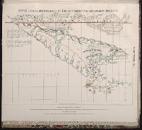
- Beinecke Rare Book and Manuscript Library > Lengths of the principal rivers in the world
- Published / Created:
- 1850
- Call Number:
- 1975 Folio 26
- Collection Title:
- A new universal atlas containing maps of the various empires, kingdoms, states and republics of the
- Image Count:
- 1
- Resource Type:
- Maps, Atlases & Globes
- Found in:
- Beinecke Rare Book and Manuscript Library > A new map of Maine
- Published / Created:
- 1846
- Call Number:
- 1976 Folio 93
- Collection Title:
- Mitchell’s universal atlas
- Image Count:
- 1
- Resource Type:
- Maps, Atlases & Globes
- Found in:
- Beinecke Rare Book and Manuscript Library > A new map of Maine
- Published / Created:
- 1833
- Call Number:
- 1976 Folio 98
- Collection Title:
- A new universal atlas, containing maps of the various empires, kingdoms, states and republics of
- Image Count:
- 1
- Resource Type:
- Maps, Atlases & Globes
- Found in:
- Beinecke Rare Book and Manuscript Library > A new map of Maine
- Published / Created:
- 1850
- Call Number:
- 1976 Folio 96
- Collection Title:
- A new universal atlas containing maps of the various empires, kingdoms, states and republics of the
- Image Count:
- 1
- Resource Type:
- Maps, Atlases & Globes
- Found in:
- Beinecke Rare Book and Manuscript Library > A new map of Maine
- Call Number:
- 1976 Folio 94
- Collection Title:
- A new universal atlas containing maps of the various empires, kingdoms, states and republics of the
- Image Count:
- 1
- Resource Type:
- Maps, Atlases & Globes
- Found in:
- Beinecke Rare Book and Manuscript Library > A new map of Maine
- Creator:
- Benitz, A.
- Published / Created:
- [1840]
- Call Number:
- 1973 Folio 105
- Collection Title:
- Atlas fisico y politico de la Republica de Venezuela ... por ... Agustin Codazzi ...
- Image Count:
- 1
- Resource Type:
- Maps, Atlases & Globes
- Found in:
- Beinecke Rare Book and Manuscript Library > Mapa de las costas de Tierra-Firme desde el Orinoco hasta Yucatan: de las islas Antillas y la mayor parte de las Lucayas, con las derrotas que siguio Dn. Cristobal Colon en sus descubrimientos por estos mares y las derrotas de otros navegantes que reconoc
- Creator:
- Benitz, A.
- Published / Created:
- [1840]
- Call Number:
- 1973 Folio 105
- Collection Title:
- Atlas fisico y politico de la Republica de Venezuela ... por ... Agustin Codazzi ...
- Image Count:
- 1
- Resource Type:
- Maps, Atlases & Globes
- Found in:
- Beinecke Rare Book and Manuscript Library > Mapa fisico de Venezuela, divida en hoyas hydrograficas.
- Creator:
- Benitz, A.
- Published / Created:
- [1840]
- Call Number:
- 1973 Folio 105
- Collection Title:
- Atlas fisico y politico de la Republica de Venezuela ... por ... Agustin Codazzi ...
- Image Count:
- 1
- Resource Type:
- Maps, Atlases & Globes
- Found in:
- Beinecke Rare Book and Manuscript Library > [Provincia de Apure]
- Creator:
- Benitz, A.
- Published / Created:
- [1840]
- Call Number:
- 1973 Folio 105
- Collection Title:
- Atlas fisico y politico de la Republica de Venezuela ... por ... Agustin Codazzi ...
- Image Count:
- 1
- Resource Type:
- Maps, Atlases & Globes
- Found in:
- Beinecke Rare Book and Manuscript Library > Carta del Canton de Upata de la provincia de la Guayana
- Creator:
- Benitz, A.
- Published / Created:
- [1840]
- Call Number:
- 1973 Folio 105
- Collection Title:
- Atlas fisico y politico de la Republica de Venezuela ... por ... Agustin Codazzi ...
- Image Count:
- 1
- Resource Type:
- Maps, Atlases & Globes
- Found in:
- Beinecke Rare Book and Manuscript Library > Carta del Canton de Angostura de la provincia de la Guayana
- Creator:
- Raleigh, Walter, Sir, 1552?-1618
- Call Number:
- 1978 Folio 106
- Collection Title:
- Maps of the Orinoco-Essequibo region, South America. Compiled for the Commission appointed by the
- Image Count:
- 1
- Resource Type:
- Maps, Atlases & Globes
- Found in:
- Beinecke Rare Book and Manuscript Library > Chart of Guiana by Sir Walter Raleigh, [1595?]
- Creator:
- Bry, Theodor de, 1528-1598
- Call Number:
- 1978 Folio 106
- Collection Title:
- Maps of the Orinoco-Essequibo region, South America. Compiled for the Commission appointed by the
- Image Count:
- 1
- Resource Type:
- Maps, Atlases & Globes
- Found in:
- Beinecke Rare Book and Manuscript Library > Map of Guiana by Theodore de Bry, 1599
- Creator:
- Sanson, Nicolas, 1600-1667
- Call Number:
- 1978 Folio 106
- Collection Title:
- Maps of the Orinoco-Essequibo region, South America. Compiled for the Commission appointed by the
- Image Count:
- 1
- Resource Type:
- Maps, Atlases & Globes
- Found in:
- Beinecke Rare Book and Manuscript Library > Map of Guiana and Caribana by N. Sanson d'Abbeville, Paris, 1656
- Creator:
- Arrowsmith, John, 1790-1873
- Published / Created:
- 1832
- Call Number:
- 1978 Folio 106
- Collection Title:
- Maps of the Orinoco-Essequibo region, South America. Compiled for the Commission appointed by the
- Image Count:
- 1
- Resource Type:
- Maps, Atlases & Globes
- Found in:
- Beinecke Rare Book and Manuscript Library > Part of a map of Colombia by J. Arrowsmith, London, 1832
- Creator:
- Gumilla, Joseph, d. 1750
- Published / Created:
- 1741
- Call Number:
- 1978 Folio 106
- Collection Title:
- Maps of the Orinoco-Essequibo region, South America. Compiled for the Commission appointed by the
- Image Count:
- 1
- Resource Type:
- Maps, Atlases & Globes
- Found in:
- Beinecke Rare Book and Manuscript Library > Map of the Jesuit missions of New Granada, by father Joseph Gumilla, S. J., Madrid, 1741
- Published / Created:
- 1778
- Call Number:
- 1978 Folio 106
- Collection Title:
- Maps of the Orinoco-Essequibo region, South America. Compiled for the Commission appointed by the
- Image Count:
- 1
- Resource Type:
- Maps, Atlases & Globes
- Found in:
- Beinecke Rare Book and Manuscript Library > Map of the Spanish privince of Nueva Andalucia made at the order of the head of the Spanish Archive of the Indies by Luis de Surville, Assistant Archivist, 1778
- Published / Created:
- [15--]
- Call Number:
- 1978 Folio 106
- Collection Title:
- Maps of the Orinoco-Essequibo region, South America. Compiled for the Commission appointed by the
- Image Count:
- 1
- Resource Type:
- Maps, Atlases & Globes
- Found in:
- Beinecke Rare Book and Manuscript Library > Early Spanish map of Guiana
- Creator:
- Jode, Gerard de, 1509-1591
- Published / Created:
- [1578]
- Call Number:
- 1976 Folio 2
- Image Count:
- 1
- Found in:
- Beinecke Rare Book and Manuscript Library > Specvlvum orbis terrarvm.
- Creator:
- Faden, William, 1749-1836, creator
Palmer, W. (William), 1739-1812
- Published / Created:
- 1786 January 11
- Call Number:
- 1982 Folio 10
- Image Count:
- 1
- Found in:
- Beinecke Rare Book and Manuscript Library > The sea of Marmara or Propontis: with the straits of Constantinople and of Gallipoli