Great Britain. War Office. General Staff. Geographical Section
Published / Created:
1942
Call Number:
68 B64 1942
Container / Volume:
BRBL_00350
Image Count:
1
Resource Type:
Maps, Atlases & Globes
Alternative Title:
Geographical Section, General Staff ; no.4275 and GSGS (Series) ; 4275.
Description:
"Contours are shown at 20 metre vertical interval.", "Revised and copied from an intelligence plan dated 1935.", In upper margin: Algeria 1:10,000 ..., and Military grid.
Great Britain. War Office. General Staff. Geographical Section United States. Army Map Service
Published / Created:
1942
Call Number:
354 1942
Container / Volume:
BRBL_00112
Image Count:
1
Resource Type:
Maps, Atlases & Globes
Alternative Title:
[G.S.G.S.] 4327 and GSGS (Series) ; 4327.
Description:
"Copied from a map produced by 512 (A. Fd. svy.) coy. R.E., January 1942 and collated by Mid-Asiatic bureau M.E.", In lower right corner of margin: Reprint November 1942., Relief shown by hachures and shading., and Two gauges of railroads, principal roads and tr
Great Britain. War Office. General Staff. Geographical Section
Published / Created:
1945
Call Number:
56 C442 1945
Container / Volume:
BRBL_00296
Image Count:
1
Resource Type:
Maps, Atlases & Globes
Alternative Title:
Great Britain. War Office. General Staff. Geographical Section. G.S.G.S. ; 2400. and Its G.S.G.S. ; 2400
Description:
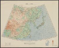
"Form lines are shown at about 30 feet V.I.", "Polyconic projection.", "Published at W.O., Dec. 1908. G.S.G.S. revised edition, 1927-AMS 1, 1944.", In upper margin: China 1:63,360 ..., Military grid., and Soundings are shown for port areas.
Publisher:
Army Map Service, U.S. Army,
Subject (Geographic):
Beidaihe (China)--Maps and Qinhuangdao Shi (China)--Maps
Great Britain. War Office. General Staff. Geographical Section
Published / Created:
1943
Call Number:
56cbf 1942
Container / Volume:
BRBL_00297
Image Count:
1
Resource Type:
Maps, Atlases & Globes
Alternative Title:
Great Britain. War Office. General Staff. Geographical Section. G.S.G.S. ; 4304. and Its [G.S.G.S.] ; 4304
Description:
"Drawn and reproduced by 512 (A. Fd. svy.) coy., R.E., Dec. 1941. Compiled from G.S.G.S. 4065 and 2957.", "Published by W.O. 1942.", Elevations shown by altitude tints., Marginal map: Index to adjoining sheet [Malaya] and boundaries., and Relief shown by contours
Great Britain. War Office. General Staff. Geographical Section
Published / Created:
1943
Call Number:
67 R11 1942
Container / Volume:
BRBL_00348
Image Count:
1
Resource Type:
Maps, Atlases & Globes
Alternative Title:
Geographical Section, General Staff ; no. 4241 and GSGS (Series) ; 4035.
Description:
"Contours at 2.5 metre interval.", "Copied from a French map dated 1933." Published in 1941 and 1942 by War Office., "Legend" gives key to points of interest; important streets of Rabat are named., and Military grid.