Skip to search
Skip to main content
Skip to first result
Search
You Searched For
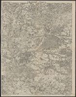
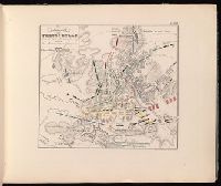
%22Austria--Maps%22
New Search
Search Results
Creator:
Published / Created:
2d. July 1772.
Call Number:
71 1763
Container / Volume:
BRBL_00364
Image Count:
4
Resource Type:
Maps , Atlases & Globes
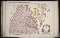
Alternative Title:
Particular map of Baffin and Hudson's
Description:
map of Baffin and Hudson's Bay" and "The
Subject (Geographic):
North America--Maps --Early works to
Subject (Topic):
British--America--Maps --Early works to
Found in:
Beinecke Rare Book and Manuscript Library > An accurate map of North America [cartographic material] : Describing and distinguishing the British and Spanish dominions on this great continent; according to the definitive treaty concluded at Paris 10th Feby. 1763. Also all the West India Islands belo
Creator:
From the Collection: Lmanian, Alexander, 1925-1996
Published / Created:
1968 April 13
Call Number:
GEN MSS 590
Container / Volume:
Box 1, folder 21-23
Image Count:
8
Found in:
Beinecke Rare Book and Manuscript Library > Photographs of Washington, D.C., and New Haven, Connecticut (GEN MSS 590) > Series I: Negatives > Negatives from Negative Sleeve Book > Copy photograph of a map of and a tally of costs
Creator:
Published / Created:
1864]
Call Number:
787hc 1864C
Container / Volume:
BRBL_00517A
Image Count:
2
Resource Type:
Maps , Atlases & Globes
Alternative Title:
[Sherman map collection ; no. 22 ]
Subject (Geographic):
Alabama--Maps
Found in:
Beinecke Rare Book and Manuscript Library > Part of northern Georgia : / compiled under the direction of Capt. Wm. E. Merrill, Chief Top'l Eng'r, D.C.
Call Number:
1976 1233
Collection Title:
Twenty four new and accurate maps of the several parts of Europe ... : all (except the last) new
Image Count:
1
Description:
In pencil on verso: 22 .
Subject (Geographic):
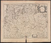
Switzerland --Maps --Early works to
Found in:
Beinecke Rare Book and Manuscript Library > Suisse or Switzerland together with their allies & subjects &c
Creator:
Published / Created:
[1618]
Call Number:
1983 Folio 19
Collection Title:
[Atlas factice of 96 maps by Blaeu, Visscher, Jansson, Hondius and others]
Image Count:
1
Description:
. Sheet measures 45.7 x 54.6 cm. No. 22 of 92
Subject (Geographic):
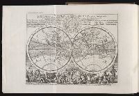
America --Maps --Early works to 1800
Found in:
Beinecke Rare Book and Manuscript Library > America noviter delineata / auct. Judoco Hondio
Call Number:
1976 1233
Collection Title:
Forty-two new maps of Asia, Africa, and America ... : all engrav’d, according to the latest
Image Count:
1
Description:
In ink on verso: 22 .
Subject (Geographic):
Ethiopia --Maps --Early works to 1800
Found in:
Beinecke Rare Book and Manuscript Library > Abissina and Anian &c
Creator:
Published / Created:
1759
Call Number:
774 1759
Container / Volume:
BRBL_00497
Image Count:
3
Resource Type:
Maps , Atlases & Globes
Alternative Title:
Map of the improved part of the
Subject (Geographic):
political divisions--Maps --Early works to 1800
Found in:
Beinecke Rare Book and Manuscript Library > To the honourable Thomas Penn and Richard Penn...this map of the improved part of the province of Pennsylvania is humbly dedicated / by Nicholas Scull ; engraved by Ja. Turner.
Creator:
Published / Created:
1943
Call Number:
11hd 1939-1
Image Count:
1
Resource Type:
Maps , Atlases & Globes
Description:
"Enlargement of original map drawn for
Subject (Geographic):
Europe, Western--Maps
Subject (Topic):
, Western--Maps
Found in:
Beinecke Rare Book and Manuscript Library > Winter Projection / TIME map by R. M. Chapin, Jr.
Creator:
From the Collection: Kissinger, Henry, 1923-2023
Published / Created:
1967-1973
Call Number:
MS 2004
Container / Volume:
Box 206, folder 4
Image Count:
58
Found in:
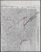
Manuscripts and Archives > Henry A. Kissinger papers, part III (MS 2004) > Series V: Writing and Research Materials > Research files for books > White House Years > Maps of Middle East
Creator:
From the Collection: Kissinger, Henry, 1923-2023
Published / Created:
1970, undated
Call Number:
MS 2004
Container / Volume:
Box 206, folder 3
Image Count:
76
Found in:
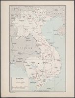
Manuscripts and Archives > Henry A. Kissinger papers, part III (MS 2004) > Series V: Writing and Research Materials > Research files for books > White House Years > Maps of Indochina
Creator:
Published / Created:
[1943]
Call Number:
382 1943
Container / Volume:
BRBL_00175
Image Count:
1
Resource Type:
Maps , Atlases & Globes
Description:
"22 November 1943."
Subject (Geographic):
Normandy (France)--Maps
Subject (Topic):
Beaches--France--Normandy--Maps
Found in:
Beinecke Rare Book and Manuscript Library > Beaches of Normandy - Vierville to Houlgate [cartographic material] / compiled and drawn in the Branch of Research and Analysis, OSS.
Creator:
Published / Created:
1944
Call Number:
28 1944C
Container / Volume:
BRBL_00023E
Image Count:
1
Resource Type:
Maps , Atlases & Globes
Description:
"No. 3764--R & A, OSS; 22 June 1944."
Subject (Geographic):
Visayan Islands (Philippines)--Maps
Subject (Topic):
--Maps
Found in:
Beinecke Rare Book and Manuscript Library > Philippine Islands, transportation facilities of the southern Visayan Islands.
Creator:
Published / Created:
1944
Call Number:
28 1944D
Container / Volume:
BRBL_00023E
Image Count:
1
Resource Type:
Maps , Atlases & Globes
Description:
"No. 3417--R & A, OSS; 22 June 1944."
Subject (Geographic):
Visayan Islands (Philippines)--Maps
Subject (Topic):
--Maps
Found in:
Beinecke Rare Book and Manuscript Library > Philippine Islands, transportation facilities of the northern Visayan Islands.
Creator:
From the Collection: Kissinger, Henry, 1923-2023
Published / Created:
1970-1979, undated
Call Number:
MS 2004
Container / Volume:
Box 206, folder 2
Image Count:
130
Found in:
Manuscripts and Archives > Henry A. Kissinger papers, part III (MS 2004) > Series V: Writing and Research Materials > Research files for books > White House Years > Maps and photographs for White House Years
Published / Created:
1918
Call Number:
11hc 1918-Z12
Container / Volume:
BRBL_00010G
Image Count:
2
Resource Type:
Maps , Atlases & Globes
Description:
On verso: Map with "Bl.22 .La Malmaison
Subject (Geographic):
France--Maps
Found in:
Beinecke Rare Book and Manuscript Library > Clermont-Noyon.
Call Number:
402 M59 1630
Container / Volume:
BRBL_00233A
Image Count:
2
Resource Type:
Maps , Atlases & Globes
Description:
Signature R, page number 22 on verso.
Subject (Geographic):
Milan (Italy : Province)--Maps --Early
Found in:
Beinecke Rare Book and Manuscript Library > Stato di Milano.
Published / Created:
1965-1966
Call Number:
GEN MSS 1319
Container / Volume:
Box 4
Image Count:
1640
Found in:
Beinecke Rare Book and Manuscript Library > The Vinland Map and the Tartar Relation: proofs and subject files (GEN MSS 1319) > Series II: Subject files > Newspaper and magazine clippings
Creator:
Published / Created:
1739
Call Number:
1996 +91
Image Count:
3
Resource Type:
Books, Journals & Pamphlets
Description:
Frontispiece map , 25 x 41 cm.
Subject (Geographic):
Madras (India)--Maps --Early works to
Found in:
Beinecke Rare Book and Manuscript Library > Modern history: or, The present state of all nations. Describing their respective situations, persons, habits, ... animals and minerals. ... By Mr. Salmon. Illustrated with cuts and maps ... by Herman Moll ...
Creator:
Published / Created:
1559
Call Number:
Beinecke MS 560
Image Count:
33
Resource Type:
text
Description:
-Grra-Phia" in red. The maps show varying
Subject (Topic):
Manuscript maps
Found in:
Beinecke Rare Book and Manuscript Library > Portolan atlas
Creator:
Published / Created:
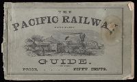
c1870.
Call Number:
Zc10 870hac
Image Count:
67
Description:
Maps have 6 panels and are bound in at
Subject (Topic):
Railroads--Maps
Found in:
Beinecke Rare Book and Manuscript Library > The traveler's own book, a panorama of overland travel, from Chicago to San Francisco via the great and attractive route, Chicago Burlington & Quincy R.R. ... Burlington & Missouri River R.R. ... Union Pacific Railroad ... Utah Central Railroad ... Central Pacific Railroad ... Western Pacific Railroad ... containing complete traveler's maps ... By Alfred A. Hart.
Creator:
Published / Created:
1595
Call Number:
Pequot +L65
Collection Title:
Nauigatio ac itinerarium Iohannis Hugonis Linscotani in Orientalem siue Lusitanorum Indiam
Image Count:
1
Description:
Bound in following page 22 .
Subject (Geographic):
Borneo --Maps
Found in:
Beinecke Rare Book and Manuscript Library > Exacta & accurata delineatio cum orarum maritimarum tum etiam locorum terrestrium quae in regionibus China, Cauchinchina, Camboia sive Champa, Syao, Malacca, Arracamn & Pegu ...
Creator:
From the Collection: Kissinger, Henry, 1923-2023
Published / Created:
2004
Call Number:
MS 1981
Container / Volume:
Box 745, folder 9
Image Count:
176
Found in:
Manuscripts and Archives > Henry A. Kissinger papers, part II (MS 1981) > Series III: Post-Government Career > Speeches and writings > General > Testimony before Senate Foreign Relations Committee on "Middle East: Re-thinking the Road Map," Feb 24, 2004 [2 of 2]
Call Number:
WA MSS 443
Collection Title:
Isaac Ingalls Stevens papers
Container / Volume:
Box 2 | Folder 29
Image Count:
51
Resource Type:
Archives or Manuscripts
Abstract:
. I. Stevens. 49 p.
Map , "Plan of the
Found in:
Beinecke Rare Book and Manuscript Library > [Delacy, Walter Washington]
Creator:
From the Collection: Kissinger, Henry, 1923-2023
Published / Created:
2004
Call Number:
MS 1981
Container / Volume:
Box 745, folder 8
Image Count:
318
Found in:
Manuscripts and Archives > Henry A. Kissinger papers, part II (MS 1981) > Series III: Post-Government Career > Speeches and writings > General > Testimony before Senate Foreign Relations Committee on "Middle East: Re-thinking the Road Map," Feb 24, 2004 [1 of 2]
Creator:
Published / Created:
1789 June 1
Call Number:
1982 Folio 10
Image Count:
1
Description:
No. 22 of 43 maps bound together in
Subject (Geographic):
Germany --Maps --Early works to 1800
Found in:
Beinecke Rare Book and Manuscript Library > A new map of the King of Great Britain's dominions in Germany or the electorate of Brunswick-Luneburg and its dependencies
Creator:
Published / Created:
[1706?]
Call Number:
1973 Folio 10
Image Count:
1
Resource Type:
Maps , Atlases & Globes
Description:
No. 22 of 69 maps bound together in
Subject (Geographic):
Italy, Southern --Maps --Early works to
Found in:
Beinecke Rare Book and Manuscript Library > Regnum Neapolis: in quo sunt Aprutium ulterius et citerius, Comitatus Molisius, Terra Laboris, Capitaniata Principatus ulterior et citerior, Terra Bariensis et Hidruntina, Basilicata, Calabria citerior et ulterior
Creator:
Published / Created:
[1730?]
Call Number:
755 1730
Container / Volume:
BRBL_00426
Image Count:
1
Resource Type:
Maps , Atlases & Globes
Subject (Geographic):
Louisiana--Maps --Early works to 1800
Found in:
Beinecke Rare Book and Manuscript Library > Carte de la Louisiane et du cours du Mississipi / dressée sur un grand nombre de memoires entr'autres sur ceux de Mr. le Maire, par Guillme. de L'Isle de l'Academie Rle. des Sciences.
Creator:
From the Collection: Stenzel, Franz
Published / Created:
n.d.
Call Number:
WA MSS S-2368
Container / Volume:
Box 7, folder 134
Image Count:
1
Found in:
Beinecke Rare Book and Manuscript Library > Franz R. and Kathryn M. Stenzel collection of western American art (WA MSS S-2368) > Series II: James G. Swan Artwork and Associated Material > ... > ARTWORK > Works by Swan > Views of Native American Life > [Map of coastal village Alekistet?] Pencil drawing, 19.1 x 22 cm.
Creator:
Published / Created:
1804?
Call Number:
WA MSS 303
Collection Title:
Lewis and Clark Expedition maps and receipt, ca. 1803-1810
Container / Volume:
Box 1 | Folder 8
Image Count:
2
Found in:
Beinecke Rare Book and Manuscript Library > Evans's Map 5 (the Expedition's route about October 14-22, 1804)
Creator:
Map Company
Published / Created:
August, 1923.
Call Number:
776 B764 1923
Container / Volume:
BRBL_00502
Image Count:
4
Resource Type:
Maps , Atlases & Globes
Abstract:
Fire insurance map , colored to show
Description:
Coordinates not present on map and are
Publisher:
Sanborn Map Company,
Subject (Geographic):
Bridgeville (Del.)--Maps .
Subject (Topic):
--Bridgeville--Maps .
Found in:
Beinecke Rare Book and Manuscript Library > Bridgeville, Sussex County, Delaware.
Published / Created:
1595
Call Number:
Taylor 219
Collection Title:
Navigatio ac itinerarivm Iohannis Hvgonis Linscotani in Orientalem sive Lvsitanorvm Indiam
Image Count:
1
Description:
Bound in following page 22 .
Subject (Geographic):
Borneo --Maps
Found in:
Beinecke Rare Book and Manuscript Library > Exacta & accurata delineatio cum orarum maritimarum tum etiam locorum terrestrium quae in regionibus China, Cauchinchina, Camboia sive Champa, Syao, Malacca, Arracamn & Pegu ...
Creator:
From the Collection: Fellows, Abraham Lincoln, 1864-1942
Published / Created:
1901-1904, n.d.
Call Number:
WA MSS S-1296
Container / Volume:
Box 3, folder 28
Image Count:
146
Found in:
Beinecke Rare Book and Manuscript Library > Abraham Lincoln Fellows papers (WA MSS S-1296) > Gunnison Tunnel Files > Photograph album: Gunnison Tunnel
Creator:
Published / Created:
1804
Call Number:
WA MSS 303
Collection Title:
Lewis and Clark Expedition maps and receipt, ca. 1803-1810
Container / Volume:
Box 1 | Folder 9
Image Count:
2
Found in:
Beinecke Rare Book and Manuscript Library > Evans's Map 6 (the Expedition's route about October 22-November 1, 1804)
Creator:
Map Company, issuing body
Published / Created:
1922
Call Number:
766 F16 1922
Image Count:
22
Resource Type:
Maps , Atlases & Globes
Abstract:
Sanborn fire insurance maps are a rich
Description:
"22 sheets (5093)."
Subject (Geographic):
Fairfield (Conn.)--Maps
Subject (Topic):
--Fairfield--Maps
Found in:
Beinecke Rare Book and Manuscript Library > Fairfield, Fairfield County, Connecticut.
Published / Created:
[193-?]
Call Number:
Zc41 930ga
Image Count:
28
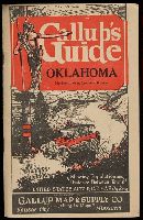
Alternative Title:
Gallup's guide auto route & highway map
Publisher:
Gallup Map & Supply Co.
Found in:
Beinecke Rare Book and Manuscript Library > Gallup's guide Oklahoma, northern Texas southern Kansas : showing population and distance between towns, United States auto road map on back [of state map].
Creator:
Published / Created:
1777
Call Number:
73 1777
Container / Volume:
BRBL_00373
Image Count:
1
Resource Type:
Maps , Atlases & Globes
Alternative Title:
[American maps ; v. 3, no. 22 ]
Subject (Geographic):
Canada--Boundaries--United States--Maps
Found in:
Beinecke Rare Book and Manuscript Library > A map of the inhabited part of Canada from the French surveys, with the frontiers of New York and New England; from the large survey by Claude Joseph Sauthier. Engraved by Wm. Faden, 1777.
Creator:
Published / Created:
1927-1929.
Call Number:
GEN MSS 583
Image Count:
103
Resource Type:
Archives or Manuscripts
Abstract:
album by a map of the region with
Found in:
Beinecke Rare Book and Manuscript Library > Africa : a survey inspection tour.
Creator:
Map Company, issuing body
Published / Created:
1912
Call Number:
766 D444 1912
Image Count:
22
Resource Type:
Maps , Atlases & Globes
Abstract:
Sanborn fire insurance maps are a rich
Description:
"22 sheets. (4763)."
Subject (Geographic):
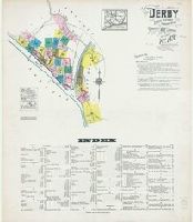
Derby (Conn.)--Maps
Subject (Name):
Library of Congress. Map Division Stamp
Subject (Topic):
--Derby--Maps
Found in:
Beinecke Rare Book and Manuscript Library > Insurance maps of Derby and Shelton, New Haven County, Connecticut.
Creator:
Published / Created:
ca. 1702?]
Call Number:
1973 Folio 18
Image Count:
1
Resource Type:
Maps , Atlases & Globes
Description:
cm. No. 22 of 87 maps bound together.
Subject (Geographic):
Germany, Northern--Maps --Early works to
Found in:
Beinecke Rare Book and Manuscript Library > Circulus Saxoniae Inferioris, divisa in ducatus Brunsuici, Zellae, Holsatiae, Meklenburgi et Bremae, archiepiscopatum Magdeburgi, et episcopatus Hildesii et Halberstadii [cartographic material] / per Gerardi et Leonardi Valk, cum privilegio.
Published / Created:
1847 February 22
Call Number:
WA MSS S-1882
Image Count:
1
Resource Type:
Maps , Atlases & Globes
Abstract:
Autograph manuscript map , drawn on
Description:
Map has been repaired with two pieces
Subject (Geographic):
San Francisco (Calif.) --Maps
Found in:
Beinecke Rare Book and Manuscript Library > Map of San Francisco, Calif., 1847
Creator:
Published / Created:
[1840?]
Call Number:
2002 Folio 32
Image Count:
1
Description:
de 22 aôut, 1852, Belgique, France
Subject (Geographic):
France--History--Revolution--Maps
Found in:
Beinecke Rare Book and Manuscript Library > Atlas portatif pour l'intelligence des relations des dernières guerres : publiées sans plans ; notamment pour la vie de Napoléon.
Creator:
Published / Created:
c1903.
Call Number:
792 1903
Container / Volume:
BRBL_00519
Image Count:
2
Resource Type:
Maps , Atlases & Globes
Alternative Title:
Hammonds 16 x 22 map of Florida
Subject (Geographic):
Florida--Maps
Subject (Topic):
Railroads--Florida--Maps
Found in:
Beinecke Rare Book and Manuscript Library > The Clyde Steamship Co. map of Florida : showing routes and railroad connections.
Creator:
Map Company, issuing body
Published / Created:
1906
Call Number:
766 An81 1906
Image Count:
22
Resource Type:
Maps , Atlases & Globes
Abstract:
Sanborn fire insurance maps are a rich
Description:
"22 sheets (8531)."
Subject (Geographic):
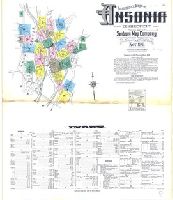
Ansonia (Conn.)--Maps
Subject (Name):
Library of Congress. Map Divison Stamp
Subject (Topic):
--Ansonia--Maps
Found in:
Beinecke Rare Book and Manuscript Library > Insurance maps of Ansonia, Connecticut, New Haven County.
Creator:
Map Company, issuing body
Published / Created:
1923
Call Number:
766 So87 1923
Image Count:
22
Resource Type:
Maps , Atlases & Globes
Abstract:
Sanborn fire insurance maps are a rich
Description:
"22 sheets. (5907)."
Subject (Geographic):
Southington (Conn.)--Maps
Subject (Topic):
--Southington--Maps
Found in:
Beinecke Rare Book and Manuscript Library > Southington, including Plantsville and Milldale, Hartford County, Connecticut.
Creator:
Published / Created:
[1783?]
Call Number:
1977 Folio 177
Image Count:
4
Resource Type:
Maps , Atlases & Globes
Description:
measure 70.0 x 50.5 cm or smaller. No. 22 of
Subject (Geographic):
Great Britain--Maps --Early works to
Found in:
Beinecke Rare Book and Manuscript Library > England and Ireland : containing all the cities, boroughs, markettowns & principal villages : with the coast of France from Calais to Brest delineated and engraved from actual surveys / by Richard William Seale.
Creator:
Published / Created:
1761
Call Number:
762 1761
Container / Volume:
BRBL_00450
Image Count:
2
Resource Type:
Maps , Atlases & Globes
Description:
topography of North America. 1768. no. 22 , plates
Found in:
Beinecke Rare Book and Manuscript Library > An accurate map of His Majesty's Province of New-Hampshire in New England, taken from actual surveys of all the inhabited part, and from the best information of what is uninhabited, together with the adjacent countries, which exhibits the theatre of this
Creator:
Published / Created:
[ca. 1734]
Call Number:
1973 Folio 18
Image Count:
1
Resource Type:
Maps , Atlases & Globes
Description:
, map 22 .
Subject (Geographic):
Wismar (Germany)--Maps --Early works to
Found in:
Beinecke Rare Book and Manuscript Library > Nieuwe afteekening van de Haven en Stad Wismar [cartographic material] : met desselfs inkoomende Zee Gaatten soo beoosten als bewesten Poel Eyland en beleegering van dito Stad.
Creator:
Published / Created:
1771
Call Number:
BrSides Folio 2017 8
Image Count:
1
Resource Type:
Maps , Atlases & Globes
Description:
Left sheet: bottom right: 22 . Right
Subject (Geographic):
Asiatic Russia--Maps --Early works to
Found in:
Beinecke Rare Book and Manuscript Library > Partie orientale de l'empire de Russie : extrait de l'Atlas Russien et d'autres cartes / projetée et assujetie aux observations astronomiques posterieures, par Mr. Bonne m.tre de mathémat. ; Arrivet inv. & sculp.
Creator:
Published / Created:
1792-1800, bulk 1792-1794.
Call Number:
WA MSS S-2405 (Oversize)
Image Count:
130
Abstract:
Fitzhugh Sound. There are two maps of Queen
Found in:
Beinecke Rare Book and Manuscript Library > Drawings and sketches made during a voyage around the world, 1791-1795
Creator:
Published / Created:
1753.
Call Number:
Topos M627 no. 16+
Image Count:
1
Resource Type:
still image
Description:
No. 22 , "Mr. and Mrs. George Morton
Found in:
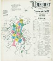
Lewis Walpole Library > A view of Governour Pitts house at Twickenham Vüe de la maison du Governour Pitt a Twickenham / [graphic] =
Creator:
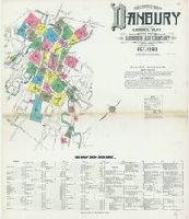
Map Company, issuing body
Published / Created:
1904
Call Number:
766 D19 1904
Image Count:
23
Resource Type:
Maps , Atlases & Globes
Abstract:
Sanborn fire insurance maps are a rich
Description:
Partial cadastral map .
Subject (Geographic):
Danbury (Conn.)--Maps
Subject (Name):
Library of Congress. Map Division Stamp
Subject (Topic):
--Danbury--Maps
Found in:
Beinecke Rare Book and Manuscript Library > Insurance maps of Danbury, Fairfield County, Connecticut.
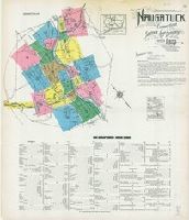
Creator:
Map Company, issuing body
Published / Created:
1923
Call Number:
766 N22 1923
Image Count:
23
Resource Type:
Maps , Atlases & Globes
Abstract:
Sanborn fire insurance maps are a rich
Description:
Partial cadastral map .
Subject (Geographic):
Naugatuck (Conn.)--Maps
Subject (Topic):
--Naugatuck--Maps
Found in:
Beinecke Rare Book and Manuscript Library > Naugatuck, New Haven County, Connecticut.
Creator:
Map Company, issuing body
Published / Created:
1931
Call Number:
766 W73 1931
Image Count:
23
Resource Type:
Maps , Atlases & Globes
Abstract:
Sanborn fire insurance maps are a rich
Description:
Partial cadastral map .
Subject (Geographic):
Winsted (Conn.)--Maps
Subject (Topic):
--Winsted--Maps
Found in:
Beinecke Rare Book and Manuscript Library > Winsted, Litchfield County, Connecticut.
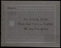
Creator:
Published / Created:
1900?]
Call Number:
Zc35 +900bL
Image Count:
25
Subject (Geographic):
Black Hills (S.D. and Wyo.)--Maps
Found in:
Beinecke Rare Book and Manuscript Library > Prospectus : the Black Hills Porcelain Clay and Marble Mining Company (incorporated under laws of South Dakota) ...
Creator:
Map Company, issuing body
Published / Created:
1924
Call Number:
766 B72 1924
Image Count:
24
Resource Type:
Maps , Atlases & Globes
Abstract:
Sanborn fire insurance maps are a rich
Description:
Partial cadastral map .
Subject (Geographic):
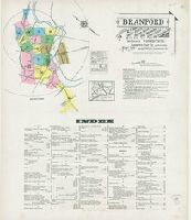
Branford (Conn.)--Maps
Subject (Topic):
--Branford--Maps
Found in:
Beinecke Rare Book and Manuscript Library > Branford : including Short Beach, Indian Neck, Pine Orchard, Stony Creek and Pine Orchard West, New Haven Co., Connecticut.
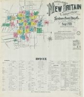
Creator:
Map Co., issuing body
Published / Created:
1895
Call Number:
766 N42 1895
Image Count:
24
Resource Type:
Maps , Atlases & Globes
Abstract:
Sanborn fire insurance maps are a rich
Description:
Partial cadastral map .
Subject (Geographic):
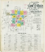
New Britain (Conn.)--Maps
Subject (Topic):
Britain--Maps
Found in:
Beinecke Rare Book and Manuscript Library > Insurance maps of New Britain, Hartford Co., Connecticut.
Creator:
Map Company, issuing body
Published / Created:
1911
Call Number:
766 An81 1911
Image Count:
25
Resource Type:
Maps , Atlases & Globes
Abstract:
Sanborn fire insurance maps are a rich
Description:
Partial cadastral map .
Subject (Geographic):
Ansonia (Conn.)--Maps
Subject (Topic):
--Ansonia--Maps
Found in:
Beinecke Rare Book and Manuscript Library > Insurance maps of Ansonia, Connecticut, New Haven County.
Creator:
Map Company, issuing body
Published / Created:
1912
Call Number:
766 G852 1912
Image Count:
25
Resource Type:
Maps , Atlases & Globes
Abstract:
Sanborn fire insurance maps are a rich
Description:
Partial cadastral map .
Subject (Geographic):
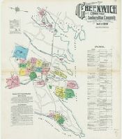
Greenwich (Conn. : Town)--Maps
Subject (Topic):
--Greenwich (Town)--Maps
Found in:
Beinecke Rare Book and Manuscript Library > Insurance Maps of Greenwich, Fairfield Co., Connecticut.
Creator:
Map Company, issuing body
Published / Created:
1919
Call Number:
766 M31 1919
Image Count:
25
Resource Type:
Maps , Atlases & Globes
Abstract:
Sanborn fire insurance maps are a rich
Description:
Partial cadastral map .
Subject (Geographic):
Manchester--Maps
Subject (Topic):
--Manchester--Maps
Found in:
Beinecke Rare Book and Manuscript Library > Insurance maps of Manchester and South Manchester, Hartford County, Connecticut.
Creator:
Map Company, issuing body
Published / Created:
1920
Call Number:
766 Ea76 1920
Image Count:
26
Resource Type:
Maps , Atlases & Globes
Abstract:
Sanborn fire insurance maps are a rich
Description:
Partial cadastral map .
Subject (Geographic):
East Hartford (Conn.)--Maps
Subject (Topic):
Hartford--Maps
Found in:
Beinecke Rare Book and Manuscript Library > East Hartford, Hartford County, Connecticut.
Creator:
Map Company, issuing body
Published / Created:
1924
Call Number:
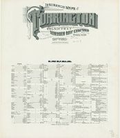
766 T63 1924
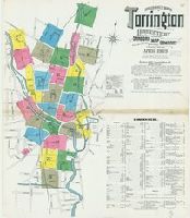
Image Count:
36
Resource Type:
Maps , Atlases & Globes
Abstract:
Sanborn fire insurance maps are a rich
Description:
Partial cadastral map .
Subject (Geographic):
Torrington (Conn.)--Maps
Subject (Topic):
--Torrington--Maps
Found in:
Beinecke Rare Book and Manuscript Library > Torrington, Litchfield County, Connecticut.
Creator:
Map Company, issuing body
Published / Created:
1911
Call Number:
766 M31 1911
Image Count:
27
Resource Type:
Maps , Atlases & Globes
Abstract:
Sanborn fire insurance maps are a rich
Description:
Partial cadastral map .
Subject (Geographic):
Manchester--Maps
Subject (Topic):
--Manchester--Maps
Found in:
Beinecke Rare Book and Manuscript Library > Insurance maps of Manchester, Hartford County, Connecticut.
Creator:
Map Co., issuing body
Published / Created:
1891
Call Number:
766 M54 1891
Image Count:
28
Resource Type:
Maps , Atlases & Globes
Abstract:
Sanborn fire insurance maps are a rich
Description:
Partial cadastral map .
Subject (Geographic):
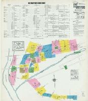
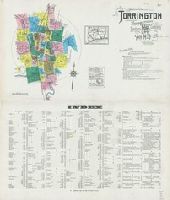
Meriden (Conn.)--Maps
Subject (Topic):
--Meriden--Maps
Found in:
Beinecke Rare Book and Manuscript Library > Meriden, Connecticut.
Creator:
Map Co., issuing body
Published / Created:
1901
Call Number:
766 M584 1901
Image Count:
27
Resource Type:
Maps , Atlases & Globes
Abstract:
Sanborn fire insurance maps are a rich
Description:
Partial cadastral map .
Subject (Geographic):
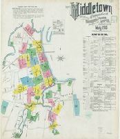
Middletown (Conn.)--Maps
Subject (Topic):
--Middletown--Maps
Found in:
Beinecke Rare Book and Manuscript Library > Insurance maps of Middletown, Middlesex County, Connecticut.
Creator:
Map Company, issuing body
Published / Created:
1920
Call Number:
766 M59 1920
Image Count:
28
Resource Type:
Maps , Atlases & Globes
Abstract:
Sanborn fire insurance maps are a rich
Description:
Partial cadastral map .
Subject (Geographic):
Milford (Conn.)--Maps
Subject (Topic):
--Milford--Maps
Found in:
Beinecke Rare Book and Manuscript Library > Insurance maps of Milford, New Haven County, Connecticut.
Creator:
Map Co., issuing body
Published / Created:
1901
Call Number:
766 N47 1901
Image Count:
27
Resource Type:
Maps , Atlases & Globes
Abstract:
Sanborn fire insurance maps are a rich
Description:
Partial cadastral map .
Subject (Geographic):
Groton (Conn.)--Maps
Subject (Topic):
--Groton--Maps
Found in:
Beinecke Rare Book and Manuscript Library > Insurance maps of New London, including Groton, New London County, Connecticut.
Creator:
Map Company, issuing body
Published / Created:
1911
Call Number:
766 B77 1911
Image Count:
26
Resource Type:
Maps , Atlases & Globes
Abstract:
Sanborn fire insurance maps are a rich
Description:
Partial cadastral map .
Subject (Geographic):
Bristol (Conn.)--Maps
Subject (Topic):
--Bristol--Maps
Found in:
Beinecke Rare Book and Manuscript Library > Insurance maps of Bristol, Hartford County, Connecticut.
Creator:
Map Company, issuing body
Published / Created:
1903
Call Number:
766 N835 1903
Image Count:
26
Resource Type:
Maps , Atlases & Globes
Abstract:
Sanborn fire insurance maps are a rich
Description:
Partial cadastral map .
Subject (Geographic):
Norwich (Conn.)--Maps
Subject (Topic):
--Norwich--Maps
Found in:
Beinecke Rare Book and Manuscript Library > Insurance maps of Norwich, New London Co., Connecticut.
Creator:
Map Co., issuing body
Published / Created:
1901
Call Number:
766 St22 1901
Image Count:
26
Resource Type:
Maps , Atlases & Globes
Abstract:
Sanborn fire insurance maps are a rich
Description:
Partial cadastral map .
Subject (Geographic):
Stamford (Conn.)--Maps
Subject (Topic):
--Stamford--Maps
Found in:
Beinecke Rare Book and Manuscript Library > Insurance maps of Stamford, Fairfield Co., Connecticut.
Creator:
Map Company, issuing body
Published / Created:
1924
Call Number:
766 W677 1924
Image Count:
26
Resource Type:
Maps , Atlases & Globes
Abstract:
Sanborn fire insurance maps are a rich
Description:
Partial cadastral map .
Subject (Geographic):
Coventry (Conn.)--Maps
Subject (Topic):
--Coventry--Maps
Found in:
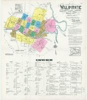
Beinecke Rare Book and Manuscript Library > Willimantic, including South Coventry, Storrs, South Windham, and Mansfield Center, Windham County, Connecticut.
Creator:
Published / Created:
[1868?]
Call Number:
1981 409
Image Count:
42
Resource Type:
Books, Journals & Pamphlets
Found in:
Beinecke Rare Book and Manuscript Library > Two months in Brittany with my knapsack and fly rod / by George Harrison.
Creator:
Published / Created:
1689
Call Number:
1973 425
Image Count:
29
Found in:
Beinecke Rare Book and Manuscript Library > Mr. Ogilby's and William Morgan's Pocket book of the roads : with their computed and measured distances, and the distinction of market and post-towns / by William Morgan ...
Creator:
Map Company, issuing body
Published / Created:
1919
Call Number:
766 D19 1919
Image Count:
29
Resource Type:
Maps , Atlases & Globes
Abstract:
Sanborn fire insurance maps are a rich
Description:
Partial cadastral map .
Subject (Geographic):
Danbury (Conn.)--Maps
Subject (Topic):
--Danbury--Maps
Found in:
Beinecke Rare Book and Manuscript Library > Insurance maps of Danbury, Fairfield County, Connecticut.
Creator:
Map & Publishing Co., issuing body
Published / Created:
1886
Call Number:
766 N46 1886 Copy 2
Image Count:
31
Resource Type:
Maps , Atlases & Globes
Abstract:
Sanborn fire insurance maps are a rich
Description:
Partial cadastral map .
Subject (Geographic):
New Haven (Conn.)--Maps
Subject (Topic):
Haven--Maps
Found in:
Beinecke Rare Book and Manuscript Library > Insurance maps of New Haven, Connecticut. Volume 1.
Creator:
Map Company, issuing body
Published / Created:
1912
Call Number:
766 So885 1912
Image Count:
28
Resource Type:
Maps , Atlases & Globes
Abstract:
Sanborn fire insurance maps are a rich
Description:
Partial cadastral map .
Subject (Geographic):
Norwalk (Conn.)--Maps
Subject (Topic):
--Norwalk--Maps
Found in:
Beinecke Rare Book and Manuscript Library > Insurance maps of South Norwalk, including East Norwalk, Rowayton, Bell Island, and Roton Point, Fairfield Co., Connecticut.
Creator:
Map Company, issuing body
Published / Created:
1909
Call Number:
766 T63 1909
Image Count:
28
Resource Type:
Maps , Atlases & Globes
Abstract:
Sanborn fire insurance maps are a rich
Description:
Partial cadastral map .
Subject (Geographic):
Torrington (Conn.)--Maps
Subject (Topic):
--Torrington--Maps
Found in:
Beinecke Rare Book and Manuscript Library > Insurance maps of Torrington, Litchfield Co., Connecticut.
Creator:
Map Company, issuing body
Published / Created:
1931
Call Number:
766 T63 1931
Image Count:
39
Resource Type:
Maps , Atlases & Globes
Abstract:
Sanborn fire insurance maps are a rich
Description:
Partial cadastral map .
Subject (Geographic):
Torrington (Conn.)--Maps
Subject (Topic):
--Torrington--Maps
Found in:
Beinecke Rare Book and Manuscript Library > Torrington, Litchfield County, Connecticut.
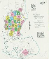
Creator:
Map Company, issuing body
Published / Created:
1924
Call Number:
766 St82 1924
Image Count:
41
Resource Type:
Maps , Atlases & Globes
Abstract:
Sanborn fire insurance maps are a rich
Description:
Partial cadastral map .
Subject (Geographic):
Stratford (Conn.)--Maps
Subject (Topic):
--Stratford--Maps
Found in:
Beinecke Rare Book and Manuscript Library > Insurance maps of Stratford, including Lordship Manor, Fairfield County, Connecticut.
Creator:
Published / Created:
MDCXIII [1613]. Avec privilege dv Roy.
Call Number:
Taylor 257
Image Count:
1
Resource Type:
Books, Journals & Pamphlets
Description:
22 x 26 cm.) bound in after p. 22 (first
Subject (Geographic):
New France--Maps .
Found in:
Beinecke Rare Book and Manuscript Library > Les voyages dv sievr de Champlain Xaintongeois, capitaine ordinaire pour le Roy, en la marine : divisez en devx livres, ou, iovrnal tres-fidele des observations faites es descouuertures de la Nouuelle France : tant en la descriptiõ des terres, costes, riuieres, ports, haures, leurs hauteurs, & plusieurs declinaisons de la guide-aymant : qu'en la crẽace des peuples, leur superstition, façon de viure & de guerroyer : enrichi de quantité de figures : Ensemble deux cartes geografiques : la premiere seruant à la nauigation, dressée selon les compas qui nordestent, sur lesquels les mariniers nauigent : l'autre en son vray Meridien, auec ses longitudes & latitudes : à laquelle est adiousté le voyage du destroict qu'ont trouué les Anglois, au dessus de Labrador, depuis le 53e. degré de latitude, iusques au 63e. en l'an 1612, cerchans vn chemin par le Nord, pour aller à la Chine.
Creator:
Published / Created:
1625]
Call Number:
343 1610
Container / Volume:
BRBL_00683
Image Count:
2
Resource Type:
Maps , Atlases & Globes
Alternative Title:
Chap. 22 , Discipline, honour, Island
Description:
Paginated 643-644; map on p. 644.
Subject (Geographic):
Iceland--Maps --Early works to 1800
Found in:
Beinecke Rare Book and Manuscript Library > Island [cartographic material].
Creator:
Map Company, issuing body
Published / Created:
1925
Call Number:
766 M59 1925
Image Count:
31
Resource Type:
Maps , Atlases & Globes
Abstract:
Sanborn fire insurance maps are a rich
Description:
Partial cadastral map .
Subject (Geographic):
Milford (Conn.)--Maps
Subject (Topic):
--Milford--Maps
Found in:
Beinecke Rare Book and Manuscript Library > Insurance maps of Milford, New Haven County, Connecticut, including Woodmont, Merwin's Point, Bay View, Fort Trumbull Beach, Silver Sands, Seaside, Myrtle Beach, Meadows End, Walnut Beach, Wildmere Beach, Laurel Beach, Cedar Beach, Devon and Rivercliff.
Creator:
Map Company, issuing body
Published / Created:
1924
Call Number:
766 D444 1924
Image Count:
30
Resource Type:
Maps , Atlases & Globes
Abstract:
Sanborn fire insurance maps are a rich
Description:
Partial cadastral map .
Subject (Geographic):
Derby (Conn.)--Maps
Subject (Topic):
--Derby--Maps
Found in:
Beinecke Rare Book and Manuscript Library > Derby, including East Derby, New Haven County, Connecticut.
Creator:
Map Company, issuing body
Published / Created:
1927
Call Number:
766 Ea76 1927
Image Count:
30
Resource Type:
Maps , Atlases & Globes
Abstract:
Sanborn fire insurance maps are a rich
Description:
Partial cadastral map .
Subject (Geographic):
East Hartford (Conn.)--Maps
Subject (Topic):
Hartford--Maps
Found in:
Beinecke Rare Book and Manuscript Library > East Hartford, Hartford County, Connecticut.
Creator:
Map Company, issuing body
Published / Created:
1915
Call Number:
766 T63 1915
Image Count:
32
Resource Type:
Maps , Atlases & Globes
Abstract:
Sanborn fire insurance maps are a rich
Description:
Partial cadastral map .
Subject (Geographic):
Torrington (Conn.)--Maps
Subject (Topic):
--Torrington--Maps
Found in:
Beinecke Rare Book and Manuscript Library > Insurance maps of Torrington, Litchfield Co., Connecticut.
Creator:
Map Co., issuing body
Published / Created:
1890
Call Number:
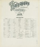
766 W29 1890
Image Count:
31
Resource Type:
Maps , Atlases & Globes
Abstract:
Sanborn fire insurance maps are a rich
Description:
Partial cadastral map .
Subject (Geographic):
Waterbury (Conn.)--Maps
Subject (Topic):
--Waterbury--Maps
Found in:
Beinecke Rare Book and Manuscript Library > Waterbury, New Haven County, Connecticut.
Creator:
Map Company, issuing body
Published / Created:
1909
Call Number:
766 D19 1909
Image Count:
33
Resource Type:
Maps , Atlases & Globes
Abstract:
Sanborn fire insurance maps are a rich
Description:
Partial cadastral map .
Subject (Geographic):
Danbury (Conn.)--Maps
Subject (Topic):
--Danbury--Maps
Found in:
Beinecke Rare Book and Manuscript Library > Insurance maps of Danbury, Fairfield County, Connecticut.
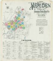
Creator:
Map Co., issuing body
Published / Created:
1896
Call Number:
766 M54 1896
Image Count:
32
Resource Type:
Maps , Atlases & Globes
Abstract:
Sanborn fire insurance maps are a rich
Description:
Partial cadastral map .
Subject (Geographic):
Meriden (Conn.)--Maps
Subject (Topic):
--Meriden--Maps
Found in:
Beinecke Rare Book and Manuscript Library > Insurance maps of Meriden, New Haven Co., Connecticut.
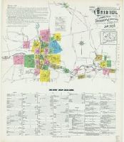
Creator:
Map Company, issuing body
Published / Created:
1907
Call Number:
766 M584 1907
Image Count:
32
Resource Type:
Maps , Atlases & Globes
Abstract:
Sanborn fire insurance maps are a rich
Description:
Partial cadastral map .
Subject (Geographic):
Middletown (Conn.)--Maps
Subject (Name):
Library of Congress. Map Division Stamp
Subject (Topic):
--Middletown--Maps
Found in:
Beinecke Rare Book and Manuscript Library > Insurance maps of Middletown, Middlesex County, Connecticut.
Creator:
Map Company, issuing body
Published / Created:
1916
Call Number:
766 B77 1916
Image Count:
32
Resource Type:
Maps , Atlases & Globes
Abstract:
Sanborn fire insurance maps are a rich
Description:
Partial cadastral map .
Subject (Geographic):
Bristol (Conn.)--Maps
Subject (Topic):
--Bristol--Maps
Found in:
Beinecke Rare Book and Manuscript Library > Insurance maps of Bristol, Hartford County, Connecticut.
Creator:
Map Company, issuing body
Published / Created:
1914
Call Number:
766 N835 1914
Image Count:
33
Resource Type:
Maps , Atlases & Globes
Abstract:
Sanborn fire insurance maps are a rich
Description:
Partial cadastral map .
Subject (Geographic):
Norwich (Conn.)--Maps
Subject (Topic):
--Norwich--Maps
Found in:
Beinecke Rare Book and Manuscript Library > Insurance maps of Norwich, New London Co., Connecticut.
Creator:
Published / Created:
1850
Call Number:
2003 1141
Container / Volume:
3
Image Count:
257
Found in:
Beinecke Rare Book and Manuscript Library > Mémoires d'un voyageur qui se repose : with illustrations : in four parts
Creator:
Published / Created:
[1925]
Call Number:
847 Se18 1922
Container / Volume:
BRBL_00627
Image Count:
2
Resource Type:
Maps , Atlases & Globes
Alternative Title:
City map of Seattle
Description:
Text and map of "Business section of
Subject (Geographic):
Seattle (Wash.)--Maps
Subject (Topic):
(State)--Seattle--Maps
Found in:
Beinecke Rare Book and Manuscript Library > Route map of Seattle / compiled and published by Automobile Club of Washington ; drawn by S.E. Brokaw, 6-15-22, cor. 4-27-25.
Creator:
Published / Created:
1755
Call Number:
2003 Folio 85
Image Count:
1
Description:
BEIN 2003 Folio 85: No. 22 of 45 maps
Subject (Geographic):
Maryland -- Maps -- 1755
Found in:
Beinecke Rare Book and Manuscript Library > Carte de la Virginie et du Maryland
Creator:
Map Company, issuing body
Published / Created:
1926
Call Number:
766 M31 1926
Image Count:
36
Resource Type:
Maps , Atlases & Globes
Abstract:
Sanborn fire insurance maps are a rich
Description:
Partial cadastral map .
Subject (Geographic):
Manchester--Maps
Subject (Topic):
--Manchester--Maps
Found in:
Beinecke Rare Book and Manuscript Library > Insurance maps of Manchester, including part of Highland Park and Manchester Green, Hartford Co., Connecticut.
Creator:
Map Co., issuing body
Published / Created:
1901
Call Number:
766 N42 1901
Image Count:
35
Resource Type:
Maps , Atlases & Globes
Abstract:
Sanborn fire insurance maps are a rich
Description:
Partial cadastral map .
Subject (Geographic):
New Britain (Conn.)--Maps
Subject (Topic):
Britain--Maps
Found in:
Beinecke Rare Book and Manuscript Library > Insurance maps of New Britain, Hartford County, Connecticut.
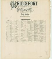
Creator:
Map & Publishing Co., issuing body
Published / Created:
1889
Call Number:
766 B76 1889
Image Count:
37
Resource Type:
Maps , Atlases & Globes
Abstract:
Sanborn fire insurance maps are a rich
Description:
Partial cadastral map .
Subject (Geographic):
Bridgeport (Conn.)--Maps
Subject (Topic):
--Bridgeport--Maps
Found in:
Beinecke Rare Book and Manuscript Library > Bridgeport, Connecticut.
Creator:
Published / Created:
[1741]
Call Number:
741.00.00.06.1+
Image Count:
1
Resource Type:
still image
Description:
-- Maps : capture of Porto Bello, November 22
Found in:
Lewis Walpole Library > A skit on Britain [graphic]
Published / Created:
MDXCIX [1599]
Call Number:
E159 +B794 1-3
Image Count:
1
Resource Type:
Books, Journals & Pamphlets
Description:
; 2 maps (Nova tabula insularum Iavae
Found in:
Beinecke Rare Book and Manuscript Library > II. pars Indiae Orientalis : in qua Iohan. Hugonis Lintscotani nauigatio in Orientem, item regna, littora, portus, flumina, apparentiae, habitus moresq́ue Indorum & Lusitanorum pariter in Oriente degentium : praeterea merces monentae, mensurae, & pondera, quae quibus in locis, quóve compendio prostent, accurate proponuntur / ea Lintscotus ipse spectator atq[ue] autor primùm vernaculo sibi idiomate Belgice in publicum dedit ; deinde superioribus Germanis Germanice & nunc Latnis item auribus Latine vtcunq[ue] reddita enunciauit Teucrides Annaeus Lonicerus priuatus ciuis Francfordiensis Opus & nauigantibus & mercatoribus historiarumque studiosis apprime vtile ; additae sunt passim D. Paludani annotationes:, item icones in artificiose in are factae per Ioh. Theodorum, & Ioh. Israëlem de Bry fratres quorum sumptibus opus ipsum recens iterum foras datum.
Branch:v1.60.98 ,Deployed:2024-04-24T10:14:36-04:00