Search
You Searched For
Search Results
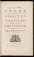
- Creator:
- Fouquet, Pierre, d. 1800.
- Published / Created:
- 1783
- Call Number:
- DJ411 A53 F64 1783
- Image Count:
- 9
- Resource Type:
- Books, Journals & Pamphlets
- Found in:
- Beinecke Rare Book and Manuscript Library > Nieuwe atlas / van de voornaamste gebouwen en gezigten der stad Amsterdam, met derzelver beknopte beschryvingen ...
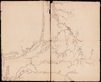
- Published / Created:
- 1836-1839, undated
- Call Number:
- WA MSS S-2678
- Collection Title:
- Ethan Allen Hitchcock collection on Indian removal
- Container / Volume:
- Box 3 | Folder 14
- Image Count:
- 1
- Resource Type:
- Archives or Manuscripts
- Found in:
- Beinecke Rare Book and Manuscript Library > Florida Indians
- Creator:
- Cóvens et Mortier
- Published / Created:
- ca. 1730-ca. 1800]
- Call Number:
- 1973 Folio 71
- Image Count:
- 1
- Resource Type:
- Maps, Atlases & Globes
- Found in:
- Beinecke Rare Book and Manuscript Library > [Atlas nouveau contenant toutes les parties du monde ou sont exactement marqués les empires, monarchies, royaumes, états, republiques &c. Le tout recueilli par les meilleurs geógraphes.]
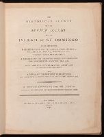
- Creator:
- Stockdale, John, 1749?-1814
- Published / Created:
- 1800 Nov. 24
- Call Number:
- CF1921 E38 1801
- Collection Title:
- An historical survey of the island of Saint Domingo, together with an account of the Maroon negroes
- Image Count:
- 1
- Resource Type:
- Maps, Atlases & Globes
- Found in:
- Beinecke Rare Book and Manuscript Library > A Map of the Island of St. Domingo
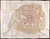
- Creator:
- Montigny, Léon.
- Published / Created:
- [1869]
- Call Number:
- 2015 523
- Image Count:
- 5
- Resource Type:
- Maps, Atlases & Globes
- Found in:
- Beinecke Rare Book and Manuscript Library > Les élections parisiennes de mai et juin 1869 [cartographic material] : application de la géométrie à la statistique / par Léon Montigny.
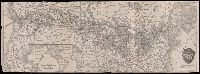
- Published / Created:
- 1915, undated
- Call Number:
- WA MSS S-2162
- Collection Title:
- Frank Richard Oastler collection
- Container / Volume:
- Box 69 | Folder 70
- Image Count:
- 1
- Found in:
- Beinecke Rare Book and Manuscript Library > Printed maps and a letter from Joe Warner, hunter and guide, to Dr. Oastler dated 1915 Mar 16, which were previously in the "Maps" envelope at the front of the 1914 Mount Robson Trip, Album I
- Creator:
- Wytfliet, Corneille.
- Published / Created:
- 1597
- Call Number:
- 1977 +400
- Image Count:
- 2
- Resource Type:
- Maps, Atlases & Globes
- Found in:
- Beinecke Rare Book and Manuscript Library > Descriptionis Ptolemaicae avgmentvm, siue Occidentis notitia breui commentario illustrata, studio et opera Cornely Wytfliet Louaniensis.
- Creator:
- Edwards, Bryan, 1743-1800.
- Published / Created:
- 1797
- Call Number:
- CF1921 E38
- Image Count:
- 2
- Resource Type:
- Books, Journals & Pamphlets
- Found in:
- Beinecke Rare Book and Manuscript Library > An historical survey of the French colony in the island of St. Domingo: comprehending a short account of its ancient government, political state, population, productions, and exports; a narrative of the calamities which have desolated the country ever since the year 1789 and a detail of the military transactions of the British army in that island to the end of 1794, by Bryan Edwards.
- Creator:
- Great Britain. Hydrographic Dept.
- Call Number:
- Conrad +Zz1
- Image Count:
- 2
- Resource Type:
- Maps, Atlases & Globes
- Found in:
- Beinecke Rare Book and Manuscript Library > Original navigation charts used by Joseph Conrad.
- Creator:
- Kitchin, Thomas, d. 1784.
- Published / Created:
- 1773
- Call Number:
- 1979 Folio 59
- Image Count:
- 2
- Resource Type:
- Maps, Atlases & Globes
- Found in:
- Beinecke Rare Book and Manuscript Library > A general atlas, describing the whole universe. Being a compleat and new collection of the most approved maps extant; corrected with the utmost care, and augmented from the latest discoveries: the whole being an improvement of the maps of d'Anville and Robert ... By Thomas Kitchen, senior, and others ...
- Creator:
- Stieler, Adolf, 1775-1836
- Call Number:
- Lxe2 +842s
- Image Count:
- 2
- Resource Type:
- Maps, Atlases & Globes
- Found in:
- Beinecke Rare Book and Manuscript Library > Schul-Atlas über alle Theile der Erde nach dem neuesten Zustande, und über das Weltgebäude : nach Stieler's Hand-Atlas verkleinert.
- Creator:
- Beautemps-Beaupré, Charles François, 1766-1854.
- Published / Created:
- 1822-43.
- Call Number:
- 1975 +8
- Image Count:
- 3
- Resource Type:
- Maps, Atlases & Globes
- Found in:
- Beinecke Rare Book and Manuscript Library > Pilote français... rédigé par M. Beautemps-Beaupré, ingénieur hydrographe en chef de la Marine... Publié par ordre du roi...
- Creator:
- Moll, Herman, d. 1732
- Published / Created:
- [1732]
- Call Number:
- E1015 M66 1732
- Image Count:
- 1
- Found in:
- Beinecke Rare Book and Manuscript Library > Atlas minor: or a set of sixty-two new and correct maps, of all parts of the world. All composed and done by Herman Moll, geographer ...
- Creator:
- Moll, Herman, d. 1732
- Published / Created:
- [1732]
- Call Number:
- E1015 M66 1732
- Collection Title:
- Atlas minor: or a set of sixty-two new and correct maps, of all parts of the world. All composed
- Image Count:
- 1
- Found in:
- Beinecke Rare Book and Manuscript Library > The Island of St. Christophers, alias St. Kitts By H. Moll Geographer
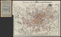
- Published / Created:
- [ca. 1896]
- Call Number:
- 36 N93 1896
- Container / Volume:
- BRBL_00125
- Image Count:
- 1
- Resource Type:
- Maps, Atlases & Globes
- Found in:
- Beinecke Rare Book and Manuscript Library > Neuester Plan der k[öniglichen] bayr[ischen] Stadt Nürnberg.
- Published / Created:
- 1797
- Call Number:
- 3213 1797
- Container / Volume:
- BRBL_00055
- Image Count:
- 1
- Resource Type:
- Maps, Atlases & Globes
- Found in:
- Beinecke Rare Book and Manuscript Library > A map of Kent.
- Creator:
- Bowles, Carington, 1724-1793
- Published / Created:
- [1766]
- Call Number:
- ByzL 79t
- Collection Title:
- A new and accurate history and survey of London, Westminster, Southwark, and places adjacent
- Image Count:
- 1
- Resource Type:
- Maps, Atlases & Globes
- Found in:
- Beinecke Rare Book and Manuscript Library > The London guide, or, a pocket plan of the cities of London & Westminster and Borough of Southwark; with the new buildings, &c. to the present year
- Call Number:
- 1977 +379
- Collection Title:
- Geografia; cioe, Descrittione vniversale della terra. Partita in due volumi, nel primo de' quali si
- Image Count:
- 1
- Found in:
- Beinecke Rare Book and Manuscript Library > A new map of that part of Africacalled the coast of Guinea ...
- Published / Created:
- 1850
- Call Number:
- 1976 Folio 96
- Collection Title:
- A new universal atlas containing maps of the various empires, kingdoms, states and republics of the
- Image Count:
- 1
- Resource Type:
- Maps, Atlases & Globes
- Found in:
- Beinecke Rare Book and Manuscript Library > 10. Map of Connecticut
- Published / Created:
- 1846
- Call Number:
- 1976 Folio 93
- Collection Title:
- A new universal atlas containing maps of the various empires, kingdoms, states and republics of the
- Image Count:
- 1
- Resource Type:
- Maps, Atlases & Globes
- Found in:
- Beinecke Rare Book and Manuscript Library > 9. Connecticut