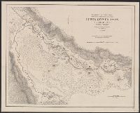
Ms. notes in red and blue highlighting 500' and 1500' contours. Imperfect: Mutilated. Upper left corner missing, text wanting. and Relief shown by contours.
Insets: Alaska -- Philippine Islands -- Tutuila Group of the Samoan Islands -- Manua -- Guam or Cuajan Island -- Hawaiian Islands -- Porto Rico -- Panama Canal -- Isthmus of Panama showing location of canal. and Relief shown by hachures.
Publisher:
Dept. of the Interior, General Land Office,
Subject (Geographic):
United States--Discovery and exploration--Maps and United States--Maps
Subject (Name):
Bond, Frank, 1856-1940 and United States. General Land Office
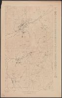
"Datum is mean sea level, based upon elevation of Oregon Short Line R.R. Station at Eureka taken as 6387 feet.", "Description of Topographic map of the United States" on verso., and "R.U. Goode, Geographer in charge. Triangulation by S.S. Gannett. Topography by W.T. Griswold and R.B. Marshall."
Publisher:
U.S. Geological Survey,
Subject (Geographic):
Juab County (Utah)--Maps and Utah County (Utah)--Maps
Subject (Name):
Gannett, Samuel S. (Samuel Stinson), 1861-1939, Goode, Richard Urquhart, 1858-1903, Griswold, W. T. (William Tudor), 1859-1931, and Marshall, R. B. (Robert Bradford), 1867-1949
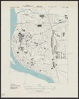
"Surveyed in 1888-91, 1896, and 1906-1907." and On verso: Jamestown Exposition on Hampton Roads, Virginia : plan of exposition grounds and buildings : progress map, June 1st 1907 / made by W.R. Kelly ; copyright applied for by Jamestown Exposition Co. Scale [ca. 1:6,800]
Publisher:
U.S. Geological Survey,
Subject (Geographic):
Hampton Roads (Va. : Harbor)--Maps, Norfolk Metropolitan Area (Va.)--Maps, Norfolk Metropolitan Area (Va.)--Maps, Topographic, and Norfolk Region (Va.)--Maps, Topographic
Subject (Name):
Jamestown Exposition Co, Jamestown Ter-centennial Exposition--(1907)--Maps, Kelly, W. R. Jamestown Exposition on Hampton Roads, Virginia, and U.S. Coast and Geodetic Survey