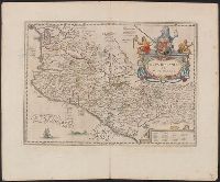
Dutch text of verso, with caption title "Nieuvv Spanien" and signature 2G., From Jansson's Nieuwen atlas ... Amstelodami : Apud Ioannem Ianssonium, 1647., Includes ill., index, and text., and Relief shown pictorially.
Ferro meridian., Gemeene Duytsche mylen van 15 in een graedt., No. 53 of 69 maps bound together in composite atlas., Relief shown pictorially., and Scale [ca 1:8 750 000].
Publisher:
By Frederick de Wit in de Kalversbraet in de Witte Pascaert
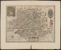
Dutch text on verso, with running and caption title "Virginia," signature 2D, and catchword "riviere.", Hendrik Hondius' derivative of John Smith's map of Virginia, 1612., Oriented with north toward the right., Relief shown pictorially., and Royal arms in upper r
Publisher:
Ex officina Henrici Hondii,
Subject (Geographic):
Chesapeake Bay (Md. and Va.)--Maps--Early works to 1800, Maryland--Maps--Early works to 1800, and Virginia--Maps--Early works to 1800
Subject (Name):
Jansson, Jan, 1588-1664. Atlas novus. Dutch and Smith, John, 1580-1631
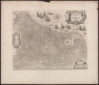
Coordinates not present on map and are approximated., From Joan Blaeu's Atlas maior (1662)., Latin text on verso; paginated ij-j, with caption Belgica., Relief shown pictorially., and With north oriented towards the upper right.
Subject (Geographic):
Netherlands--Maps--Early works to 1800
Subject (Name):
Blaeu, Joan, 1596-1673. Atlas maior, Ende, Josua van den, approximately 1584-approximately 1634, engraver, and Typographia Blaviani
Appeared in Willem and Joan Blaeu's Theatrum orbis terrarum., Backed with linen., Coordinates not present on map and are approximated., Relief shown pictorially., and With north oriented towards the upper right.
Subject (Geographic):
Netherlands--Maps--Early works to 1800
Subject (Name):
Blaeu, Joan, 1596-1673. Theatrum orbis terrarum, Blaeu, Willem Janszoon, 1571-1638. Theatrum orbis terrarum, and Ende, Josua van den, approximately 1584-approximately 1634, engraver
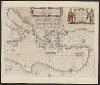
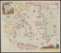
"Met priviligie voor 15 Iaar.", Appears in the author's De groote niewe vermeerderde zee-atlas ofte water-waereld., Dutch, with Latin place names., Has watermark., and Includes col. ill., decorative cartouche, and rhumb lines.
Publisher:
By Ioannes van Keulen, boeck verkooper en graad boogh maker, aen de N:Brugh inde gekroonde Loots,
Subject (Geographic):
Aegean Islands (Greece and Turkey)--Maps--Early works to 1800 and Crete (Greece)--Maps--Early works to 1800
Subject (Name):
Keulen, Johannes van, 1654-1715. Groote nieuwe vermeerderde zee-atlas ofte water-waereld
Appears in various Dutch eds. of Blaeu's Theatrum orbis terrarum., Bar scales in "Miliaria Germanica communia" and "Miliaria Gallica communia.", In Dutch on verso, with caption title "Peru" and signature Y., Oriented with north to the left., Relief shown pictorially., and Sheet measures 47.3 x 61.4 cm.
Publisher:
Guiljelmus Blaeuw excudit,
Subject (Geographic):
Peru--Maps--Early works to 1800
Subject (Name):
Blaeu, Willem Janszoon, 1571-1638. Theatrum orbis terrarum. Dutch
Vlakke aard-kloot gemeenlyk genaamd de geheele waereld
Description:
Backed with paper. Sheet measures 53.6 x 61.9 cm. No. 1 of 87 maps bound together., Includes twelve ancillary maps., Relief shown pictorially., Scale determined by using graticule method., and Watermark.
Descriptio ac delineatio geographica detectionis freti, sive, transitus ad occasum supra terras
Image Count:
1
Abstract:
Map depicts the Coat of Arms of the United Kingdom (era of the Union of the Crowns), reigning between the years 1603-1707.
Alternative Title:
Tabula nautica, qua repraesentantur orae maritimae, meatus, ac freta, noviter a H. Hudsono Anglo ad Caurum supra Novam Franciam
Description:
Bound in after p. [2]., In pencil on recto: 170., Map cut and folded irregularly., Map has multiple small stains on both the recto and verso., and Scale [ca. 1:9,000,000].