North-American pilot for New England, New York, Pensilvania, Maryland, and Virginia.
Description:
A Scale of 5 "English Miles" is given below the title at upper left., Below the scale: The Light-House of Sandy Hook is 40d. 27m. North Latitude., Coordinates not present on map and are approximated., Depths shown by soundings. Relief shown by hachures., First state., Includes note., Issued separately and in the first edition of Sayer & Bennett's North American Pilot for New England, New York, Pensilvania, Maryland, and Virginia. 1777., Sailing chart of the area around New York Harbor and Long Island; centered on Staten Island, York's Bay and Constable Point, extending north to Hells Gate, New York Island, Netwon Inlet, Bushwick Inlet, Wallabout Bay, Crown Point, the Battery and Ship Yards and south to the Shrewsbury River. The map extends East to include Amboy and the Raritan River, noting (Samuel?) Holland's House and east to Jamaica Bay and Plumb Island., and Watermarks.
Publisher:
Printed for Robt. Sayer & John Bennett, sea chart & map-sellers, No. 53, in Fleet Street. Published as the Act directs,
Subject (Geographic):
Atlantic Ocean--Lower Bay, Atlantic Ocean--Upper Bay, New Jersey--Sandy Hook, New York Harbor (N.Y. and N.J.) Maps--Early works to 1800., New York Region--Maps--Early works to 1800., and Sandy Hook (N.J.)
Subject (Name):
Robert Sayer and John Bennett (Firm), printmaker, printseller
Subject (Topic):
Nautical charts, Nautical charts--Hudson River Estuary (N.Y. and N.J.)--Early works to 1800., Nautical charts--Lower Bay (N.Y. and N.J.)--Early works to 1800., and Nautical charts--Upper Bay (N.Y. and N.J.)--Early works to 180
Course of the river Mississippi from the Balise to Fort Chartres
Description:
From Thomas Jeffery's The American atlas. 1775. Also published in Faden's North America Atlas, 1777., Imperfect: torn along fold. Title in manuscript on verso., Map of the Mississippi River Valley from the Gulf of Mexico to Fort Chartres, Illinois. Covers the Mississippi Valley from the Delta of the Mississippi where it joins the Gulf of Mexico to Fort Chartres., Prime meridian: New Orleans., Relief shown pictorially and by hachures. Depths shown by soundings., Scale of "Sea Leagues, 20 to a Degree"; and "British Miles, 69 1/2 to a Degree" below the imprint., Second issue. The first issue appeared in 1772. This 1775 issue has many changes in the area around New Orleans including the addition of forts St. Leon and St. Mary. Shows Baton Rouge and Lake Pontchartrain., The first official English survey of the Lower Mississippi, and one of the most historically significant American maps, delineating the British gains from France in the French and Indian War and later establishing the future western boundary of the new United States., The map includes detail of the lands to the immediate east of the Mississippi including numerous tributary rivers: the Pearl River, the Yasous River, the Chickasaw River, and the Ohio River. The locations of tribal lands and villages are noted, as well as alliances, roads to reach the villages, and the number of soldiers for several villages. Some tribes delineated in the map include the Arkansas, Chocktaw, Chicasaw, Yazoo, Wiapes, and Caskaskias., and Watermark.
Publisher:
Printed for Robt. Sayer, No. 53 in Fleet Street. Publishd as the Act directs,
Subject (Geographic):
Mississippi River Valley--Maps--Early works to 1800. and Mississippi River--Maps--Early works to 1800.
Subject (Name):
Jefferys, Thomas, -1771. American atlas. and Sayer, Robert, 1725-1794
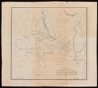
Coordinates not present on map and are approximated., Map of Champion Bay region (now Geraldton) in Western Australia, showing coastal soundings and topography of an area of approx. 250 square miles inland and south to Wizard Peak, centring on Mt. Fairfax. Shows Captain Grey's track and Captain Stokes' track. Relief shown by hachures and spot heights. Depths by soundings., and Originally published in: Discoveries in Australia : with an account of the coasts and rivers explored and surveyed during the voyage of H.M.S. Beagle in the years 1837-43 ... Volume 2 / J. Lort Stokes.
Publisher:
J. Arrowsmith,
Subject (Geographic):
Champion Bay (W.A.)--Maps., Geraldton Region (W.A.)--Discovery and exploration--Maps., and Western Australia--Geraldton Region
Subject (Name):
Beagle (Ship), Grey, George,--1812-1898, Grey, George,--1812-1898--Travel--Australia--Western Australia--Maps., Stokes, John Lort, 1811-1885. Discoveries in Australia., and Stokes, John Lort,--1811-1885--Travel--Australia--Western Australia--Maps.
Subject (Topic):
Discoveries in geography, Nautical charts--Australia--Champion Bay (W.A.), and Voyages and travels
Cuba with part of the Bahama banks & the Martyrs and The North American pilot.
Description:
From: The North American pilot. London, 1778-1779. Vol. 2, no. 13., Imperfect: chipped and torn, with no loss of text. Joined with Jeffrey's Coast of Yucatán from Campeche to Baha del Ascencion, with the west end of Cuba., Prime meridians: Ferro and London., Relief shown pictorially. Depths shown by soundings and shading., and Shows towns and roads in Cuba (except easternmost and westernmost parts) and part of Bahamas and Florida Keys.
Publisher:
Printed for Robt. Sayer,
Subject (Geographic):
Bahamas--Maps--Early works to 1800, Cuba--Maps--Early works to 1800, and Florida Keys (Fla.)--Maps--Early works to 1800