Insets: Aleutian Islands, Sitka, Juneau, Nome., Relief shown by shading and spot heights., and Shows forest reserves, Indian reservations, reindeer station reserves, military installations, etc.
Publisher:
General Land Office,
Subject (Geographic):
Alaska--Maps
Subject (Name):
Andrew B. Graham Co, Bond, Frank, 1856-1940, Hendges, M, and United States. General Land Office
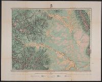
Copper River and adjacent territory, Geological Survey (U.S.). Report, Public resolution ; no. 25, 55th Congress, 3d session., and Its Report, Public resolution ; no. 25, 55th Congress, 3d session
Description:
Contour interval approximately 250 feet., Imperfect: Upper portion of map wanting. Dimensions 35 x 50 cm., and Relief shown by form lines, hachures, and spot heights.
Publisher:
The Survey,
Subject (Geographic):
Alaska--Maps, Chugach Mountains (Alaska)--Maps, and Copper River Region (Alaska)--Maps
Subject (Name):
Abercrombie, W. R.--(William Ralph),--b. 1857, Lowe, P. G, Mahlo, Emil, and Schrader, Frank C. (Frank Charles), 1860-1944
Geographical Surveys West of the 100th Meridian (U.S.)
Published / Created:
1879
Call Number:
834 1879B
Container / Volume:
BRBL_00587
Image Count:
1
Resource Type:
Maps, Atlases & Globes
Description:
"By Order of the Honorable The Secretary of War. Under the, "Expeditions of 1873, '74, '75 & '76 under the command of 1st. Lieut. Geo. M. Wheeler, Corps of Engineers, U.S. Army.", On verso: 4., and Shows geographical features, roads, settlements, and distances.
Publisher:
U.S. Geographical Surveys West of the 100th Meridian,
Subject (Geographic):
Colorado--Surveys--Maps
Subject (Name):
United States. Army. Corps of Engineers, Weyss, Lang & Herman, Del, Wheeler, George M. (George Montague), 1842-1905, and Wright, Horatio Gouverneur, 1820-1899
Subject (Topic):
Land capability for agriculture--Colorado--Maps and Land use--Colorado--Maps