Search
You Searched For
Search Results
- Creator:
- Bry, Theodor de, 1528-1598
Hariot, Thomas, 1560-1621
- Published / Created:
- 1590
- Call Number:
- Taylor 194
- Image Count:
- 71
- Found in:
- Beinecke Rare Book and Manuscript Library > A briefe and true report of the new found land of Virginia: of the commodities and of the nature and manners of the naturall inhabitants. Discouered by the English colony there seated by Sir Richard Greinuile ... in ... 1585 ... This fore booke is made in
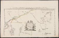
- Creator:
- Popple, Henry, -1743
- Published / Created:
- 1733
- Call Number:
- 89 1720
- Container / Volume:
- BRBL_00697
- Image Count:
- 1
- Resource Type:
- Maps, Atlases & Globes
- Description:
- . Popple's Map of America. 25 cm.
- Subject (Geographic):
- Great Britain--Colonies--America--Maps
- Found in:
- Beinecke Rare Book and Manuscript Library > A map of the British Empire in America, with the French and Spanish settlements adjacent thereto / by Henry Popple.
- Creator:
- Faden, William, 1749-1836
- Published / Created:
- 1777
- Call Number:
- 73 1777
- Container / Volume:
- BRBL_00373
- Image Count:
- 1
- Resource Type:
- Maps, Atlases & Globes
- Alternative Title:
- [American maps ; v. 3, no. 22]
- Subject (Geographic):
- Canada--Boundaries--United States--Maps
- Found in:
- Beinecke Rare Book and Manuscript Library > A map of the inhabited part of Canada from the French surveys, with the frontiers of New York and New England; from the large survey by Claude Joseph Sauthier. Engraved by Wm. Faden, 1777.
- Creator:
- Faden, William, 1749-1836
Jefferys, Thomas, d. 1771, creator
- Published / Created:
- 1789 June 1
- Call Number:
- 1982 Folio 10
- Image Count:
- 1
- Description:
- No. 22 of 43 maps bound together in
- Subject (Geographic):
- Germany --Maps --Early works to 1800
- Found in:
- Beinecke Rare Book and Manuscript Library > A new map of the King of Great Britain's dominions in Germany or the electorate of Brunswick-Luneburg and its dependencies

- Creator:
- Baldwyn, George Augustus.
- Published / Created:
- [1794?]
- Call Number:
- EEa 794b
- Image Count:
- 1128
- Resource Type:
- Books, Journals & Pamphlets
- Description:
- Irregularities in paging 1 map (Europe
- Found in:
- Beinecke Rare Book and Manuscript Library > A new, royal, authentic, complete, and universal system of geography: or, A modern history and description of the whole world. Containing ... accounts and descriptions of Europe, Asia, Africa, and America ... including the substance and essence of the most remarkable voyages and travels ... particularly the late discoveries in the South seas, and towards the North pole ... Comprising every interesting discovery and circumstance in the narratives of Captain Cook's voyages round the world. Together with all the recent discoveries ... carefully written and compiled from the late journals of ... Captains Phillips, King, Ball, Hunter, White, Dixon, Portlock, Mears, Patterson, Bruce, Anbury, Rochon, Morse, Blyth, Ross, Imlay, Keate, Brissot, Hodges, &c. &c. Also compendious histories of every empire, kingdom, state, &c. ... The whole embellished and enriched with upwards of an hundred most elegant and superb copperplates ... By George Augustus Baldwyn, esq. assisted by many gentlemen eminent for their knowledge ... of geography; particularly Charles Andres Robertson, esq.--Clement Walley Oulton. esq.-- and Henry Hogg ...
- Creator:
- Bickham, George, 1706?-1771, printmaker
- Published / Created:
- [1741]
- Call Number:
- Folio 724 C2 738
- Image Count:
- 1
- Resource Type:
- still image
- Description:
- -- Maps: capture of Porto Bello, November 22
- Found in:
- Lewis Walpole Library > A skit on Britain [graphic]
- Creator:
- Bickham, George, 1706?-1771, printmaker
- Published / Created:
- [1741]
- Call Number:
- 741.00.00.06.1+
- Image Count:
- 1
- Resource Type:
- still image
- Description:
- -- Maps: capture of Porto Bello, November 22
- Found in:
- Lewis Walpole Library > A skit on Britain [graphic]
- Creator:
- Boydell, John, 1720-1804, printmaker
- Published / Created:
- 1753.
- Call Number:
- Topos M627 no. 16+
- Image Count:
- 1
- Resource Type:
- still image
- Description:
- No. 22, "Mr. and Mrs. George Morton
- Found in:
- Lewis Walpole Library > A view of Governour Pitts house at Twickenham Vüe de la maison du Governour Pitt a Twickenham / [graphic] =
- Call Number:
- 1976 1233
- Collection Title:
- Forty-two new maps of Asia, Africa, and America ... : all engrav’d, according to the latest
- Image Count:
- 1
- Description:
- In ink on verso: 22.
- Subject (Geographic):
- Ethiopia --Maps --Early works to 1800
- Found in:
- Beinecke Rare Book and Manuscript Library > Abissina and Anian &c
- Creator:
- Winterbotham, Harold St. John Loyd, 1878-1946.
- Published / Created:
- 1927-1929.
- Call Number:
- GEN MSS 583
- Image Count:
- 103
- Resource Type:
- Archives or Manuscripts
- Abstract:
- album by a map of the region with
- Found in:
- Beinecke Rare Book and Manuscript Library > Africa : a survey inspection tour.
- Creator:
- Hondius, Jodocus, 1563-1612
- Published / Created:
- [1618]
- Call Number:
- 1983 Folio 19
- Collection Title:
- [Atlas factice of 96 maps by Blaeu, Visscher, Jansson, Hondius and others]
- Image Count:
- 1
- Description:
- . Sheet measures 45.7 x 54.6 cm. No. 22 of 92
- Subject (Geographic):
- America --Maps --Early works to 1800
- Found in:
- Beinecke Rare Book and Manuscript Library > America noviter delineata / auct. Judoco Hondio
- Creator:
- Blanchard, Joseph, d. 1758
- Published / Created:
- 1761
- Call Number:
- 762 1761
- Container / Volume:
- BRBL_00450
- Image Count:
- 2
- Resource Type:
- Maps, Atlases & Globes
- Description:
- topography of North America. 1768. no. 22, plates
- Found in:
- Beinecke Rare Book and Manuscript Library > An accurate map of His Majesty's Province of New-Hampshire in New England, taken from actual surveys of all the inhabited part, and from the best information of what is uninhabited, together with the adjacent countries, which exhibits the theatre of this
- Creator:
- Bowen, Emanuel, -1767
- Published / Created:
- 2d. July 1772.
- Call Number:
- 71 1763
- Container / Volume:
- BRBL_00364
- Image Count:
- 4
- Resource Type:
- Maps, Atlases & Globes
- Alternative Title:
- Particular map of Baffin and Hudson's
- Description:
- map of Baffin and Hudson's Bay" and "The
- Subject (Geographic):
- North America--Maps--Early works to
- Subject (Topic):
- British--America--Maps--Early works to
- Found in:
- Beinecke Rare Book and Manuscript Library > An accurate map of North America [cartographic material] : Describing and distinguishing the British and Spanish dominions on this great continent; according to the definitive treaty concluded at Paris 10th Feby. 1763. Also all the West India Islands belo
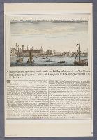
- Published / Created:
- [approximately 1758]
- Call Number:
- 758.00.00.34++
- Image Count:
- 1
- Resource Type:
- text and still image
- Description:
- ' in the Catalogue of Maps, Prints
- Found in:
- Lewis Walpole Library > An exact view of London Bridge since the conflagration of the late temporary bridge
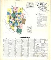
- Creator:
- Sanborn Map Company, issuing body
- Published / Created:
- 1924
- Call Number:
- 766 An81 1924
- Image Count:
- 39
- Resource Type:
- Maps, Atlases & Globes
- Abstract:
- Sanborn fire insurance maps are a rich
- Description:
- Partial cadastral map.
- Subject (Geographic):
- Ansonia (Conn.)--Maps
- Subject (Topic):
- --Ansonia--Maps
- Found in:
- Beinecke Rare Book and Manuscript Library > Ansonia, New Haven Co., Connecticut.
- Creator:
- Browne, Edward Granville, 1862-1926
- Published / Created:
- 1921.
- Call Number:
- Hist R143 1921b c.2
- Image Count:
- 159
- Found in:
- Medical Historical Library, Cushing/Whitney Medical Library > Arabian medicine : being the Fitzpatrick lectures delivered at the College of Physicians in November 1919 and November 1920
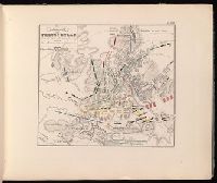
- Creator:
- Jomini, Antoine Henri, baron de, 1779-1869
- Published / Created:
- [1840?]
- Call Number:
- 2002 Folio 32
- Image Count:
- 1
- Description:
- de 22 aôut, 1852, Belgique, France
- Subject (Geographic):
- France--History--Revolution--Maps
- Found in:
- Beinecke Rare Book and Manuscript Library > Atlas portatif pour l'intelligence des relations des dernières guerres : publiées sans plans ; notamment pour la vie de Napoléon.
- Creator:
- United States. Office of Strategic Services. Research and Analysis Branch
- Published / Created:
- [1943]
- Call Number:
- 382 1943
- Container / Volume:
- BRBL_00175
- Image Count:
- 1
- Resource Type:
- Maps, Atlases & Globes
- Description:
- "22 November 1943."
- Subject (Geographic):
- Normandy (France)--Maps
- Subject (Topic):
- Beaches--France--Normandy--Maps
- Found in:
- Beinecke Rare Book and Manuscript Library > Beaches of Normandy - Vierville to Houlgate [cartographic material] / compiled and drawn in the Branch of Research and Analysis, OSS.
- Creator:
- Sanborn Map Company, issuing body
- Published / Created:
- 1924
- Call Number:
- 766 B72 1924
- Image Count:
- 24
- Resource Type:
- Maps, Atlases & Globes
- Abstract:
- Sanborn fire insurance maps are a rich
- Description:
- Partial cadastral map.
- Subject (Geographic):
- Branford (Conn.)--Maps
- Subject (Topic):
- --Branford--Maps
- Found in:
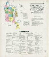
- Beinecke Rare Book and Manuscript Library > Branford : including Short Beach, Indian Neck, Pine Orchard, Stony Creek and Pine Orchard West, New Haven Co., Connecticut.
- Creator:
- Sanborn Map & Publishing Co., issuing body
- Published / Created:
- 1889
- Call Number:
- 766 B76 1889
- Image Count:
- 37
- Resource Type:
- Maps, Atlases & Globes
- Abstract:
- Sanborn fire insurance maps are a rich
- Description:
- Partial cadastral map.
- Subject (Geographic):
- Bridgeport (Conn.)--Maps
- Subject (Topic):
- --Bridgeport--Maps
- Found in:
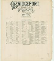
- Beinecke Rare Book and Manuscript Library > Bridgeport, Connecticut.