Search
You Searched For
Search Results
- Creator:
- Jones, Lewis A
- Published / Created:
- 1915
- Call Number:
- 794gcf B48 1914
- Container / Volume:
- BRBL_00521
- Image Count:
- 11
- Resource Type:
- Maps, Atlases & Globes
- Found in:
- Beinecke Rare Book and Manuscript Library > A report on the methods and cost of reclaiming the overflowed lands along the Big Black River, Mississippi / by Lewis A. Jones ; assisted by W.J. Schlick and C.E. Ramser.
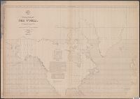
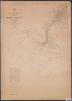
- Creator:
- Maury, Matthew Fontaine, 1806-1873
- Published / Created:
- 1852
- Call Number:
- 11cfk 1850D-2
- Container / Volume:
- BRBL_00773
- Image Count:
- 4
- Resource Type:
- Maps, Atlases & Globes
- Found in:
- Beinecke Rare Book and Manuscript Library > Wind and current chart of the South Atlantic [cartographic material] / by M.F. Maury, L.L.D. Lieut. U.S. Navy, Superint'dt. of U.S.N. Observatory ; compiled from materials in the Bureau of Ordnance and Hydrography, Commodore Charles Morris, Chief of Bureau.
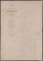
- Creator:
- Maury, Matthew Fontaine, 1806-1873
- Published / Created:
- 1852
- Call Number:
- 11cfk 1850F
- Container / Volume:
- BRBL_00774
- Image Count:
- 4
- Resource Type:
- Maps, Atlases & Globes
- Found in:
- Beinecke Rare Book and Manuscript Library > Whale chart of the world [cartographic material] / by M.F. Maury, L.L.D. Lieut. U.S. Navy, superin'dt. of U.S.N. Observatory ; compiled from materials in the Bureau of Ordnance and Hydrography by P.M. A.C. Jackson.
- Creator:
- Maury, Matthew Fontaine, 1806-1873
- Published / Created:
- 1852
- Call Number:
- 11cfk 1850D-2
- Container / Volume:
- BRBL_00773
- Image Count:
- 4
- Resource Type:
- Maps, Atlases & Globes
- Found in:
- Beinecke Rare Book and Manuscript Library > Wind and current chart of the South Atlantic [cartographic material] / by M.F. Maury, L.L.D. Lieut. U.S. Navy, Superint'dt. of U.S.N. Observatory ; compiled from materials in the Bureau of Ordnance and Hydrography, Commodore Charles Morris, Chief of Bureau.
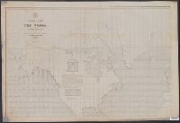
- Creator:
- Maury, Matthew Fontaine, 1806-1873
- Published / Created:
- 1850
- Call Number:
- 11cfk 1850D-1
- Container / Volume:
- BRBL_00773
- Image Count:
- 4
- Resource Type:
- Maps, Atlases & Globes
- Found in:
- Beinecke Rare Book and Manuscript Library > Wind and current chart of the North Atlantic [cartographic material] : thermal sheet / by M.F. Maury, A.M. Lieut. U.S. Navy, Superint'dt. of U.S.N. Observatory ; compiled from materials in the Bureau of Ordnance and Hydrography, Commodore Lewis Warrington, Chief of Bureau ; drawn by Lt. Benjn. S. Gantt, U.S.N.
- Creator:
- Maury, Matthew Fontaine, 1806-1873
- Published / Created:
- 1852
- Call Number:
- 11cfk 1850F
- Container / Volume:
- BRBL_00774
- Image Count:
- 4
- Resource Type:
- Maps, Atlases & Globes
- Found in:
- Beinecke Rare Book and Manuscript Library > Whale chart of the world [cartographic material] / by M.F. Maury, L.L.D. Lieut. U.S. Navy, superin'dt. of U.S.N. Observatory ; compiled from materials in the Bureau of Ordnance and Hydrography by P.M. A.C. Jackson.
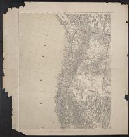
- Creator:
- United States. Army Map Service
- Published / Created:
- 1943
- Call Number:
- 5844 1943
- Container / Volume:
- BRBL_00315
- Image Count:
- 6
- Resource Type:
- Maps, Atlases & Globes
- Found in:
- Beinecke Rare Book and Manuscript Library > Malaya 1:253 440 : Pahang.
- Creator:
- Freyhold, Edward
- Published / Created:
- 1879
- Call Number:
- 80 1879
- Container / Volume:
- BRBL_00536
- Image Count:
- 5
- Resource Type:
- Maps, Atlases & Globes
- Found in:
- Beinecke Rare Book and Manuscript Library > Map of the territory of the United States, west of the Mississippi River / prepared by authority of the Hon. the Secretary of War, in the office of the Chief of Engineers under the direction of Brig. Gen. A.A. Humphreys, Chief of Engrs. Bvt. Major General
- Creator:
- Maury, Matthew Fontaine, 1806-1873
- Published / Created:
- 1850
- Call Number:
- 11cfk 1850D-1
- Container / Volume:
- BRBL_00773
- Image Count:
- 8
- Resource Type:
- Maps, Atlases & Globes
- Found in:
- Beinecke Rare Book and Manuscript Library > Wind and current chart of the North Atlantic [cartographic material] : thermal sheet / by M.F. Maury, A.M. Lieut. U.S. Navy, Superint'dt. of U.S.N. Observatory ; compiled from materials in the Bureau of Ordnance and Hydrography, Commodore Lewis Warrington, Chief of Bureau ; drawn by Lt. Benjn. S. Gantt, U.S.N.
- Creator:
- Maury, Matthew Fontaine, 1806-1873
- Published / Created:
- 1849-[1856?]
- Call Number:
- 11cfk 1850A-1
- Container / Volume:
- BRBL_00767
- Image Count:
- 10
- Resource Type:
- Maps, Atlases & Globes
- Found in:
- Beinecke Rare Book and Manuscript Library > Wind and current chart of the North Pacific [cartographic material] / by M.F. Maury, A.M. Lieut. U.S. Navy, Superint'dt. of U.S.N. Observatory ; compiled from materials in the Bureau of Ordnance and Hydrography, Commodore Lewis Warrington ; drawn by P.M. Lardner Gibbon, U.S.N. ; tracks projected by Lieut. A.W. Johnson, U.S. Navy.
- Creator:
- Maury, Matthew Fontaine, 1806-1873
- Published / Created:
- 1851-1859.
- Call Number:
- 11cfk 1850C-6
- Container / Volume:
- BRBL_00771
- Image Count:
- 10
- Resource Type:
- Maps, Atlases & Globes
- Found in:
- Beinecke Rare Book and Manuscript Library > Pilot chart of the South Pacific [cartographic material] / by M.F. Maury, L.L.D., Lieut. U.S. Navy ; Superin'dt. of U.S.N. Observatory ; compiled from materials in the Bureau of Ordnance and Hydrography, Commodre Charles Morris, Chief of Bureau.
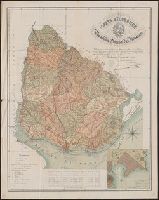
- Creator:
- Reyes, José Maria, 1803-1864
- Published / Created:
- c1893.
- Call Number:
- 93 1893
- Container / Volume:
- BRBL_00674
- Image Count:
- 1
- Resource Type:
- Maps, Atlases & Globes
- Found in:
- Beinecke Rare Book and Manuscript Library > Carta geográfica de la Republica Oriental del Uruguay [cartographic material] / reduccion dela del general ingeniero Don José M. Reyes. Aumentada y correjida en parte con antecedentes del archivo dela direccion gral de obras publicas por el vocal dela s
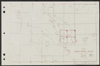
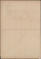
- Creator:
- Ringgold, Cadwalader, 1802-1867
- Published / Created:
- [1851?]
- Call Number:
- 844cea Sa52 1850D
- Container / Volume:
- BRBL_00614
- Image Count:
- 1
- Resource Type:
- Maps, Atlases & Globes
- Found in:
- Beinecke Rare Book and Manuscript Library > Chart of the Sacramento River from Suisun City to the American River : California / by Cadwalader Ringgold, Commander, U.S. Navy ; assisted by Edwin Cullberg, Lieut. of the Hydrotechnic Corps, Swedish Navy, and T.A. Emmet, civil engineer, 1850.
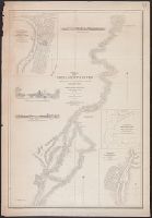
- Creator:
- Ringgold, Cadwalader, 1802-1867
- Published / Created:
- [1851?]
- Call Number:
- 844cea Sa52 1850A
- Container / Volume:
- BRBL_00614
- Image Count:
- 1
- Resource Type:
- Maps, Atlases & Globes
- Found in:
- Beinecke Rare Book and Manuscript Library > Chart of the Farallones and entrance to the bay of San Francisco : California / by Cadwalader Ringgold, Commander, U.S. Navy ; assisted by Simon F. Blunt, Lieut., U.S. Navy, 1850.
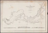
- Creator:
- Ringgold, Cadwalader, 1802-1867
- Published / Created:
- [1851?]
- Call Number:
- 844cea Sa52 1850B
- Container / Volume:
- BRBL_00614
- Image Count:
- 1
- Resource Type:
- Maps, Atlases & Globes
- Found in:
- Beinecke Rare Book and Manuscript Library > Chart of the bay of San Pablo, Straits of Carquines, and part of the bay of San Francisco : California / by Cadwalader Ringgold, Commander, U.S. Navy ; assisted by Simon F. Blunt, Lieut., U.S.N., 1850.
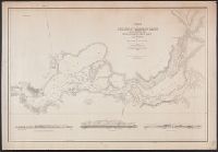
- Creator:
- Ringgold, Cadwalader, 1802-1867
- Published / Created:
- [1851?]
- Call Number:
- 844cea Sa52 1850C
- Container / Volume:
- BRBL_00614
- Image Count:
- 1
- Resource Type:
- Maps, Atlases & Globes
- Found in:
- Beinecke Rare Book and Manuscript Library > Chart of Suisun & Vallejo Bays, with the confluence of the rivers Sacramento and San Joaquin : California / by Cadwalader Ringgold, Commander, U.S. Navy ; assisted by Sam. R. Knox, Lieut., U.S.N. and Wm. P. Humphreys & J.H. Rowe, engineers, 1850.
- Creator:
- Ringgold, Cadwalader, 1802-1867
- Published / Created:
- [1851?]
- Call Number:
- 844cea Sa52 1850B
- Container / Volume:
- BRBL_00614
- Image Count:
- 1
- Resource Type:
- Maps, Atlases & Globes
- Found in:
- Beinecke Rare Book and Manuscript Library > Chart of the bay of San Pablo, Straits of Carquines, and part of the bay of San Francisco : California / by Cadwalader Ringgold, Commander, U.S. Navy ; assisted by Simon F. Blunt, Lieut., U.S.N., 1850.
- Creator:
- Ringgold, Cadwalader, 1802-1867
- Published / Created:
- [1851?]
- Call Number:
- 844cea Sa52 1850D
- Container / Volume:
- BRBL_00614
- Image Count:
- 1
- Resource Type:
- Maps, Atlases & Globes
- Found in:
- Beinecke Rare Book and Manuscript Library > Chart of the Sacramento River from Suisun City to the American River : California / by Cadwalader Ringgold, Commander, U.S. Navy ; assisted by Edwin Cullberg, Lieut. of the Hydrotechnic Corps, Swedish Navy, and T.A. Emmet, civil engineer, 1850.
- Creator:
- Ringgold, Cadwalader, 1802-1867
- Published / Created:
- [1851?]
- Call Number:
- 844cea Sa52 1850C
- Container / Volume:
- BRBL_00614
- Image Count:
- 1
- Resource Type:
- Maps, Atlases & Globes
- Found in:
- Beinecke Rare Book and Manuscript Library > Chart of Suisun & Vallejo Bays, with the confluence of the rivers Sacramento and San Joaquin : California / by Cadwalader Ringgold, Commander, U.S. Navy ; assisted by Sam. R. Knox, Lieut., U.S.N. and Wm. P. Humphreys & J.H. Rowe, engineers, 1850.