Search
You Searched For
Search Results
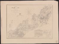
- Creator:
- Bache, A. D. (Alexander Dallas), 1806-1867
- Published / Created:
- 1865
- Call Number:
- 754 1865B
- Container / Volume:
- BRBL_00417
- Image Count:
- 1
- Resource Type:
- Maps, Atlases & Globes
- Found in:
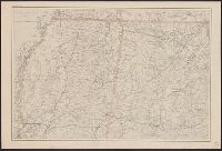
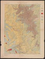
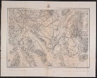
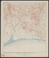
- Beinecke Rare Book and Manuscript Library > [Northern Mississippi, Alabama, and a small part of southern Tennessee] / U.S. Coast Survey, A.D. Bache, supdt.; drawn by A. Lindenkohl; H. Lindenkohl & Chas. G. Krebs, lith.
- Creator:
- Bache, A. D. (Alexander Dallas), 1806-1867
- Published / Created:
- 1865
- Call Number:
- 754 1865
- Container / Volume:
- BRBL_00417
- Image Count:
- 1
- Resource Type:
- Maps, Atlases & Globes
- Found in:
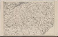
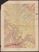
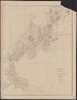
- Beinecke Rare Book and Manuscript Library > [Northern Georgia and part of South Carolina].
- Published / Created:
- [1898]
- Call Number:
- 855hc 1898H
- Container / Volume:
- BRBL_00765
- Image Count:
- 1
- Resource Type:
- Maps, Atlases & Globes
- Found in:
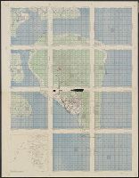
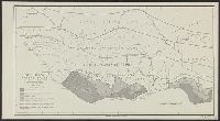
- Beinecke Rare Book and Manuscript Library > [Map showing fortifications around the mouth of the San Juan River, Cuba during the War of 1898.]
- Creator:
- United States. Office of Strategic Services. Research and Analysis Branch
- Published / Created:
- 1943
- Call Number:
- 60ba 1943
- Container / Volume:
- BRBL_00329
- Image Count:
- 1
- Resource Type:
- Maps, Atlases & Globes
- Found in:
- Beinecke Rare Book and Manuscript Library > [Map of Africa, Europe and Middle East] / compiled and drawn in the Branch of Research and Analysis, OSS ; lithographed in the Reproduction Branch, OSS.
- Creator:
- United States. Army Map Service
- Published / Created:
- 1945
- Call Number:
- 273 T171 1945
- Container / Volume:
- BRBL_00023B
- Image Count:
- 1
- Resource Type:
- Maps, Atlases & Globes
- Found in:
- Beinecke Rare Book and Manuscript Library > [Air support charts, Tarakan] / prepared and reproduced by Army Map Service.
- Creator:
- United States. Office of Strategic Services. Research and Analysis Branch
- Published / Created:
- 1943
- Call Number:
- 364g 1943
- Container / Volume:
- BRBL_00144
- Image Count:
- 1
- Resource Type:
- Maps, Atlases & Globes
- Found in:
- Beinecke Rare Book and Manuscript Library > Zones of intensive urban land use in the Ruhr [cartographic material] / compiled and drawn in the Branch of Research and Analysis, OSS.
- Creator:
- Geological Survey (U.S.)
- Published / Created:
- [188-?]
- Call Number:
- 833fcm Y38 1885
- Container / Volume:
- BRBL_00585
- Image Count:
- 1
- Resource Type:
- Maps, Atlases & Globes
- Found in:
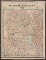
- Beinecke Rare Book and Manuscript Library > Yellowstone National Park and north western Wyoming / U.S. Geological Survey ; Henry Gannett, Chief Geographer ; J.H. Renshawe, Geographer in Charge ; triangulation by H.S. Chase ; topography by J.H. Renshawe, Frank Tweedy, and S.A. Aplin, Jr.
- Creator:
- Berthrong, I. P
- Published / Created:
- [1911]
- Call Number:
- 833fcm Y38 1911
- Container / Volume:
- BRBL_00585
- Image Count:
- 1
- Resource Type:
- Maps, Atlases & Globes
- Found in:
- Beinecke Rare Book and Manuscript Library > Yellowstone National Park / compiled from the official records of the General Land Office, U.S. Geological Survey and other sources, under the direction of I.P. Berthrong, Chief of Drafting Division, G.L.O., 1911 ; compiled and drawn by I.P. Berthrong ; l
- Creator:
- Hergesheimer, E. (Edwin)
- Published / Created:
- [1872]
- Call Number:
- 833 Y38 1871B
- Container / Volume:
- BRBL_00584
- Image Count:
- 1
- Resource Type:
- Maps, Atlases & Globes
- Found in:
- Beinecke Rare Book and Manuscript Library > Yellowstone Lake, Wyoming Territory / surveyed by the party in charge of F.V. Hayden ; compiled and drawn by E. Hergesheimer from field notes and sketches of A. Schönborn & H.W. Elliott.
- Creator:
- Geological Survey (U.S.)
- Published / Created:
- [1901]
- Call Number:
- 833gc N431 1899
- Container / Volume:
- BRBL_00586
- Image Count:
- 1
- Resource Type:
- Maps, Atlases & Globes
- Found in:
- Beinecke Rare Book and Manuscript Library > Wyoming-South Dakota, Newcastle quadrangle : land classification and density of standing timber / U.S. Geological Survey ; E.M. Douglas, geographer in charge ; triangulation by Frank Tweedy and R.H. Chapman ; topography by W.H. Herron ; Henry Gannett, geo
- Creator:
- Geological Survey (U.S.)
- Published / Created:
- [1900].
- Call Number:
- 833gc D337 1899
- Container / Volume:
- BRBL_00586
- Image Count:
- 1
- Resource Type:
- Maps, Atlases & Globes
- Found in:
- Beinecke Rare Book and Manuscript Library > Wyoming, Dayton quadrangle : land classification and density of standing timber / U.S. Geological Survey ; E.M. Douglas, geographer in charge ; triangulation by W.S. Post ; topography by Frank Tweedy ; Henry Gannett, geographer in charge ; land classifica
- Creator:
- Geological Survey (U.S.)
- Published / Created:
- [1900].
- Call Number:
- 833gc C625 1899
- Container / Volume:
- BRBL_00586
- Image Count:
- 1
- Resource Type:
- Maps, Atlases & Globes
- Found in:
- Beinecke Rare Book and Manuscript Library > Wyoming, Cloud Peak quadrangle : land classification and density of standing timber / U.S. Geological Survey ; E.M. Douglas, geographer in charge ; triangulation by T.M. Bannon ; topography by H.S. Wallace and F.E. Matthes ; Henry Gannett, geographer in c
- Creator:
- Geological Survey (U.S.)
- Published / Created:
- [1900].
- Call Number:
- 833gc B19 1898
- Container / Volume:
- BRBL_00586
- Image Count:
- 1
- Resource Type:
- Maps, Atlases & Globes
- Found in:
- Beinecke Rare Book and Manuscript Library > Wyoming, Bald Mountain quadrangle : land classification and density of standing timber / U.S. Geological Survey ; E.M. Douglas, geographer in charge ; triangulation by W.S. Post ; topography by Frank Tweedy ; Henry Gannett, geographer in charge ; land cla
- Creator:
- Maury, Matthew Fontaine, 1806-1873
- Published / Created:
- [1847?]-1853.
- Call Number:
- 11cfk 1850A-3
- Container / Volume:
- BRBL_00768
- Image Count:
- 1
- Resource Type:
- Maps, Atlases & Globes
- Found in:
- Beinecke Rare Book and Manuscript Library > Wind and current chart of the South Atlantic [cartographic material] / by M.F. Maury, L.L.D.U.S. Navy, Superindt. of U.S.N. Observatory ; compiled from materials in the Bureau of Ordnance and Hydrography, Commodore Charles Morris, Chief of Bureau.
- Creator:
- Maury, Matthew Fontaine, 1806-1873
- Published / Created:
- [1847?]-1853.
- Call Number:
- 11cfk 1850A-3
- Container / Volume:
- BRBL_00768
- Image Count:
- 4
- Resource Type:
- Maps, Atlases & Globes
- Found in:
- Beinecke Rare Book and Manuscript Library > Wind and current chart of the South Atlantic [cartographic material] / by M.F. Maury, L.L.D.U.S. Navy, Superindt. of U.S.N. Observatory ; compiled from materials in the Bureau of Ordnance and Hydrography, Commodore Charles Morris, Chief of Bureau.
- Creator:
- U.S. Coast and Geodetic Survey
- Published / Created:
- 1883
- Call Number:
- 771 W528 1883
- Container / Volume:
- BRBL_00492
- Image Count:
- 1
- Resource Type:
- Maps, Atlases & Globes
- Found in:
- Beinecke Rare Book and Manuscript Library > West Point, New York / from a Plane Table survey under the direction of H.L. Whiting, Assistant, by W.C. Hodgkins, Aid. ; engraved from the original sheet by H.C. Evans ; title and lettering by E.A. Maedel.
- Creator:
- United States. Office of Strategic Services. Research and Analysis Branch
- Published / Created:
- 1943
- Call Number:
- 654gcr 1943
- Container / Volume:
- BRBL_00344
- Image Count:
- 1
- Resource Type:
- Maps, Atlases & Globes
- Found in:
- Beinecke Rare Book and Manuscript Library > West Africa, forest zones / drawn in R and A, OSS.
- Creator:
- Geological Survey (U.S.)
- Published / Created:
- [1901]
- Call Number:
- 847gc Sp65 1898
- Container / Volume:
- BRBL_00628
- Image Count:
- 1
- Resource Type:
- Maps, Atlases & Globes
- Found in:
- Beinecke Rare Book and Manuscript Library > Washington-Idaho, Spokane quadrangle : land classification and density of standing timber / U.S. Geological Survey ; R.U. Goode, geographer in charge ; triangulation by S.S. Gannett ; topography by Van H. Manning ; Henry Gannett, geographer in charge ; la
- Creator:
- Geological Survey (U.S.)
- Published / Created:
- [1900].
- Call Number:
- 847gc M865 1897
- Container / Volume:
- BRBL_00628
- Image Count:
- 1
- Resource Type:
- Maps, Atlases & Globes
- Found in:
- Beinecke Rare Book and Manuscript Library > Washington, Mount Stuart quadrangle : land classification and density of standing timber / U.S. Geological Survey ; R.U. Goode, geographer in charge ; triangulation by S.S. Gannett ; topography by G.E. Hyde ; Henry Gannett, geographer in charge ; land cla
- Creator:
- Geological Survey (U.S.)
- Published / Created:
- [1900].
- Call Number:
- 847gc El54 1899
- Container / Volume:
- BRBL_00628
- Image Count:
- 1
- Resource Type:
- Maps, Atlases & Globes
- Found in:
- Beinecke Rare Book and Manuscript Library > Washington, Ellensburg quadrangle : land classification and density of standing timber / U.S. Geological Survey ; R.U. Goode, geographer in charge ; triangulation by S.S. Gannett and A.H. Sylvester ; topography by A.E. Murlin ; Henry Gannett, geographer i
- Creator:
- Geological Survey (U.S.)
- Published / Created:
- [1901].
- Call Number:
- 847gc C417 1898
- Container / Volume:
- BRBL_00628
- Image Count:
- 1
- Resource Type:
- Maps, Atlases & Globes
- Found in:
- Beinecke Rare Book and Manuscript Library > Washington, Chelan quadrangle : land classification and density of standing timber / U.S. Geological Survey ; R.U. Goode, geographer in charge ; triangulation by W.T. Griswold ; topography by R.A. Farmer and W.T. Griswold ; Henry Gannett, geographer in ch
- Creator:
- Geological Survey (U.S.)
- Published / Created:
- 1907
- Call Number:
- 783 N765 1907
- Container / Volume:
- BRBL_00510
- Image Count:
- 2
- Resource Type:
- Maps, Atlases & Globes
- Found in:
- Beinecke Rare Book and Manuscript Library > Virginia, Norfolk special map / topography by U.S. Geological Survey ; control and shore topography by Coast and Geodetic Survey.
- Creator:
- United States. Army Map Service
- Published / Created:
- 1943
- Call Number:
- 38 V66 1943
- Container / Volume:
- BRBL_00167
- Image Count:
- 1
- Resource Type:
- Maps, Atlases & Globes
- Found in:
- Beinecke Rare Book and Manuscript Library > Vichy [cartographic material] : City plan.
- Creator:
- Geological Survey (U.S.)
- Published / Created:
- [1898]
- Call Number:
- 836gfc T498 1898
- Container / Volume:
- BRBL_00593
- Image Count:
- 2
- Resource Type:
- Maps, Atlases & Globes
- Found in:
- Beinecke Rare Book and Manuscript Library > Utah : Tintic mining map.
- Creator:
- Hergesheimer, E. (Edwin)
- Published / Created:
- 1871
- Call Number:
- 833 Y38 1871D
- Container / Volume:
- BRBL_00584
- Image Count:
- 1
- Resource Type:
- Maps, Atlases & Globes
- Found in:
- Beinecke Rare Book and Manuscript Library > Upper Geyser Basin, Fire Hole River, Wyoming Territory / surveyed by the party in charge of F.V. Hayden ; compiled and drawn from field notes and sketches of A. Schönborn by E. Hergesheimer.
- Creator:
- Berthrong, I. P
- Published / Created:
- 1908
- Call Number:
- 75gmb 1908
- Container / Volume:
- BRBL_00411
- Image Count:
- 1
- Resource Type:
- Maps, Atlases & Globes
- Found in:
- Beinecke Rare Book and Manuscript Library > United States showing routes of principal explorers and early roads and highways [map] / from data prepared by Frank Bond ; by I. B. Berthrong.
- Creator:
- Berthrong, I. P
- Published / Created:
- 1908
- Call Number:
- 75j 1908
- Container / Volume:
- BRBL_00414A
- Image Count:
- 1
- Resource Type:
- Maps, Atlases & Globes
- Found in:
- Beinecke Rare Book and Manuscript Library > United States showing routes of principal explorers and early roads and highways [map] / from data prepared by Frank Bond ; by I. B. Berthrong.
- Creator:
- Geological Survey (U.S.)
- Published / Created:
- 1911
- Call Number:
- 75cbf 1911S
- Container / Volume:
- BRBL_00408
- Image Count:
- 1
- Resource Type:
- Maps, Atlases & Globes
- Found in:
- Beinecke Rare Book and Manuscript Library > United States relief map / U.S. Geological Survey, Department of the Interior ; compiled by Henry Gannett.
- Creator:
- Gannett, Henry, 1846-1914
- Published / Created:
- [1904]
- Call Number:
- 754cbf 1904
- Container / Volume:
- BRBL_00417
- Image Count:
- 1
- Resource Type:
- Maps, Atlases & Globes
- Found in:
- Beinecke Rare Book and Manuscript Library > United States contour map / U.S. Geological Survey ; compiled by Henry Gannett.
- Creator:
- Geographical Surveys West of the 100th Meridian (U.S.)
- Published / Created:
- [1878]
- Call Number:
- 841 1878B
- Container / Volume:
- BRBL_00596
- Image Count:
- 1
- Resource Type:
- Maps, Atlases & Globes
- Found in:
- Beinecke Rare Book and Manuscript Library > U.S. geographical surveys west of the 100th meridian part of southern New Mexico, atlas sheet no. 84 (B) [cartographic material] / under the command of 1st. Lieut. Geo. M. Wheeler, Corps of Engineer, U.S. Army.
- Creator:
- Geographical Surveys West of the 100th Meridian (U.S.)
- Published / Created:
- 1879
- Call Number:
- 841 1879A
- Container / Volume:
- BRBL_00596
- Image Count:
- 1
- Resource Type:
- Maps, Atlases & Globes
- Found in:
- Beinecke Rare Book and Manuscript Library > U.S. geographical surveys west of the 100th meridian land classification map of part of southern New Mexico, atlas sheet no. 84 (B) [cartographic material] / under the command of 1st. Lieut. Geo. M. Wheeler, Corps of Engineer, U.S. Army.
- Creator:
- Wheeler, George M. (George Montague), 1842-1905
- Published / Created:
- 1876
- Call Number:
- 842 1876B
- Container / Volume:
- BRBL_00598
- Image Count:
- 1
- Resource Type:
- Maps, Atlases & Globes
- Found in:
- Beinecke Rare Book and Manuscript Library > U.S. geographical surveys west of the 100th meridian [cartographic material] : parts of eastern Arizona and western New Mexico, atlas sheet no. 76 / under the command of 1st. Lieut. Geo. M. Wheeler.
- Creator:
- United States. Dept. of the Treasury. Bureau of Statistics
- Published / Created:
- [190-?]
- Call Number:
- 70GM 1900
- Container / Volume:
- BRBL_00359
- Image Count:
- 1
- Resource Type:
- Maps, Atlases & Globes
- Found in:
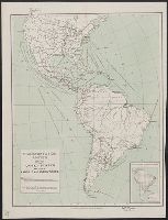
- Beinecke Rare Book and Manuscript Library > Transportation routes between the United States and other American countries / U.S. Treasury Department, Bureau of Statistics ; [B.?] Olszewski.
- Creator:
- Geological Survey (U.S.)
- Published / Created:
- 1911
- Call Number:
- 848 K15 1911
- Container / Volume:
- BRBL_00633
- Image Count:
- 1
- Resource Type:
- Maps, Atlases & Globes
- Found in:
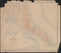
- Beinecke Rare Book and Manuscript Library > Topography of Kasaan Peninsula, Prince of Wales Island, Alaska / Alfred H. Brooks, geologist in charge of division ; topography by D.C. Witherspoon, R.H. Sargent, and J.W. Bagley.
- Creator:
- Geological Survey (U.S.)
- Published / Created:
- [1897]
- Call Number:
- 831cbf B98 1897
- Container / Volume:
- BRBL_00581
- Image Count:
- 1
- Resource Type:
- Maps, Atlases & Globes
- Found in:
- Beinecke Rare Book and Manuscript Library > Topographic sheet, Montana (Silver Bow Co.) : Butte special map / Henry Gannett, chief topographer ; E.M. Douglas, topographer in charge ; triangulation and topography by R.H. Chapman.
- Creator:
- Geological Survey (U.S.)
- Published / Created:
- 1922
- Call Number:
- 848 T15 1922
- Container / Volume:
- BRBL_00634
- Image Count:
- 1
- Resource Type:
- Maps, Atlases & Globes
- Found in:
- Beinecke Rare Book and Manuscript Library > Topographic reconnaissance map of Upper Tanana River Valley region, Alaska / U.S. Geological Survey; Alfred H. Brooks in charge of division; Control and topography by D.C. Witherspoon and J.W. Bagley; Upper Tanana River from boat traverses by W.J. Peters.
- Creator:
- Geological Survey (U.S.)
- Published / Created:
- 1921
- Call Number:
- 848 In6 1921
- Container / Volume:
- BRBL_00633
- Image Count:
- 1
- Resource Type:
- Maps, Atlases & Globes
- Found in:
- Beinecke Rare Book and Manuscript Library > Topographic reconnaissance map of Innoko-Iditarod region, Alaska / Geological Survey.
- Creator:
- Geological Survey (U.S.)
- Published / Created:
- [1912]
- Call Number:
- 833fcm Y38 1912
- Container / Volume:
- BRBL_00585
- Image Count:
- 1
- Resource Type:
- Maps, Atlases & Globes
- Found in:
- Beinecke Rare Book and Manuscript Library > Topographic map of the Yellowstone National Park, Wyoming-Montana-Idaho / from Geological Survey atlas sheets surveyed in 1883-85 ; partial revision in 1910 by E.P. Davis ; R.B. Marshall, chief geographer.
- Creator:
- Geological Survey (U.S.)
- Published / Created:
- 1907
- Call Number:
- 848 So47 1909
- Container / Volume:
- BRBL_00634
- Image Count:
- 1
- Resource Type:
- Maps, Atlases & Globes
- Found in:
- Beinecke Rare Book and Manuscript Library > Topographic map of Solomon quadrangle, Alaska.
- Creator:
- Geological Survey (U.S.)
- Published / Created:
- 1918
- Call Number:
- 848 M41 1918
- Container / Volume:
- BRBL_00634
- Image Count:
- 1
- Resource Type:
- Maps, Atlases & Globes
- Found in:
- Beinecke Rare Book and Manuscript Library > Topographic map of Lower Matanuska Valley, Alaska / Department of the Interior, U.S. Geological Survey.
- Published / Created:
- 1945
- Call Number:
- 57 T578 1945
- Container / Volume:
- BRBL_00304
- Image Count:
- 1
- Resource Type:
- Maps, Atlases & Globes
- Found in:
- Beinecke Rare Book and Manuscript Library > Tokyo.
- Creator:
- United States. Army. Corps of Engineers, author
- Published / Created:
- [1834]
- Call Number:
- 761 1834
- Container / Volume:
- BRBL_00447
- Image Count:
- 1
- Resource Type:
- Maps, Atlases & Globes
- Found in:
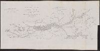
- Beinecke Rare Book and Manuscript Library > The Kennebec River and adjacent country : shewing the routes examined for a road from Augusta to the Canada line in the direction of Quebec / reconnaissance made in 1834 by Hartman Bache, T.E. & B.T. Major, assisted by G.W. Ward, 2nd Lt. 2nd Arty. and J.F
- Creator:
- Mitchell, John Murray, 1858-1905
Norris Peters Co
United States. Hydrographic Office
- Published / Created:
- [1896?]
- Call Number:
- 231 1896
- Container / Volume:
- BRBL_00020
- Image Count:
- 1
- Resource Type:
- Maps, Atlases & Globes
- Found in:
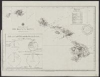
- Beinecke Rare Book and Manuscript Library > The Hawaiian Islands [cartographic material] : compiled from the latest information.
- Creator:
- United States Coast Survey
- Published / Created:
- 1857
- Call Number:
- 764cea W86 1857
- Container / Volume:
- BRBL_00461
- Image Count:
- 1
- Resource Type:
- Maps, Atlases & Globes
- Found in:
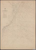
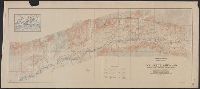
- Beinecke Rare Book and Manuscript Library > The Harbor of Wood's Hole, Massachusetts / from a trigonometrical survey under the direction of A.D. Bache, superintendent of the Survey of the Coast of the United States. Triangulation by C.M. Eakin, assist. ; topography by W.M. Boyce assist. ; hydrograp
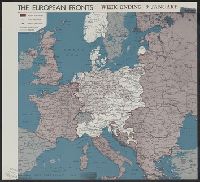
- Creator:
- United States. Office of Strategic Services. Reproduction Branch
United States. Office of Strategic Services. Research and Analysis Branch
- Published / Created:
- 1945
- Call Number:
- 11hd 1945K-21
- Container / Volume:
- BRBL_00010ZG
- Image Count:
- 1
- Resource Type:
- Maps, Atlases & Globes
- Found in:
- Beinecke Rare Book and Manuscript Library > The European fronts [cartographic material] : week ending 9 January / R & A, OSS.
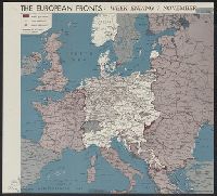
- Creator:
- United States. Office of Strategic Services. Research and Analysis Branch
- Published / Created:
- [1944?]
- Call Number:
- 11hd 1945K-16
- Container / Volume:
- BRBL_00010ZG
- Image Count:
- 1
- Resource Type:
- Maps, Atlases & Globes
- Found in:
- Beinecke Rare Book and Manuscript Library > The European fronts [cartographic material] : week ending 7 November.
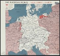
- Creator:
- United States. Office of Strategic Services. Research and Analysis Branch
- Published / Created:
- [1945?]
- Call Number:
- 11hd 1945K-5
- Container / Volume:
- BRBL_00010ZG
- Image Count:
- 1
- Resource Type:
- Maps, Atlases & Globes
- Found in:
- Beinecke Rare Book and Manuscript Library > The European fronts [cartographic material] : week ending 6 March.