
Search


Limit your search
- Public✖[remove]267
- cartographic267
- Maps, Atlases & Globes✖[remove]267
- Shell Union Oil Corporation7
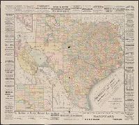
- Rand McNally and Company5
- Shell Oil Company4
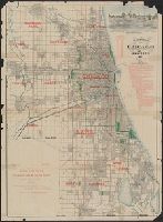
- Blanchard, Rufus, 1821-19043
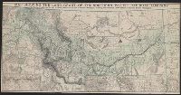
- Atchison, Topeka, and Santa Fe Railroad Company2
- Atchison, Topeka, and Santa Fe Railroad Company--Maps2
- Canadian Pacific Railway Company2
- Chicago, Milwaukee, and St. Paul Railway Company--Maps2
- Cia. de la Guia Oficial Mexicana S.A2
- Conoco Travel Bureau2
- Chicago :✖[remove]267
- New York :2
Current results range from 1853 to 1999