Skip to search
Skip to main content
Skip to first result
Search
You Searched For
Access
Public
Genre
Maps
Publication Place
London :
Subject (Geographic)
Balkan Peninsula--Maps
New Search
Search Results
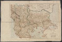
Creator:
Published / Created:
1801
Call Number:
491 1801
Container / Volume:
BRBL_00269
Image Count:
1
Resource Type:
Maps, Atlases & Globes
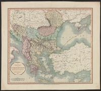
Description:
Appears in the author's Cary's new universal atlas. 1808., Relief shown pictorially., and Shows "boundary of Europe and Asia."
Publisher:
J. Cary, engraver & map-seller, no. 181 Strand,
Subject (Geographic):
Balkan Peninsula--Maps and Thrace, Eastern (Turkey)--Maps
Subject (Name):
Cary, John, ca. 1754-1835. Cary's new universal atlas
Found in:
Beinecke Rare Book and Manuscript Library > A new map of Turkey in Europe, divided into its provinces, from the best authorities / by John Cary, engraver.
Published / Created:
[1912]
Call Number:
41 1912
Container / Volume:
BRBL_00241
Image Count:
1
Resource Type:
Maps, Atlases & Globes
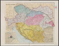
Description:
Inset: Environs of Vienna.
Publisher:
George Philip & Son, Ltd.,
Subject (Geographic):
Austria--Maps, Balkan Peninsula--Maps, and Hungary--Maps
Found in:
Beinecke Rare Book and Manuscript Library > Austria-Hungary / The London Geographical Institute.
Creator:
Published / Created:
1916
Call Number:
46f 1916
Container / Volume:
BRBL_00260
Image Count:
1
Resource Type:
Maps, Atlases & Globes
Description:
From the Geographical Journal, April, 1916.
Publisher:
Royal Geographical Society,
Subject (Geographic):
Balkan Peninsula--Maps
Subject (Name):
Royal Geographical Society (Great Britain)
Found in:
Beinecke Rare Book and Manuscript Library > Diagrammatic map of Slav territories east of the Adriatic [cartographic material] / by Sir Arthur Evans.
Creator:
Published / Created:
[1852?]
Call Number:
44 1852
Container / Volume:
BRBL_00255
Image Count:
1
Resource Type:
Maps, Atlases & Globes
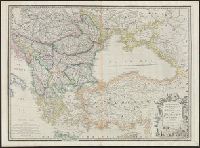
Description:
Relief shown pictorially. and Shows "railways completed."
Publisher:
Js. Wyld,
Subject (Geographic):
Balkan Peninsula--Maps and Turkey--Maps
Subject (Topic):
Railroads--Balkan Peninsula--Maps and Railroads--Turkey--Maps
Found in:
Beinecke Rare Book and Manuscript Library > European dominions of the Ottomans, or Turkey in Europe.
Creator:
Published / Created:
[1918]
Call Number:
44ed 1918A
Container / Volume:
BRBL_00257
Image Count:
1
Resource Type:
Maps, Atlases & Globes
Description:
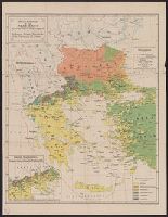
Inset: Greek Macedonia, Distribution of various Nationalities 1st of January 1916.
Publisher:
Stanford's Geographical Establishment,
Subject (Geographic):
Balkan Peninsula--Maps and Turkey--Maps
Subject (Name):
Stanford's Geographical Estabt
Subject (Topic):
Ethnology--Balkan Peninsula--Maps and Ethnology--Turkey--Maps
Found in:
Beinecke Rare Book and Manuscript Library > Hellenism in the Near East : an ethnological map compiled from the latest statistics / by George Soteriadis.
Creator:
Published / Created:
[1862?]
Call Number:
53 1862
Container / Volume:
BRBL_00284
Image Count:
1
Resource Type:
Maps, Atlases & Globes
Description:
Inset: Large Scale Map of the Danube.
Publisher:
Letts, Son & Co.,
Subject (Geographic):
Balkan Peninsula--Maps, Caucasus--Maps, and Turkey--Maps
Found in:
Beinecke Rare Book and Manuscript Library > Letts's General Map of Russia & Turkey.
Creator:
Published / Created:
1914
Call Number:
44 1914A
Container / Volume:
BRBL_00256
Image Count:
1
Resource Type:
Maps, Atlases & Globes
Alternative Title:
Geographic journal. [Offprint] and Geographic journal. Offprint.
Description:
From the Geographical Journal, May, 1914. and Relief shown by shading and spot heights.
Publisher:
Royal Geographical Society,
Subject (Geographic):
Balkan Peninsula--Maps
Found in:
Beinecke Rare Book and Manuscript Library > Map of the Balkan States showing frontiers in accordance with the treaties and agreements of 1913-14 [cartographic material].
Creator:
Published / Created:
1878
Call Number:
44FD 1878A
Container / Volume:
BRBL_00257
Image Count:
1
Resource Type:
Maps, Atlases & Globes
Alternative Title:
Map to illustrate the Treaty of San Stefano and Stanford's map of south-eastern Europe and Armenia illustrating the Treaty of San Stefano, the new limits of Bulgaria, Servia, Roumania, Montenegro, etc., etc., and the acquisitions of Russia
Description:
Inset: Map of Armenia to illustrate Article XIX of the Treaty of San Stefano. and Map of southeastern Europe showing existing boundaries and boundaries proposed in the Treaty of San Stefano. Relief shown by hachures.
Publisher:
Edward Stanford,
Subject (Geographic):
Balkan Peninsula--Maps
Subject (Topic):
Eastern question (Balkan)--Maps and Treaty of San Stefano--(1878)--Maps
Found in:
Beinecke Rare Book and Manuscript Library > Stanford's "Treaty map" of south eastern Europe and Armenia [cartographic material].
Published / Created:
[1914]
Call Number:
44 1914
Container / Volume:
BRBL_00256
Image Count:
1
Resource Type:
Maps, Atlases & Globes
Alternative Title:
London Atlas Series
Publisher:
E. Stanford Ltd,
Subject (Geographic):
Balkan Peninsula--Maps
Found in:
Beinecke Rare Book and Manuscript Library > The states & provinces of the Balkan Peninsula [cartographic material].
Creator:
Published / Created:
1876
Call Number:
491 1876
Container / Volume:
BRBL_00269
Image Count:
1
Resource Type:
Maps, Atlases & Globes
Description:
"Scale: 60 miles to one degree."
Publisher:
Edward Stanford,
Subject (Geographic):
Balkan Peninsula--Maps
Found in:
Beinecke Rare Book and Manuscript Library > Turkey in Europe [cartographic material] / by J. Arrowsmith.
Branch:v1.64.0 ,Deployed:2024-09-11T10:25:40-04:00