Search
You Searched For
Search Results
- Published / Created:
- 1794
- Call Number:
- 38GMD 1794
- Container / Volume:
- BRBL_00171
- Image Count:
- 1
- Resource Type:
- Maps, Atlases & Globes
- Found in:
- Beinecke Rare Book and Manuscript Library > A new map of the Kingdom of France ... with all the Post Roads ...
- Published / Created:
- 1806
- Call Number:
- 38 1806
- Container / Volume:
- BRBL_00154
- Image Count:
- 1
- Resource Type:
- Maps, Atlases & Globes
- Found in:
- Beinecke Rare Book and Manuscript Library > A new map of France ... division into Provinces as previous to the Revolution ... by John Cary, Engraver.
- Published / Created:
- 1794
- Call Number:
- 38cea 1757
- Container / Volume:
- BRBL_00169
- Image Count:
- 1
- Resource Type:
- Maps, Atlases & Globes
- Found in:
- Beinecke Rare Book and Manuscript Library > An accurate chart of the Bay of Biscay ... taken in 1756 & 1757 ... By Mr. Magin Engineer to the Marine.
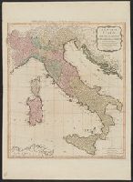
- Creator:
- Delarochette, L. (Louis), 1731-1802
- Published / Created:
- [1769]
- Call Number:
- 40 1777
- Container / Volume:
- BRBL_00198
- Image Count:
- 1
- Resource Type:
- Maps, Atlases & Globes
- Found in:
- Beinecke Rare Book and Manuscript Library > A map of Italy / by Mr. Palairet with improvements & additions from the best authorities by L. Delarochette ; Tho Kitchin sculpt.
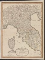
- Published / Created:
- 1799
- Call Number:
- 40 1799B
- Container / Volume:
- BRBL_00198
- Image Count:
- 1
- Resource Type:
- Maps, Atlases & Globes
- Found in:
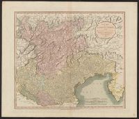
- Beinecke Rare Book and Manuscript Library > A new map of the county of Tyrol, and the republic of Venice ... / by John Cary, engraver.
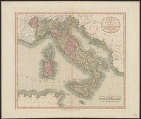
- Published / Created:
- 1776
- Call Number:
- 40 1776
- Container / Volume:
- BRBL_00198
- Image Count:
- 1
- Resource Type:
- Maps, Atlases & Globes
- Found in:
- Beinecke Rare Book and Manuscript Library > Italy, divided into its several dominions ... / from Mr. d'Anville ; by the late Thomas Jefferys ...
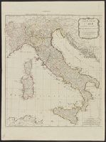
- Published / Created:
- 1790
- Call Number:
- 40 1790
- Container / Volume:
- BRBL_00198
- Image Count:
- 1
- Resource Type:
- Maps, Atlases & Globes
- Found in:
- Beinecke Rare Book and Manuscript Library > A new map of Italy, with the islands of Sicily, Sardinia & Corsica / from Monsr. d'Anville ...
- Published / Created:
- 1834
- Call Number:
- 40 1832
- Container / Volume:
- BRBL_00199
- Image Count:
- 1
- Resource Type:
- Maps, Atlases & Globes
- Found in:
- Beinecke Rare Book and Manuscript Library > North Italy &c. and the passes of the Alps & Apennines / by J. Arrowsmith.
- Published / Created:
- 1799
- Call Number:
- 40 1799A
- Container / Volume:
- BRBL_00198
- Image Count:
- 1
- Resource Type:
- Maps, Atlases & Globes
- Found in:
- Beinecke Rare Book and Manuscript Library > A new map of the middle and upper parts of Italy ... / Jones & Smith sculp ...
- Published / Created:
- [1780?]
- Call Number:
- 40 1780A
- Container / Volume:
- BRBL_00198
- Image Count:
- 1
- Resource Type:
- Maps, Atlases & Globes
- Found in:
- Beinecke Rare Book and Manuscript Library > Bowles's new pocket map of Italy ... / by J. Palairet ... ; lately revised and improved ... by L. Delarochette.
- Published / Created:
- 1799
- Call Number:
- 40 1799
- Container / Volume:
- BRBL_00198
- Image Count:
- 1
- Resource Type:
- Maps, Atlases & Globes
- Found in:
- Beinecke Rare Book and Manuscript Library > A new map of Italy ... / by John Cary, engraver.
- Published / Created:
- 1832
- Call Number:
- 40 1832
- Container / Volume:
- BRBL_00199
- Image Count:
- 1
- Resource Type:
- Maps, Atlases & Globes
- Found in:
- Beinecke Rare Book and Manuscript Library > South Italy / by J. Arrowsmith.
- Creator:
- Kitchin, Thomas, d. 1784
- Published / Created:
- 1794
- Call Number:
- 40 1794
- Container / Volume:
- BRBL_00198
- Image Count:
- 1
- Resource Type:
- Maps, Atlases & Globes
- Found in:
- Beinecke Rare Book and Manuscript Library > A new map of Italy with the islands of Sicily, Sardinia & Corsica / from Monsr. d'Anville: to which have been added the post roads and several other improvements.
- Published / Created:
- 1811
- Call Number:
- 40 1811
- Container / Volume:
- BRBL_00199
- Image Count:
- 1
- Resource Type:
- Maps, Atlases & Globes
- Found in:
- Beinecke Rare Book and Manuscript Library > A new map of the county of Tyrol, and the republic of Venice ... / by John Cary, engraver.
- Published / Created:
- 1843
- Call Number:
- 40 1843
- Container / Volume:
- BRBL_00200
- Image Count:
- 1
- Resource Type:
- Maps, Atlases & Globes
- Found in:
- Beinecke Rare Book and Manuscript Library > South Italy, to accompany the handbook for travellers / by J. & C. Walker.
- Creator:
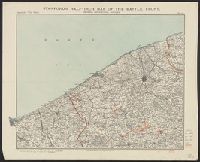
- Edward Stanford Ltd
- Published / Created:
- 1917
- Call Number:
- 11hc 1917S
- Container / Volume:
- BRBL_00010E
- Image Count:
- 1
- Resource Type:
- Maps, Atlases & Globes
- Found in:
- Beinecke Rare Book and Manuscript Library > Stanford's half-inch map of the battle front, Ostend, Zeebrugge, Bruges / Edward Stanford Ltd.
- Creator:
- Stanford's Geographical Estabt
- Published / Created:
- [1917?]
- Call Number:
- 11hc 1919W
- Image Count:
- 1
- Resource Type:
- Maps, Atlases & Globes
- Found in:
- Beinecke Rare Book and Manuscript Library > The downfall of Germany's world-empire / Stanford's Geogl. Estabt., London.
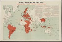
- Published / Created:
- [1916?]
- Call Number:
- 11hc 1914R
- Container / Volume:
- BRBL_00010B
- Image Count:
- 1
- Resource Type:
- Maps, Atlases & Globes
- Found in:
- Beinecke Rare Book and Manuscript Library > What Germany wants : her claims as set forth by leaders of German thought.
- Creator:
- H. & C. Graham Ltd., lithographer
- Published / Created:
- [1916?]
- Call Number:
- 11hc 1915P
- Container / Volume:
- BRBL_00010C
- Image Count:
- 1
- Resource Type:
- Maps, Atlases & Globes
- Found in:
- Beinecke Rare Book and Manuscript Library > The Prussian octopus. [graphic].
- Creator:
- Edward Stanford Ltd
- Published / Created:
- 1917
- Call Number:
- 11hc 1917P
- Container / Volume:
- BRBL_00010E
- Image Count:
- 1
- Resource Type:
- Maps, Atlases & Globes
- Found in:
- Beinecke Rare Book and Manuscript Library > Stanford's half-inch map of the British front in France & Flanders.
- Creator:
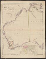
- Arrowsmith, John, 1790-1873
- Published / Created:
- 1st. Jany. 1850.
- Call Number:
- 26 1850A
- Container / Volume:
- BRBL_00022
- Image Count:
- 1
- Resource Type:
- Maps, Atlases & Globes
- Found in:
- Beinecke Rare Book and Manuscript Library > Australia from surveys made by order of the British Government : combined with those of D'Entrecasteaux, Baudin, Freycinet &c. &c. [cartographic material] / by John Arrowsmith.
- Published / Created:
- 1782
- Call Number:
- 21cea 1782
- Container / Volume:
- BRBL_00016
- Image Count:
- 1
- Resource Type:
- Maps, Atlases & Globes
- Found in:
- Beinecke Rare Book and Manuscript Library > A Chart of the Atlantic Ocean.
- Creator:
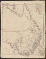
- Arrowsmith, John, 1790-1873
- Published / Created:
- 1st Jany. 1850.
- Call Number:
- 26 1850B
- Container / Volume:
- BRBL_00022
- Image Count:
- 1
- Resource Type:
- Maps, Atlases & Globes
- Found in:
- Beinecke Rare Book and Manuscript Library > Eastern portion of Australia / by John Arrowsmith.
- Creator:
- Great Britain. Hydrographic Dept
Stokes, J. Lort (John Lort), 1811-1885
- Published / Created:
- Aug. 16th. 1852 [i.e. 1865]
- Call Number:
- 26cea 1851A
- Container / Volume:
- BRBL_00023
- Image Count:
- 1
- Resource Type:
- Maps, Atlases & Globes
- Found in:
- Beinecke Rare Book and Manuscript Library > Australia east coast. Sheet I, Cape Howe to Barriga Point / from a running survey by Captn. J. Lort Stokes ... 1851.
- Published / Created:
- 1770
- Call Number:
- 219cea 1770
- Image Count:
- 1
- Resource Type:
- Maps, Atlases & Globes
- Found in:
- Beinecke Rare Book and Manuscript Library > A draught of Falklands Islands in the latitude of 51° 22' South, longitude 64° 30' West.
- Creator:
- Great Britain. General Staff. Geographical Section
- Published / Created:
- 1919
- Call Number:
- 11hcf 1919-4
- Container / Volume:
- BRBL_00010L
- Image Count:
- 1
- Resource Type:
- Maps, Atlases & Globes
- Found in:
- Beinecke Rare Book and Manuscript Library > Map of the Dragoman Pass, GSGS 2922.
- Creator:
- Geographia Ltd
Gross, Alexander, 1879-1958
- Published / Created:
- [1916?]
- Call Number:
- 11hcf 1919C-6
- Container / Volume:
- BRBL_00010V
- Image Count:
- 1
- Resource Type:
- Maps, Atlases & Globes
- Found in:
- Beinecke Rare Book and Manuscript Library > The Daily telegraph war map no. 15 [cartographic material] : of the western front, Verdun to Belfort / By Alexander Gross ; Geographia Ltd.
- Creator:
- Ordnance Survey of Great Britain and Ireland
Royal Geographical Society (Great Britain). Geographical Section
- Published / Created:
- 1915
- Call Number:
- 11hcf 1919E-11
- Image Count:
- 1
- Resource Type:
- Maps, Atlases & Globes
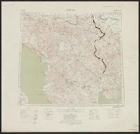
- Found in:
- Beinecke Rare Book and Manuscript Library > Triest : North L 33. / compiled at the Royal Geographical Society under the direction of the Geographical Section; drawn and printed by Ordnance Survey.
- Creator:
- Ordnance Survey of Great Britain and Ireland
Royal Geographical Society (Great Britain). Geographical Section
- Published / Created:
- 1915
- Call Number:
- 11hcf 1919E-10
- Container / Volume:
- BRBL_00010Z
- Image Count:
- 1
- Resource Type:
- Maps, Atlases & Globes
- Found in:
- Beinecke Rare Book and Manuscript Library > Triest : North L 33. / compiled at the Royal Geographical Society under the direction of the Geographical Section; drawn and printed by Ordnance Survey.
- Creator:
- Ordnance Survey of Great Britain and Ireland
Royal Geographical Society (Great Britain). Geographical Section
- Published / Created:
- 1915
- Call Number:
- 11hcf 1919E-12
- Image Count:
- 1
- Resource Type:
- Maps, Atlases & Globes
- Found in:
- Beinecke Rare Book and Manuscript Library > (Warsaw) Varshava : North N. 34. / compiled at the Royal Geographical Society under the direction of the Geographical Section; drawn and printed by Ordnance Survey.
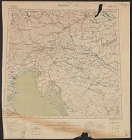
- Creator:
- Ordnance Survey of Great Britain and Ireland
Royal Geographical Society (Great Britain). Geographical Section
- Published / Created:
- 1915
- Call Number:
- 11hcf 1919E-18
- Image Count:
- 1
- Resource Type:
- Maps, Atlases & Globes
- Found in:
- Beinecke Rare Book and Manuscript Library > Jitomir : North M 35. / compiled at the Royal Geographical Society under the direction of the Geographical Section; drawn and printed by Ordnance Survey.
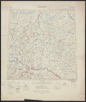
- Creator:
- Ordnance Survey of Great Britain and Ireland
Royal Geographical Society (Great Britain). Geographical Section
- Published / Created:
- 1918
- Call Number:
- 11hcf 1919E-15
- Image Count:
- 1
- Resource Type:
- Maps, Atlases & Globes
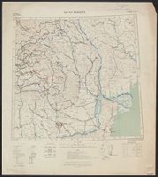
- Found in:
- Beinecke Rare Book and Manuscript Library > Bucuresti : North L 35. / compiled at the Royal Geographical Society under the direction of the Geographical Section; drawn and printed by Ordnance Survey.
- Creator:
- Ordnance Survey of Great Britain and Ireland
Royal Geographical Society (Great Britain). Geographical Section
- Published / Created:
- 1915
- Call Number:
- 11hcf 1919E-13
- Image Count:
- 1
- Resource Type:
- Maps, Atlases & Globes
- Found in:
- Beinecke Rare Book and Manuscript Library > Bucuresti : North L 35. / compiled at the Royal Geographical Society under the direction of the Geographical Section; drawn and printed by Ordnance Survey.
- Creator:
- Ordnance Survey of Great Britain and Ireland
Royal Geographical Society (Great Britain). Geographical Section
- Published / Created:
- [1914?]
- Call Number:
- 11hcf 1919E-17
- Image Count:
- 1
- Resource Type:
- Maps, Atlases & Globes
- Found in:
- Beinecke Rare Book and Manuscript Library > Milano : North L. 32. / compiled at the Royal Geographical Society under the direction of the Geographical Section; drawn and printed by Ordnance Survey.
- Creator:
- Ordnance Survey of Great Britain and Ireland
Royal Geographical Society (Great Britain). Geographical Section
- Published / Created:
- 1915
- Call Number:
- 11hcf 1919E-19
- Image Count:
- 1
- Resource Type:
- Maps, Atlases & Globes
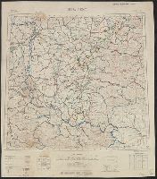
- Found in:
- Beinecke Rare Book and Manuscript Library > Buda Pest : North L 34. / compiled at the Royal Geographical Society under the direction of the Geographical Section; drawn and printed by Ordnance Survey.
- Creator:
- Ordnance Survey of Great Britain and Ireland
Royal Geographical Society (Great Britain). Geographical Section
- Published / Created:
- 1915
- Call Number:
- 11hcf 1919E-10
- Image Count:
- 1
- Resource Type:
- Maps, Atlases & Globes
- Found in:
- Beinecke Rare Book and Manuscript Library > Triest : North L 33. / compiled at the Royal Geographical Society under the direction of the Geographical Section; drawn and printed by Ordnance Survey.
- Creator:
- Ordnance Survey of Great Britain and Ireland
Royal Geographical Society (Great Britain). Geographical Section
- Published / Created:
- 1916
- Call Number:
- 11hcf 1919E-16
- Image Count:
- 1
- Resource Type:
- Maps, Atlases & Globes
- Found in:
- Beinecke Rare Book and Manuscript Library > Roma : North K 33. / compiled at the Royal Geographical Society under the direction of the Geographical Section; drawn and printed by Ordnance Survey.
- Creator:
- Great Britain. Admiralty
- Published / Created:
- 1894 [i.e. 1903?]
- Call Number:
- 261cea T636 1894
- Container / Volume:
- BRBL_00022
- Image Count:
- 1
- Resource Type:
- Maps, Atlases & Globes
- Found in:
- Beinecke Rare Book and Manuscript Library > Australia, north coast, Torres Strait. Thursday Island Harbour / surveyed by Mr. E.A. Cullen.
- Published / Created:
- 1812
- Call Number:
- 29 1812
- Container / Volume:
- BRBL_00028
- Image Count:
- 1
- Resource Type:
- Maps, Atlases & Globes
- Found in:
- Beinecke Rare Book and Manuscript Library > A Chart of the Great Ethiopian Archipelago in the Indian Seas ... M.D. Apres. For the History of Mauritus by Ch. Grant ... 1801 S.J. Neele Sculp. 1812.
- Published / Created:
- 1801
- Call Number:
- 297 1801
- Container / Volume:
- BRBL_00028
- Image Count:
- 1
- Resource Type:
- Maps, Atlases & Globes
- Found in:
- Beinecke Rare Book and Manuscript Library > Map of the Isle of France or Mauritius ... By Charles Grant Viscount de Vaux. Engraved by S.J. Neele.
- Creator:
- Rose, Fredk. W. (Frederick W.)
- Published / Created:
- [1877]
- Call Number:
- 30an 1877
- Container / Volume:
- BRBL_00037
- Image Count:
- 1
- Resource Type:
- Maps, Atlases & Globes
- Found in:
- Beinecke Rare Book and Manuscript Library > Serio-comic war map for the year 1877 / by F.W. Rose.
- Creator:
- Rose, Fredk. W. (Frederick W.)
- Published / Created:
- [1877]
- Call Number:
- 30an 1877B
- Container / Volume:
- BRBL_00037
- Image Count:
- 1
- Resource Type:
- Maps, Atlases & Globes
- Found in:
- Beinecke Rare Book and Manuscript Library > Serio-comic war map for the year 1877 / by F.W. Rose.
- Creator:
- Rose, Fredk. W. (Frederick W.)
- Published / Created:
- [1877]
- Call Number:
- 30an 1877A
- Container / Volume:
- BRBL_00037
- Image Count:
- 1
- Resource Type:
- Maps, Atlases & Globes
- Found in:
- Beinecke Rare Book and Manuscript Library > Serio-comic war map for the year 1877 / by F.W. Rose.
- Creator:
- Geographia Ltd
Thomas Cook Ltd
- Published / Created:
- [1890?]
- Call Number:
- 304ag 1890
- Container / Volume:
- BRBL_00034A
- Image Count:
- 1
- Resource Type:
- Maps, Atlases & Globes
- Found in:
- Beinecke Rare Book and Manuscript Library > Cook's map of central Europe.
- Published / Created:
- [1917?]
- Call Number:
- 304ed 1916B
- Container / Volume:
- BRBL_00034A
- Image Count:
- 1
- Resource Type:
- Maps, Atlases & Globes
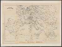
- Found in:
- Beinecke Rare Book and Manuscript Library > Subject nationalities of the German alliance : from the Allies' peace terms as stated in their reply to President Wilson's note of 19th Dec. 1916 : [Eurasia].
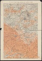
- Published / Created:
- 1835
- Call Number:
- 304gmd 1835
- Container / Volume:
- BRBL_00034B
- Image Count:
- 1
- Resource Type:
- Maps, Atlases & Globes
- Found in:
- Beinecke Rare Book and Manuscript Library > New Post Map of Central Europe, Exhibiting the Great and secondary routes with the various stations where relays are obtained showing also the distance between each according to the measure used in the respective countries ...
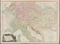
- Published / Created:
- 1793
- Call Number:
- 304gmd 1793
- Container / Volume:
- BRBL_00034B
- Image Count:
- 1
- Resource Type:
- Maps, Atlases & Globes
- Found in:
- Beinecke Rare Book and Manuscript Library > A New map of the Emperor's Dominions exhibiting the Post Roads of Germany, Hungary, and the Netherlands ... parts of France, Italy, Switzerland and Poland ...
- Published / Created:
- 1743
- Call Number:
- 319 1743
- Container / Volume:
- BRBL_00040
- Image Count:
- 1
- Resource Type:
- Maps, Atlases & Globes
- Found in:
- Beinecke Rare Book and Manuscript Library > A New and exact map of Great Britain ... [Including Ireland].
- Creator:
- Horsley, John, 1675-1732, cartographer
Laurie, Richard Holmes
- Published / Created:
- 1821
- Call Number:
- 3190 No. 6
- Container / Volume:
- BRBL_00041
- Image Count:
- 1
- Resource Type:
- Maps, Atlases & Globes
- Found in:
- Beinecke Rare Book and Manuscript Library > Britanniæ Antiquæ [cartographic material] : tabula geographica ex ævi Romani monumentis / ab eruditissimo viro Johanne Horsley ... recentissinmus observationibus concinnata.
- Creator:
- Hewerdine, Matt
Rose, Fredk. W. (Frederick W.)
- Published / Created:
- c1899.
- Call Number:
- 30an 1899
- Container / Volume:
- BRBL_00037A
- Image Count:
- 1
- Resource Type:
- Maps, Atlases & Globes
- Found in:
- Beinecke Rare Book and Manuscript Library > Angling in troubled waters [cartographic material] : a serio-comic map of Europe / by Fred. W. Rose ; Matt. Hewerdine, from design by Fred. W. Rose.
- Published / Created:
- 1801
- Call Number:
- 3191 1801
- Container / Volume:
- BRBL_00041
- Image Count:
- 1
- Resource Type:
- Maps, Atlases & Globes
- Found in:
- Beinecke Rare Book and Manuscript Library > A Map of England, Wales, & Scotland ... by W. Faden ...
- Published / Created:
- 1878
- Call Number:
- 32 L84 1878
- Container / Volume:
- BRBL_00051
- Image Count:
- 1
- Resource Type:
- Maps, Atlases & Globes
- Found in:
- Beinecke Rare Book and Manuscript Library > District map of the South London Microscopical and Natural History club 1878.
- Published / Created:
- 1886
- Call Number:
- 32 Ox1 1886
- Container / Volume:
- BRBL_00053
- Image Count:
- 1
- Resource Type:
- Maps, Atlases & Globes
- Found in:
- Beinecke Rare Book and Manuscript Library > University of London. The Park and Marston Estate, 1886.
- Published / Created:
- [1840?]
- Call Number:
- 32 Ox1 1840
- Container / Volume:
- BRBL_00052A
- Image Count:
- 1
- Resource Type:
- Maps, Atlases & Globes
- Found in:
- Beinecke Rare Book and Manuscript Library > Darton's Environs of Oxford, including London, East. Huntingdon, North. Chetenham, West and Andover South of the City of Oxford.
- Published / Created:
- 1846
- Call Number:
- 32 L84 1846
- Container / Volume:
- BRBL_00050
- Image Count:
- 1
- Resource Type:
- Maps, Atlases & Globes
- Found in:
- Beinecke Rare Book and Manuscript Library > A guide through London and the surrounding boroughs. Engraved S.I. Russell.
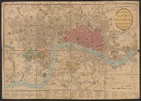
- Published / Created:
- 1835
- Call Number:
- 32 L84 1835A
- Container / Volume:
- BRBL_00050
- Image Count:
- 1
- Resource Type:
- Maps, Atlases & Globes
- Found in:
- Beinecke Rare Book and Manuscript Library > Mogg's Strangers Guide to London Exhibiting all the various Alterations and Improvements complete to the Present Time.
- Published / Created:
- 1844
- Call Number:
- 32 L84 1844
- Container / Volume:
- BRBL_00050
- Image Count:
- 1
- Resource Type:
- Maps, Atlases & Globes
- Found in:
- Beinecke Rare Book and Manuscript Library > Cruchley's New Plan of London ...
- Published / Created:
- 1823
- Call Number:
- 32 L84 1823A
- Container / Volume:
- BRBL_00049
- Image Count:
- 1
- Resource Type:
- Maps, Atlases & Globes
- Found in:
- Beinecke Rare Book and Manuscript Library > A new and correct plan of London and Westminster ...
- Published / Created:
- 1816
- Call Number:
- 32 L84 1816A
- Container / Volume:
- BRBL_00049
- Image Count:
- 1
- Resource Type:
- Maps, Atlases & Globes
- Found in:
- Beinecke Rare Book and Manuscript Library > William Belch's New Map of London.
- Creator:
- Wyld, James, 1812-1887
- Published / Created:
- [1862]
- Call Number:
- 32 L84 1862
- Container / Volume:
- BRBL_00050
- Image Count:
- 1
- Resource Type:
- Maps, Atlases & Globes
- Found in:
- Beinecke Rare Book and Manuscript Library > Wyld's new plan of London = Nouveau plan des Londres = Neuer Plan von London.
- Published / Created:
- 1814
- Call Number:
- 32 L84 1814
- Container / Volume:
- BRBL_00049
- Image Count:
- 1
- Resource Type:
- Maps, Atlases & Globes
- Found in:
- Beinecke Rare Book and Manuscript Library > A plan of London with its Modern Improvements. Neele Sc.
- Creator:
- Reynolds, James, active 1845-1864
- Published / Created:
- 1871
- Call Number:
- 32 L84 1871
- Container / Volume:
- BRBL_00051
- Image Count:
- 1
- Resource Type:
- Maps, Atlases & Globes
- Found in:
- Beinecke Rare Book and Manuscript Library > New map of London with the recent improvements : divided into quarter mile sections for measuring distances.
- Published / Created:
- 1841
- Call Number:
- 32 L84 1841
- Container / Volume:
- BRBL_00050
- Image Count:
- 1
- Resource Type:
- Maps, Atlases & Globes
- Found in:
- Beinecke Rare Book and Manuscript Library > 24 miles round London.
- Published / Created:
- 1858
- Call Number:
- 32 L84 1858A
- Container / Volume:
- BRBL_00050
- Image Count:
- 1
- Resource Type:
- Maps, Atlases & Globes
- Found in:
- Beinecke Rare Book and Manuscript Library > Wyld's new plan of London for 1858.
- Published / Created:
- 1827
- Call Number:
- 32 L84 1827
- Container / Volume:
- BRBL_00049
- Image Count:
- 1
- Resource Type:
- Maps, Atlases & Globes
- Found in:
- Beinecke Rare Book and Manuscript Library > Cruchley's New Plan of London improved to 1827 including the East and West India Docks.
- Published / Created:
- 1855
- Call Number:
- 32 L84 1855
- Container / Volume:
- BRBL_00050
- Image Count:
- 1
- Resource Type:
- Maps, Atlases & Globes
- Found in:
- Beinecke Rare Book and Manuscript Library > Darton's London Guide 1855.
- Creator:
- G.W. Bacon & Co
- Published / Created:
- [1876?]
- Call Number:
- 32 L84 1876A
- Container / Volume:
- BRBL_00051
- Image Count:
- 1
- Resource Type:
- Maps, Atlases & Globes
- Found in:
- Beinecke Rare Book and Manuscript Library > Bacon's new map of London : divided into half mile squares & circles.
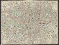
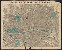
- Creator:
- Collins, H. G. (Henry George)
Stanford, Edward, 1827-1904
- Published / Created:
- [1877?].
- Call Number:
- 32 L84 1877
- Container / Volume:
- BRBL_00051
- Image Count:
- 1
- Resource Type:
- Maps, Atlases & Globes
- Found in:
- Beinecke Rare Book and Manuscript Library > Collins' standard map of London [cartographic material].
- Creator:
- Reynolds, James, active 1845-1864
- Published / Created:
- 1875
- Call Number:
- 32 L84 1875B
- Container / Volume:
- BRBL_00051
- Image Count:
- 1
- Resource Type:
- Maps, Atlases & Globes
- Found in:
- Beinecke Rare Book and Manuscript Library > Reynolds's new map of London and its suburbs [cartographic material] : divided into quarter-mile sections for measuring distances.
- Creator:
- Wyld, James, 1812-1887
- Published / Created:
- [ca. 1880]
- Call Number:
- 32 L84 1880B
- Container / Volume:
- BRBL_00051
- Image Count:
- 1
- Resource Type:
- Maps, Atlases & Globes
- Found in:
- Beinecke Rare Book and Manuscript Library > The post office plan of London [map] / engraved by Jas. Wyld, geographer to the Queen ...
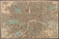
- Published / Created:
- 1896
- Call Number:
- 32 L84 1896
- Container / Volume:
- BRBL_00051
- Image Count:
- 1
- Resource Type:
- Maps, Atlases & Globes
- Found in:
- Beinecke Rare Book and Manuscript Library > New Map of Central London.
- Published / Created:
- [1900?]
- Call Number:
- 32 L84 1900A
- Container / Volume:
- BRBL_00051
- Image Count:
- 1
- Resource Type:
- Maps, Atlases & Globes
- Found in:
- Beinecke Rare Book and Manuscript Library > Bacon's Cycling Road-Map 30 miles round London.
- Creator:
- Bacon & Co.
- Published / Created:
- 1870
- Call Number:
- 32 L84 1870
- Container / Volume:
- BRBL_00051
- Image Count:
- 1
- Resource Type:
- Maps, Atlases & Globes
- Found in:
- Beinecke Rare Book and Manuscript Library > Bacon's map of London : with the railways in operation and constructing.
- Published / Created:
- 1827
- Call Number:
- 32 L84 1827A
- Container / Volume:
- BRBL_00049
- Image Count:
- 1
- Resource Type:
- Maps, Atlases & Globes
- Found in:
- Beinecke Rare Book and Manuscript Library > New Plan of London including the East and West India Docks.
- Published / Created:
- 1821
- Call Number:
- 32 L84 1821
- Container / Volume:
- BRBL_00049
- Image Count:
- 1
- Resource Type:
- Maps, Atlases & Globes
- Found in:
- Beinecke Rare Book and Manuscript Library > New Plan of the Cities of London and Westminster ...
- Creator:
- Davies, Benjamin Rees
- Published / Created:
- 1858
- Call Number:
- 32 L84 1858B
- Container / Volume:
- BRBL_00050
- Image Count:
- 1
- Resource Type:
- Maps, Atlases & Globes
- Found in:
- Beinecke Rare Book and Manuscript Library > Davies's map of the environs of London [cartographic material] / drawn & engraved by B.R. Davies, 1858.
- Published / Created:
- 1826
- Call Number:
- 32 L84 1826
- Container / Volume:
- BRBL_00049
- Image Count:
- 1
- Resource Type:
- Maps, Atlases & Globes
- Found in:
- Beinecke Rare Book and Manuscript Library > Cruchley's New Plan of London Improved to 1826.
- Creator:
- Letts, Son & Co., author
- Published / Created:
- [1882?]
- Call Number:
- 32 L84 1881
- Container / Volume:
- BRBL_00051
- Image Count:
- 1
- Resource Type:
- Maps, Atlases & Globes
- Found in:
- Beinecke Rare Book and Manuscript Library > Letts's map of London [cartographic material].
- Published / Created:
- [1890?]
- Call Number:
- 321 1890A
- Container / Volume:
- BRBL_00054A
- Image Count:
- 1
- Resource Type:
- Maps, Atlases & Globes
- Found in:
- Beinecke Rare Book and Manuscript Library > The River Thames from its Source to the Sea / By Edwd. Weller.
- Published / Created:
- [1900?]
- Call Number:
- 321 1900A
- Container / Volume:
- BRBL_00054A
- Image Count:
- 1
- Resource Type:
- Maps, Atlases & Globes
- Found in:
- Beinecke Rare Book and Manuscript Library > Tombleson's Panoramic Map of the Thames and Medway.
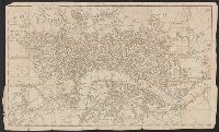
- Published / Created:
- 1774
- Call Number:
- 321 1793
- Container / Volume:
- BRBL_00054A
- Image Count:
- 1
- Resource Type:
- Maps, Atlases & Globes
- Found in:
- Beinecke Rare Book and Manuscript Library > Bowles's Draught of the River Thames from its Spring ... to ... Sea: ... table of all the locks ... J. Ellis Sculp.
- Published / Created:
- [1760?]
- Call Number:
- 3211cea 1760A
- Container / Volume:
- BRBL_00055
- Image Count:
- 1
- Resource Type:
- Maps, Atlases & Globes
- Found in:
- Beinecke Rare Book and Manuscript Library > A new chart of the Sea Coasts between England and Ireland.
- Published / Created:
- [1760?]
- Call Number:
- 3211cea 1760
- Container / Volume:
- BRBL_00055
- Image Count:
- 1
- Resource Type:
- Maps, Atlases & Globes
- Found in:
- Beinecke Rare Book and Manuscript Library > A new chart of the Channell between England and France.
- Published / Created:
- [1756?]
- Call Number:
- 3217 1756
- Container / Volume:
- BRBL_00056
- Image Count:
- 1
- Resource Type:
- Maps, Atlases & Globes
- Found in:
- Beinecke Rare Book and Manuscript Library > The Hundreds of Middlesex ... R. W. Seale.
- Published / Created:
- 1829
- Call Number:
- 3213 1829
- Container / Volume:
- BRBL_00055
- Image Count:
- 1
- Resource Type:
- Maps, Atlases & Globes
- Found in:
- Beinecke Rare Book and Manuscript Library > Map of the County of Kent ... by C. & J. Greenwood. Engraved by Jas. & Josih. Neele.
- Published / Created:
- 1829
- Call Number:
- 3214 1829
- Container / Volume:
- BRBL_00056
- Image Count:
- 1
- Resource Type:
- Maps, Atlases & Globes
- Found in:
- Beinecke Rare Book and Manuscript Library > Map of the County of Sussex ... by C. & J. Greenwood. Engraved by H. Frost.
- Published / Created:
- 1749
- Call Number:
- 3214 1749
- Container / Volume:
- BRBL_00056
- Image Count:
- 1
- Resource Type:
- Maps, Atlases & Globes
- Found in:
- Beinecke Rare Book and Manuscript Library > An Accurate Map of the County of Sussex ... by Eman: Bowen ... 1749.
- Published / Created:
- 1758
- Call Number:
- 3242 1758
- Container / Volume:
- BRBL_00065
- Image Count:
- 1
- Resource Type:
- Maps, Atlases & Globes
- Found in:
- Beinecke Rare Book and Manuscript Library > Derby ... Eman: Bowen ... 1758.
- Published / Created:
- 1846
- Call Number:
- 3235 1846
- Container / Volume:
- BRBL_00064
- Image Count:
- 1
- Resource Type:
- Maps, Atlases & Globes
- Found in:
- Beinecke Rare Book and Manuscript Library > Lancashire. By J. & C. Walker.
- Published / Created:
- 1830
- Call Number:
- 3238 1830
- Container / Volume:
- BRBL_00065
- Image Count:
- 1
- Resource Type:
- Maps, Atlases & Globes
- Found in:
- Beinecke Rare Book and Manuscript Library > Map of the County of Cumberland ... by C. & J. Greenwood. Engraved by J. Dower.
- Published / Created:
- 1829
- Call Number:
- 3246 1829
- Container / Volume:
- BRBL_00066
- Image Count:
- 1
- Resource Type:
- Maps, Atlases & Globes
- Found in:
- Beinecke Rare Book and Manuscript Library > Map of the County of Dorset ... by C. & J. Greenwood. Engraved by H. Frost.
- Published / Created:
- v 1831.
- Call Number:
- 3255 1831
- Container / Volume:
- BRBL_00068
- Image Count:
- 1
- Resource Type:
- Maps, Atlases & Globes
- Found in:
- Beinecke Rare Book and Manuscript Library > Map of the County of Gloucester ... by C. & J. Greenwood. Engraved by J. & C. Walker.
- Creator:
- C. & J. Greenwood, cartographer
Greenwood & Co., publisher
J. & C. Walker (Firm), engraver
Richards, G
- Published / Created:
- 1834
- Call Number:
- 3243 1834
- Collection Title:
- Atlas of the counties of England
- Container / Volume:
- BRBL_00066
- Image Count:
- 1
- Resource Type:
- Maps, Atlases & Globes
- Found in:
- Beinecke Rare Book and Manuscript Library > Map of the county of Cambridge [cartographic material] : from an actual survey made in the years 1832 & 1833 / by C. & J. Greenwood ; engraved by J. & C. Walker ; Richards, delt.
- Published / Created:
- 1830
- Call Number:
- 3253 1830
- Container / Volume:
- BRBL_00067
- Image Count:
- 1
- Resource Type:
- Maps, Atlases & Globes
- Found in:
- Beinecke Rare Book and Manuscript Library > Map of the County of Westmorland ... by C. & J. Greenwood. Engraved by J. & C. Walker.
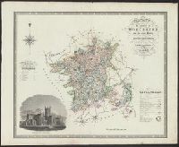
- Published / Created:
- 1830
- Call Number:
- 3254 1830
- Container / Volume:
- BRBL_00068
- Image Count:
- 1
- Resource Type:
- Maps, Atlases & Globes
- Found in:
- Beinecke Rare Book and Manuscript Library > Map of the County of Worcester ... by C. & J. Greenwood. Engraved by J. & C. Walker.
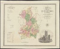
- Published / Created:
- 1831
- Call Number:
- 3251 1831
- Container / Volume:
- BRBL_00067
- Image Count:
- 1
- Resource Type:
- Maps, Atlases & Globes
- Found in:
- Beinecke Rare Book and Manuscript Library > Map of the County of Rutland ... by C. & J. Greenwood. Engraved by Josiah Neele.
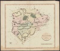
- Published / Created:
- 1831
- Call Number:
- 3248 1831
- Container / Volume:
- BRBL_00067
- Image Count:
- 1
- Resource Type:
- Maps, Atlases & Globes
- Found in:
- Beinecke Rare Book and Manuscript Library > Map of the County of Northumberland ... by C. & J. Greenwood. Engraved by J. & C. Walker.
- Published / Created:
- 1811
- Call Number:
- 3251 1811
- Container / Volume:
- BRBL_00067
- Image Count:
- 1
- Resource Type:
- Maps, Atlases & Globes
- Found in:
- Beinecke Rare Book and Manuscript Library > A New Map of Rutlandshire, Divided into Hundreds ... By John Cary.
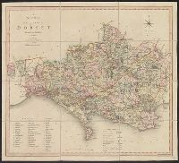
- Published / Created:
- 1804
- Call Number:
- 3246 1808
- Container / Volume:
- BRBL_00066
- Image Count:
- 1
- Resource Type:
- Maps, Atlases & Globes
- Found in:
- Beinecke Rare Book and Manuscript Library > A new map of the County of Dorset ...
- Published / Created:
- 1831
- Call Number:
- 3249 1831
- Container / Volume:
- BRBL_00067
- Image Count:
- 1
- Resource Type:
- Maps, Atlases & Globes
- Found in:
- Beinecke Rare Book and Manuscript Library > Map of the County of Nottingham ... by C. & J. Greenwood. Engraved by J. & C. Walker.