
You Searched For
1 - 7 of 7
Search Results
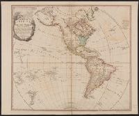
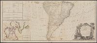
2.
- Published / Created:
- 1786
- Call Number:
- 70 1786B
- Container / Volume:
- BRBL_00357
- Image Count:
- 2
- Resource Type:
- Maps, Atlases & Globes
- Description:
- English and U.S. possessions shown in color with index to same., Inset: Hudson, Baffins Bay, Greenland, Iceland etc., and Possessions of France, Spain, Portugal, Dutch, and Denmark shown in color, with index to same.
- Publisher:
- Robt. Sayer,
- Subject (Geographic):
- America--Maps--Early works to 1800
- Found in:
- Beinecke Rare Book and Manuscript Library > A new map of the Whole Continent of American ... from the Original Materials of Governor Pownall, M.P.
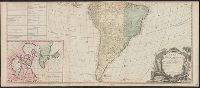
3.
- Creator:
- Anville, Jean Baptiste Bourguignon d', 1697-1782
- Published / Created:
- 1794
- Call Number:
- 70 1794
- Container / Volume:
- BRBL_00686
- Image Count:
- 2
- Resource Type:
- Maps, Atlases & Globes
- Description:
- "Publish'd by Laurie & Whittle, No. 53 Fleet Street, as the Act directs, 12th May 1794.", Appears in Thomas Kitchin's General atlas, describing the whole universe., Includes table, "The Continent and Islands of America are Divided and Possessed as follows viz.", Inset: The supplement to North America containing the countries adjoining to Baffins & Hudson bays., Joined into two sheets measuring 53.8 x 121.6 cm. and 53.8 x 121.2 cm. Stamped number on top sheet: 60. Stamped number on top sheet: 61. Cross Collection no. 139., Prime meridian: Ferro., Re-issue of John Gibson's map of [1763], 1772, 1777, 1783, and 1786., Relief shown pictorially., Shows the Western Hemisphere with some political borders, tabular information indicates national possessions; cities and rivers., and Title from ornamental cartouche.
- Publisher:
- Laurie & Whittle,
- Subject (Geographic):
- America--Maps--Early works to 1800 and West Indies--Maps--Early works to 1800
- Subject (Name):
- Gibson, J. (John), Kitchin, Thomas, d. 1784. General atlas describing the whole universe, Pownall, Thomas, 1722-1805, and Robert Laurie and James Whittle
- Found in:
- Beinecke Rare Book and Manuscript Library > A new map of the whole continent of America : divided into North and South and West Indies wherein are exactly described the United States of North America as well as the several European possessions according to the preliminaries of peace signed at Versa
4.
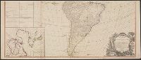
- Creator:
- Anville, Jean Baptiste Bourguignon d', 1697-1782
- Published / Created:
- 1794
- Call Number:
- 70 1794
- Container / Volume:
- BRBL_00725
- Image Count:
- 2
- Resource Type:
- Maps, Atlases & Globes
- Description:
- "Publish'd by Laurie & Whittle, No. 53 Fleet Street, as the Act directs, 12th May 1794.", Appears in Thomas Kitchin's General atlas, describing the whole universe., Copy 2: Joined into two sheets measuring 53.7 x 125.6 cm. and 53.7 x 125.6 cm. Stamped number on sheets: 34. Franklin Collection no. 131 1794 11-12., Includes table, "The Continent and Islands of America are Divided and Possessed as follows viz.", Inset: The supplement to North America containing the countries adjoining to Baffins & Hudson bays., Prime meridian: Ferro., Re-issue of John Gibson's map of [1763], 1772, 1777, 1783, and 1786., Relief shown pictorially., Shows the Western Hemisphere with some political borders, tabular information indicates national possessions; cities and rivers., and Title from ornamental cartouche.
- Publisher:
- Laurie & Whittle,
- Subject (Geographic):
- America--Maps--Early works to 1800 and West Indies--Maps--Early works to 1800
- Subject (Name):
- Gibson, J. (John), Kitchin, Thomas, d. 1784. General atlas describing the whole universe, Pownall, Thomas, 1722-1805, and Robert Laurie and James Whittle
- Found in:
- Beinecke Rare Book and Manuscript Library > A new map of the whole continent of America : divided into North and South and West Indies wherein are exactly described the United States of North America as well as the several European possessions according to the preliminaries of peace signed at Versa
5.
- Creator:
- Anville, Jean Baptiste Bourguignon d', 1697-1782
- Published / Created:
- 1794
- Call Number:
- 70 1794
- Container / Volume:
- BRBL_00725
- Image Count:
- 2
- Resource Type:
- Maps, Atlases & Globes
- Description:
- "Publish'd by Laurie & Whittle, No. 53 Fleet Street, as the Act directs, 12th May 1794.", Appears in Thomas Kitchin's General atlas, describing the whole universe., Copy 3: Joined into two sheets measuring 54.7 x 123.5 cm. and 54.6 x 123.4 cm. Stamped number on top sheet: 32. Stamped number on top sheet: 33. Franklin Collection no. 131 1794 13-14., Includes table, "The Continent and Islands of America are Divided and Possessed as follows viz.", Inset: The supplement to North America containing the countries adjoining to Baffins & Hudson bays., Prime meridian: Ferro., Re-issue of John Gibson's map of [1763], 1772, 1777, 1783, and 1786., Relief shown pictorially., Shows the Western Hemisphere with some political borders, tabular information indicates national possessions; cities and rivers., and Title from ornamental cartouche.
- Publisher:
- Laurie & Whittle,
- Subject (Geographic):
- America--Maps--Early works to 1800 and West Indies--Maps--Early works to 1800
- Subject (Name):
- Gibson, J. (John), Kitchin, Thomas, d. 1784. General atlas describing the whole universe, Pownall, Thomas, 1722-1805, and Robert Laurie and James Whittle
- Found in:
- Beinecke Rare Book and Manuscript Library > A new map of the whole continent of America : divided into North and South and West Indies wherein are exactly described the United States of North America as well as the several European possessions according to the preliminaries of peace signed at Versa
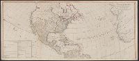
6.

- Creator:
- Moll, Herman, d. 1732
- Published / Created:
- [1732]
- Call Number:
- E1015 M66 1732
- Image Count:
- 1
- Description:
- Autograph of Gravely. Autograph of Baldock. Autograph of Aston. Autograph of W. Alington. and Teaching resource: Professor John Mack Faragher, History 141: The American West.
- Publisher:
- Printed for Thomas Bowles, next to the Chapter-house in St. Paul’s Church-yard, and John Bowles, at the Black Horse in Cornhill ...,
- Subject (Geographic):
- America--Maps--Early works to 1800
- Subject (Topic):
- Atlases--Early works to 1800
- Found in:
- Beinecke Rare Book and Manuscript Library > Atlas minor: or a set of sixty-two new and correct maps, of all parts of the world. All composed and done by Herman Moll, geographer ...
7.
- Published / Created:
- [1759-1771] and 1763 May
- Call Number:
- Z17 289q
- Image Count:
- 1
- Resource Type:
- Books, Journals & Pamphlets
- Alternative Title:
- A new map of North America: shewing the advantages obtain'd therein to England, by the peace. and Gentleman's monthly companion
- Description:
- Includes essays, songs, poetry, British and foreign news, bankrupts, translations and reprints on various subjects., Individual issues lack imprint., Title vignettes (royal coat of arms)., Two vols. a year, 1759-1767; 1 vol. a year, 1768-1771; ceased publication with v. 21, 1771., Vols. 1-2 include supplements., and Volumes have numerical designation only.
- Publisher:
- Printed for J. Coote,
- Subject (Geographic):
- America--Maps--Early works to 1800, East (U.S.)--Maps--Early works to 1800, Great Britain--Description and travel--Periodicals--Early works to 1800, Louisiana Purchase--Maps, and United States--Maps--Early works to 1800
- Subject (Topic):
- English literature--Periodicals--Early works to 1800 and Periodicals--England
- Found in:
- Beinecke Rare Book and Manuscript Library > Royal magazine; or, Gentleman's monthly companion.