Search
You Searched For
Search Results
- Creator:
- Richardson, Samuel, 1689-1761
- Published / Created:
- 1751
- Call Number:
- Ik R396 748cp
- Image Count:
- 5
- Resource Type:
- Books, Journals & Pamphlets
- Found in:
- Beinecke Rare Book and Manuscript Library > Clarissa, or, The history of a young lady : comprehending the most important concerns of private life ...
- Creator:
- Rochester, John Wilmot, Earl of, 1647-1680.
- Published / Created:
- 1679
- Call Number:
- Ij R586 +679L
- Image Count:
- 5
- Resource Type:
- Books, Journals & Pamphlets
- Found in:
- Beinecke Rare Book and Manuscript Library > Artemisa to Cloe : a letter from a lady in the tovvn, to a lady in the country : concerning the loves of the tovvn / by a person of quality.
- Creator:
- Pope, Alexander, 1688-1744
- Published / Created:
- 1729
- Call Number:
- Ik P810 729
- Image Count:
- 5
- Found in:
- Beinecke Rare Book and Manuscript Library > The Dunciad, variorvm : with the prolegomena of Scriblerus.
- Creator:
- Dickens, Charles, 1812-1870
Leech, John, 1817-1864
- Published / Created:
- 1847-1864
- Call Number:
- Gimbel/Dickens D5 Set 6
- Image Count:
- 5
- Resource Type:
- Books, Journals & Pamphlets
- Found in:
- Beinecke Rare Book and Manuscript Library > The works of Charles Dickens.
- Creator:
- Peacham, Henry, 1576?-1643?
- Published / Created:
- [1612]
- Call Number:
- Ih P311 612
- Image Count:
- 3
- Resource Type:
- Books, Journals & Pamphlets
- Found in:
- Beinecke Rare Book and Manuscript Library > Minerva Britanna, or, A garden of heroical deuises : furnished, and adorned with emblemes and impresa's of sundry natures / newly devised, moralized, and published, by Henry Peacham, Mr. of Artes.
- Published / Created:
- 1794
- Call Number:
- 755cea 1794
- Container / Volume:
- BRBL_00441
- Image Count:
- 4
- Resource Type:
- Maps, Atlases & Globes
- Found in:
- Beinecke Rare Book and Manuscript Library > A New and Correct Chart of the Coast of New England and New York with the adjacent parts of Nova Scotia and New Brunswick from Cape Sable to the entrance of Hudsons or North River by Captain Holland.
- Creator:
- Bowen, Emanuel, -1767
- Published / Created:
- 2d. July 1772.
- Call Number:
- 71 1763
- Container / Volume:
- BRBL_00364
- Image Count:
- 4
- Resource Type:
- Maps, Atlases & Globes
- Found in:
- Beinecke Rare Book and Manuscript Library > An accurate map of North America [cartographic material] : Describing and distinguishing the British and Spanish dominions on this great continent; according to the definitive treaty concluded at Paris 10th Feby. 1763. Also all the West India Islands belo
- Published / Created:
- 1796
- Call Number:
- 755 1802
- Container / Volume:
- BRBL_00437
- Image Count:
- 4
- Resource Type:
- Maps, Atlases & Globes
- Found in:
- Beinecke Rare Book and Manuscript Library > A map of the United States of North America ...
- Creator:
- Arrowsmith, Aaron, 1750-1823
- Published / Created:
- [betw. 1804 and 1811?]
- Call Number:
- 70 1808
- Container / Volume:
- BRBL_00358
- Image Count:
- 4
- Resource Type:
- Maps, Atlases & Globes
- Found in:
- Beinecke Rare Book and Manuscript Library > Map of America / by A. Arrowsmith ; engraved by W. West, the hills by H. Wilson.
- Creator:
- Mitchell, John, 1711-1768
- Published / Created:
- [1773]
- Call Number:
- 71 1773
- Container / Volume:
- BRBL_00365
- Image Count:
- 4
- Resource Type:
- Maps, Atlases & Globes
- Found in:
- Beinecke Rare Book and Manuscript Library > A map of the British and French dominions in North America : with the roads, distances, limits, and extent of the settlements, humbly inscribed to the Right Honourable the Earl of Halifax, and the other Right Honourable the Lords Commissioners for Trade &
- Published / Created:
- 1809
- Call Number:
- 60 1809
- Container / Volume:
- BRBL_00325
- Image Count:
- 4
- Resource Type:
- Maps, Atlases & Globes
- Found in:
- Beinecke Rare Book and Manuscript Library > The Continent and Islands of Africa ... Delineated by John Purdy.
- Creator:
- Arrowsmith, Aaron, 1750-1823
- Published / Created:
- [1818]
- Call Number:
- 71 1818A
- Container / Volume:
- BRBL_00368
- Image Count:
- 4
- Resource Type:
- Maps, Atlases & Globes
- Found in:
- Beinecke Rare Book and Manuscript Library > A map exhibiting all the new discoveries in the interior parts of North America : inscribed by permission to the honourable governor and company of adventurers of England trading into Hudsons Bay in testimony of their liberal communications to their most
- Creator:
- Linton, W. J. (William James), 1812-1897
- Published / Created:
- 1889
- Call Number:
- IIp L658 889Mb
- Image Count:
- 2
- Found in:
- Beinecke Rare Book and Manuscript Library > The masters of wood-engraving / by W. J. Linton ... issued to subscribers only.
- Published / Created:
- 1858
- Call Number:
- 3222 1858
- Container / Volume:
- BRBL_00059
- Image Count:
- 2
- Resource Type:
- Maps, Atlases & Globes
- Found in:
- Beinecke Rare Book and Manuscript Library > Cruchley's Railway and Station Map of Berkshire showing all the railways & names of stations also the turnpike roads, gentlemens seats &c &c.
- Published / Created:
- [1750?]
- Call Number:
- 3211cea 1750
- Container / Volume:
- BRBL_00055
- Image Count:
- 2
- Resource Type:
- Maps, Atlases & Globes
- Found in:
- Beinecke Rare Book and Manuscript Library > A Large Chart of the Channel between England and France ... by Capt. Edmund Halley ...
- Published / Created:
- 1824
- Call Number:
- 3218 1824
- Container / Volume:
- BRBL_00058
- Image Count:
- 2
- Resource Type:
- Maps, Atlases & Globes
- Found in:
- Beinecke Rare Book and Manuscript Library > Map of the county of Oxford ... by A. Bryant ... Inscribed by permission to the ... and to the Nobility, Clergy and Gentry of the County.
- Published / Created:
- 1811
- Call Number:
- 326 1811
- Container / Volume:
- BRBL_00070
- Image Count:
- 2
- Resource Type:
- Maps, Atlases & Globes
- Found in:
- Beinecke Rare Book and Manuscript Library > A new map of Scotland ... by John Cary, Engraver.
- Creator:
- Cruchley, G. F.
- Call Number:
- 3221gme 1845
- Container / Volume:
- BRBL_00059
- Image Count:
- 2
- Resource Type:
- Maps, Atlases & Globes
- Found in:
- Beinecke Rare Book and Manuscript Library > Cruchley's railway and station map of Suffolk : showing all the railways & names of stations, also the turnpike roads, gentlemens seats, &c. &c.L65, improved from ordnance surveys.
- Creator:
- Collins, Henry George
- Published / Created:
- [1860?]
- Call Number:
- 3226 1860
- Container / Volume:
- BRBL_00061
- Image Count:
- 2
- Resource Type:
- Maps, Atlases & Globes
- Found in:
- Beinecke Rare Book and Manuscript Library > Collins' railway and telegraph map of Devonshire : divided into hundreds, containing the district divisions and other local arrangements effected by the Reform Bill.
- Published / Created:
- 1845
- Call Number:
- 32gme 1845
- Container / Volume:
- BRBL_00076
- Image Count:
- 2
- Resource Type:
- Maps, Atlases & Globes
- Found in:
- Beinecke Rare Book and Manuscript Library > Map of the Railways of England & Wales ...
- Published / Created:
- c1900.
- Call Number:
- 32am L84 1900
- Container / Volume:
- BRBL_00075
- Image Count:
- 2
- Resource Type:
- Maps, Atlases & Globes
- Found in:
- Beinecke Rare Book and Manuscript Library > London in the beginning of the 20th Century.
- Published / Created:
- 1828
- Call Number:
- 327cea 1828
- Container / Volume:
- BRBL_00073
- Image Count:
- 2
- Resource Type:
- Maps, Atlases & Globes
- Found in:
- Beinecke Rare Book and Manuscript Library > Ireland East Coast ... J. & C. Walker, Sculpt.
- Published / Created:
- 1790
- Call Number:
- 326 1790
- Container / Volume:
- BRBL_00069
- Image Count:
- 2
- Resource Type:
- Maps, Atlases & Globes
- Found in:
- Beinecke Rare Book and Manuscript Library > A new and correct map of Scotland or North Britain ... by Lieutenant Campbell.
- Published / Created:
- [1890]
- Call Number:
- 32gme 1890
- Container / Volume:
- BRBL_00076
- Image Count:
- 2
- Resource Type:
- Maps, Atlases & Globes
- Found in:
- Beinecke Rare Book and Manuscript Library > Great Western Railway General Map.
- Published / Created:
- [1794?]
- Call Number:
- 36 1794A
- Container / Volume:
- BRBL_00119
- Image Count:
- 2
- Resource Type:
- Maps, Atlases & Globes
- Found in:
- Beinecke Rare Book and Manuscript Library > Map of the Empire of Germany, ... with the Kingdom of Prussia, etc. By L. Delarochette. T.Kitchin, Sculpt.
- Published / Created:
- 1839
- Call Number:
- 53 1839
- Container / Volume:
- BRBL_00284
- Image Count:
- 2
- Resource Type:
- Maps, Atlases & Globes
- Found in:
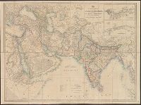
- Beinecke Rare Book and Manuscript Library > Map of the Countries lying betwen Turkey and Birmah, Comprising Asia Minor, Persia, India, Egypt, and Arabia and including the Black, Caspian, and Red Seas. By James Wyld, Geographer to t he Queen.
- Published / Created:
- 1857
- Call Number:
- 59 1857A
- Container / Volume:
- BRBL_00317
- Image Count:
- 2
- Resource Type:
- Maps, Atlases & Globes
- Found in:
- Beinecke Rare Book and Manuscript Library > India by A.K. Johnston, F.R.G.S. Engraved by W. & A.K. Johnston.
- Published / Created:
- 1791
- Call Number:
- 59 1791
- Container / Volume:
- BRBL_00316
- Image Count:
- 2
- Resource Type:
- Maps, Atlases & Globes
- Found in:
- Beinecke Rare Book and Manuscript Library > The Southern Countries of India from Madrass to Cape Comorin describing the routes of the armies ... Campaigns of 1782, 1783, & 1784.
- Published / Created:
- 1943
- Call Number:
- 57 1943
- Container / Volume:
- BRBL_00303
- Image Count:
- 2
- Resource Type:
- Maps, Atlases & Globes
- Found in:
- Beinecke Rare Book and Manuscript Library > The Japanese empire : with central and southern Manchukuo (Manchuria).
- Published / Created:
- 1857
- Call Number:
- 59AM 1857
- Container / Volume:
- BRBL_00318
- Image Count:
- 2
- Resource Type:
- Maps, Atlases & Globes
- Found in:
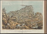
- Beinecke Rare Book and Manuscript Library > Panoramic View of India from the Himalaya Mountains : shewing the actual geographical position of the principal cities, military stations, railways, &c. with table of distances from Calcutta.
- Published / Created:
- [1849?]
- Call Number:
- 61 1849
- Container / Volume:
- BRBL_00331
- Image Count:
- 2
- Resource Type:
- Maps, Atlases & Globes
- Found in:
- Beinecke Rare Book and Manuscript Library > Egypt ... By H. Long ... J. & C. Walker Sculpt.
- Published / Created:
- [1840?]
- Call Number:
- 654 1840
- Container / Volume:
- BRBL_00344
- Image Count:
- 2
- Resource Type:
- Maps, Atlases & Globes
- Found in:
- Beinecke Rare Book and Manuscript Library > West Africa. Engraved by J. & C. Walker.
- Creator:
- Pownall, Thomas, 1722-1805
- Published / Created:
- [1783?]
- Call Number:
- 71 1783B
- Container / Volume:
- BRBL_00366
- Image Count:
- 2
- Resource Type:
- Maps, Atlases & Globes
- Found in:
- Beinecke Rare Book and Manuscript Library > A new and correct map of North America, with the West India Islands : divided according to the preliminary articles of peace, concluded at Versailles, 20 Jan. 1783, wherein are particularly distinguished, the United States & the several provinces and colo
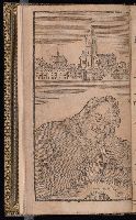
- Creator:
- Back, John,
Blare, Joseph
Bunyan, John, 1628-1688
Deacon, John, fl. 1682-1701
Lortic, M. (Marcelin), 1852-1928
Millet, E
- Published / Created:
- 1693
- Call Number:
- 2004 354
- Image Count:
- 2
- Found in:
- Beinecke Rare Book and Manuscript Library > The pilgrim's progress from this world to that which is to come ...
- Published / Created:
- 1787
- Call Number:
- 11 1787
- Container / Volume:
- BRBL_00006
- Image Count:
- 2
- Resource Type:
- Maps, Atlases & Globes
- Found in:
- Beinecke Rare Book and Manuscript Library > A General Map of the World or Terraqueous globe with all the new discoveries ... by Sam'l Dunn ...
- Creator:
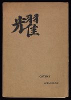
- Fenolloso, Ernest Francisco, 1853-1908
Li, Bai, 701-762
Mathews, Elkin, 1851-1921, publisher
Pound, Ezra, 1885-1972
- Published / Created:
- 1915
- Call Number:
- Za P865 Eg915C
- Image Count:
- 2
- Found in:
- Beinecke Rare Book and Manuscript Library > Cathay : translations / by Ezra Pound, for the most part from the Chinese of Rihaku, from the notes of the late Ernest Fenollosa, and the decipherings of the professors Mori and Ariga.
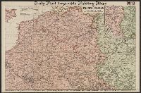
- Creator:
- Philip, George, 1870-1937
- Published / Created:
- [1914.]
- Call Number:
- 11hc 1915B
- Image Count:
- 2
- Resource Type:
- Maps, Atlases & Globes
- Found in:
- Beinecke Rare Book and Manuscript Library > Daily Mail large-scale Military maps No. 3. : The Franco-Belgian Theatre of War / edited by George Philip, F.R.G.S., in conjunction with Military experts.
- Published / Created:
- 1825
- Call Number:
- 23cea 1825A
- Container / Volume:
- BRBL_00021
- Image Count:
- 2
- Resource Type:
- Maps, Atlases & Globes
- Found in:
- Beinecke Rare Book and Manuscript Library > [Two charts of the Pacific Ocean, showing the Northwestern America and Sandwich Islands and ports].
- Creator:
- Longmans, Green, and Co
- Published / Created:
- [191-?]
- Call Number:
- 11hcf 1919A-18
- Container / Volume:
- BRBL_00010M
- Image Count:
- 2
- Resource Type:
- Maps, Atlases & Globes
- Found in:
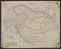
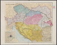
- Beinecke Rare Book and Manuscript Library > Austria-Hungary.
- Creator:
- Longmans, Green, and Co
- Published / Created:
- [191-?]
- Call Number:
- 11hcf 1919A-21
- Container / Volume:
- BRBL_00010M
- Image Count:
- 2
- Resource Type:
- Maps, Atlases & Globes
- Found in:
- Beinecke Rare Book and Manuscript Library > Austria-Hungary.
- Creator:
- Longmans, Green, and Co
- Published / Created:
- [191-?]
- Call Number:
- 11hcf 1919A-19
- Container / Volume:
- BRBL_00010M
- Image Count:
- 2
- Resource Type:
- Maps, Atlases & Globes
- Found in:
- Beinecke Rare Book and Manuscript Library > Austria-Hungary.
- Creator:
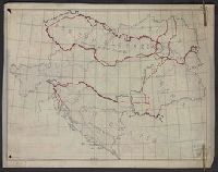
- Pope-Hennessy, Una, 1876-1949
- Published / Created:
- [1917]
- Call Number:
- 11hc 1919Y
- Image Count:
- 2
- Resource Type:
- Maps, Atlases & Globes
- Found in:
- Beinecke Rare Book and Manuscript Library > Map of the main prison camps in Germany and Austria / by Mrs Pope-Hennessy.
- Creator:
- Longmans, Green, and Co
- Published / Created:
- [191-?]
- Call Number:
- 11hcf 1919A-22
- Container / Volume:
- BRBL_00010M
- Image Count:
- 2
- Resource Type:
- Maps, Atlases & Globes
- Found in:
- Beinecke Rare Book and Manuscript Library > Austria-Hungary.
- Creator:
- George Philip & Son
London Geographical Institute
- Published / Created:
- c1942.
- Call Number:
- 352 1942A
- Container / Volume:
- BRBL_00106
- Image Count:
- 2
- Resource Type:
- Maps, Atlases & Globes
- Found in:
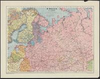
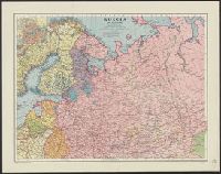
- Beinecke Rare Book and Manuscript Library > Russia in Europe.
- Creator:
- George Philip & Son
London Geographical Institute
- Published / Created:
- c1942.
- Call Number:
- 352 1942A
- Container / Volume:
- BRBL_00106
- Image Count:
- 2
- Resource Type:
- Maps, Atlases & Globes
- Found in:
- Beinecke Rare Book and Manuscript Library > Russia in Europe.
- Creator:
- Great Britain. War Office. General Staff. Geographical Section
- Published / Created:
- 1940
- Call Number:
- 342 1944
- Container / Volume:
- BRBL_00092
- Image Count:
- 2
- Resource Type:
- Maps, Atlases & Globes
- Found in:
- Beinecke Rare Book and Manuscript Library > The Faeroes / Drawn at the War Office, 1940, from a Danish map of 1932.
- Published / Created:
- 1808
- Call Number:
- 39 1808A
- Container / Volume:
- BRBL_00186
- Image Count:
- 2
- Resource Type:
- Maps, Atlases & Globes
- Found in:
- Beinecke Rare Book and Manuscript Library > A new map of the Kingdom of Spain and Portugal ...
- Published / Created:
- [1802?]
- Call Number:
- 39 1802
- Container / Volume:
- BRBL_00186
- Image Count:
- 2
- Resource Type:
- Maps, Atlases & Globes
- Found in:
- Beinecke Rare Book and Manuscript Library > A map of the Kingdoms of Spain and Portugal according to DeLisle ...
- Published / Created:
- 1873
- Call Number:
- 40 1873
- Container / Volume:
- BRBL_00202
- Image Count:
- 2
- Resource Type:
- Maps, Atlases & Globes
- Found in:
- Beinecke Rare Book and Manuscript Library > Central and South Italy : to accompany the handbooks for travellers / by J. & C. Walker.
- Published / Created:
- [ca. 1760]
- Call Number:
- 40 1780C
- Container / Volume:
- BRBL_00198
- Image Count:
- 2
- Resource Type:
- Maps, Atlases & Globes
- Found in:
- Beinecke Rare Book and Manuscript Library > A new map of Italy : distinguishing all the sovereignties in it whether states, kingdoms, dutchies, principalities, republicks &c. with the post roads, & many remarks not extant in any map, according to the newest and most exact observations.
- Published / Created:
- 1800
- Call Number:
- 40 1800
- Container / Volume:
- BRBL_00199
- Image Count:
- 2
- Resource Type:
- Maps, Atlases & Globes
- Found in:
- Beinecke Rare Book and Manuscript Library > Italy with the addition of the southern parts of Germany ... / by L.S. Delarochette.
- Creator:
- Maclure, Macdonald & Macgregor
- Published / Created:
- 1859
- Call Number:
- 402hc 1859
- Container / Volume:
- BRBL_00233A
- Image Count:
- 2
- Resource Type:
- Maps, Atlases & Globes
- Found in:
- Beinecke Rare Book and Manuscript Library > Maclure, Macdonald & Macgregor's large scale map of the seat of war in Italy! [cartographic material] : sheet no. 1 / Maclure, Macdonald & Macgregor, lithrs. by steam power.
- Creator:
- Stow, John, 1525?-1605
- Published / Created:
- MDCCXX [1720]
- Call Number:
- 1977 +392
- Image Count:
- 2
- Found in:
- Beinecke Rare Book and Manuscript Library > A survey of the cities of London and Westminster : containing the original, antiquity, increase, modern estate and government of those cities / written at first in the year MDXCVIII ... since ... augmented by the author, and afterwards by A.M., H.D., and
- Creator:
- Montrésor, John, 1736-1799
- Published / Created:
- 1768
- Call Number:
- 732 1768
- Container / Volume:
- BRBL_00376A
- Image Count:
- 2
- Resource Type:
- Maps, Atlases & Globes
- Found in:
- Beinecke Rare Book and Manuscript Library > Map of Nova Scotia, or Acadia : with the islands of Cape Breton and St. John's, from actual surveys / by Captn. Montresor, engir.
- Creator:
- Arrowsmith, John, 1790-1873
- Published / Created:
- 25 April 1859.
- Call Number:
- 73 1859D
- Container / Volume:
- BRBL_00375
- Image Count:
- 2
- Resource Type:
- Maps, Atlases & Globes
- Found in:
- Beinecke Rare Book and Manuscript Library > British North America : by permission dedicated to the Honble. Hudsons Bay Company, containing the latest information which their documents furnish / by their obedient servant, J. Arrowsmith.
- Creator:
- Wyld, James, 1812-1887
- Published / Created:
- July 16th, 1858.
- Call Number:
- 739 1858
- Container / Volume:
- BRBL_00388
- Image Count:
- 2
- Resource Type:
- Maps, Atlases & Globes
- Found in:
- Beinecke Rare Book and Manuscript Library > Map of the colony of New Caledonia and the British & American territory west of the Rocky mountains including Vancouvers Island and the gold fields [cartographic material] / by James Wyld, geographer to the Queen & the Prince Consort, Charing Cross East,
- Creator:
- Betts, John, fl. 1844-1863
- Published / Created:
- [18--?]
- Call Number:
- 71 18XX
- Container / Volume:
- BRBL_00371
- Image Count:
- 2
- Resource Type:
- Maps, Atlases & Globes
- Found in:
- Beinecke Rare Book and Manuscript Library > North America.
- Published / Created:
- 1786
- Call Number:
- 70 1786B
- Container / Volume:
- BRBL_00357
- Image Count:
- 2
- Resource Type:
- Maps, Atlases & Globes
- Found in:
- Beinecke Rare Book and Manuscript Library > A new map of the Whole Continent of American ... from the Original Materials of Governor Pownall, M.P.
- Creator:
- Pownall, Thomas, 1722-1805
- Published / Created:
- 1794 May 12
- Call Number:
- 71 1794
- Container / Volume:
- BRBL_00367
- Image Count:
- 2
- Resource Type:
- Maps, Atlases & Globes
- Found in:
- Beinecke Rare Book and Manuscript Library > A new map of North America with the West India Islands : divided according to the preliminary articles of peace, signed at Versailles, 20 Jan. 1783, wherein are particularly distinguished the United States, and the several provinces, governments &ca which
- Creator:
- Wyld, James, 1812-1887
- Published / Created:
- March 2nd 1857.
- Call Number:
- 71 1857
- Container / Volume:
- BRBL_00371
- Image Count:
- 2
- Resource Type:
- Maps, Atlases & Globes
- Found in:
- Beinecke Rare Book and Manuscript Library > The British possessions in North America and the United States with the Hudson's Bay territories / by James Wyld, geographer to the Queen & H.R.H. Prince Albert.
- Creator:
- Arrowsmith, John, 1790-1873
- Published / Created:
- 1839
- Call Number:
- 734 Q31 1839
- Container / Volume:
- BRBL_00380
- Image Count:
- 2
- Resource Type:
- Maps, Atlases & Globes
- Found in:
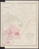
- Beinecke Rare Book and Manuscript Library > Map of the eastern townships of Lower Canada : drawn principally from actual survey for the British American Land Company by A. Wells, provincial land survr. / by John Arrowsmith.
- Creator:
- Wyld, James, 1812-1887
- Published / Created:
- [1857]
- Call Number:
- 75 1857A
- Container / Volume:
- BRBL_00401
- Image Count:
- 1
- Resource Type:
- Maps, Atlases & Globes
- Found in:
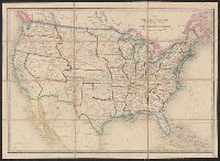
- Beinecke Rare Book and Manuscript Library > The United States & the relative position of the Oregon & Texas / by James Wyld, Charing Cross East.
- Published / Created:
- 1861 May 13
- Call Number:
- 75 1861A
- Container / Volume:
- BRBL_00402
- Image Count:
- 1
- Resource Type:
- Maps, Atlases & Globes
- Found in:
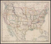
- Beinecke Rare Book and Manuscript Library > Stanford's new hand map of the United States of North America / Constructed and engrd. at Stanford's Geographical Establishmt. London.
- Creator:
- Morden, Robert, d. 1703
- Published / Created:
- [1676?]
- Call Number:
- 755 1675E
- Container / Volume:
- BRBL_00423
- Image Count:
- 1
- Resource Type:
- Maps, Atlases & Globes
- Found in:
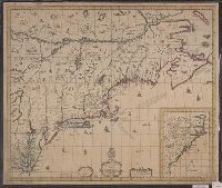
- Beinecke Rare Book and Manuscript Library > A map of New England, New Yorke, New Jersey, Mary-land & Virginia / Gr. King sculpsit.
- Published / Created:
- [1684?]
- Call Number:
- 755 1684A
- Container / Volume:
- BRBL_00424
- Image Count:
- 1
- Resource Type:
- Maps, Atlases & Globes
- Found in:
- Beinecke Rare Book and Manuscript Library > A map of ye English Empire in Y Continent of America, ... W. Binneman, sculpsit.
- Published / Created:
- 1776
- Call Number:
- 771 H864 1776A
- Container / Volume:
- BRBL_00483
- Image Count:
- 1
- Resource Type:
- Maps, Atlases & Globes
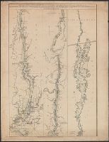
- Found in:
- Beinecke Rare Book and Manuscript Library > A Topographical map of Hudsons River ... Communication with Canada by Lake George and lake Champlain ... by Claude Joseph Sauthier ...
- Published / Created:
- 1776
- Call Number:
- 771 H864 1776
- Container / Volume:
- BRBL_00483
- Image Count:
- 1
- Resource Type:
- Maps, Atlases & Globes
- Found in:
- Beinecke Rare Book and Manuscript Library > A Topographical map of Hudsons River ... Communication with Canada by Lake George and lake Champlain ... by Claude Joseph Sauthier ...
- Published / Created:
- 1776
- Call Number:
- 786cea D32 1776
- Container / Volume:
- BRBL_00516
- Image Count:
- 1
- Resource Type:
- Maps, Atlases & Globes
- Found in:
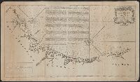
- Beinecke Rare Book and Manuscript Library > A plan of the RIver And Sound of D'Awfoskee ...
- Published / Created:
- [1780?]
- Call Number:
- 786 1780A
- Container / Volume:
- BRBL_00515
- Image Count:
- 1
- Resource Type:
- Maps, Atlases & Globes
- Found in:
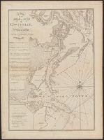
- Beinecke Rare Book and Manuscript Library > A draught of South Carolina and Georgia from Sewee to St. Estaca / by Andrew Hughes
- Published / Created:
- 1770
- Call Number:
- 785 1770
- Container / Volume:
- BRBL_00513
- Image Count:
- 1
- Resource Type:
- Maps, Atlases & Globes
- Found in:
- Beinecke Rare Book and Manuscript Library > A Compleat Map of North-Carolina from an actual Survey. By Capnt. [John A. ] Collet, Governor of Fort Johnson, Engraved by I. Bayly. Published according to Act of Parliament May the 1st. 1770, by S. Hooper Nọ 25 Ludgate Hill, London.
- Published / Created:
- 1776
- Call Number:
- 786cea C38 1776A
- Container / Volume:
- BRBL_00516
- Image Count:
- 1
- Resource Type:
- Maps, Atlases & Globes
- Found in:
- Beinecke Rare Book and Manuscript Library > An exact plan of Charles -Town-Bar and Harbour ...
- Published / Created:
- 1776
- Call Number:
- 786cea P838 1776
- Container / Volume:
- BRBL_00516
- Image Count:
- 1
- Resource Type:
- Maps, Atlases & Globes
- Found in:
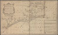
- Beinecke Rare Book and Manuscript Library > A Plan of Port Royal in South Carolina ...
- Published / Created:
- [1738]
- Call Number:
- 785cea 1738
- Container / Volume:
- BRBL_00514
- Image Count:
- 1
- Resource Type:
- Maps, Atlases & Globes
- Found in:
- Beinecke Rare Book and Manuscript Library > To his grace Thomas Hollis Pelham, Duke of Newcastle... : this chart of his majesties province of North Carolina... / James Wimble... 1738.
- Published / Created:
- 1776
- Call Number:
- 785cea C17 1776
- Container / Volume:
- BRBL_00514
- Image Count:
- 1
- Resource Type:
- Maps, Atlases & Globes
- Found in:
- Beinecke Rare Book and Manuscript Library > A plan of Cape Fear River from the bar to Brunswick.
- Published / Created:
- 1776
- Call Number:
- 786hc C38 1776
- Container / Volume:
- BRBL_00516
- Image Count:
- 1
- Resource Type:
- Maps, Atlases & Globes
- Found in:
- Beinecke Rare Book and Manuscript Library > A plan of the attack of Fort Sullivan, the key of Charlestown in South Carolina ... by Sir Peter Parker ...
- Creator:
- Broughton, William Robert, 1762-1821
- Published / Created:
- 1st. Novr. 1798.
- Call Number:
- 846 C72 1798
- Container / Volume:
- BRBL_00622
- Image Count:
- 1
- Resource Type:
- Maps, Atlases & Globes
- Found in:
- Beinecke Rare Book and Manuscript Library > Plan of the River Oregan, from an actual survey.
- Creator:
- Vancouver, George, 1757-1798
- Published / Created:
- 1798
- Call Number:
- 845 1798E
- Container / Volume:
- BRBL_00619
- Image Count:
- 1
- Resource Type:
- Maps, Atlases & Globes
- Found in:
- Beinecke Rare Book and Manuscript Library > A chart shewing part of the coast of N.W. America, with the tracks of His Majesty's sloop Discovery and armed tender Chatham / commanded by George Vancouver, esqu. and prepared under his immediate inspection by Lieut. Joseph Baker, in which the continenta
- Creator:
- Vancouver, George, 1757-1798
- Published / Created:
- 1798
- Call Number:
- 845 1798B
- Container / Volume:
- BRBL_00619
- Image Count:
- 1
- Resource Type:
- Maps, Atlases & Globes
- Found in:
- Beinecke Rare Book and Manuscript Library > A chart shewing part of the coast of N.W. America, with the tracks of His Majesty's sloop Discovery and armed tender Chatham / commanded by George Vancouver, esqr. and prepared from the foregoing surveys under his immediate inspection by Lieut. Edwd. Robe
- Creator:
- Wyld, James, 1812-1887
- Published / Created:
- April 10th 1845.
- Call Number:
- 846 1845
- Container / Volume:
- BRBL_00620
- Image Count:
- 1
- Resource Type:
- Maps, Atlases & Globes
- Found in:
- Beinecke Rare Book and Manuscript Library > Map of the Oregon districts and the adjacent country / James Wyld, geographer to the Queen.
- Creator:
- Vancouver, George, 1757-1798
- Published / Created:
- 1798
- Call Number:
- 845 1798C
- Container / Volume:
- BRBL_00619
- Image Count:
- 1
- Resource Type:
- Maps, Atlases & Globes
- Found in:
- Beinecke Rare Book and Manuscript Library > A chart shewing part of the coast of N.W. America, with the tracks of His Majesty's sloop Discovery and armed tender Chatham / commanded by George Vancouver, esq. and prepared under his immediate inspection by Lieut. Joseph Baker, in which the continental
- Creator:
- Vancouver, George, 1757-1798
- Published / Created:
- 1798
- Call Number:
- 845 1798G
- Container / Volume:
- BRBL_00619
- Image Count:
- 1
- Resource Type:
- Maps, Atlases & Globes
- Found in:
- Beinecke Rare Book and Manuscript Library > A chart shewing part of the coast of N.W. America, with the tracks of His Majesty's sloop Discovery and armed tender Chatham / commanded by George Vancouver, esqr. and prepared under his immediate inspection by Lieut. Joseph Baker, in which the continenta
- Creator:
- Wyld, James, 1812-1887
- Published / Created:
- April 10th 1845.
- Call Number:
- 846 1845
- Container / Volume:
- BRBL_00620
- Image Count:
- 1
- Resource Type:
- Maps, Atlases & Globes
- Found in:
- Beinecke Rare Book and Manuscript Library > Map of the Oregon districts and the adjacent country / James Wyld, geographer to the Queen.
- Creator:
- Vancouver, George, 1757-1798
- Published / Created:
- 1798
- Call Number:
- 845 1798A
- Container / Volume:
- BRBL_00619
- Image Count:
- 1
- Resource Type:
- Maps, Atlases & Globes
- Found in:
- Beinecke Rare Book and Manuscript Library > A chart shewing part of the coast of N.W. America : with the tracks of His Majesty's sloop Discovery and armed tender Chatham / commanded by George Vancouver, esqr. and prepared under his immediate inspection by Lieut. Joseph Baker, in which the continent
- Creator:
- Vancouver, George, 1757-1798
- Published / Created:
- 1798
- Call Number:
- 845 1798H
- Container / Volume:
- BRBL_00619
- Image Count:
- 1
- Resource Type:
- Maps, Atlases & Globes
- Found in:
- Beinecke Rare Book and Manuscript Library > A chart shewing part of the coast of N.W. America, with the tracks of His Majesty's sloop Discovery and armed tender Chatham / commanded by George Vancouver, esq. and prepared under his immediate inspection by Lieut. Joseph Baker, in which the continental
- Creator:
- Vancouver, George, 1757-1798
- Published / Created:
- 1798
- Call Number:
- 845 1798F
- Container / Volume:
- BRBL_00619
- Image Count:
- 1
- Resource Type:
- Maps, Atlases & Globes
- Found in:
- Beinecke Rare Book and Manuscript Library > A chart shewing part of the coast of N.W. America, with the tracks of His Majesty's sloop Discovery and armed tender Chatham / commanded by George Vancouver, esqr. and prepared under his immediate inspection by Lieut. Joseph Baker, in which the continenta
- Creator:
- Vancouver, George, 1757-1798
- Published / Created:
- 1798
- Call Number:
- 845 1798D
- Container / Volume:
- BRBL_00619
- Image Count:
- 1
- Resource Type:
- Maps, Atlases & Globes
- Found in:
- Beinecke Rare Book and Manuscript Library > A chart shewing part of the coast of N.W. America, with the tracks of His Majesty's sloop Discovery and armed tender Chatham / commanded by George Vancouver, esqr. and prepared under his immediate inspection by Lieut. Joseph Baker, in which the continenta
- Creator:
- Jefferys, Thomas, -1771, cartographer
- Published / Created:
- 20 Feby. 1775.
- Call Number:
- 792cea 1775A
- Container / Volume:
- BRBL_00691
- Image Count:
- 1
- Resource Type:
- Maps, Atlases & Globes
- Found in:
- Beinecke Rare Book and Manuscript Library > The coast of West Florida and Louisiana : the Peninsula and Gulf of Florida or Channel of Bahama with the Bahama Islands / by Thos. Jefferys ...
- Creator:
- Ross, Lieut
- Published / Created:
- 1 June 1775.
- Call Number:
- 807 1775B
- Container / Volume:
- BRBL_00691
- Image Count:
- 1
- Resource Type:
- Maps, Atlases & Globes
- Found in:
- Beinecke Rare Book and Manuscript Library > Course of the river Mississippi from the Balise to Fort Chartres : taken on an expedition to the Illinois, in the latter end of the year 1765 / by Lieut. Ross of the 34th Regiment ; improved from the surveys of the river made by the French.
- Creator:
- Lynch, H. F. B. (Harry Finnis Blosse), 1862-1913
- Published / Created:
- [1901]
- Call Number:
- 3546 1901
- Container / Volume:
- BRBL_00113
- Image Count:
- 1
- Resource Type:
- Maps, Atlases & Globes
- Found in:
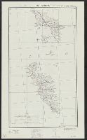
- Beinecke Rare Book and Manuscript Library > Map of Armenia and adjacent countries / by H.F.B. Lynch & F. Oswald. The material compiled by W. Shawe. 1901.
- Creator:
- Weller, Edward, d. 1884
- Published / Created:
- [1905?]
- Call Number:
- 352 1905
- Container / Volume:
- BRBL_00105
- Image Count:
- 1
- Resource Type:
- Maps, Atlases & Globes
- Found in:
- Beinecke Rare Book and Manuscript Library > Handbook map of Russia / Edwa[rd] Weller.
- Published / Created:
- 1905
- Call Number:
- 38hc C71 1871
- Container / Volume:
- BRBL_00172
- Image Count:
- 1
- Resource Type:
- Maps, Atlases & Globes
- Found in:
- Beinecke Rare Book and Manuscript Library > Battle of Colombey-Nouilly.
- Published / Created:
- 1829
- Call Number:
- 32 L84 1829
- Container / Volume:
- BRBL_00049
- Image Count:
- 1
- Resource Type:
- Maps, Atlases & Globes
- Found in:
- Beinecke Rare Book and Manuscript Library > Cruchley's New Plan of London shewing all the new and intended improvements to the present time.
- Published / Created:
- 1905
- Call Number:
- 38hc Se27 1871A
- Container / Volume:
- BRBL_00173
- Image Count:
- 1
- Resource Type:
- Maps, Atlases & Globes
- Found in:
- Beinecke Rare Book and Manuscript Library > Battle of Sedan: position of the Germans in the afternoon shortly before the end of the struggle.
- Published / Created:
- 1905
- Call Number:
- 38hc Se27 1871
- Container / Volume:
- BRBL_00173
- Image Count:
- 1
- Resource Type:
- Maps, Atlases & Globes
- Found in:
- Beinecke Rare Book and Manuscript Library > Battle of Sedan: position of the contending forces towards noon.
- Creator:
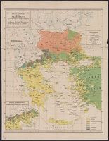
- Sōtēriadēs, Geōrgios, 1852-1941
- Published / Created:
- [1918]
- Call Number:
- 44ed 1918A
- Container / Volume:
- BRBL_00257
- Image Count:
- 1
- Resource Type:
- Maps, Atlases & Globes
- Found in:
- Beinecke Rare Book and Manuscript Library > Hellenism in the Near East : an ethnological map compiled from the latest statistics / by George Soteriadis.
- Creator:
- Walter, Richard, 1716?-1785
- Published / Created:
- MDCCXLVIII. [1748]
- Call Number:
- 1984 Folio 22
- Image Count:
- 1
- Found in:
- Beinecke Rare Book and Manuscript Library > Plates to Anson's voyage
- Published / Created:
- [1912]
- Call Number:
- 41 1912
- Container / Volume:
- BRBL_00241
- Image Count:
- 1
- Resource Type:
- Maps, Atlases & Globes
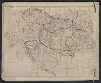
- Found in:
- Beinecke Rare Book and Manuscript Library > Austria-Hungary / The London Geographical Institute.
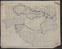
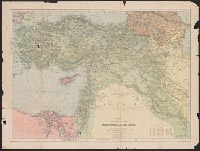
- Creator:
- George Philip & Son
- Published / Created:
- [1918?]
- Call Number:
- 53 1917
- Container / Volume:
- BRBL_00285
- Image Count:
- 1
- Resource Type:
- Maps, Atlases & Globes
- Found in:
- Beinecke Rare Book and Manuscript Library > Philips' strategical map of Mesopotamia & Asia Minor / George Philip & Son, ltd.
- Creator:
- China Inland Mission
- Published / Created:
- 1911
- Call Number:
- 56 1911
- Container / Volume:
- BRBL_00296
- Image Count:
- 1
- Resource Type:
- Maps, Atlases & Globes
- Found in:
- Beinecke Rare Book and Manuscript Library > A map of China [cartographic material] : prepared for the China Inland Mission.