Search
You Searched For
Search Results
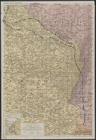
- Published / Created:
- 1850
- Call Number:
- 754gme 1850
- Container / Volume:
- BRBL_00419
- Image Count:
- 1
- Resource Type:
- Maps, Atlases & Globes
- Found in:
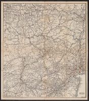
- Beinecke Rare Book and Manuscript Library > [Railroads of the Lake States, from Great Lakes to Ohio River]
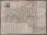
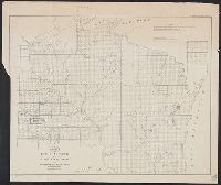
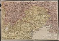
- Published / Created:
- [ca. 1905]
- Call Number:
- 771 N49 1905R
- Image Count:
- 1
- Resource Type:
- Maps, Atlases & Globes
- Found in:
- Beinecke Rare Book and Manuscript Library > [New York City real estate].
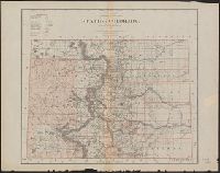
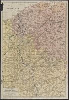
- Published / Created:
- c1915.
- Call Number:
- 902 1915
- Container / Volume:
- BRBL_00665
- Image Count:
- 1
- Resource Type:
- Maps, Atlases & Globes
- Found in:
- Beinecke Rare Book and Manuscript Library > [Map of Colombia].
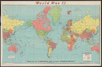
- Published / Created:
- 1940
- Call Number:
- 30hd 1940I
- Container / Volume:
- BRBL_00038
- Image Count:
- 1
- Resource Type:
- Maps, Atlases & Globes
- Found in:
- Beinecke Rare Book and Manuscript Library > [Europe-Western Battle Lines].
- Creator:
- E. & G.W. Blunt (Firm)
- Published / Created:
- [between 1827? and 1850?]
- Call Number:
- 21cea 1830
- Container / Volume:
- BRBL_00016
- Image Count:
- 1
- Resource Type:
- Maps, Atlases & Globes
- Found in:
- Beinecke Rare Book and Manuscript Library > [Coast chart from Cape Hatteras to Cape Fear, North Carolina [cartographic material] : with insets of Cape Hatteras, Ocracoke Bar and Roads, Cape Lookout, Beaufort Harbour, Cape Fear, and the Cape Fear River] / engraved & printed by W. Hooker.
- Published / Created:
- [1840?]
- Call Number:
- 785 C17 1840
- Container / Volume:
- BRBL_00513
- Image Count:
- 1
- Resource Type:
- Maps, Atlases & Globes
- Found in:
- Beinecke Rare Book and Manuscript Library > [Cape Hatteras.]
- Published / Created:
- 1940
- Call Number:
- 11hc 1915C
- Container / Volume:
- BRBL_00010B
- Image Count:
- 2
- Resource Type:
- Maps, Atlases & Globes
- Found in:
- Beinecke Rare Book and Manuscript Library > [A soldier saved a map.]
- Published / Created:
- 1847
- Call Number:
- 11 1847
- Container / Volume:
- BRBL_00008
- Image Count:
- 1
- Resource Type:
- Maps, Atlases & Globes
- Found in:
- Beinecke Rare Book and Manuscript Library > World at one view.
- Creator:
- Williams, Henry T
- Published / Created:
- [1877?]
- Call Number:
- 80gme 1877A
- Container / Volume:
- BRBL_00539
- Image Count:
- 2
- Resource Type:
- Maps, Atlases & Globes
- Found in:
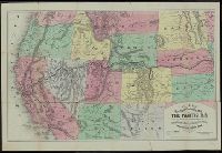
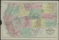
- Beinecke Rare Book and Manuscript Library > Williams' new trans-continental map of the Pacific R.R. and routes of overland travel to Colorado, Nebraska, the Black Hills, Utah, Idaho, Nevada, Montana, California, and the Pacific coast.
- Creator:
- Williams, Henry T
- Published / Created:
- [1876?]
- Call Number:
- 80gme 1876C
- Container / Volume:
- BRBL_00539
- Image Count:
- 2
- Resource Type:
- Maps, Atlases & Globes
- Found in:
- Beinecke Rare Book and Manuscript Library > Williams' new trans-continental map of the Pacific R.R. and routes of overland travel to Colorado, Nebraska, the Black Hills, Utah, Idaho, Nevada, Montana, California and the Pacific coast / Henry T. Williams.
- Creator:
- Rapkin, J
- Published / Created:
- [1851]
- Call Number:
- Small 655 1851
- Image Count:
- 1
- Resource Type:
- Maps, Atlases & Globes
- Found in:
- Beinecke Rare Book and Manuscript Library > Western Africa / the map drawn & engraved by J. Rapkin ; the ill. by H. Winkles ; engraved by E. Radclyffe.
- Creator:
- E. & G.W. Blunt (Firm)
- Published / Created:
- 1849
- Call Number:
- 88cea 1849
- Container / Volume:
- BRBL_00648
- Image Count:
- 1
- Resource Type:
- Maps, Atlases & Globes
- Found in:
- Beinecke Rare Book and Manuscript Library > West coast of North America from the Gulf of Dulce to San Francisco.
- Creator:
- E. & G.W. Blunt (Firm)
- Published / Created:
- 1848
- Call Number:
- 71cea 1848
- Container / Volume:
- BRBL_00371
- Image Count:
- 1
- Resource Type:
- Maps, Atlases & Globes
- Found in:
- Beinecke Rare Book and Manuscript Library > West coast of North America from the Gulf of Dulce to San Francisco.
- Published / Created:
- 1855
- Call Number:
- 304hc 1855
- Image Count:
- 1
- Resource Type:
- Maps, Atlases & Globes
- Found in:
- Beinecke Rare Book and Manuscript Library > Wells' new map of the seat of war / compiled from the latest German and Austrian surveys and comprising the Black Sea, Crimea, Danubian provinces, Russia, Turkey in Asia, etc., with plan of Kronstadt, St. Petersburg and ground plan of siege operations bef
- Published / Created:
- 1855
- Call Number:
- 304hc 1855A
- Container / Volume:
- BRBL_00035
- Image Count:
- 2
- Resource Type:
- Maps, Atlases & Globes
- Found in:
- Beinecke Rare Book and Manuscript Library > Wells' new map of the Seat of war.
- Creator:
- Fleming, Brewster & Alley
- Published / Created:
- 1888
- Call Number:
- 847gme 1888A
- Container / Volume:
- BRBL_00629
- Image Count:
- 1
- Resource Type:
- Maps, Atlases & Globes
- Found in:
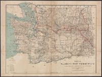
- Beinecke Rare Book and Manuscript Library > Washington Territory : showing lines of the Seattle, Lake Shore and Eastern railway / compiled from the official records of the General land office and other sources.
- Creator:
- Colton, J. H. (Joseph Hutchins), 1800-1893
- Published / Created:
- 1857
- Call Number:
- 783 1857
- Container / Volume:
- BRBL_00508
- Image Count:
- 1
- Resource Type:
- Maps, Atlases & Globes
- Found in:
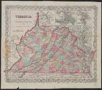
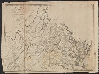
- Beinecke Rare Book and Manuscript Library > Virginia.
- Published / Created:
- 1835
- Call Number:
- 97 L62 1685
- Container / Volume:
- BRBL_00678
- Image Count:
- 1
- Resource Type:
- Maps, Atlases & Globes
- Found in:
- Beinecke Rare Book and Manuscript Library > View of Lima. "The City of Kings." before its destruction by the great earthquake of 1746.
- Published / Created:
- [1796?]
- Call Number:
- 763 1796B
- Container / Volume:
- BRBL_00452
- Image Count:
- 1
- Resource Type:
- Maps, Atlases & Globes
- Found in:
- Beinecke Rare Book and Manuscript Library > Vermont from the latest Authorities.
- Published / Created:
- 1870
- Call Number:
- 75 1870
- Container / Volume:
- BRBL_00404
- Image Count:
- 1
- Resource Type:
- Maps, Atlases & Globes
- Found in:
- Beinecke Rare Book and Manuscript Library > United States and Territories.
- Creator:
- American Russian Institute
C.S. Hammond & Company
- Published / Created:
- [1940?]
- Call Number:
- 35gf 1954
- Container / Volume:
- BRBL_00103
- Image Count:
- 1
- Resource Type:
- Maps, Atlases & Globes
- Found in:
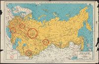
- Beinecke Rare Book and Manuscript Library > Union of Soviet Socialist Republics / American Russian Institute.
- Creator:
- American Russian Institute
C.S. Hammond & Company
- Published / Created:
- [1941?]
- Call Number:
- 35g 1940
- Container / Volume:
- BRBL_00103
- Image Count:
- 1
- Resource Type:
- Maps, Atlases & Globes
- Found in:
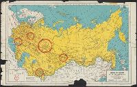
- Beinecke Rare Book and Manuscript Library > Union of Soviet Socialist Republics / American Russian Institute.
- Published / Created:
- [1920]
- Call Number:
- 771gmb 1920A
- Container / Volume:
- BRBL_00494
- Image Count:
- 2
- Resource Type:
- Maps, Atlases & Globes
- Found in:
- Beinecke Rare Book and Manuscript Library > Tydol Trails.
- Published / Created:
- 1843
- Call Number:
- 811 1843
- Container / Volume:
- BRBL_00552
- Image Count:
- 1
- Resource Type:
- Maps, Atlases & Globes
- Found in:
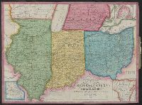
- Beinecke Rare Book and Manuscript Library > Traveller's map of Michigan, Indiana & Ohio.
- Creator:
- G.W. & C.B. Colton & Co
- Published / Created:
- 1874
- Call Number:
- 761 1874
- Container / Volume:
- BRBL_00447
- Image Count:
- 1
- Resource Type:
- Maps, Atlases & Globes
- Found in:
- Beinecke Rare Book and Manuscript Library > Township map of the state of Maine : with adjoining portions of Canada & New Brunswick.
- Creator:
- Ensign, Bridgman & Fanning
- Published / Created:
- 1855
- Call Number:
- 76 1855
- Container / Volume:
- BRBL_00445
- Image Count:
- 1
- Resource Type:
- Maps, Atlases & Globes
- Found in:
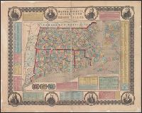
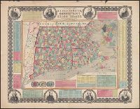
- Beinecke Rare Book and Manuscript Library > Township map of Massachusetts, Connecticut and Rhode Island.
- Creator:
- Ensign, Bridgman & Fanning
- Published / Created:
- 1855
- Call Number:
- 76 1855
- Container / Volume:
- BRBL_00445
- Image Count:
- 1
- Resource Type:
- Maps, Atlases & Globes
- Found in:
- Beinecke Rare Book and Manuscript Library > Township map of Massachusetts, Connecticut and Rhode Island.
- Creator:
- Nell, Louis
- Published / Created:
- 1868
- Call Number:
- 844gme 1868
- Container / Volume:
- BRBL_00619
- Image Count:
- 1
- Resource Type:
- Maps, Atlases & Globes
- Found in:
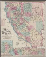
- Beinecke Rare Book and Manuscript Library > Topographical railroad & county map of the states of California and Nevada : compiled from the latest explorations and other official information / by L. Nell.
- Creator:
- Dripps, M. (Matthew)
- Published / Created:
- 1858
- Call Number:
- 771 N49 1858
- Container / Volume:
- BRBL_00486
- Image Count:
- 1
- Resource Type:
- Maps, Atlases & Globes
- Found in:
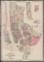
- Beinecke Rare Book and Manuscript Library > Topographical map of the cities of New York, Brooklyn, Jersey City & Hoboken.
- Creator:
- Burr, David H., 1803-1875
- Published / Created:
- 1846
- Call Number:
- 796 1846A
- Container / Volume:
- BRBL_00524
- Image Count:
- 1
- Resource Type:
- Maps, Atlases & Globes
- Found in:
- Beinecke Rare Book and Manuscript Library > The state of Texas, 1836-1845 / by David H. Burr ; engraved by S. Stiles & Co.
- Creator:
- Bien, Joseph R
- Published / Created:
- 1902
- Call Number:
- 766 1902
- Container / Volume:
- BRBL_00467
- Image Count:
- 4
- Resource Type:
- Maps, Atlases & Globes
- Found in:
- Beinecke Rare Book and Manuscript Library > The standard map of Connecticut / prepared under the direction of Joseph R. Bien, E.M., from original surveys and the triangulations and surveys of the U.S. Geological Survey and U.S. Coast and Geodetic Survey.
- Creator:
- Schedler, Joseph
- Published / Created:
- c1861.
- Call Number:
- 754hc 1862B
- Container / Volume:
- BRBL_00421
- Image Count:
- 1
- Resource Type:
- Maps, Atlases & Globes
- Found in:
- Beinecke Rare Book and Manuscript Library > The seat of war : birds eye view of Virginia, Maryland, Delaware and the District of Columbia / drawn and engr. by J. Schedler.
- Creator:
- Automobile Club of America
- Published / Created:
- c1920.
- Call Number:
- 76gmb B455 1920
- Container / Volume:
- BRBL_00446A
- Image Count:
- 2
- Resource Type:
- Maps, Atlases & Globes
- Found in:
- Beinecke Rare Book and Manuscript Library > The real tour to the Berkshires / compiled by the Bureau of Tours of the Automobile Club of America, 54th St. West of Broadway, New York City.
- Creator:
- Geographia Map Company
- Published / Created:
- [194-?]
- Call Number:
- 834 D437 1948
- Container / Volume:
- BRBL_00589
- Image Count:
- 1
- Resource Type:
- Maps, Atlases & Globes
- Found in:
- Beinecke Rare Book and Manuscript Library > The premier map of Denver and vicinity : featuring transit lines and house numbers / produced under the direction of Alexander Gross, F.R.G.S.
- Published / Created:
- 1841
- Call Number:
- 76 1614A
- Container / Volume:
- BRBL_00443
- Image Count:
- 1
- Resource Type:
- Maps, Atlases & Globes
- Found in:
- Beinecke Rare Book and Manuscript Library > The original Carte Figurative, of wich the above is an accurate Fac-Simile was found ... 1841 in ... the Royal Archives at the Hague ... 1614, and is referred to in the Memorial as showing the extent of the discoveries [in New England] made by ... Hendric
- Published / Created:
- 1869
- Call Number:
- 75gme 1869
- Container / Volume:
- BRBL_00412
- Image Count:
- 1
- Resource Type:
- Maps, Atlases & Globes
- Found in:
- Beinecke Rare Book and Manuscript Library > The great railroad routes to the Pacific, and their connections : 1869 / [by Joseph Gorlinski, Draughtsman].
- Creator:
- E. & G.W. Blunt (Firm)
- Published / Created:
- 1861
- Call Number:
- 754cea 1854
- Container / Volume:
- BRBL_00418
- Image Count:
- 1
- Resource Type:
- Maps, Atlases & Globes
- Found in:
- Beinecke Rare Book and Manuscript Library > The coast of the United States sheet no. 1. : From Point Judith to Cape Lookout, from the U.S. Coast Surveys.
- Published / Created:
- March 22, 1837.
- Call Number:
- 796 V541 1837
- Container / Volume:
- BRBL_00528
- Image Count:
- 1
- Resource Type:
- Maps, Atlases & Globes
- Found in:
- Beinecke Rare Book and Manuscript Library > The city of Velasco.
- Creator:
- G.W. & C.B. Colton & Co
- Published / Created:
- [1871]
- Call Number:
- 806 C43 1871A
- Container / Volume:
- BRBL_00548
- Image Count:
- 1
- Resource Type:
- Maps, Atlases & Globes
- Found in:
- Beinecke Rare Book and Manuscript Library > The city of Chicago, Illinois.
- Creator:
- G.W. & C.B. Colton & Co
- Published / Created:
- [1871]
- Call Number:
- 806 C43 1871
- Container / Volume:
- BRBL_00548
- Image Count:
- 1
- Resource Type:
- Maps, Atlases & Globes
- Found in:
- Beinecke Rare Book and Manuscript Library > The city of Chicago, Illinois.
- Creator:
- Heald, D. A. (Daniel Addison), 1818-1900
- Published / Created:
- [1862]
- Call Number:
- 754hc 1862
- Container / Volume:
- BRBL_00421
- Image Count:
- 1
- Resource Type:
- Maps, Atlases & Globes
- Found in:
- Beinecke Rare Book and Manuscript Library > The battle fields and military positions in eastern Virginia, from surveys supplied by officers of the army Entered according to Act of Congress in the year 1862, by D.A. Heald.
- Published / Created:
- 1862
- Call Number:
- 783hc R41 1862A
- Container / Volume:
- BRBL_00512
- Image Count:
- 1
- Resource Type:
- Maps, Atlases & Globes
- Found in:
- Beinecke Rare Book and Manuscript Library > The approaches from Washington, to Richmond / from surveys supplied by officers of the army.
- Published / Created:
- [1870?]
- Call Number:
- 11 1870
- Container / Volume:
- BRBL_00009
- Image Count:
- 1
- Resource Type:
- Maps, Atlases & Globes
- Found in:
- Beinecke Rare Book and Manuscript Library > The World on Mercator's projection. Engraved by Charles Copley, N.Y.
- Published / Created:
- 1847
- Call Number:
- 11 1847E
- Container / Volume:
- BRBL_00008
- Image Count:
- 1
- Resource Type:
- Maps, Atlases & Globes
- Found in:
- Beinecke Rare Book and Manuscript Library > The World at one view.
- Creator:
- J.H. Colton & Co
- Published / Created:
- 1855
- Call Number:
- BrSides Folio 2017 60
- Image Count:
- 1
- Resource Type:
- Maps, Atlases & Globes
- Found in:
- Beinecke Rare Book and Manuscript Library > The United States of America.
- Published / Created:
- [1858?], c1855.
- Call Number:
- 75 1858
- Container / Volume:
- BRBL_00401
- Image Count:
- 1
- Resource Type:
- Maps, Atlases & Globes
- Found in:
- Beinecke Rare Book and Manuscript Library > The United States of America.
- Published / Created:
- 1855
- Call Number:
- 75 1855
- Container / Volume:
- BRBL_00401
- Image Count:
- 1
- Resource Type:
- Maps, Atlases & Globes
- Found in:
- Beinecke Rare Book and Manuscript Library > The United States of America.
- Published / Created:
- c1901.
- Call Number:
- 75 1901
- Container / Volume:
- BRBL_00407
- Image Count:
- 1
- Resource Type:
- Maps, Atlases & Globes
- Found in:
- Beinecke Rare Book and Manuscript Library > The United States / by Rand, McNally & Co.
- Published / Created:
- 1837
- Call Number:
- 811 1837
- Container / Volume:
- BRBL_00552
- Image Count:
- 1
- Resource Type:
- Maps, Atlases & Globes
- Found in:
- Beinecke Rare Book and Manuscript Library > The Surveyed Part of Michigan by John Farmer.
- Published / Created:
- 1795
- Call Number:
- 777 1795A
- Container / Volume:
- BRBL_00503
- Image Count:
- 1
- Resource Type:
- Maps, Atlases & Globes
- Found in:
- Beinecke Rare Book and Manuscript Library > The States of Maryland and Delaware from the latest Surveys.
- Published / Created:
- 1796
- Call Number:
- 783 1796A
- Container / Volume:
- BRBL_00507
- Image Count:
- 1
- Resource Type:
- Maps, Atlases & Globes
- Found in:
- Beinecke Rare Book and Manuscript Library > The State of Virginia from the best Authorities.
- Published / Created:
- 1796
- Call Number:
- 762 1796A
- Container / Volume:
- BRBL_00450
- Image Count:
- 1
- Resource Type:
- Maps, Atlases & Globes
- Found in:
- Beinecke Rare Book and Manuscript Library > The State of New Hampshire, Compiled chiefly from Actual Surveys.
- Published / Created:
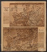
- [c1940?]
- Call Number:
- 34 1940
- Container / Volume:
- BRBL_00091
- Image Count:
- 1
- Resource Type:
- Maps, Atlases & Globes
- Found in:
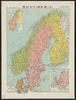
- Beinecke Rare Book and Manuscript Library > The Scandinavian Countries and Finland/ Alexander Gross F.R.G.S.
- Published / Created:
- 1861
- Call Number:
- 792cea P38 1861
- Container / Volume:
- BRBL_00519
- Image Count:
- 1
- Resource Type:
- Maps, Atlases & Globes
- Found in:
- Beinecke Rare Book and Manuscript Library > The Key of the South, showing Fort Pickens and vicinity, positions of forts, batteries, fleet & soundings of every part of Pensacola Bay/ By M.K. Couzens, Litho. Lang & Laing.
- Published / Created:
- 1918
- Call Number:
- 11hc 1918G
- Container / Volume:
- BRBL_00010E
- Image Count:
- 2
- Resource Type:
- Maps, Atlases & Globes
- Found in:
- Beinecke Rare Book and Manuscript Library > The Fourth of five sections making up the New York Times war map.
- Published / Created:
- 1918
- Call Number:
- 11hc 1918F
- Container / Volume:
- BRBL_00010E
- Image Count:
- 2
- Resource Type:
- Maps, Atlases & Globes
- Found in:
- Beinecke Rare Book and Manuscript Library > The Fifth of five sections making up the New York Times war map.
- Published / Created:
- 1825
- Call Number:
- 21cea 1825
- Container / Volume:
- BRBL_00016
- Image Count:
- 1
- Resource Type:
- Maps, Atlases & Globes
- Found in:
- Beinecke Rare Book and Manuscript Library > The Coasts of West Florida, Alabama, Mississippi & Louisiana ...
- Published / Created:
- 1848
- Call Number:
- 91cea 1848
- Container / Volume:
- BRBL_00668
- Image Count:
- 1
- Resource Type:
- Maps, Atlases & Globes
- Found in:
- Beinecke Rare Book and Manuscript Library > The Coast of South America, from Latitide 2° South to 9° North, Long. 45° to 61° West. E & G.W. Blunt ... N. York.1848. Drawn & Engraved by Charles Copley.
- Published / Created:
- 1840
- Call Number:
- 911cea 1840A
- Container / Volume:
- BRBL_00670
- Image Count:
- 1
- Resource Type:
- Maps, Atlases & Globes
- Found in:
- Beinecke Rare Book and Manuscript Library > The Coast of Brazil from Cape Frio to the River Plate ...
- Creator:
- Rosa, R
- Published / Created:
- 1868, c1864.
- Call Number:
- 75 1868B
- Container / Volume:
- BRBL_00404
- Image Count:
- 2
- Resource Type:
- Maps, Atlases & Globes
- Found in:
- Beinecke Rare Book and Manuscript Library > The American continent : topographical and railroad map of the United States, British possessions, West Indies, Mexico, and Central America / compiled from the best authorities by R. Rosa, late Col. 46th Regiment N.Y.V. ; Haasis & Lubrecht, publishers, Li
- Creator:
- J.H. Colton & Co
- Published / Created:
- [1855?]
- Call Number:
- 796 1855
- Container / Volume:
- BRBL_00525
- Image Count:
- 1
- Resource Type:
- Maps, Atlases & Globes
- Found in:
- Beinecke Rare Book and Manuscript Library > Texas.
- Creator:
- Burr, David H., 1803-1875
- Published / Created:
- 1835
- Call Number:
- 796 1835C
- Container / Volume:
- BRBL_00524
- Image Count:
- 1
- Resource Type:
- Maps, Atlases & Globes
- Found in:
- Beinecke Rare Book and Manuscript Library > Texas / by David H. Burr ; engraved by S. Stiles & Co.
- Creator:
- United States. General Land Office
- Published / Created:
- 1876
- Call Number:
- 847 1876
- Container / Volume:
- BRBL_00625
- Image Count:
- 1
- Resource Type:
- Maps, Atlases & Globes
- Found in:
- Beinecke Rare Book and Manuscript Library > Territory of Washington.
- Creator:
- United States. General Land Office
- Published / Created:
- 1879
- Call Number:
- 832 1879
- Container / Volume:
- BRBL_00582
- Image Count:
- 1
- Resource Type:
- Maps, Atlases & Globes
- Found in:
- Beinecke Rare Book and Manuscript Library > Territory of Idaho : 1879 / compiled from the official records of the General Land Office and other sources by C. Roeser.
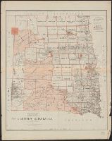
- Creator:
- United States. General Land Office
- Published / Created:
- 1879
- Call Number:
- 821 1879
- Container / Volume:
- BRBL_00566
- Image Count:
- 1
- Resource Type:
- Maps, Atlases & Globes
- Found in:
- Beinecke Rare Book and Manuscript Library > Territory of Dakota / compiled from the official records of the General Land Office and other sources by C. Roeser.
- Creator:
- Ensigns & Thayer
- Published / Created:
- 1851
- Call Number:
- 771 1851
- Container / Volume:
- BRBL_00478
- Image Count:
- 1
- Resource Type:
- Maps, Atlases & Globes
- Found in:
- Beinecke Rare Book and Manuscript Library > State of New York.
- Creator:
- United States. General Land Office
- Published / Created:
- 1879
- Call Number:
- 824 1879
- Container / Volume:
- BRBL_00570
- Image Count:
- 1
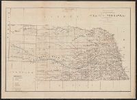
- Resource Type:
- Maps, Atlases & Globes
- Found in:
- Beinecke Rare Book and Manuscript Library > State of Nebraska / compiled from the official records of the General Land Office and other sources by C. Roeser.
- Creator:
- United States. General Land Office
- Published / Created:
- 1885
- Call Number:
- 834 1885
- Container / Volume:
- BRBL_00587
- Image Count:
- 1
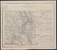
- Resource Type:
- Maps, Atlases & Globes
- Found in:
- Beinecke Rare Book and Manuscript Library > State of Colorado : compiled from the official records of the General Land Office and other sources / under the supervision of G.P. Strum, principal draughtsman G.L.O.
- Creator:
- Roeser, C. (Charles)
- Published / Created:
- 1879
- Call Number:
- 834 1879A
- Container / Volume:
- BRBL_00587
- Image Count:
- 1
- Resource Type:
- Maps, Atlases & Globes
- Found in:
- Beinecke Rare Book and Manuscript Library > State of Colorado : compiled from the official records of the General Land Office and other sources / by C. Roeser, principal draughtsman G.L.O.
- Creator:
- Sanborn Map Company
- Published / Created:
- August, 1915.
- Call Number:
- 766 Sm95 1915
- Container / Volume:
- BRBL_00502
- Image Count:
- 7
- Resource Type:
- Maps, Atlases & Globes
- Found in:
- Beinecke Rare Book and Manuscript Library > Smyrna, Kent County, Delaware.
- Creator:
- United States. Surveyor General
- Published / Created:
- 1860
- Call Number:
- 812fcm 1860
- Container / Volume:
- BRBL_00556
- Image Count:
- 1
- Resource Type:
- Maps, Atlases & Globes
- Found in:
- Beinecke Rare Book and Manuscript Library > Sketch of the public surveys in the state of Wisconsin and territory of Minnesota.
- Published / Created:
- [1916?]
- Call Number:
- 11hcf 1919B-24
- Container / Volume:
- BRBL_00010Q
- Image Count:
- 1
- Resource Type:
- Maps, Atlases & Globes
- Found in:
- Beinecke Rare Book and Manuscript Library > Sketch map of the Russian Empire.
- Published / Created:
- 1911
- Call Number:
- 773gmb 1911
- Container / Volume:
- BRBL_00497
- Image Count:
- 1
- Resource Type:
- Maps, Atlases & Globes
- Found in:
- Beinecke Rare Book and Manuscript Library > Servoss' Road Map of Northwestern New Jersey.
- Creator:
- Servoss, R. D
- Published / Created:
- [1910?]
- Call Number:
- 771 G83 1910
- Container / Volume:
- BRBL_00482A
- Image Count:
- 2
- Resource Type:
- Maps, Atlases & Globes
- Found in:
- Beinecke Rare Book and Manuscript Library > Servoss Road map of Greene County, New York.
- Creator:
- Benoist, Philippe, 1813-ca. 1905
Ciceri, Eugène, 1813-1890
Goupil & Cie
- Published / Created:
- [1855?]
- Call Number:
- 35311hc Se21 1855B
- Container / Volume:
- BRBL_00112
- Image Count:
- 1
- Resource Type:
- Maps, Atlases & Globes
- Found in:
- Beinecke Rare Book and Manuscript Library > Sebastopol et ses environs : vue prise à vol d'oiseau / dessiné et lith. par Eug. Cicéri et Ph. Benoist.
- Published / Created:
- [1853?]
- Call Number:
- 35311 1853
- Container / Volume:
- BRBL_00112
- Image Count:
- 1
- Resource Type:
- Maps, Atlases & Globes
- Found in:
- Beinecke Rare Book and Manuscript Library > Seat of war, Russia and Turkey : latest news per steamers Atlantic and Asia, March 9th.
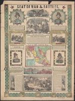
- Published / Created:
- [1847?]
- Call Number:
- 88hc 1847E
- Container / Volume:
- BRBL_00649
- Image Count:
- 1
- Resource Type:
- Maps, Atlases & Globes
- Found in:
- Beinecke Rare Book and Manuscript Library > Seat of war & battles.
- Published / Created:
- [1847?]
- Call Number:
- 88hc 1847B
- Container / Volume:
- BRBL_00649
- Image Count:
- 2
- Resource Type:
- Maps, Atlases & Globes
- Found in:
- Beinecke Rare Book and Manuscript Library > Seat of war & battles.
- Creator:
- Schedler, J. (Joseph)
- Published / Created:
- c1877.
- Call Number:
- 44 1877A
- Container / Volume:
- BRBL_00255
- Image Count:
- 1
- Resource Type:
- Maps, Atlases & Globes
- Found in:
- Beinecke Rare Book and Manuscript Library > Schedler's topographical map of the Dobrudsha (eastern Bulgaria), central Roumania and Bessarabia [cartographic material] / drawn by J. Schedler.
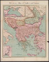
- Creator:
- Schedler, J. (Joseph)
- Published / Created:
- 1876
- Call Number:
- 44 1876A
- Container / Volume:
- BRBL_00255
- Image Count:
- 1
- Resource Type:
- Maps, Atlases & Globes
- Found in:
- Beinecke Rare Book and Manuscript Library > Schedler's map of Turkey and Greece [cartographic material].
- Creator:
- American Geographical Society of New York
- Published / Created:
- 1918
- Call Number:
- 11hcf 1919B-42
- Image Count:
- 1
- Resource Type:
- Maps, Atlases & Globes
- Found in:
- Beinecke Rare Book and Manuscript Library > Roumania [cartographic material].
- Published / Created:
- 1861
- Call Number:
- 90cea 1861
- Container / Volume:
- BRBL_00664
- Image Count:
- 1
- Resource Type:
- Maps, Atlases & Globes
- Found in:
- Beinecke Rare Book and Manuscript Library > River La Plata : from the English, French, and Spanish Surveys.
- Published / Created:
- [1866?]
- Call Number:
- 796 1866A
- Container / Volume:
- BRBL_00525
- Image Count:
- 1
- Resource Type:
- Maps, Atlases & Globes
- Found in:
- Beinecke Rare Book and Manuscript Library > Richardson's new map of the state of Texas.
- Creator:
- Rand McNally and Company
- Published / Created:
- [1945?]
- Call Number:
- 11hd 1941R
- Image Count:
- 1
- Resource Type:
- Maps, Atlases & Globes
- Found in:
- Beinecke Rare Book and Manuscript Library > Rand McNally war map.
- Creator:
- Rand McNally and Company
- Published / Created:
- [1945?]
- Call Number:
- 11hc 1945
- Container / Volume:
- BRBL_00010I
- Image Count:
- 1
- Resource Type:
- Maps, Atlases & Globes
- Found in:
- Beinecke Rare Book and Manuscript Library > Rand McNally war map.
- Creator:
- Rand McNally and Company
- Published / Created:
- [1917?]
- Call Number:
- 40hc 1914
- Container / Volume:
- BRBL_00232
- Image Count:
- 4
- Resource Type:
- Maps, Atlases & Globes
- Found in:
- Beinecke Rare Book and Manuscript Library > Rand McNally war map of the Italian front [cartographic material] : northern section : strategic map of the battle ground in northern Italy from Swiss border to Adriatic Sea / compiled from the latest military maps of the army staffs in Washington, London
- Creator:
- Rand McNally and Company
- Published / Created:
- [1918?]
- Call Number:
- 11hc 1917D
- Container / Volume:
- BRBL_00010D
- Image Count:
- 2
- Resource Type:
- Maps, Atlases & Globes
- Found in:
- Beinecke Rare Book and Manuscript Library > Rand McNally war map of the French front : southern section : strategic map of the battle ground in northern France from St. Mihiel to the Swiss border / compiled from the latest military maps of the army staffs in Washington, London, and Paris, and from
- Creator:
- Rand McNally and Company
- Published / Created:
- [1918]
- Call Number:
- 11hc 1917C
- Container / Volume:
- BRBL_00010D
- Image Count:
- 2
- Resource Type:
- Maps, Atlases & Globes
- Found in:
- Beinecke Rare Book and Manuscript Library > Rand McNally war map of the French front : northern section : strategic map of the battle ground in northern France from St. Quentin to St. Mihiel, showing the farthest advance of the Germans in 1914 and the battle line in September, 1917.
- Creator:
- Rand McNally and Company
- Published / Created:
- [c1917]
- Call Number:
- 11hc 1917B
- Container / Volume:
- BRBL_00010D
- Image Count:
- 2
- Resource Type:
- Maps, Atlases & Globes
- Found in:
- Beinecke Rare Book and Manuscript Library > Rand McNally war map of the British front : a strategic map of of the battleground in Belgium and northern France, from Ostend to St. Quentin / compiled from the latest military maps of the army staffs in Washington, London and Paris, and from other offic
- Creator:
- Rand McNally and Company
- Published / Created:
- 1910
- Call Number:
- 771 N49 1910B
- Image Count:
- 2
- Resource Type:
- Maps, Atlases & Globes
- Found in:
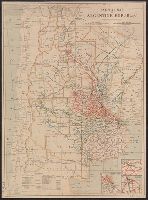
- Beinecke Rare Book and Manuscript Library > Rand McNally & Co.'s new handy map of New York City / Rand McNally & Co.
- Published / Created:
- [1913?]
- Call Number:
- 94gme 1913
- Container / Volume:
- BRBL_00675
- Image Count:
- 1
- Resource Type:
- Maps, Atlases & Globes
- Found in:
- Beinecke Rare Book and Manuscript Library > Railway map of Argentine Republic.
- Creator:
- Watson, Walter, civil engineer
- Published / Created:
- c1883.
- Call Number:
- 764 B45 1883
- Container / Volume:
- BRBL_00454
- Image Count:
- 1
- Resource Type:
- Maps, Atlases & Globes
- Found in:
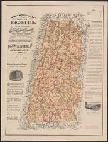
- Beinecke Rare Book and Manuscript Library > Railway and highway map of the famous Berkshire Hills region, showing also villages and points of interest : from official records and other information / by Walter Watson, C.E. for the Berkshire Life Insurance Co. of Pittsfield, Mass., 1883.
- Creator:
- Watson, Walter, civil engineer
- Published / Created:
- c1883.
- Call Number:
- 764 B45 1883
- Container / Volume:
- BRBL_00454
- Image Count:
- 1
- Resource Type:
- Maps, Atlases & Globes
- Found in:
- Beinecke Rare Book and Manuscript Library > Railway and highway map of the famous Berkshire Hills region, showing also villages and points of interest : from official records and other information / by Walter Watson, C.E. for the Berkshire Life Insurance Co. of Pittsfield, Mass., 1883.
- Creator:
- Watson, Walter, civil engineer
- Published / Created:
- [1896].
- Call Number:
- 764 B45 1896
- Container / Volume:
- BRBL_00454
- Image Count:
- 1
- Resource Type:
- Maps, Atlases & Globes
- Found in:
- Beinecke Rare Book and Manuscript Library > Railway and highway map of the famous Berkshire Hills region, showing also villages and points of interest : from official records and other information / by Walter Watson, C.E. for the Berkshire Life Insurance Co. of Pittsfield, Mass., 1883 (Corrected 18
- Creator:
- Ensign, Thayer & Co
- Published / Created:
- 1853
- Call Number:
- 804 1853
- Container / Volume:
- BRBL_00543
- Image Count:
- 1
- Resource Type:
- Maps, Atlases & Globes
- Found in:
- Beinecke Rare Book and Manuscript Library > Railroad & township map of Ohio.
- Creator:
- Horace Thayer & Co
- Published / Created:
- 1853
- Call Number:
- 76 1853
- Container / Volume:
- BRBL_00445
- Image Count:
- 1
- Resource Type:
- Maps, Atlases & Globes
- Found in:
- Beinecke Rare Book and Manuscript Library > Rail-road & township map of Massachusetts, Connecticut and Rhode Island.
- Published / Created:
- 1870
- Call Number:
- 773 C127 1870
- Container / Volume:
- BRBL_00496
- Image Count:
- 1
- Resource Type:
- Maps, Atlases & Globes
- Found in:
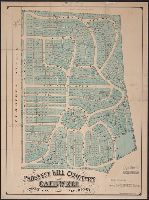
- Beinecke Rare Book and Manuscript Library > Prospect Hill Cemetery, Caldwell, Essex Co., New Jersey / by Otis Chickering, Drainage, Landscape & Civil Engineer.
- Published / Created:
- 1888
- Call Number:
- 896 1888
- Container / Volume:
- BRBL_00659
- Image Count:
- 1
- Resource Type:
- Maps, Atlases & Globes
- Found in:
- Beinecke Rare Book and Manuscript Library > Profile of the Nicaragua interoceanic canal