Search
You Searched For
Search Results
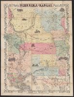
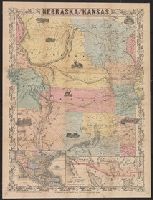
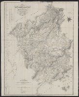
- Creator:
- J.H. Colton & Co
- Published / Created:
- [1855?]
- Call Number:
- 824 1855A
- Container / Volume:
- BRBL_00570
- Image Count:
- 1
- Resource Type:
- Maps, Atlases & Globes
- Found in:
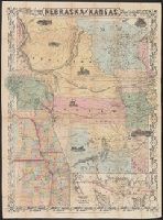
- Beinecke Rare Book and Manuscript Library > Nebraska and Kansas.
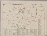
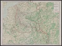
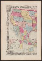
- Creator:
- American Map Company (New York, N.Y.)
- Published / Created:
- [1931].
- Call Number:
- 834 1931A
- Container / Volume:
- BRBL_00588
- Image Count:
- 1
- Resource Type:
- Maps, Atlases & Globes
- Found in:
- Beinecke Rare Book and Manuscript Library > Cleartype county-town map of Colorado.
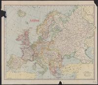
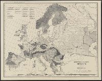
- Creator:
- C.S. Hammond & Company
- Published / Created:
- 1915
- Call Number:
- 30 1915B
- Container / Volume:
- BRBL_00032
- Image Count:
- 1
- Resource Type:
- Maps, Atlases & Globes
- Found in:
- Beinecke Rare Book and Manuscript Library > Europe.
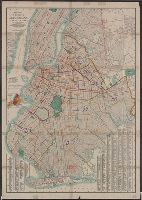
- Published / Created:
- 1862
- Call Number:
- 783 1874
- Container / Volume:
- BRBL_00509
- Image Count:
- 1
- Resource Type:
- Maps, Atlases & Globes
- Found in:
- Beinecke Rare Book and Manuscript Library > Johnson's map of the vicinity of Richmond and Peninsular Campaign in Virginia : showing also the interesting localities along the James, Chickahominy and York Rivers / by A.J. Johnson ; compiled from the official maps of the War Department.
- Published / Created:
- [1909?]
- Call Number:
- 771 N49 1609
- Image Count:
- 1
- Resource Type:
- Maps, Atlases & Globes
- Found in:
- Beinecke Rare Book and Manuscript Library > 1609 The Island of Manhattan (Mannahtin) at the time of its discovery ... L.L. Coates Engr'g Co., N.Y.
- Published / Created:
- [ca. 1905]
- Call Number:
- 771 N49 1905R
- Image Count:
- 1
- Resource Type:
- Maps, Atlases & Globes
- Found in:
- Beinecke Rare Book and Manuscript Library > [New York City real estate].
- Creator:
- Ohman, August R
- Published / Created:
- 1904
- Call Number:
- 771 N49 1904
- Image Count:
- 1
- Resource Type:
- Maps, Atlases & Globes
- Found in:
- Beinecke Rare Book and Manuscript Library > New map of the Borough of Brooklyn, City of New York : with indexes to streets, etc. / August R. Ohman.
- Creator:
- C.S. Hammond & Company
- Published / Created:
- c1906.
- Call Number:
- 773gmb 1906
- Container / Volume:
- BRBL_00497
- Image Count:
- 1
- Resource Type:
- Maps, Atlases & Globes
- Found in:
- Beinecke Rare Book and Manuscript Library > Hammond's road map of northern New Jersey / C.S. Hammond & Company.
- Published / Created:
- 1905
- Call Number:
- 773 P176 1905
- Container / Volume:
- BRBL_00497
- Image Count:
- 1
- Resource Type:
- Maps, Atlases & Globes
- Found in:
- Beinecke Rare Book and Manuscript Library > Part one of Section one: Palisade / Property of Hudson River Realty Company.
- Published / Created:
- 1905
- Call Number:
- 771ae N49 1905
- Image Count:
- 1
- Resource Type:
- Maps, Atlases & Globes
- Found in:
- Beinecke Rare Book and Manuscript Library > New York City, Manhattan and the Bronx / conflagration hazard and fire department, committee of 20, plan no. 1.
- Published / Created:
- c1909.
- Call Number:
- 7715gmb 1909A
- Image Count:
- 1
- Resource Type:
- Maps, Atlases & Globes
- Found in:
- Beinecke Rare Book and Manuscript Library > Automobile map of western part of Long Island / compiled by Bureau of Tours, Automobile Club of America.
- Published / Created:
- 1909
- Call Number:
- 7715gmb 1909B
- Image Count:
- 1
- Resource Type:
- Maps, Atlases & Globes
- Found in:
- Beinecke Rare Book and Manuscript Library > Automobile map of eastern part of Long Island / compiled by Bureau of Tours and published by the Automobile Club of America.
- Published / Created:
- 1917
- Call Number:
- 764gmb 1917
- Container / Volume:
- BRBL_00462
- Image Count:
- 1
- Resource Type:
- Maps, Atlases & Globes
- Found in:
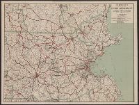
- Beinecke Rare Book and Manuscript Library > Hammonds New road map of eastern Massachusetts and southern New Hampshire.
- Published / Created:
- 1905
- Call Number:
- 771ae N49 1905A
- Image Count:
- 1
- Resource Type:
- Maps, Atlases & Globes
- Found in:
- Beinecke Rare Book and Manuscript Library > New York City, Manhattan and the Bronx water supply / committee of 20, plan no. 2.
- Published / Created:
- [1890?]
- Call Number:
- 773gme 1890
- Container / Volume:
- BRBL_00497
- Image Count:
- 1
- Resource Type:
- Maps, Atlases & Globes
- Found in:
- Beinecke Rare Book and Manuscript Library > Erie Railroad suburban lines.
- Creator:
- C.S. Hammond & Company
- Published / Created:
- [1917].
- Call Number:
- 76gmb 1917
- Container / Volume:
- BRBL_00446
- Image Count:
- 1
- Resource Type:
- Maps, Atlases & Globes
- Found in:
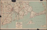
- Beinecke Rare Book and Manuscript Library > Hammond's new road map of Rhode Island and southeastern Massachusetts.
- Creator:
- Yale Land Co
- Published / Created:
- 1912
- Call Number:
- 766 M59 1912
- Container / Volume:
- BRBL_00469
- Image Count:
- 1
- Resource Type:
- Maps, Atlases & Globes
- Found in:
- Beinecke Rare Book and Manuscript Library > Map of Morningside property, Pond Point, Milford, Conn. / Yale Land Co.
- Published / Created:
- 1911
- Call Number:
- 773gmb 1911
- Container / Volume:
- BRBL_00497
- Image Count:
- 1
- Resource Type:
- Maps, Atlases & Globes
- Found in:
- Beinecke Rare Book and Manuscript Library > Servoss' Road Map of Northwestern New Jersey.
- Creator:
- G.W. & C.B. Colton & Co.
- Published / Created:
- 1855
- Call Number:
- BrSides Folio 2019 9
- Image Count:
- 1
- Resource Type:
- Maps, Atlases & Globes
- Found in:
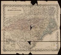
- Beinecke Rare Book and Manuscript Library > Colton's North Carolina [cartographic material].
- Creator:
- Johnson, A. J. (Alvin Jewett), 1827-1884
- Published / Created:
- [1864]
- Call Number:
- 75 1864E
- Container / Volume:
- BRBL_00403
- Image Count:
- 1
- Resource Type:
- Maps, Atlases & Globes
- Found in:
- Beinecke Rare Book and Manuscript Library > Johnson's United States.
- Published / Created:
- 1846
- Call Number:
- 75 1846C
- Container / Volume:
- BRBL_00399
- Image Count:
- 1
- Resource Type:
- Maps, Atlases & Globes
- Found in:
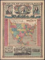
- Beinecke Rare Book and Manuscript Library > Map of the United States and Mexico Including Oregon, Texas and the Californias. By John Haven.
- Published / Created:
- [1844?]
- Call Number:
- 75 1844
- Container / Volume:
- BRBL_00399
- Image Count:
- 1
- Resource Type:
- Maps, Atlases & Globes
- Found in:
- Beinecke Rare Book and Manuscript Library > Map of the United States and Texas. Engraved by C. Copley, New York.
- Published / Created:
- 1848
- Call Number:
- 75 1848A
- Container / Volume:
- BRBL_00399
- Image Count:
- 1
- Resource Type:
- Maps, Atlases & Globes
- Found in:
- Beinecke Rare Book and Manuscript Library > Map of the United States & Mexico.
- Published / Created:
- 1849
- Call Number:
- 75 1849F
- Container / Volume:
- BRBL_00400
- Image Count:
- 1
- Resource Type:
- Maps, Atlases & Globes
- Found in:
- Beinecke Rare Book and Manuscript Library > Map of the United States Mexico &c. Showing the various Land and Water Routes from the Atlantic Cities to California. Compiled by J.H. Colton for "Last Leaves of American History."
- Creator:
- Ensign, Bridgman & Fanning
- Published / Created:
- [1854]
- Call Number:
- 75 1854
- Container / Volume:
- BRBL_00401
- Image Count:
- 1
- Resource Type:
- Maps, Atlases & Globes
- Found in:
- Beinecke Rare Book and Manuscript Library > Map of the United States and Mexico.
- Published / Created:
- [1858?], c1855.
- Call Number:
- 75 1858
- Container / Volume:
- BRBL_00401
- Image Count:
- 1
- Resource Type:
- Maps, Atlases & Globes
- Found in:
- Beinecke Rare Book and Manuscript Library > The United States of America.
- Published / Created:
- 1847
- Call Number:
- 75 1847A
- Container / Volume:
- BRBL_00399
- Image Count:
- 1
- Resource Type:
- Maps, Atlases & Globes
- Found in:
- Beinecke Rare Book and Manuscript Library > Phelps' Ornamental Map of the United States and Mexico.
- Published / Created:
- 1882
- Call Number:
- 75gme 1882
- Container / Volume:
- BRBL_00413
- Image Count:
- 1
- Resource Type:
- Maps, Atlases & Globes
- Found in:
- Beinecke Rare Book and Manuscript Library > New railroad and county map of the United States and Dominion of Canada / drawn and engraved expressly for the Travelers' Official Railway Guide.
- Published / Created:
- [1880?].
- Call Number:
- 75gme 1880R
- Container / Volume:
- BRBL_00413
- Image Count:
- 1
- Resource Type:
- Maps, Atlases & Globes
- Found in:
- Beinecke Rare Book and Manuscript Library > Map of Michigan, Southern & Northern Indiana Railroad : with their connections from Council Bluffs to New York.
- Creator:
- Phelps & Watson
- Published / Created:
- 1867
- Call Number:
- 75hc 1863
- Container / Volume:
- BRBL_00414A
- Image Count:
- 1
- Resource Type:
- Maps, Atlases & Globes
- Found in:
- Beinecke Rare Book and Manuscript Library > Phelps & Watson's historical and military map of the border & southern states.
- Creator:
- G.W. & C.B. Colton & Co
- Published / Created:
- 1874
- Call Number:
- 761 1874
- Container / Volume:
- BRBL_00447
- Image Count:
- 1
- Resource Type:
- Maps, Atlases & Globes
- Found in:
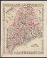
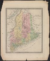
- Beinecke Rare Book and Manuscript Library > Township map of the state of Maine : with adjoining portions of Canada & New Brunswick.
- Creator:
- J.H. Colton & Co
- Published / Created:
- 1853
- Call Number:
- 76gme 1853
- Container / Volume:
- BRBL_00446A
- Image Count:
- 1
- Resource Type:
- Maps, Atlases & Globes
- Found in:
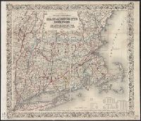
- Beinecke Rare Book and Manuscript Library > Colton's railroad and township map of Massachusetts, Rhode Island, and Connecticut. / published by J.H. Colton, no. 86 Cedar St. New York. 1853.
- Creator:
- J.H. Colton & Co
- Published / Created:
- 1853
- Call Number:
- 76gme 1853
- Container / Volume:
- BRBL_00446A
- Image Count:
- 1
- Resource Type:
- Maps, Atlases & Globes
- Found in:
- Beinecke Rare Book and Manuscript Library > Colton's railroad and township map of Massachusetts, Rhode Island, and Connecticut. / published by J.H. Colton, no. 86 Cedar St. New York. 1853.
- Creator:
- G.W. & C.B. Colton & Co
- Published / Created:
- [1884]
- Call Number:
- 761 1884
- Container / Volume:
- BRBL_00447
- Image Count:
- 1
- Resource Type:
- Maps, Atlases & Globes
- Found in:
- Beinecke Rare Book and Manuscript Library > Colton's Maine / published by G.W. and C.B. Colton & Co.
- Published / Created:
- [1831?]
- Call Number:
- 761 1831
- Container / Volume:
- BRBL_00447
- Image Count:
- 1
- Resource Type:
- Maps, Atlases & Globes
- Found in:
- Beinecke Rare Book and Manuscript Library > Maine.
- Published / Created:
- [1796?]
- Call Number:
- 763 1796B
- Container / Volume:
- BRBL_00452
- Image Count:
- 1
- Resource Type:
- Maps, Atlases & Globes
- Found in:
- Beinecke Rare Book and Manuscript Library > Vermont from the latest Authorities.
- Published / Created:
- 1796
- Call Number:
- 762 1796A
- Container / Volume:
- BRBL_00450
- Image Count:
- 1
- Resource Type:
- Maps, Atlases & Globes
- Found in:
- Beinecke Rare Book and Manuscript Library > The State of New Hampshire, Compiled chiefly from Actual Surveys.
- Published / Created:
- 1850
- Call Number:
- 763FAC 1850
- Container / Volume:
- BRBL_00452
- Image Count:
- 1
- Resource Type:
- Maps, Atlases & Globes
- Found in:
- Beinecke Rare Book and Manuscript Library > Morse's railroad and township map of Vermont and New Hampshire.
- Creator:
- Colton, J. H. (Joseph Hutchins), 1800-1893
- Published / Created:
- 1860
- Call Number:
- 764 1860
- Container / Volume:
- BRBL_00453
- Image Count:
- 1
- Resource Type:
- Maps, Atlases & Globes
- Found in:
- Beinecke Rare Book and Manuscript Library > Colton's Massachusetts and Rhode Island.
- Published / Created:
- 1829
- Call Number:
- 771 W25 1829
- Container / Volume:
- BRBL_00492
- Image Count:
- 1
- Resource Type:
- Maps, Atlases & Globes
- Found in:
- Beinecke Rare Book and Manuscript Library > Map of the county of Warren [NY].
- Published / Created:
- 1829
- Call Number:
- 771 On2 1829
- Image Count:
- 1
- Resource Type:
- Maps, Atlases & Globes
- Found in:
- Beinecke Rare Book and Manuscript Library > Map of the County of Oneida [N.Y.].
- Published / Created:
- 1829
- Call Number:
- 771 ON6 1829
- Container / Volume:
- BRBL_00490
- Image Count:
- 1
- Resource Type:
- Maps, Atlases & Globes
- Found in:
- Beinecke Rare Book and Manuscript Library > Map of the County of Onondaga [N.Y.]
- Published / Created:
- 1829
- Call Number:
- 771 OT7 1829
- Container / Volume:
- BRBL_00490
- Image Count:
- 1
- Resource Type:
- Maps, Atlases & Globes
- Found in:
- Beinecke Rare Book and Manuscript Library > Map of the County of Otsego [N.Y.].
- Published / Created:
- 1829
- Call Number:
- 771 OS9 1829
- Container / Volume:
- BRBL_00490
- Image Count:
- 1
- Resource Type:
- Maps, Atlases & Globes
- Found in:
- Beinecke Rare Book and Manuscript Library > Map of the County of Oswego [N.Y.].
- Creator:
- G.W. & C.B. Colton & Co
- Published / Created:
- 1869
- Call Number:
- 771 Sa69 1869
- Container / Volume:
- BRBL_00491
- Image Count:
- 1
- Resource Type:
- Maps, Atlases & Globes
- Found in:
- Beinecke Rare Book and Manuscript Library > Map of the Saranac Lakes : prepared from Dr. Ely's large pocket map of the New York wilderness for D.L. Fouquet & Son / by G.W & C.B. Colton & Co.
- Published / Created:
- 1829
- Call Number:
- 771 Sa71 1829
- Container / Volume:
- BRBL_00491
- Image Count:
- 1
- Resource Type:
- Maps, Atlases & Globes
- Found in:
- Beinecke Rare Book and Manuscript Library > Map of the County of Saratoga [NY].
- Published / Created:
- 1829
- Call Number:
- 771 OT7 1829A
- Container / Volume:
- BRBL_00490
- Image Count:
- 1
- Resource Type:
- Maps, Atlases & Globes
- Found in:
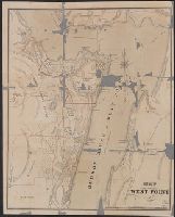
- Beinecke Rare Book and Manuscript Library > Map of the County of Otsego. By David H. Burr. Published by the Surveyor General pursuant to an act of the Legislature.
- Call Number:
- 771 W528 1867
- Container / Volume:
- BRBL_00492
- Image Count:
- 1
- Resource Type:
- Maps, Atlases & Globes
- Found in:
- Beinecke Rare Book and Manuscript Library > Map of West Point.
- Published / Created:
- 1858
- Call Number:
- 811cea Sa245 1858A
- Container / Volume:
- BRBL_00554
- Image Count:
- 1
- Resource Type:
- Maps, Atlases & Globes
- Found in:
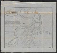
- Beinecke Rare Book and Manuscript Library > Chart of East Neebish rapids, River St. Mary : showing the improved west channel, dredged and surveyed in 1858 under the direction of Capt. A.W. Whipple, T.E. / J.H. Foster U.S. Sub. Agt., James T. Foster, draughtsman.
- Published / Created:
- 1836
- Call Number:
- 811 Al53 1836
- Container / Volume:
- BRBL_00553
- Image Count:
- 1
- Resource Type:
- Maps, Atlases & Globes
- Found in:
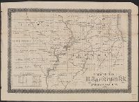
- Beinecke Rare Book and Manuscript Library > A plan of the city of Allegan, situated on the Kalamazoo River in the County of Allegan and Territory of Michigan.
- Published / Created:
- 1860
- Call Number:
- 806gme 1860
- Container / Volume:
- BRBL_00549
- Image Count:
- 1
- Resource Type:
- Maps, Atlases & Globes
- Found in:
- Beinecke Rare Book and Manuscript Library > Map of the Warsaw and Rockford R.R. and its connections.
- Published / Created:
- [1831?]
- Call Number:
- 811 1831
- Container / Volume:
- BRBL_00552
- Image Count:
- 1
- Resource Type:
- Maps, Atlases & Globes
- Found in:
- Beinecke Rare Book and Manuscript Library > Michigan.
- Published / Created:
- 1898
- Call Number:
- 806gme C43 1898
- Container / Volume:
- BRBL_00549
- Image Count:
- 1
- Resource Type:
- Maps, Atlases & Globes
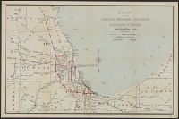
- Found in:
- Beinecke Rare Book and Manuscript Library > Map of the Chicago terminal transfer railroad company : and connecting lines / F.E. Paradis, chief engineer.
- Creator:
- J.H. Colton & Co
- Published / Created:
- 1857
- Call Number:
- 824 1857D
- Container / Volume:
- BRBL_00570
- Image Count:
- 1
- Resource Type:
- Maps, Atlases & Globes
- Found in:
- Beinecke Rare Book and Manuscript Library > Nebraska and Kansas.
- Creator:
- J.H. Colton & Co
- Published / Created:
- [1854?]
- Call Number:
- 824 1854A
- Container / Volume:
- BRBL_00570
- Image Count:
- 1
- Resource Type:
- Maps, Atlases & Globes
- Found in:
- Beinecke Rare Book and Manuscript Library > Nebraska and Kansas.
- Creator:
- Johnson, A. J. (Alvin Jewett), 1827-1884
- Published / Created:
- c1865.
- Call Number:
- 824 1865
- Container / Volume:
- BRBL_00570
- Image Count:
- 1
- Resource Type:
- Maps, Atlases & Globes
- Found in:
- Beinecke Rare Book and Manuscript Library > Johnson's Nebraska, Dakota, Idaho, and Montana.
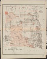
- Creator:
- United States. General Land Office
- Published / Created:
- 1879
- Call Number:
- 821 1879
- Container / Volume:
- BRBL_00566
- Image Count:
- 1
- Resource Type:
- Maps, Atlases & Globes
- Found in:
- Beinecke Rare Book and Manuscript Library > Territory of Dakota / compiled from the official records of the General Land Office and other sources by C. Roeser.
- Creator:
- J.H. Colton & Co
- Published / Created:
- 1857
- Call Number:
- 824 1857D
- Container / Volume:
- BRBL_00570
- Image Count:
- 1
- Resource Type:
- Maps, Atlases & Globes
- Found in:
- Beinecke Rare Book and Manuscript Library > Nebraska and Kansas.
- Published / Created:
- 1867
- Call Number:
- 824 1867
- Container / Volume:
- BRBL_00570
- Image Count:
- 1
- Resource Type:
- Maps, Atlases & Globes
- Found in:
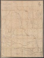
- Beinecke Rare Book and Manuscript Library > Map of Nebraska and Dakota and portions of the states and territories bordering thereon ... by Bv't. Maj. Gen. G.K. Warren, Maj. Eng'rs. March 1967.
- Published / Created:
- 1861
- Call Number:
- 90cea 1861
- Container / Volume:
- BRBL_00664
- Image Count:
- 1
- Resource Type:
- Maps, Atlases & Globes
- Found in:
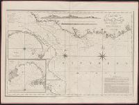
- Beinecke Rare Book and Manuscript Library > River La Plata : from the English, French, and Spanish Surveys.
- Published / Created:
- 1848
- Call Number:
- 91cea 1848
- Container / Volume:
- BRBL_00668
- Image Count:
- 1
- Resource Type:
- Maps, Atlases & Globes
- Found in:
- Beinecke Rare Book and Manuscript Library > The Coast of South America, from Latitide 2° South to 9° North, Long. 45° to 61° West. E & G.W. Blunt ... N. York.1848. Drawn & Engraved by Charles Copley.
- Published / Created:
- 1796
- Call Number:
- 90 1796
- Container / Volume:
- BRBL_00661
- Image Count:
- 1
- Resource Type:
- Maps, Atlases & Globes
- Found in:
- Beinecke Rare Book and Manuscript Library > A General Map Of South America. from the Best Surveys.
- Published / Created:
- [1880?].
- Call Number:
- 902 1880
- Container / Volume:
- BRBL_00665
- Image Count:
- 1
- Resource Type:
- Maps, Atlases & Globes
- Found in:
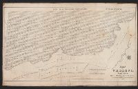
- Beinecke Rare Book and Manuscript Library > Map of the river and valley of the Magdalena : and their connections with the principal towns.
- Creator:
- Whiting, Charles J
- Published / Created:
- 1850
- Call Number:
- 844 V243 1850
- Container / Volume:
- BRBL_00611
- Image Count:
- 1
- Resource Type:
- Maps, Atlases & Globes
- Found in:
- Beinecke Rare Book and Manuscript Library > Map of Vallejo, California / surveyed by Chas. J. Whiting, Surveyor General of the State of California, by order of the Legislature.
- Published / Created:
- 1831
- Call Number:
- 911cea 1831
- Container / Volume:
- BRBL_00670
- Image Count:
- 1
- Resource Type:
- Maps, Atlases & Globes
- Found in:
- Beinecke Rare Book and Manuscript Library > A New General Chart of the Coast of Brazil ... order of the Portuguese Government ... by Joseph Foss Dessiou ... London by W. Faden ... 1818.
- Published / Created:
- 1840
- Call Number:
- 911cea 1840A
- Container / Volume:
- BRBL_00670
- Image Count:
- 1
- Resource Type:
- Maps, Atlases & Globes
- Found in:
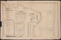
- Beinecke Rare Book and Manuscript Library > The Coast of Brazil from Cape Frio to the River Plate ...
- Published / Created:
- 1840
- Call Number:
- 919cea 1840
- Container / Volume:
- BRBL_00673
- Image Count:
- 1
- Resource Type:
- Maps, Atlases & Globes
- Found in:
- Beinecke Rare Book and Manuscript Library > New Chart of the River Plate: Improved by Edmund and George W. Blunt, and Published by Edmund M. Blunt ... New York.
- Creator:
- E. & G.W. Blunt (Firm)
- Published / Created:
- 1849
- Call Number:
- 88cea 1849
- Container / Volume:
- BRBL_00648
- Image Count:
- 1
- Resource Type:
- Maps, Atlases & Globes
- Found in:
- Beinecke Rare Book and Manuscript Library > West coast of North America from the Gulf of Dulce to San Francisco.
- Creator:
- Bruff, Joseph Goldsborough, 1804-1889
- Published / Created:
- 1847
- Call Number:
- 88hc 1847A
- Container / Volume:
- BRBL_00649
- Image Count:
- 1
- Resource Type:
- Maps, Atlases & Globes
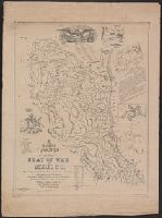
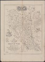
- Found in:
- Beinecke Rare Book and Manuscript Library > A correct map of the seat of war in Mexico : being a copy of Gen.l Arista's map taken at Resaca de la Palma with additions and corrections, embellished with diagrams of the battles of 8th & 9th May, and capture of Monterey, with a memorandum of forces eng
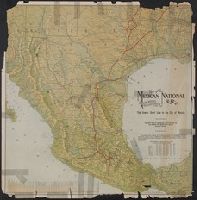
- Creator:
- Mexican National Railroad Company
- Published / Created:
- [19--?]
- Call Number:
- 88gme 19XX
- Container / Volume:
- BRBL_00649
- Image Count:
- 1
- Resource Type:
- Maps, Atlases & Globes
- Found in:
- Beinecke Rare Book and Manuscript Library > Map of the Mexican National R.R : "Laredo route" and connections, the scenic short line to the city of Mexico / drawn and engraved by American Bank Note.
- Published / Created:
- [1847?]
- Call Number:
- 88hc 1847E
- Container / Volume:
- BRBL_00649
- Image Count:
- 1
- Resource Type:
- Maps, Atlases & Globes
- Found in:
- Beinecke Rare Book and Manuscript Library > Seat of war & battles.
- Creator:
- Bruff, Joseph Goldsborough, 1804-1889
- Published / Created:
- 1847
- Call Number:
- 88hc 1847A
- Container / Volume:
- BRBL_00649
- Image Count:
- 1
- Resource Type:
- Maps, Atlases & Globes
- Found in:
- Beinecke Rare Book and Manuscript Library > A correct map of the seat of war in Mexico : being a copy of Gen.l Arista's map taken at Resaca de la Palma with additions and corrections, embellished with diagrams of the battles of 8th & 9th May, and capture of Monterey, with a memorandum of forces eng
- Published / Created:
- 1913
- Call Number:
- 899 1913
- Container / Volume:
- BRBL_00660
- Image Count:
- 1
- Resource Type:
- Maps, Atlases & Globes
- Found in:
- Beinecke Rare Book and Manuscript Library > Map showing the Panama Canal and Canal Zone.
- Creator:
- Leuthner, Frederick
- Published / Created:
- [1888]
- Call Number:
- 896am 1888
- Container / Volume:
- BRBL_00659
- Image Count:
- 1
- Resource Type:
- Maps, Atlases & Globes
- Found in:
- Beinecke Rare Book and Manuscript Library > Nicaragua Canal : bird's-eye view of the interoceanic canal of Nicaragua and Costa Rica / compiled from official data by Fred'k Leuthner ; lithographed by Julius Bien & Co. N.Y.
- Creator:
- Harrison, Thomas
- Published / Created:
- 1857
- Call Number:
- 899 1857
- Container / Volume:
- BRBL_00660
- Image Count:
- 1
- Resource Type:
- Maps, Atlases & Globes
- Found in:
- Beinecke Rare Book and Manuscript Library > Map of the Isthmus of Panama representing the line of the Panama Rail Road as constructed under the direction of George M. Totten, chief engineer &c. / reduced and compiled from the original surveys by Thos. Harrison, crown surveyor, Jamaica, 1857.
- Published / Created:
- 1888
- Call Number:
- 896 1888
- Container / Volume:
- BRBL_00659
- Image Count:
- 1
- Resource Type:
- Maps, Atlases & Globes
- Found in:
- Beinecke Rare Book and Manuscript Library > Profile of the Nicaragua interoceanic canal
- Published / Created:
- 1859
- Call Number:
- 893 1859
- Container / Volume:
- BRBL_00659
- Image Count:
- 1
- Resource Type:
- Maps, Atlases & Globes
- Found in:
- Beinecke Rare Book and Manuscript Library > Mapa general de la republica de Salvador / levantado por Maxmilian v. Sonnenstern por orden de su excelencia Sr. Don Rafael Campo.
- Published / Created:
- 1888
- Call Number:
- 896 1888
- Container / Volume:
- BRBL_00659
- Image Count:
- 1
- Resource Type:
- Maps, Atlases & Globes
- Found in:
- Beinecke Rare Book and Manuscript Library > Profile of the Nicaragua interoceanic canal
- Creator:
- C.S. Hammond & Company
- Published / Created:
- c1917.
- Call Number:
- 11 1917
- Container / Volume:
- BRBL_00010
- Image Count:
- 1
- Resource Type:
- Maps, Atlases & Globes
- Found in:
- Beinecke Rare Book and Manuscript Library > Hammond's large scale war map of the Western Front [cartographic material].
- Creator:
- Geographia Map Company
- Published / Created:
- [194-?]
- Call Number:
- 834 D437 1948
- Container / Volume:
- BRBL_00589
- Image Count:
- 1
- Resource Type:
- Maps, Atlases & Globes
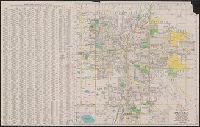
- Found in:
- Beinecke Rare Book and Manuscript Library > The premier map of Denver and vicinity : featuring transit lines and house numbers / produced under the direction of Alexander Gross, F.R.G.S.
- Published / Created:
- c1915.
- Call Number:
- 902 1915
- Container / Volume:
- BRBL_00665
- Image Count:
- 1
- Resource Type:
- Maps, Atlases & Globes
- Found in:
- Beinecke Rare Book and Manuscript Library > [Map of Colombia].
- Creator:
- C.S. Hammond & Company.
- Published / Created:
- ©1913.
- Call Number:
- BrSides Double Folio 2017 10
- Image Count:
- 1
- Resource Type:
- Maps, Atlases & Globes
- Found in:
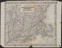
- Beinecke Rare Book and Manuscript Library > Hammond's new road map of Connecticut [cartographic material] / based on the surveys of the United States Geological Survey, United States Coast and Geodetic Survey and the various local surveys, revised and corrected ... C.S. Hammond & Company.
- Creator:
- J.H. Colton & Co
- Published / Created:
- 1855
- Call Number:
- BrSides Folio 2017 60
- Image Count:
- 1
- Resource Type:
- Maps, Atlases & Globes
- Found in:
- Beinecke Rare Book and Manuscript Library > The United States of America.
- Creator:
- Sanborn Map Company
- Published / Created:
- August, 1923.
- Call Number:
- 776 B764 1923
- Container / Volume:
- BRBL_00502
- Image Count:
- 4
- Resource Type:
- Maps, Atlases & Globes
- Found in:
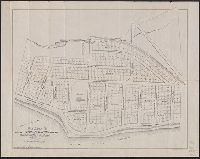
- Beinecke Rare Book and Manuscript Library > Bridgeville, Sussex County, Delaware.
- Creator:
- Sanborn Map Company, cartographer.
- Published / Created:
- June, 1948.
- Call Number:
- 804ae El64 1948
- Container / Volume:
- BRBL_00717
- Image Count:
- 4
- Resource Type:
- Maps, Atlases & Globes
- Found in:
- Beinecke Rare Book and Manuscript Library > Elmore, Ottowa County Ohio.
- Creator:
- Columbia University. Geographical Press
Lobeck, A. K. (Armin Kohl), 1886-1958
- Published / Created:
- c1923, repr. 1944.
- Call Number:
- 30cbd 1923
- Container / Volume:
- BRBL_00037A
- Image Count:
- 4
- Resource Type:
- Maps, Atlases & Globes
- Found in:
- Beinecke Rare Book and Manuscript Library > Physiographic diagram of Europe / by A.K. Lobeck.
- Creator:
- Rand McNally and Company
- Published / Created:
- [1917?]
- Call Number:
- 40hc 1914
- Container / Volume:
- BRBL_00232
- Image Count:
- 4
- Resource Type:
- Maps, Atlases & Globes
- Found in:
- Beinecke Rare Book and Manuscript Library > Rand McNally war map of the Italian front [cartographic material] : northern section : strategic map of the battle ground in northern Italy from Swiss border to Adriatic Sea / compiled from the latest military maps of the army staffs in Washington, London
- Creator:
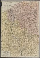
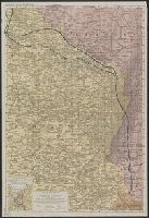
- White, Charles A. (Charles Abiathar), 1826-1910
- Published / Created:
- 1870
- Call Number:
- 847 1870
- Container / Volume:
- BRBL_00625
- Image Count:
- 4
- Resource Type:
- Maps, Atlases & Globes
- Found in:
- Beinecke Rare Book and Manuscript Library > Map of Washington Territory : west of the Cascade Mountains / compiled from the government surveys by Chas. A. White, C.E.
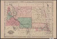
- Creator:
- Johnson, A. J. (Alvin Jewett), 1827-1884
- Published / Created:
- 1866
- Call Number:
- 44 1866
- Container / Volume:
- BRBL_00255
- Image Count:
- 2
- Resource Type:
- Maps, Atlases & Globes
- Found in:
- Beinecke Rare Book and Manuscript Library > Johnson's Austria, Turkey in Europe and Greece.
- Creator:
- General Drafting Company
- Published / Created:
- 1944?
- Call Number:
- 57hd 1944
- Container / Volume:
- BRBL_00307
- Image Count:
- 2
- Resource Type:
- Maps, Atlases & Globes
- Found in:
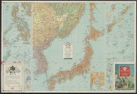
- Beinecke Rare Book and Manuscript Library > Esso war map III featuring the Pacific Theater : a third war map / edited, drafted and printed by the makers of the peace-time Esso road maps.
- Creator:
- General Drafting Company
- Published / Created:
- 1944?
- Call Number:
- 57 1942
- Container / Volume:
- BRBL_00303
- Image Count:
- 2
- Resource Type:
- Maps, Atlases & Globes
- Found in:
- Beinecke Rare Book and Manuscript Library > Esso war map III featuring the Pacific Theater : a third war map / edited, drafted and printed by the makers of the peace-time Esso road maps.
- Creator:
- General Drafting Company
- Published / Created:
- 1944?
- Call Number:
- 57hd 1944
- Container / Volume:
- BRBL_00307
- Image Count:
- 2
- Resource Type:
- Maps, Atlases & Globes
- Found in:
- Beinecke Rare Book and Manuscript Library > Esso war map III featuring the Pacific Theater : a third war map / edited, drafted and printed by the makers of the peace-time Esso road maps.
- Creator:
- Colton, G. Woolworth (George Woolworth), 1827-1901
- Published / Created:
- 1854
- Call Number:
- 71 1854B
- Container / Volume:
- BRBL_00371
- Image Count:
- 2
- Resource Type:
- Maps, Atlases & Globes
- Found in:
- Beinecke Rare Book and Manuscript Library > Map of the United States of America, the British provinces, Mexico, the West Indies, and Central America, with part of New Granada and Venezuela / map drawn by Geo. W. Colton ; engraved by John M. Atwood ; border desig'd. & eng'd. by W.S. Barnard.
- Creator:
- Rand McNally and Company
- Published / Created:
- [c1917]
- Call Number:
- 11hc 1917B
- Container / Volume:
- BRBL_00010D
- Image Count:
- 2
- Resource Type:
- Maps, Atlases & Globes
- Found in:
- Beinecke Rare Book and Manuscript Library > Rand McNally war map of the British front : a strategic map of of the battleground in Belgium and northern France, from Ostend to St. Quentin / compiled from the latest military maps of the army staffs in Washington, London and Paris, and from other offic
- Creator:
- Rand McNally and Company
- Published / Created:
- [1918?]
- Call Number:
- 11hc 1917D
- Container / Volume:
- BRBL_00010D
- Image Count:
- 2
- Resource Type:
- Maps, Atlases & Globes
- Found in:
- Beinecke Rare Book and Manuscript Library > Rand McNally war map of the French front : southern section : strategic map of the battle ground in northern France from St. Mihiel to the Swiss border / compiled from the latest military maps of the army staffs in Washington, London, and Paris, and from
- Published / Created:
- 1918
- Call Number:
- 11hc 1918F
- Container / Volume:
- BRBL_00010E
- Image Count:
- 2
- Resource Type:
- Maps, Atlases & Globes
- Found in:
- Beinecke Rare Book and Manuscript Library > The Fifth of five sections making up the New York Times war map.
- Published / Created:
- 1940
- Call Number:
- 11hc 1915C
- Container / Volume:
- BRBL_00010B
- Image Count:
- 2
- Resource Type:
- Maps, Atlases & Globes
- Found in:
- Beinecke Rare Book and Manuscript Library > [A soldier saved a map.]
- Creator:
- Rand McNally and Company
- Published / Created:
- [1918]
- Call Number:
- 11hc 1917C
- Container / Volume:
- BRBL_00010D
- Image Count:
- 2
- Resource Type:
- Maps, Atlases & Globes
- Found in:
- Beinecke Rare Book and Manuscript Library > Rand McNally war map of the French front : northern section : strategic map of the battle ground in northern France from St. Quentin to St. Mihiel, showing the farthest advance of the Germans in 1914 and the battle line in September, 1917.
- Published / Created:
- 1825
- Call Number:
- 23cea 1825
- Container / Volume:
- BRBL_00021
- Image Count:
- 2
- Resource Type:
- Maps, Atlases & Globes
- Found in:
- Beinecke Rare Book and Manuscript Library > A Chart of the West Coast of America ... from the latest Spanish surveys. Engraved by J.M. Taylor, NY.
- Creator:
- C.S. Hammond & Company
- Published / Created:
- [1918]
- Call Number:
- 11hc 1918Z-6
- Container / Volume:
- BRBL_00010H
- Image Count:
- 2
- Resource Type:
- Maps, Atlases & Globes
- Found in:
- Beinecke Rare Book and Manuscript Library > Hammond's large scale war map of the Western Front ; Hammond's large scale war map Italian Front [cartographic material].